
|
|
Mountain/Rock |
|---|---|
|
|
39.70961°N / 107.6928°W |
|
|
Garfield |
|
|
Sport Climbing |
|
|
Spring, Fall |
|
|
6950 ft / 2118 m |
|
|
Overview
Middle Ice Caves is a climbing area north of Rifle Colorado and in the famous Rifle Mountain Park. Rifle Mountain Park has become one of the most famous climbing areas in the country and some of the world’s hardest sport climbs reside here.The canyon walls in Rifle Mountain Park contain more than 400 established rock climbs. Because the approaches are short and easy the climbs are popular even though they are far from any major population centers.
Excerpt from the Park Website which outlines the history and rock climbing in the park:
On June 7, 1910 a Special Act passed by the 61st Congress, granted a number of municipalities the chance to claim land to make them into parks. In Colorado, Denver, Glenwood Springs and Rifle took this opportunity. Denver's became Winter Park Resort and Red Rocks. Glenwood's became the South Canyon Landfill. And on October 21, 1921, a US Patent signed by Warren G. Harding made Rifle Mountain Park.
Visitors from all over the globe visit the park for its rock climbing. The park boasts over (now) 400 bolted climbing routes. New routes are bolted through a permitting process, that includes the Rifle Climbers Coalition. A beginners area is currently being formed.
All of the rock here is limestone and some routes have been polished by use.
Although Rifle Mountain Park is known for difficult climbing, a few moderates also exist here.
The Middle Ice Caves area itself contains at least three moderate routes.
The climbs here range from 5.7 sport routes to 5.14b in difficulty.
 Kimberly climbing Do the Mash Potato in Rifle Mountain Park.
 Climbing the crack at the crux of Do the Mash Potato.
Getting There
Rifle Mountain Park is about 15 miles north of the town of Rifle on I-70.FROM THE WEST
Exit I-70 at Rifle (Exit 90) and head north through town. After about two miles turn right on County Road 325. Pass Rifle Gap Reservoir and Rifle Falls State Park. When County Road turns gravel continue another mile to the entrance of Rifle Mountain Park.
From the entrance station, drive another 0.6 miles and park at the large pull-off on the left.
FROM THE EAST
Exit I-70 at New Castle (Exit 105). Turn right off I-70 and then left at a four-way stop.
Follow the main road (Highway 6) west through town for about a mile. Turn right at 7th Street (posted "National Forest Access" and "Buford Road" and follow it out of town. The road becomes Grass Valley Road. Stay on Grass Valley Road for about 12 miles and reach a T-Junction. Turn right here onto County Road 325. Pass Rifle Falls State Park. When County Road turns gravel continue another mile to the entrance of Rifle Mountain Park.
From the entrance station, drive another 0.6 miles and park at the large pull-off on the left.
 Kimberly descending after coming down Do the Mash Potato. None of the climbs are far from the trailhead.
Routes Overview
Routes are listed from right to left since that's how you approach them.From the parking area, locate a trail downstream from the parking. Follow it 50 feet and cross the creek on a bridge. Feline is immediately right of the bridge and Irish Blood immediately left.
ENCHANTED FOREST
To get to the Enchanted Forest, hike under Feline through the Middle Ice Cave. This zone is immediately after the cave.
| ROUTE | DIFFICULTY | LENGTH | PITCHES | GEAR | QUALITY |
| Magic Owl | 5.14b | 85 feet | 1 | 10 draws | Fair |
| Feline | 5.11b | 100 feet | 1 | 10 draws | Excellent/Classic |
| Ledged Assault | 5.11d | 100 feet | 1 | 9 draws | Good |
| Irish Blood | 5.10a | 30 feet | 1 | 4 draws | Good |
| Rachel's Route | 5.7 | 50 feet | 1 | 9 draws | Good |
CHUD
These routes climb the left wall of a mini-cave, hidden from the road by trees.
Walk 50 yards left from Rachel's Route to reach CHUD.
| ROUTE | DIFFICULTY | LENGTH | PITCHES | GEAR | QUALITY |
| CHUD | 5.12d | 35 feet | 1 | 5 draws | Excellent |
| Monster Magnet | 5.13a | 35 feet | 1 | 5 draws | Excellent |
| Crud | 5.12b | 30 feet | 1 | 5 draws | Fair |
THE FUNNY FACE
This is the west facing wall just to the left of Crud. All routes but one are named for comedians.
| ROUTE | DIFFICULTY | LENGTH | PITCHES | GEAR | QUALITY |
| Borat | 5.11b | 60 feet | 1 | 8 draws | Excellent |
| Rickles | 5.8- | 50 feet | 1 | 8 draws | Excellent |
| Pryor | 5.10a | 50 feet | 1 | 9 draws | Excellent |
| Sellers | 5.10b | 50 feet | 1 | 8 draws | Good |
| Martin & Lewis | 5.9 | 50 feet | 1 | 7 draws | Excellent |
| Carlin | 5.10b | 85 feet | 1 | 11 draws | Excellent/Classic |
| Costello | 5.11a | 60 feet | 1 | 12 draws | Good |
POTATO WALL
This is the northwest-facing slab left of Costello.
| ROUTE | DIFFICULTY | LENGTH | PITCHES | GEAR | QUALITY |
| Small Fry | 5.10b | 95 feet | 1 | 13 draws | Fair |
| Do the Mash Potato | 5.7 | 60 feet | 1 | 7 draws | Excellent |
| Hot Potato | 5.10a | 70 feet | 1 | 8 draws | Excellent |
| Spuds in Space | 5.9 | 70 feet | 1 | 9 draws | Excellent/Classic |
| Merry Maids | 5.10a | 70 feet | 1 | ? draws | Excellent/Classic |
| The Vortex | 5.9 | 50 feet | 1 | ? draws | Good |
 Hot Potato.
Red Tape
There is a fee to climb in the Rifle Mountain Park.FEES
| TYPE FEE | RIFLE RESIDENT | GARFIELD COUNTY RESIDENT | NON-RESIDENT |
| Day Pass per Vehicle | $5 | $5 | $5 |
| Annual Pass | $15 | $30 | $50 |
| Annual Pass-2nd Vehicle | $10 | $15 | $25 |
| Camping Fee (Includes Day Pass) | $15 | $15 | $15 |
| Camping Fee (With Proof of Annual Pass) | $10 | $10 | $10 |
SPECIFIC RULES
• Fee area, all vehicles must display valid day pass.
• Parking in designated areas only.
• Camping in designated areas only; limit 14 days.
• No camping in picnic areas.
• Picnic areas close at 10:00 p.m.
• No hunting, shooting, fireworks, etc.
• ATVs may not be operated within park boundaries.
• Fires in fire rings only.
• No wood cutting, but wood gathering is permitted.
• Dogs must be on leash at all times.
• Pick up after dogs.
• No loud or amplified music.
• No glass.
• Dispose of trash properly.
• Speed limit is 20 mph.
• Group area and community house use by reservations only.
• Bears may be in the area, be aware.
• All new rock climbing routes require a permit.
 Please follow all rules and regulations.
When to Climb
Although summer is the most popular time to climb here, late Spring and Fall are the ideal times to climb here. The rock tends to weep before mid-April or so, so it may be best to wait until then.Winter weather can be nice, the rock can be icy or wet.
 Climbing on a nice day in April.
Camping
There are many good places to camp in the area. See the below links for information.Rifle Gap State Park Camping
Rifle Falls Camping
Rifle Mountain Park Camping
The town of Rifle also has several hotels, motels, and RV Parks.
Mountain Conditions
CLICK HERE FOR WEATHER FORECASTWeather and climate data for Rifle is below. *National Weather Service Data 1910-2007. Rifle Mountain Park will be 5-10 degrees cooler than Rifle itself.
| MONTH | AVE HIGH | AVE LOW | REC HIGH | REC LOW | AVE PRECIP (in) |
| JAN | 37 | 9 | 62 | -38 | 0.86 |
| FEB | 44 | 17 | 69 | -34 | 0.77 |
| MAR | 54 | 24 | 81 | -16 | 0.94 |
| APR | 64 | 31 | 92 | 4 | 1.01 |
| MAY | 74 | 39 | 99 | 17 | 1.00 |
| JUN | 84 | 45 | 102 | 22 | 0.73 |
| JUL | 90 | 52 | 104 | 33 | 1.03 |
| AUG | 88 | 50 | 102 | 31 | 1.48 |
| SEP | 79 | 41 | 99 | 21 | 1.14 |
| OCT | 67 | 31 | 88 | 7 | 1.19 |
| NOV | 51 | 21 | 79 | -16 | 0.88 |
| DEC | 39 | 12 | 65 | -27 | 0.93 |
External Links
Official Website for Rifle Mountain ParkGuidebook
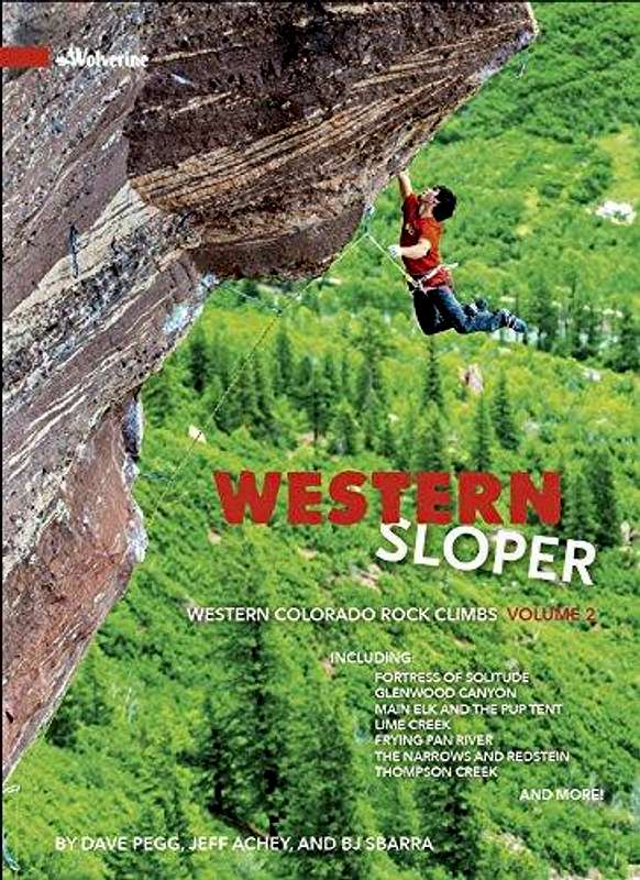
The following book mentions 12 different climbs at Rifle Arch (the book does not mention the climbs at Pothole Rock), but this is the best and most comprehensive climbing source on the area:
Western Sloper
Online Sources
Rifle Mountain Park on Mountain Project
Ice Cave Walls on Mountain Project