4 a.m. on Monday morning. My alarm pulls me out of three hours of sleep. I have to work today—-but I need to climb something and ski down it first. Immediately I notice the wind. Not much, but it's there, moving in the spruce branches outside my window. But I could see stars, too, and I hoped that a warm spring day was in store.
My plan was to drive to Quartzville, below the slopes of Mount Bross, and then climb up the Moose Creek drainage to the summit of Bross. From Hoosier Pass it looked like there would be continuous snow all the way up from the road. Even though my house is less than 20 minutes from the Quartzville trailhead, I had never climbed Bross from that side. I'm not sure why, either—-it looked like a fun, mellow ski descent, and the short approach meant I could be back to the truck well before noon.
![Bross & Lincoln, Early Spring]() Bross and Lincoln as seen from Hoosier Pass.
Bross and Lincoln as seen from Hoosier Pass.
When I parked at the top of the subdivision near Quartzville, things didn't seem so simple. A bright, waning moon was rising in the eastern sky and illuminating Bross and Licoln. I sat in the cab of the truck with the engine off for a while, listening to Radiohead and scoping the route. I was parked on Roberts Road, too far north to access Moose Creek easily, but I wasn't sure how to get closer to Moose Creek and didn't feel like exploring the subdivision at 4:30 in the morning. So I set off directly uphill in the Quartzville Creek drainage.
![Predawn on Lincoln]() First light on the slopes of Mt. Lincoln.
First light on the slopes of Mt. Lincoln.
Even down below treeline, the wind was gusting pretty strong. Just a morning breeze, bound to die off soon, I hoped. I skinned up to the right, on the lower flanks of Mt. Lincoln, to avoid some heavier timber in the valley bottom. This led to a nice, gentle snow slope where I gained a few hundred feet of elevation. Here I stopped to take some pictures of the sunrise. Some nice lenticular clouds had formed as a result of the strong winds, catching the early light of dawn and putting on a pretty cool show.
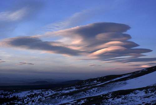
![South Park Sunrise]() Lenticular clouds over South Park at dawn.
Lenticular clouds over South Park at dawn.![Lenticular Sunrise]() Looking east.
Looking east.
Now that it was getting light out, routefinding was a little easier. I could see where the snow ran out above me. Hmm. What to climb? When I reached the end of the snow, I took my skis off and wandered over the tundra to another snow slope on the south flank of Mt. Lincoln. I contemplated climbing up it. The spring snowpack in Colorado has had plenty of time to consolidate in the past few weeks of sunny weather, so the chances of a slide were low. But this slope, a perfect 40 degrees with a fat convex roll at the top, seemed suspect. If the wind had been calm, I would have considered it, but I could visually observe plenty of snow being loaded onto the slope above with the strong winds. I ventured out across the bottom of the slope, among huge chunks of avalanche debris, to see how it felt. Cracks shot out from under my skis as I sank through a fresh soft slab. Okay, no Lincoln today.
![Sunrise on Lincoln]() Avalanche debris at around 12,000' on Mt. Lincoln.
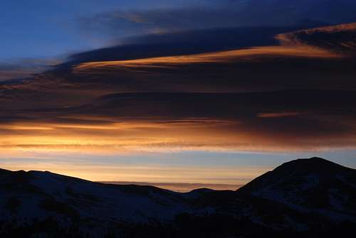
Avalanche debris at around 12,000' on Mt. Lincoln.![Quartzville Road]() Looking west at sunrise, up the Quartzville basin.
Looking west at sunrise, up the Quartzville basin.
Again I looked up the valley. The north side of Bross was almost completely windscoured, no good for skiing. The south face of Lincoln, including the Russian Couloir, might be a fun ski but probably not solo, not today. So Bross and Lincoln were both out. But at the head of the valley there was Mt. Cameron (or Cameron Point, depending on your disposition). Why not? I liked the idea of climbing Mt. Cameron, the Rodney Dangerfield of the 14ers. Cameron gets no respect, with its less-than-300 feet of prominence and rounded, flattish, gravel-heap summit. But I feel bad for the little guy, and thought someone should pay him the respect he deserves. So I decided to climb Cameron and Cameron only.
![Quartzville Basin]() Upper Quartzville basin, showing Mt. Cameron (the rounded lump left of center).
Upper Quartzville basin, showing Mt. Cameron (the rounded lump left of center).
Meanwhile, there was the wind. The Bross/Cameron/Lincoln massif is positioned in a kink in the Continental Divide, and the prevailing winds get funneled through the mountains with violent force. Often, the Tenmile Range just to the north will be completely white with snow while Bross and Lincoln remain windscoured down to the talus. Today was no exception. Over and over, strong gusts would come howling over the Cameron-Lincoln saddle and slam into me full-force. I began ducking and turning my head whenever I heard a gust coming. Sometimes the gusts were so sudden that I didn't hear them coming, and paid the price by getting a face full of spindrift. I took a break behind a boulder and had breakfast out of the wind, sort of. Then I headed up again, on the right side of the valley, as the full Cameron Ampitheater came into view. The snow didn't look particularly deep but there looked to be a pretty good, straightforward line all the way up. But the higher I went, the stronger the wind got. When I reached a windscoured patch of tundra and began hauling my skis across it, the wind tried ripping them off my shoulder. This is getting insane, I thought, but kept walking anyway.
![Mt. Lincoln, south face]() The south face of Lincoln from Cameron Ampitheater
The south face of Lincoln from Cameron Ampitheater
I started skinning up the Cameron Ampitheater on rock-hard snow. The sun was in and out of the clouds, but had done nothing to soften the snow yet. I started to worry about a lack of corn on the way down. Oh well, no time to worry about that now. I focused on keeping moving, except when the ferocious gusts would funnel over the ridge. I began crouching down on one knee when I heard the gusts coming, but sometimes I was too late. A couple of times the wind was strong enough to actually push me backward on my climbing skins, and one especially powerful gust knocked me flat on my ass. This was getting out of control.
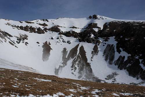
![Cameron summit cornice]() A cornice/drift near the summit of Cameron, looking northeast.
A cornice/drift near the summit of Cameron, looking northeast.
Finally I gained the Bross-Cameron ridge and started heading for the summit. Up here, the wind was blowing as strong as it had been gusting below, but with no lulls between the gusts. I began questioning my sanity as I pushed uphill, leaning almost 45 degrees into the wind. Maybe thirty yards below the summit, the snow ran out. I walked across the scree to the summit proper and sat down with my back to the wind. A constant, steady roar filled my ears, as if I was sitting on the tarmac underneath a large jet taking off. I could hear myself laughing over the wind, sounding far-off, like it was someone else. I removed my skins, managing not to let anything get carried off the mountain.
![A little wind]() This is my climbing skin being whipped sideways by the wind, near the summit.
This is my climbing skin being whipped sideways by the wind, near the summit.
After the skins were off, I took a quick walk around the summit to take pictures. Even though I've lived in Colorado my whole life, I don't think I've ever felt wind like this. If I faced it directly it filled my mouth and made my cheeks flap, like when you stick your head out the window of a moving vehicle. I couldn't make forward progress on two feet; I had to crawl. I took a few pictures of the surrounding mountains, beautiful as always. I guess this was my fifth or sixth time on top of Cameron, but I've only been up there in the summer or fall before, and this was the first time with skis.
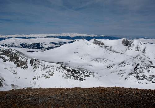
![View from Cameron]() The view to the west. The skiing looks better over there...
The view to the west. The skiing looks better over there...![Mt. Democrat, north face]() The north face of Mt. Democrat, with the Sawatch Range behind.
The north face of Mt. Democrat, with the Sawatch Range behind.![Spring Conditions]() The snow was a little thin on top.
The snow was a little thin on top.
After a couple of minutes, thoughts of frostbite crept into my mind. Time to head down. I clicked in and skied the upper snowfield on Cameron, on bulletproof sastrugi. Actually, I believe the technical term for this kind of snow is “frozen coral reef,” full of hollow overhangs and odd, wind sculpted shapes covering the uneven surface. I had to take my skis off once, in the Cameron Ampitheater, to avoid some rocks, but only for a few feet. I made quick time back down to the Quartzville basin, where I hoped the snow would be a little softer. No dice. All the way down to the truck, the snow was the same. The glorious Colorado corn I had been hoping for today never came to be.
![Cameron Descent]() My route, more or less, down Cameron.
My route, more or less, down Cameron.
Despite the tough snow I made good time on the descent, and was back down to the truck in about half an hour (the climb took about five hours). It was 10:30 when I got back to the truck. As I came around the driver's side, I saw a 'Park County Sheriff's Office' business card tucked into my window, with a note on the back: “Please contact me ASAP or stop by the Sheriff's Office.” Great. What now? Well, it seems that that the access issues in the Mosquito Range are far from being solved. When I found cell phone reception on the way down, I called the patrol officer who left the card. Apparently, a couple of the homeowners in the area had called the cops that morning to report me for trespassing on their land. Yet the trailhead, at Crest Road, has a sign advertising public access. The officer was very understanding, and he agreed that the entire area is a mosaic of private and public land, so it's hard to say who is trespassing and where. He told me to stay on the road next time and I should be fine. Yes, sir.
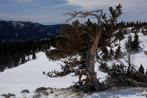
![Quartzville Sentinel]() An old sentinel near Quartzville.
An old sentinel near Quartzville.
I drove back to Alma and managed to make it in to work by 11 a.m. Not a bad adventure for a Monday morning. I could have done without the raw wind and the brush with 'the law,' but I guess those things are to be expected in the Mosquito Range. And although it might never make it on to some people's 14er lists, by climbing 3,000 feet to its humble summit, I hope to have restored a little bit of respect to mighty Mt. Cameron.
Comments
No comments posted yet.