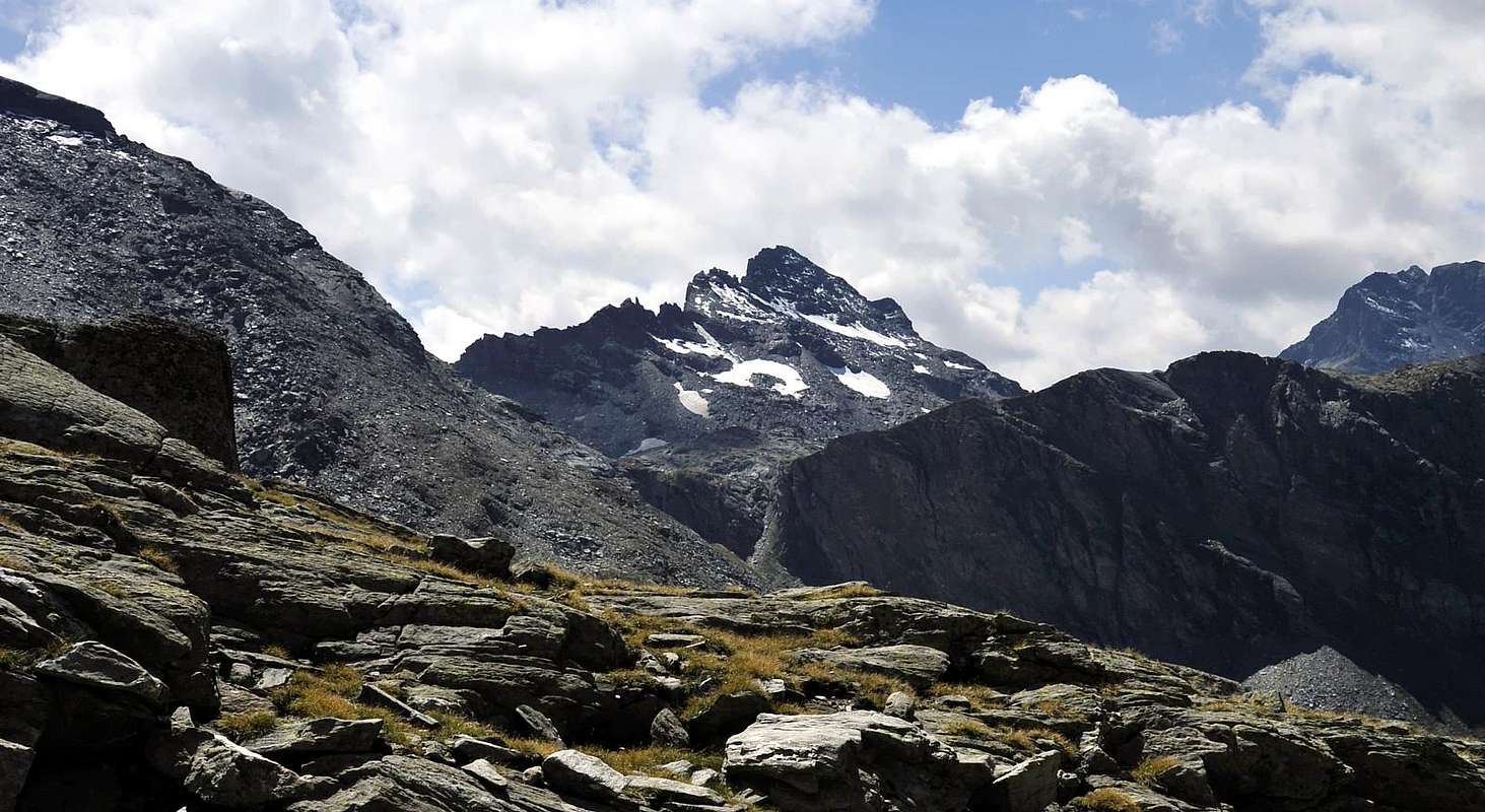
Great and large mountain, locking from Northern, whereas in the shape of little rocky castle with a series of small towers and horrifying walls plumb line to base stony ground from Southern (Champorcher Valley), Sited between Fénis/Clavalité and Champorcher/Pontonnet Valleys and more specifically amongst Pontonnet Towers-Fénis Pass (in Southwest) and Moussaillon Pass-Mount Delà (in East-northeast); very rarely popular Summit, scarcely well-known and still not as much frequented, long approach reason (especially from the long Fénis Valley with its beautiful Clavalité Tableland and following Comba Tersiva to Fénis Pass) and not very inviting aspect to Champorcher Valley. More easy for climb in respect of view, but its rock ever no good, either crossing trough the crests. Worthy of visit excursion at least for the unusual views for "upright"-uncontaminated route into a wildlife and splendid area. Paradoxically it is mountain i know "excluded and outcast" that really for to nothing he remains "cut out" also from the two Natural Parks that surround it; that National of the Gran Paradiso, that exhausts him with the Tall Walloon of the Urtier near the adjoining Tower Ponton (3.102m) and the nearby Natural Park of the Avic Mountain, that its border finishes Champdepraz/Champorcher with the neighbor Mount Glacier that with its massive greater structure, and also favored by the Mount Delà, it heavily obstructs the sight of ours, at least from Southeast or from the beautiful and extensive Champorcher Valley up to the Southern Slopes. As it regards his name him it evidently treats of it incurs in a cacophony, since Mou, Mu or Mout, that is wanted, want already, to our notice, to mean Mountain, so express for a dialect "valdotain" contraction; to such intention, and you likewise see the observations of the Guide C.A.I. of the "Gran Paradiso" by Emanuele Andreis-Renato Chabod-Mario Carlo Santi, Edit. 1939/63 and 1980, where to the page 96, and speaking of the Becca of Monciàir, the same considerations and conclusions they are effected: "… "Becca" it means mountain, stings sharp, beak and it is therefore a few illogical the expression Pecks at of Monciàr, because in the denomination Monciàir is already inherent the word mountain… ". So it is worth for our mountain for which, also in spite of the abandonment and of the alpine indifference in which it is boundless, we open, as soon as here under, a brief dissertation toponymical. What he wants to be only a small contribution to the search of the true etymology. To such intention you should be investigated through a truth "patoisan" (expert of the idiom and the dialect of the Valley of Aosta), more and more rare, above all after Teacher Robert Berton death (he owns some original manuscripts, personally delivered, on his studies, but exclusively addressed to the zone and area of Courmayeur-Mount Blanc); we launch so a proposal of investigation with which can be confirmed or to deny how much from us affirmed. And to the necessity Academician Renato Chabod considerations are always worth: better a defective, but existing work, that not a perfect but of there to come", and similarly and to conclude, sees the observations of the Guide C.A.I. of the "Gran Paradiso" of Emanuele Andreis-Renato Chabod-Mario Carlo Santi, Edit. 1939, where to the page 5 of the PREFACE: "... to the mountain climbers of good wish serves the notice than it stays to complete... ". TOPONYMY DISSERTATION Known as Mont, but also as Tour or Tower, Moussaillon as in the Papers of the institute Geographical Military Italian with Staircase 1:25.000 and, always same typology of survey, in the Map Hapax of August of 2001, Editted for the third time by the Pro Loco of Champorcher Valley (= For Place of Champorcher Community) with the title of "Les Sentiers de Champorcher". Also the remainder Cartography uses the name of Mont Moussaillon, while for the famous one "Guide of the Western Alps - Graian and Pennine Alps" of 1896, by Giovanni Bobba and Luigi Vaccarone, we find it as Hill Mussaillon to the page 20 and Mont Mussaillon to the 28. In the most recent Cartography, type The publishing Excursionist "Valley of Cogne Map of the Paths 10", 1:25.000 with coordinates U.T.M., that takes back the various "risings" & surveys to 5.000. 10.000 and 25.000 of the R.A.V.A. (Autonomous Region of the Valley of Aosta), it is verifiable what the placename Mont Moutsaillon making "more valdotain" (= more similar to dialect patois of Aosta Valley) the toponym; the same modus operarandi rather results diffused in this last Cartography, on the contrary it doesn't find equal recognition in an investigation effected near the inhabitants of the various valleys. As it regards the differentiation instead between Mountain also Tower, as already statement as soon as above, a morphology exists in the essential lines according to the point of view; if in fact from the Valley of Fénis-Clavalité-Tall Comba (= Basin) Tersiva the mountain appears more as great Mount with the wings unfolded on the axis Southwest/Northeast, on the opposite slope of Champorcher it is mostly justifiable the fascinating placename of Tower Moussaillon, or he better and better Towers to the plural as good he underlines in the picture exposed in "Overview" and in the string of the various photos of "Approach from Champorcher/Dondena". In effects, and more than the Mount Faroma set between the Valleys of Saint Barthélemy and Valpelline in Pennine Alps, it appears what great Gothic Cathedral with his "towered red towers.", hardened, indented in trained way and riverse downward on the Southerner precipices. However specific to the etymology of the toponym, instead we think, that is referable, almost certainly, to a Stony Mount, as equally for the Salliaousa (you see in "Alps Pennine I°", to work of Gino Buscaini; Edit. C.A.I. 1970, pages 199/200) in the area of the Mount Velan. In effects the total lack for these two mountains of glaciers or simply glacial-snowcapped slopes of to certain importance of it justifies broadly the denomination with this placename, being completely formed mountains from terrestrial rocky-stone, more and more you destine to a gradual and progressive, sees the composition of the predominantly formed rock from transformed micaschists, undoing if not even to crumble, as of it is already deduced by some particular lines, above all on the ridges. Good views in distance and enlarge towards Fénis Valley (Mount Rafrey also Raffray and the "binomial" Mount Glacier/Mount Delà) and Champorcher (Rosa dei Banchi or of Rocky Bands Glacier Glacier, Cima di Peradzà, Bec Costazza, Pontonnet two Towers and Ponton Tower); besides a special quick glance to nearby and impended Tersiva Point, with "her" great and high SE Face, contained among the tall South and East Crests. While the distance they are unfolded to fan the Alps Pennine toward North and the Graian Alps of the Midday Southeast, where they dominate, with great and let alone splendid sightings, the mervellaous and shining Chains of the Gran Paradiso and other.
Grande e larga montagna, se vista da Settentrione, mentre a Meridione appare quale turrito castelletto roccioso dalle orripilanti pareti a piombo sulla pietraia. Posta tra le Valli di Fénis e Champorcher e più specificamente tra i Colli di Fénis-Tour Pontonnet a SW e Moussaillon-Mont Delà a E-NE, è cima scarsamente conosciuta ed ancor meno frequentata, causa i lunghi approcci (soprattutto dalla lunga Val Fénis che sfocia nel piacevole "Tavolato" della Clavalité per poi estinguersi nell'Alta Comba Tersiva con il Colle di Fénis) e per l'aspetto tetragono che offre sulla Valle di Champorcher. Più facile a salirsi di quanto dia a vedere, ma la sua roccia non è mai buona, neppure percorrendone le creste. Merita comunque una visita se non altro per le viste inusuali e per un percorso ancora integro ed incontaminato in un ambiente di selvaggia bellezza. Paradossalmente é montagna talmente "esclusa ed emarginata" che proprio per un niente rimane "tagliata fuori" anche dai due Parchi Naturali che la circondano; quello del prossimo e dirimpettaio Nazionale del Gran Paradiso, che si esaurisce con l'Alto Vallone dell'Urtier presso l'attigua Torre Ponton (3.102 m) ed il viciniore Parco Naturale del Monte Avic, che termina i suoi confine Champdepraz/Champorcher con il vicino Mont Glacier che con la sua maggiore mole, ed assecondato anche dal Mont Delà, occlude pesantemente la vista del nostro, almeno da Sudest ovvero dall'incantevole Vallata di Champorcher con le sue vaste ed amplie estensioni, che nella parte alta ne accarezzano le pendici Meridionali. Per quanto concerne il suo nome si tratta evidentemente di incorre in una cacofonia, poiché Mou, Mu oppure Mout, che si voglia, vuole già, a nostro avviso, significare Monte, così espressa per una contrazione dialettale; a tale proposito, ed analogamente, vedi le osservazioni della Guida C.A.I. del "Gran Paradiso" di Emanuele Andreis-Renato Chabod-Mario Carlo Santi, Edit. 1939/63 e 1980, dove alla pagina 96, ed a proposito della Becca di Monciàir, vengono effettuate le medesime considerazioni e conclusioni: " … "Becca" significa monte, punta aguzza, becco ed è quindi un poco illogica l'espressione Becca di Monciàr, perché nella denominazione Monciàir è già insita la parola monte … ". Così vale per il nostro monte in favore del quale, anche a dispetto dell'abbandono e dell'indifferenza alpinistica nella quale è sconfinato, apriamo, appena qui sotto, una breve dissertazione toponomastica. Che vuole essere soltanto un piccolo contributo alla ricerca della vera etimologia. A tal proposito si dovrebbe indagare tramite un vero "patoisan" (conoscitore dell'idioma e del dialetto della Valle d'Aosta), sempre più raro, soprattutto dopo la morte del Professore Robert Berton (si è in possesso di alcuni manoscritti originali, personalmente consegnati, sui suoi studi, ma indirizzati esclusivamente alla zona di Courmayeur, nonché all'area del Mont Blanc); lanciamo così una proposta di indagine con la qual si possa confermare o smentire quanto da noi affermato. Ed all'uopo sempre valgono le considerazioni dell'Accademico Renato Chabod: meglio un'opera imperfetta, ma esistente, che non una perfetta ma di là a venire", e similarmente e per concludere, vedi le osservazioni della Guida C.A.I. del "Gran Paradiso" di Emanuele Andreis-Renato Chabod-Mario Carlo Santi, Edit. 1939, dove alla pagina 5 della PREFAZIONE: " ... agli alpinisti di buona volontà serva l'avviso di quanto resta da compiere ... ". DISSERTAZIONE TOPONOMASTICA Conosciuto come Mont, ma altresì come Tour, oppur ed ancora Torre, Moussaillon come nelle Carte dell'I.G.M. ovvero Istituto Geografico Militare Italiano con Scala 1:25.000 e, sempre stessa tipologia di rilevazione cartografica, nella Carta Hapax dell'Agosto del 2001, Editata per la terza volta dalla Pro Loco di Champorcher con il titolo di "Les Sentiers de Champorcher". Anche la restante Cartografia in esistenza utilizza il nome di Mont Moussaillon, mentre per la famosa "Guida delle Alpi Occidentali – Alpi Graie e Pennine" del 1896 di Giovanni Bobba e Luigi Vaccarone lo ritroviamo qual Colle Mussaillon alla pagina 20 e Monte Mussaillon alla 28. Nella più recente Cartografia, tipo L'Escursionista editore "Valle di Cogne Carta dei Sentieri 10", 1:25.000 con coordinate U.T.M., che riprende le varie levate al 5.000. 10.000 e 25.000 della R.A.V.A. (Regione Autonoma della Valle d'Aosta), è riscontrabile come Mont Moutsaillon rendendo "più valdostanizzato" il toponimo; il medesimo modus operarandi risulta alquanto diffuso in tutta quanta quest'ultima Cartografia, bensì non riscontra pari riconoscimento in un'indagine effettuata presso gli abitanti, nonché nei villaggi, delle varie vallate. Per quanto concerne invece la differenziazione tra Monte od altrimenti Torre, come già esposto appen sopra, esiste una morfologia nelle linee essenziali a seconda del punto di vista d'osservazione; se infatti dalla Valle di Fénis-Clavalité-Alta Comba Tersiva la montagna appare più come grande Monte con le ali dispiegate sull'asse Sudovest/Nordest, sull'opposto versante di Champorcher è maggiormente giustificabile il fascinoso ed attraente toponimo di Torre Moussaillon, od ancor meglio Torri al plurale, come ben si evidenzia nella fotografia esposta in codesta "Overview" nonché nelle varie fotografie della stringa di "Approach from Champorcher/Dondena". In effetti, e più del Monte Faroma, posto a cavallo tra le Valli di Saint Barthélemy e Valpelline nelle Alpi Pennine, appare qual grande Cattedrale Gotica con le sue "turrite rossi torri", agguerritamente indentate e riverse sulle precipiti burre Meridionali. Per quanto specifico all'etimologia del toponimo, invece, pensiamo che sia, quasi certamente, riconducibile a Monte Sassoso, come daltronde per la Salliaousa (vedi in "Alpi Pennine I°", ad opera di Gino Buscaini; Edit. C.A.I. 1970, pagine 199/200) nell'area del Mont Velan. In effetti la mancanza totale per queste due montagne di ghiacciai o semplicemente glacio-nevati d'una certa importanza od estensione ne giustificherebbe ampiamente la denominazione, essendo montagne completamente formate da terreno roccioso-petroso, sempre più destinate ad un graduale e progressivo, vista l'evidenziazione della roccia prevalentemente composta da micascisti trasformati, disfacimento se non addirittura ad uno sbriciolamento delle medesime, come di già si evince da alcuni particolar tratti, soprattutto sulle creste. Belle vedute in lungo ed in largo sulle Valli di Fénis (Mont Rafrey o Raffray ed il binomio Mont Glacier/Mont Delà) e Champorcher (Rosa dei Banchi, Cima di Peradzà, Bec Costazza e Torre Ponton e Torri del Pontonnet) ed eccezionale colpo d'occhio sulla vicina ed incombente Tersiva, con la sua grande ed alta parete SE, racchiusa tra le alte Creste Sud ed Est. Mentre il lontananza si dispiegano a ventaglio le Alpi Pennine verso Settentrione e le Alpi Graie del Sudest a Mezzogiorno, ove dominano, con grandi nonché splendidi avvistamenti, le meravigliose e luccicanti Catene del Gran Paradiso, stagliantesi a perfetta raggiera dall'Est all'Ovest dai confini del vecchio Piemonte insino alle Valli dell'Isère nella vetusta Terra di Francia.
First Ascents
First on the summit (route?): Royal gamekeeper Domenico Perruchon of Champorcher at the beginning of XX centuries.
W-SW Ridge (from Fénis Pass): Gustavo Adolfo De Petro, solo, (Jul 13th, 1916), in descent to Fénis Hill.
NW Face: Osvaldo Cardellina, solo, (Aug 13th, 1997), in ascent, in day from Barche/Lovignana up to the Grand'Alpe and Moutsaillon Loch.
NW Edge: Osvaldo Cardellina, solo, (Aug 13th 1997), in descent, in day into Comba Tersiva to Lac Moutsaillon, Cuneu, Grand'Alpe, Meney Damon and Desòt, Robbio, Marqueron, Lovignana, * first replay by two/third of crest: Osvaldo Cardellina and Emilio Bertona, (Jul 23th, 2006), in descent with same route.
N Slope (Standard Route): Domenico Perruchon in several times in ascent and in descent, at the beginning of XX Centuries, ** first replay well-known: the Ligurian mountaineers Giovan Battista Bozzino and Giovan Battista Gritti, (Aug 15th, 1910), in descent. N Slope and E Crest in final part (Left or East Variant directly to Eastern Ante Top 3.016 meters): Osvaldo and Alessandro Cardellina, (Sep 18th, 2005), in ascent, in day from Grand'Alpe, Comba Tersiva before Gran Reye, Moussaillon Torrent, Lake (* not traced in photo but just in left by blue line of Normal Via); in descent through Normal to Moutsaillon Lake, Col, Grand'Alpe.
E-NE Crest (from Moussaillon Pass, partially route): Giovan Battista Bozzino and Giovan Battista Gritti, (Aug 15th, 1910), in ascent.
E-NE Crest (Integral from Moussaillon Pass): Roberto Nicco and Company, in Eighties, in ascent from Champorcher Valley (Dondena).
Southern Spur (Direct Line to Top): Osvaldo Cardellina and Alessandro Cardellina (Aug 15th, 2005), in ascent, in day from Dondena, paths to Moutsaillon/Fénis Passes, Pontonnet Lake; in descent by North Slope or Normal with crossing to Moutsaillon Col and towards Champorcher Valley (Dondena).
S-SE Face (Way of the Big S): Osvaldo Cardellina, solo, (Jul 14th, 2006), in ascent, in day from Dondena, paths to Moutsaillon/Fénis Passes, Pontonnet Lake; in descent through integral route on SW Ridge up to the Fénis Hill and same route towards Champorcher Valley (Dondena).
Getting There
BY CAR:
From Torino, Milano, etc: Motorway A5. Exit Pont Saint Martin for then to continue on SS.26 toward Hone Bard.
From Torino, Milano, etc: Motorway A5. Exit Nus Village for Fénis Village.
From Switzerland: through the Grand Saint Bernard Tunnel or the namesake pass. Drive to Aosta, Fénis Village or Verrès and Hone Bard.
From France: through Mont Blanc Tunnel or Petit Saint Bernard Pass. It isn't necessary to take Motorway A5: you can drive on SS.26, in the direction of Aosta and Fénis Village or Verrès and Hone Bard.
BY PLANE:
Aeroporto "Corrado Gex" Saint Christophe (Aosta).
Approach from Fénis/Clavalité
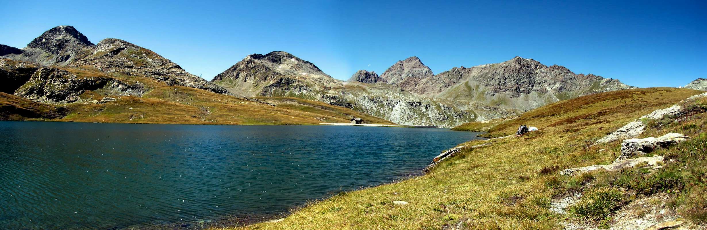
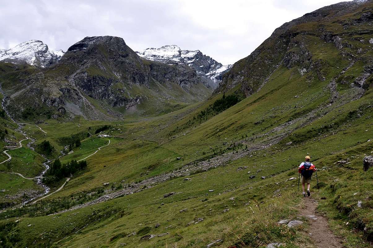
From Fénis little town (Barche Village 607m) along the dirt road (no access mark), after Lovignana (1.162m - 9km) that, boarding the Clavalitè Stream ascends the whole valley up to the Baite di Grand Alpe (2.120m), at the beginning of the Comba (Basin) Tersiva, under the Fénis Pass (2.857m). From the pastures toward East along the path n° 102 up to the Cuneu stabling buildings (2.156m), near the new Bivouac Egidio Borroz of Clavalité Rotary. Leaving in left (North) the ground road to Etsely Damon (2.434m), in quota (2.156m), near Cuneu's Alp (2.156m), continue, by Southeast direction and path n° 5C,5D along the Borgna Torrent, to quota 2.458m. Leaving in left (East) the n° 5C deviation to Upper Cuneux or Cuneus also Tramouail (High Pastures) (2.510m), instead go up by 5D to progressive more in South and, after the cross a typical grassy tableland with great boulder in North, continue among various stony grounds to Moussaillon or Moutsaillon Pass (2.853m). About eighty meters of to reach, turn rectangle West passing on Northern shore of tiny lake with same name (2.766m), between the lake and rocky quota 2.777m, more in Northern (5h'00/5h'30 from Barche).
SMALL DIRECT VARIANT:After to reach Great Alpe Pastures (2.120m), take of dirt road "poderale" (attendant with path n° 5) the left ramification in quota 2.027m, through a little bridge over the Clavalité Torrent on the side of a small wood, and by same, before with Northeast direction leaving left Etsely Desot (Lower; 2.097m) Alp, rejoin in opposite toward Southeast the preceding route, nearby the small Torrent de la Borgna (Torrent of the Hole), Cuneux Pasture and the private Refuge Egidio Borroz-Rotary Clavalité (as you khan be seen to the left in the photograph that is in bottom in the mean and on the border, in direction to Mount Delà) (more or less same times from Barche Fraction).
Partendo da Fénis, in località Barche (607 m), percorrere la lunga strada poderale (palina di divieto dopo Lovignana; (1.162 m, dopo 9 Km) che, costeggiando il Torrente Clavalité, risale l'intera omonima valle sino alle Baite di Grand Alpe (2.120 m), all'inizio della Comba Tersiva, sottostante il Colle di Fénis (2.857 m). Dall'Alpeggio seguire verso E il sentiero intervallivo n° 102 fino alle baite superiori del Cuneu o Cuneux od ancora Cuneus o Tramouail, ovvero l'alpeggio più elevato, (2.156 m), al di sopra delle quali da poco è stato edificato il Bivacco Egidio Borroz del Rotary Clavalité. Continuare verso SE lasciando a sinistra (N) la strada poderale per l'Alpeggio Etsely Damon (2.434 m), in quota (2.156 m), presso l'Alpe del Cuneux. Con il sentiero n° 5C,5D e stessa direzione SE, proseguire affiancando a destra (W) il Torrent de la Borgna sino a quota 2.458 m, ove si lascia a sinistra (E) la deviazione n° 5C per il Cuneu Damon o Tramouail (= the pasture more high; (2.510 m). Continuare invece con 5D verso S e, dopo aver attraversato un caratteristico altipiano erboso con grande masso a Settentrione, risalire con il sentiero in mezzo a pietraie verso il Col Moutsaillon o Moussaillon (2.853 m). Un'ottantina di metri prima di raggiungerlo piegare invece decisamente ad W passando sulla sponda Settentrionale del laghetto con lo stesso nome (2.766 m), tra lo stesso e la quota rocciosa 2.777 m, più a Settentrione (5h'00/5h'30 dal Villaggetto di Barche).
PICCOLA VARIANTE DIRETTA:Prima di raggiungere Grand Alpe (2.120 m), prendere il bivio di sinistra (Est) della strada poderale a quota 2.027 m, tramite un ponticello attraversante il Torrent de Clavalité al margine di un boschetto, e con la stessa, concomitante con il sentiero n° 5, dapprima con direzione Nordest e lasciando sulla sinistra l'Alpeggio dell'Etsely Desot (2.097 m), superando cinque tornanti consecutivi e tramite direzione opposta verso Sudest, ricongiungersi al precedente itinerario presso il Torrent de la Borgne (Torrente della Buca), l'Alpe del Cuneux ed il Rifugio, privato, Egidio Borroz-Rotary Clavalité (daccome si può osservare nel mezzo e sul bordo sinistro della soprastante fotografia, nella direzione del Mont Delà) (più o meno stesso tempo di percorrenza sempre dalla Frazione di Barche).
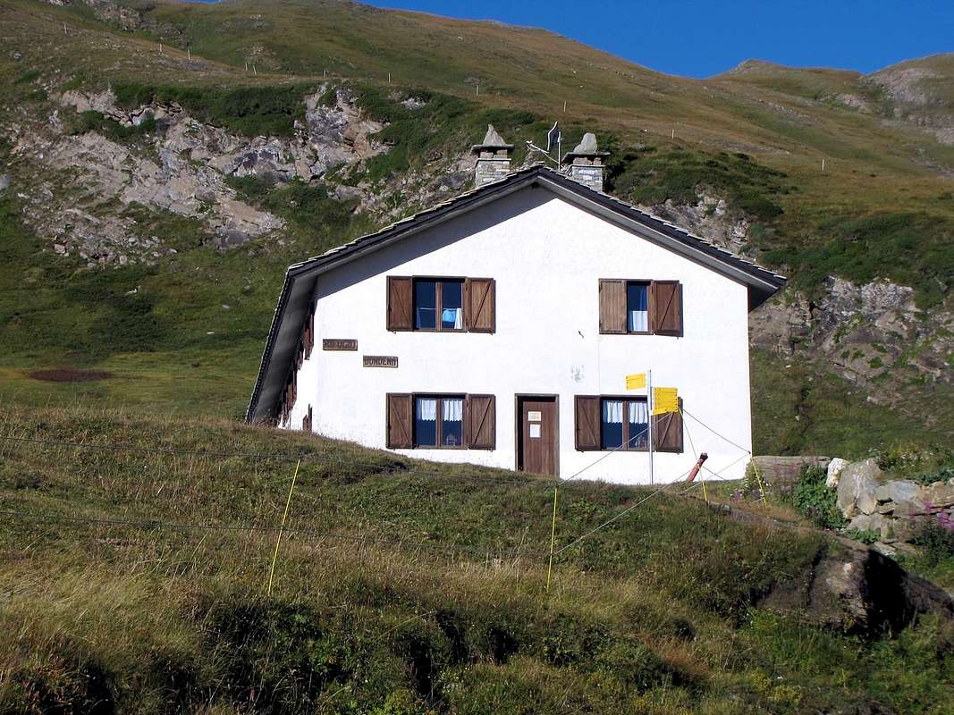
Approach from Champorcher/Dondena
From Dondena (2.110m), passing near the homonym Shelter (2.192m) to follow the excavated dirt road "poderale", concomitant with the path n° 7B,7C, Haute or High Route of the Valley of Aosta n° 2, as well as Historical Real Road built by the Savoias; (shortcut to North after the bridge actually to the Alp/Village Dondena 2.171m and to the following alternative 2.242 meters) for the Fenetre also Window of Champorcher actually to the small and attractive bridge that crosses the Torrent Ayasse to quota 2.334 meters. To continue along the path n° 8B for the Hill Moussaillon (2.853m), leaving to the right (Northeast) that (n° 8C) for the Pass Fussì/Mount Glacier, with a first deviation toward these destinations. Through to brief diagonal to the left (Northwest) and subsequent four hairpin bens that finishes in an to little longer diagonal in the opposite sense, it is reached to second ramification of the paths:
a) - with the deviation to the left (West-northwest) the initialed one 8A, that it is addressed to the Necks of Fénis, for the homonym Valley, and of Pontonnet, that crosses to the tall "Vallone" of the Urtier in Val of Cogne;
b) - with that of right again toward Northeast, and always with the path 8C, here that introduces to variation, with long diagonal in light ascent, toward the entrance of the Vallon of the Mont Glacier (3.186m; the most elevated of the homonym Subgroup) that it also gives access to the Fussì or Fussy Hill (2.910m), moving in Val Fénis toward the Alps of the Cuneux and the Etsely. Both these two important deviations happen near the hairpin bend in quota 2.540 meters, that therefore it acts from triple crossroads. Abandoning these two last, to continue more to Northern direction and line with a series of narrow "tornanti" (hairpin bends) to zig-zag and a brief diagonal to the left in the final part to reach the hill, in a line of shattered rocks and enough steep; from the same to go down about eighty meters with run semicircle to Northwest to the Little Pond Moussaillon (2.766m), set among the rocks, and therefore to rejoin him to the preceding itinerary or By Normal through the Valley of Fénis-Plateau of the Clavalité and initial part of the Comba Tersiva (E; 2h'00/2h'30 from the Village of Dondena).
LOWER VARIANT IN RIGHT:From Dondena Village briefly go down to small bridge up Ayasse Torrent, but no cross; below the little rocky gym (dedicate to two Champorcher mountaineers) passing, instead directly in West continue along of torrent left hydrographical side. Cross a very small torrent descending from Gelé Lake (sited under Southern Mount Glacier Slopes) and smoothly move at a good pace through about 1,5 Km a long prairie with perimeter ruins up to reach a narrowing, as far as the Ayasse sunk in the polished rocks transit barred. Go up right (North) flanking a water intake with fence and, by a steep and more narrow path-route among grassy slopes, reach the upper rocky headland 2.736m. About thirty metres doubling right (also reach the small summit, splendid lookout and excellent photographic area) and descend to lower great grassy tableland join again at previous route. To begin the steep slope through the path n°8A/8B/8C that, as already says above, it divides him in various ramifications according to the destinations, reaching it whereas this last begins to climb with to serpentine half dozen of small, as well as narrow hairpin bends (E; 0h'45, an a little more rapid of the precedent run and surely suggestive mostly and less crowded and boring).
Da Dondena (2.110 m), passando presso l'omonimo Rifugio (2.192 m) seguire la strada sterrata poderale, concomitante con il sentiero n° 7B,7C, Alta Via della Valle d'Aosta n° 2, nonché Storica Strada Reale costruita dai Savoia; (scorciatoia a N dopo il ponte sino all'Alpe Dondena 2.171 m ed al successivo bivio 2.242 m) per la Finestra di Champorcher sino al piccolo e grazioso ponte che attraversa il Torrente Ayasse a quota (2.334 m). Proseguire lungo il sentiero n° 8B per il Colle Moussaillon (2.853 m), lasciando a destra (NE) quello (n° 8C) per il Col Fussì/Mont Glacier, con una prima deviazione verso queste mete. Con un breve diagonale a sinistra (NO) e susseguenti quattro tornanti terminanti in un poco più lungo diagonale nell'opposto senso, si perviene ad una seconda ramificazione dei sentieri:
a) - con la deviazione a sinistra (O-NO) quello siglato 8A, che si indirizza ai Colli di Fénis, per l'omonima Valle, e di Pontonnet, attraversante all'Alto Vallone dell'Urtier in Val di Cogne;
b) - con quella di destra verso NE, e sempre con il sentiero 8C, qui presentante una variante, con lungo diagonale in leggera ascesa, verso l'imbocco del Vallone del Mont Glacier ((3.186 m; il più elevato del piccolo Sottogruppo al quale dona nome) che dà accesso anche al Col Fussì (2.910 m), traslocando in Val Fénis verso le Alpi del Cuneux e dell'Etsely. Entrambe queste due importanti deviazioni avvengono nei pressi del tornante in quota 2.540 m, che quindi funge da trivio. Trascurando queste due, proseguire invece decisamente verso Settentrione con il sentiero n° 8B e per mezzo di una serie di stretti tornanti a zig-zag ed un breve diagonale a sinistra nella parte finale raggiungere il colle, in un tratto di rocce frantumate ed abbastanza ripide; dallo stesso scendere un'ottantina di metri con percorso semicircolare a NW al Laghetto Moussaillon (2.766 m), incastonato tra le rocce, e quindi ricongiungersi all'itinerario precedente o Via Normale attraverso la Valle di Fénis-Altipiano della Clavalité e parte iniziale della Comba Tersiva (E; 2h'00/2h'30 dal Villaggio di Dondena).
VARIANTE "BASSA" DI DESTRA:Da Dondena scendere brevemente al ponte sul Torrente Ayasse, ma non attraversarlo; passando sotto la piccola palestra di roccia (dedicata a due alpinisti di Champorcher) continuare invece direttamente verso W lungo la sponda idrografica sinistra del torrente. Attraversare il torrentello proveniente dal Lac Gelé (sito alle pendici Meridionali del Glacier) e procedere successivamente ed agevolmente per 1,5 Km attraverso una lunga prateria con qualche rovina sino a raggiungere una strettoia, dove l'Ayasse si inforra tra rocce levigate impedendone il passaggio; risalire verso destra fiancheggiando una presa d'acqua recintata e, con percorso ripido su una esile traccia sul pendio erboso, risalire al promontorio soprastante 2.736 m. Non toccarne la sommità scartandola a destra di una trentina di metri (oppure raggiungerla, magnifico belvedere ed ottimo punto fotografico) e scendere in breve al sottostante grande "plateau" erboso ricongiungendosi al precedente itinerario. Iniziare la più ripida salita tramite il sentiero n° 8A/8B/8C che, come già sopraddetto, si divide in ramificazioni varie a seconda delle destinazioni, raggiungendolo laddove quest’ultimo inizia a rimontare la china con una serpentina di mezza dozzina di brevi, nonché stretti tornantini (E; 0h'45, un pò più rapido del precedente percorso e sicuramente maggiormente suggestivo e men che meno affollato e noioso).
Route
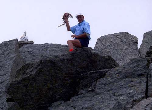
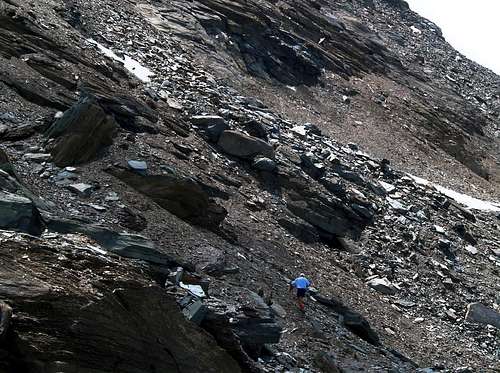
From the Lake Moussaillon (2.766m), situated to Northeast of the Mont Moussaillon and as soon as under the homonym Hill (2.846m), to abandon the path n° 5D that, with a last steep line toward Southeast, it reaches it and instead to continue verse West-southwest long, steeply, stony ground; to overcome with one easy, but fatiguing, crossed from East to West, in parallel to the impending and long E-NE Rdge, three rocky bands and some lean snowfields (you see photo of emilius, July 2006). Revolving, not without some small problem, great rocks with relative ravines, to progressively go himself supporting on the left (South) toward the triangular one and terminal Slope N in South of the quota 2.816 meters. and toward quota 2.900/2.925 meters). To easily go up again the last 150/70 meters, but with greater work, overcoming the steep slant among splinters, soil and small rocks and always supporting himself and more toward left, almost thin against a brief rocky rib, descending in sinuous way from the indented Crest E-NE. Reached this last, to arrive with a steep line to a very hold fork with big vertical jump falling toward South, above the "Chemin du Roi" (or Real Road that, departing from the Village of Dondena, it reaches the Lac Pontonnet (2.072m), as soon as before landing to the two Necks of Fénis (2.857m; adressed to the Comba also Basin Tersiva at the end last of our valley) and subsequently to the fortifications of the With the Pontonnet (2.897m), toward the Walloon of the Urtier to the Oriental limit of the Valley of Cogne). From this point to decidedly cross and as soon as under the E-NE Ridge to the right (Southwest) and, through a plate with crack (I°+/II°-), to reach the opposite Crest watershed W-SW, that salt drawing origin really from the Fénis Pass; to turn to the left decidedly then and, for easy and Cyclopean boulders that induce to a pleasant gymnastics, to touch the Peak, on which an unusual block is placed in quartz, by the form pyramidal pseudo (EE/A; F+/PD-; 6h'00/7h'00 from the Fraction of Barche; 1h'00/1h'15 from the Little Pond of the Moussaillon).
Dal Lago Moussaillon (2.766 m), situato a Nordest del Mont Moussaillon ed appena sotto l'omonimo Colle (2.846 m), abbandonare il sentiero n° 5D che, con un ultimo tratto più ripido verso SE, lo raggiunge ed invece continuare proseguendo verso W-SW lungo scoscese pietraie; superare con una facile, ma faticosa, traversata da Oriente ad Occidente, in parallelo alla soprastante lunga Cresta E-NE, tre fasce rocciose e qualche sparuto nevaio (vedi foto di emilius, Luglio 2006). Aggirando, non senza qualche piccolo problema, grandi massi con relativi anfratti, portarsi progressivamente appoggiando sulla sinistra (S) verso il triangolare e terminale Versante N a Meridione della Quota 2.816 m e verso una meno importante quota 2.900/2.925 m). Risalire gli ultimi 150/70 metri agevolmente, ma con maggior fatica, superando il ripido pendio tra frantumi, terriccio e roccette ed appoggiandosi sempre e più verso sinistra, quasi fino contro una breve nervatura rocciosa, discendente in modo sinuoso dalla turrita Cresta E-NE. Raggiunta quest'ultima, pervenire con un tratto più ripido ad una alquanto stretta forcella con gran salto verticale precipite verso Meridione, sopra le "Chemin du Roi" (o Strada Reale che, partendo dal Villaggio di Dondena, raggiunge il Lac Pontonnet (2.072 m), appena prima di approdare ai due Colli di Fénis (2.857 m; portante alla Comba Tersiva al termine ultimo della nostra valle) e successivamente alle fortificazioni del Col Pontonnet (2.897 m), verso il Vallone dell'Urtier al limite Orientale della Valle di Cogne). Da questo punto attraversare decisamente ed appena sotto la cresta E-NE a destra (SW) e, tramite una placca con fessura (I°+/II°-), raggiungere l'opposta cresta spartiacque W-SW, che sale traendo origine proprio dal Col Fénis; voltare allora decisamente a sinistra e, per facili e ciclopici macigni che inducono ad una piacevole ginnastica, toccare la Vetta, sulla quale è piazzato un singolare blocco in quarzite, dalla forma pseudo piramidale (EE/A; F+/PD-; 6h'00/7h'00 dalla Frazione di Barche; 1h'00/1h'15 dal Laghetto del Moussaillon).
Difficulty
This route can be considered EE/A (Expert Excursionists/Mountaineers); F+/PD-.
L'itinerario è classificato EE/A (Escursionisti Esperti/Alpinisti); F+/PD-.
Equipment
Standard mountaineering equipment. Rope recommended.
Da escursionismo. Corda consigliata.
Huts
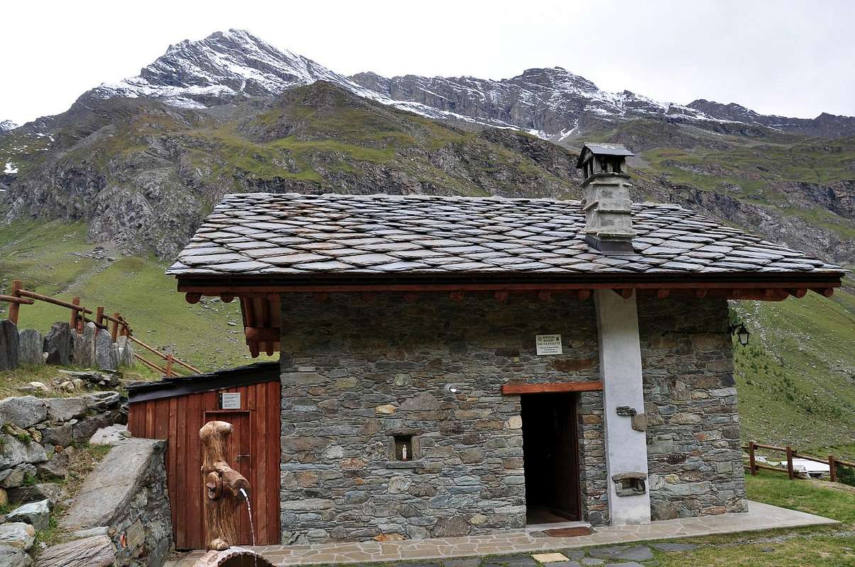
From FENIS: Bivacco Borroz-Rotary Val Clavalité (2.156m). Difficulty: E (Hikers). Sleeps 24. Always opens. Reachable from Clavalité Valley.
"Guida delle Alpi Occidentali" di Giovanni Bobba e Luigi Vaccarone C.A.I. Sezione di Torino Volume II (parte II), 25 Maggio 1896.
"Guida dei Monti d'Italia – Emilius Rosa dei Banchi-Parco del Mont Avic" di Giulio Berutto e Lino Fornelli - Club Alpino Italiano/Touring Club Italiano, Marzo 2005.
"Diari Alpinistici" di Osvaldo Cardellina e Indice Generale accompagnato da Schedario Relazioni Ascensioni 1964-2019 (inediti).
MAPS:
AIAT "Cogne Gran Paradiso" Cogne-Aymavilles, Carta escursionistica 1:25.000.
Ingenia "Parco Naturale del Mont Avic" Carta dei sentieri 1:25.000.
Hapax "Les Sentiers" Comunità Montana Monte Emilius, Luglio 2000 1:25.000.
Enrico Editori Ivrea "Carta turistica del Canavese" 1:100.000
Enrico Editore Ivrea-Aosta "Gruppo del Gran Paradiso" 1:50.000.
L'Escursionista editore "Valle di Champorcher Parco Mont Avic" Carta dei Sentieri (11) 1:25.000.
L'Escursionista "Valle di Cogne" Carta dei Sentieri 1:25.000.
Parents refers to a larger category under which an object falls. For example, theAconcagua mountain page has the 'Aconcagua Group' and the 'Seven Summits' asparents and is a parent itself to many routes, photos, and Trip Reports.

 9306 Hits
 88.19% Score
 26 Votes