
-
 6699 Hits
-
 83.1% Score
-
 16 Votes
|
|
Mountain/Rock |
|---|---|
|
|
46.03123°N / 10.92815°E |
|
|
Trentino |
|
|
Trad Climbing, Sport Climbing, Big Wall, Via Ferrata |
|
|
Spring, Fall, Winter |
|
|
5354 ft / 1632 m |
|
|
Overview
Monte Casale 1632 m
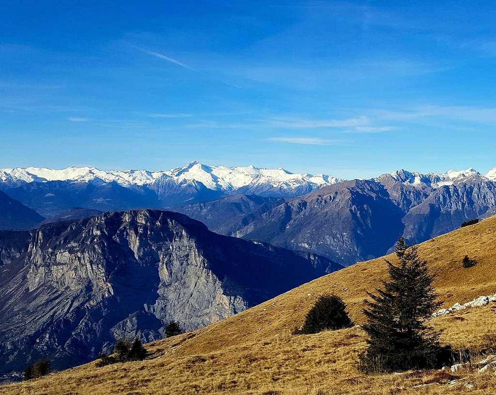
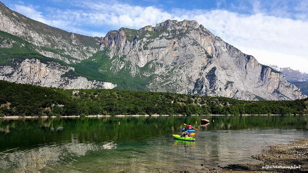
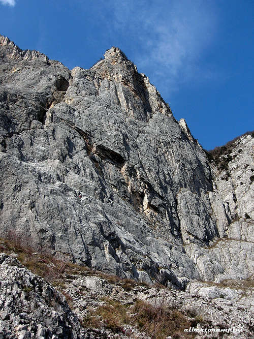
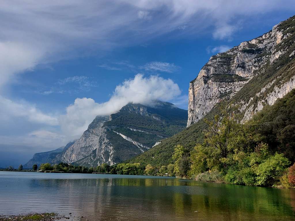
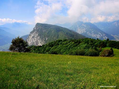
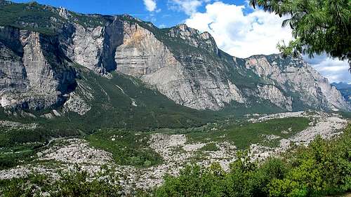
Monte Casale is a majestic mountain 1632 meters high wit a summit giving a breathtaking view. Located to the North of Garda Lake, in the province of Trento, it is part of the Prealpi Trentine, Valle del Sarca area. At its feet we find the Sarca valley. This river wraps around the Casale mountain from west to east flowing around the northern slopes. Like the nearby Brento, Monte Casale presents towards the East a high and complex limestone wall dominating the Sarca Valley 1500 meters drop, being the most majestic rocky structure in the whole valley. A famous Via Ferrata, the Che Guevara, runs along the East face of Monte Casale, near Pietramurata, and with its 1380 meters of altitude it is one of the longest Via Ferrata both in the Prealps and Alps.
Given its position, Monte Casale is the most panoramic peak in the valley. From its summit it is possible to observe: Monte Bondone, Monte Baldo and Paganella, the Pasubio to the Dolomites of Fiemme and Val di Fassa, the Ledrensi Alps, the Adamello and Presanella groups and the Brenta Dolomites Group. Moreover it is possible to admire: the lakes of Garda and Molveno, of Toblino and S. Massenza, of Cavedine with its valley and then the plateau of Ranzo and Margone and the rocky area of the "Marocche di Dro".
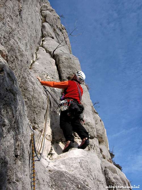
While the wall dropping down to the Sarca valley is high and impressive, the opposite side gently goes down with pleasant wooded and grassy slopes. The mountain can therefore be reached very easily from this side by a simply walk on a path that - depending on the starting point - can be really brief or require overcoming a more important vertical gain. The great itineraries that unfold with an outstanding difference in height and considerable development in the immense central amphitheater offer several challenging climbing itineraries of great historical value with climbing of considerable engagement and rarely climbed. The best rock climbs, shorter and less busy, run along the very vertical pillars that delimit the magnificent central basin on both sides, with popular classic and modern itineraries of considerable satisfaction.
Getting There
Access to the East wall
From Le Sarche take the direction Arco, at the first signpost "Pietramurata" turn to right, immediately after at a junction follow the signs to the via ferrata and the Croz dei Pini path. Park at the beginning of the path near the gate of the large quarry. Follow the path to the Via ferrata and upon reaching the boulder marked with the inscription "altitude 550" leave the path and traverse right to the base of the great wall.
Access to the Normal route
Coming from A22 Autobrennero exit Trento and follow the signs for Sarche, Vezzano, Ponte Arche, where you take the road to Comano on the left.
Grades and scales
According to Italian climbing areas habit, trad routes grades are expressed in UIAA Scale, while modern ones are in French Scale

Climbing routes
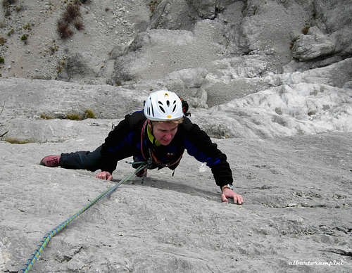
CENTRAL WALL - Routes overview from left to right
- Direttissima Via Follia
- Friederichen-Miori
- Depaoli - D'Accordi
- Via del Gran Diedro
- Via Gadotti
- Fiore di Melo
- Steinkotter-Comper
- Pilastro Gobbo
- Chobin
- Via Transylvania
Descent: after exiting the routes, cross the wood in the direction of Dain until you reach the path of the SAT which leads down to the Sarca Valley
SECONDO PILASTRO
Beautiful pillar divided by the main wall of Monte Casale by means of a deep gorge. The East face is 700 meters high with many difficult routes.
- Vedovella
- Mani di Fata
- Viaggio nel passato
- Alba chiara
- Spirito Libero
- Supergrafite
- Le Placche di Ugand
PRIMO PILASTRO
Of smaller size than the Secondo Pilastro, the Primo Pilastro is formed by the Pilastro Cristina with rather loose rock, while its spallone called Pilastro Giusti, where the most beautiful and busiest streets climb, which presents solid limestone.
Via Cristina
Ugo Merz
Via se la conosci la eviti
Via non solo pane
Via Giuma
Via del Missile
Via Vinschgerwind
Leoni in gabbia
It's a route realized by Gianni Canale, Aldo Mazzotti e Franco Cavallaro on fine rock. The route is nearby the famous Via del Missile
Croz dei Pini and Spalla sud
Fort Apache
Hasta siempre comandante
New entry
Peace on earth
Stenghel mania
Via Ferrata "Che Guevara"
Difficulty: EEA
Time require: 8 hours
Difference in level: 1300 m
It a challenging and long Via Ferrata in a wild environment that rises to the summit of Monte Casale. The difficulties are never high, but the itinerary is extremely long, sometimes subjected to discharges of stones in the middle of the wall, and never banal.
Short description: the long route of the Via Ferrata "Che Guevara" climbs up an impressive and imposing rock wall dominating the Sarca Valley, almost 1400 meters high and comes out on green pastures near the top.
Descent: along the Via Ferrata del Rampin
Normal Route from Comano
Difficulty: E
Time require: 5 hours (roundtrip) from the first parking lot, 1 hour (roundtrip) from the second parking lot
Difference in level: 1300 m
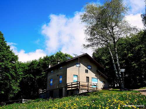
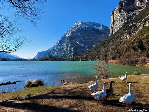
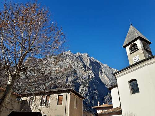
The route starts in Comano on the road to the left of the church, after the Hotel "La Panoramica", where it is possible to buy the permit to reach the upper parking lot by car, consistently shortening the difference in level to reach the summit. Continue driving along the fine paved road not by chance called "Panoramic Road", getting after a few hairpin bends the first parking lot, where it is not possible to continue without the necessary permit. Continue on foot along the road now dirt through the wooded slopes, until reaching the place named "Paghera-Madonnina" at an altitude of 1300 m. The path becomes a bit steep on a unpaved surface until it reaches "Le Quadre", the last parking lot accessible by car with the toll permit. Continue along the path that, with a large bend to the right, leads us to the meadows of "Le Quadre", where the horizon opens up, with broad view to the surrounding peaks and the Sarca Valley and its villages. In quick ascent along the pastures the path reachs the Refuge Don Zio Pisoni 1600 m., then in 10 minutes the top of Monte Casale, where an orientation table indicates the directions of the various peaks. A little further down, close to the sheer drop over the Sarca Valley, a large iron cross looks beautiful. Given its position, Monte Casale is the most panoramic in the valley; from its summit it is possible to observe: the Monte Bondone, the Baldo and the Paganella, from the Pasubio to the Dolomites of Fiemme and Val di Fassa, from the Ledrensi Alps to the Adamello up to the Brenta Dolomites Group. Moreover it is possible to admire: the lakes of Garda and Molveno, of Toblino and S. Massenza, of Cavedine with its valley and then the plateau of Ranzo and Margone and the rocky area of the "Marocche di Dro".
Red Tape
There are no restrictions in climbing, hiking, biking and other open air sport activities in Sarca Valley. No fees and no permits required.
When to Climb
Generally all round year in the area considered. Anyhow the considerable length of the routes located in the central wall of Casale and its concave shape capturing the solar radiation makes it highly unadvisable to tackle these demanding climbs during the central summer months (June, July and August).
Where to stay
This area is a primary touristic destination, offering several hotels, agriturismo, bed and breakfast, renting rooms and apartments in Sarche and Pietramurata, the closest villages, and in the others towns as Arco, Dro and Ceniga. Campings in Arco, Nago and Pietramurata.
Climate and nature
Nature is magnificent, showing a pleasant marriage of Mediterranean flora and alpine one. Due to the Garda Lake propitious influence and the low altitude of the valley, the climate is mild and it's possible to climb in all seasons. Anyhow the considerable length of the routes located in the central wall of Casale and its basin shape capturing the solar radiation makes it highly unadvisable to tackle these demanding climbs during the central summer months (June, July and August).
Meteo
Guidebooks and maps
 |
 |
 |
- Guidebooks
“Pareti del Sarca” by Diego Filippi – Edizioni Versante Sud "Arco Pareti" by Diego Filippi - Edizioni Versante Sud 2013
- Maps
“Valle del Sarca” – Map 1.25.000 - Edizioni Meridiani Montagne
External Links
Useful informations here: DRO TOURISM