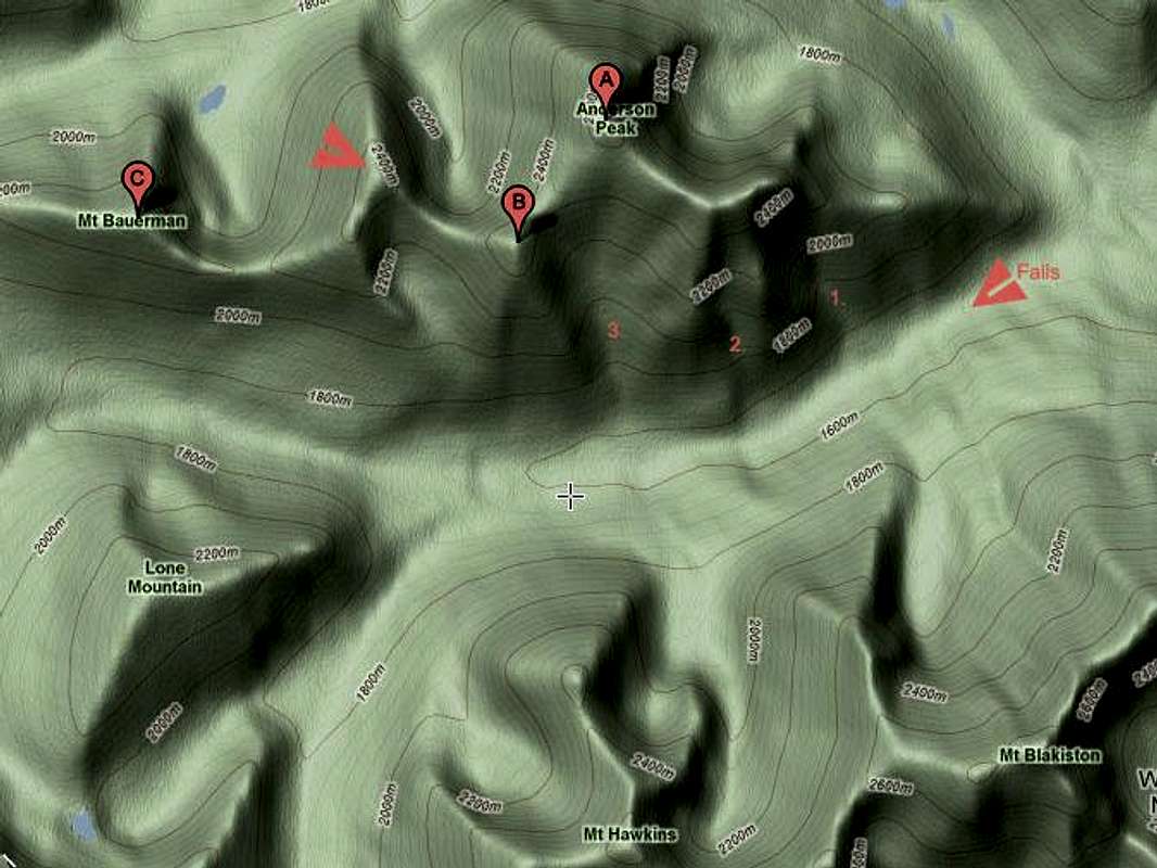
The arrowhead pointing left indicates the approximate location of Blakiston Falls along the Blakiston Trail. About 4km west of the falls is the 3rd drainage used to ascend Mount Anderson.
The drainages are labeled 1, 2, and 3.
Peak A is Anderson, Peak B is Lost, Peak C is Bauerman. The right pointing arrowhead is the unofficially named Kootenai Brown Peak.
This picture is included as part of a Mount Anderson Page. Please see
Mount Anderson.


