
|
|
Mountain/Rock |
|---|---|
|
|
48.19561°N / 121.69862°W |
|
|
Snohomish |
|
|
5974 ft / 1821 m |
|
|
Overview
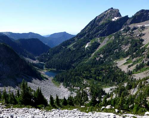
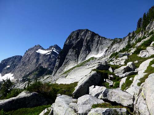
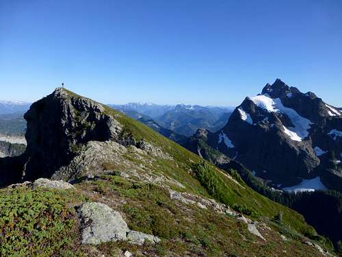
Mount Bullon from ridgeline one mile to the east. Mount Bullon Lakes can be seen at the base.
Getting There
Almost everyone who summits Mount Bullon approaches from Squire Creek. There does exist the possibility of approaching from Boulder River, which I assume would be a horrific, brushy nightmare. There is also an approach variation from Buckeye Basin, but it has not been tested by yours truly.Take SR530 east to the town of Darrington. Make the first available right hand turn after entering town (Fullerton Ave.). After four blocks, make another right hand turn onto Darrington Street. This road will turn into Squire Creek Road. Follow it for about three miles to the "new" trailhead for FS Trail #654 (N48 13.271 W121 37.523). Old maps will show the road continuing for some distance past this point, however, the roadbed was destroyed by a huge landslide just a short distance from the parking location. The first 2.1 miles of trail/old roadbed is in fairly good shape, so a mountain bike may be helpful if you are so equipped. Upon arriving at the end of the old roadbed, you will find yourself at the "old" trailhead for FS Trail #654 (N48 11.564 W121 38.087).
![Granite slab at 3000' on Mount Bullon approach]()
Granite slab at 3000' on Mount Bullon approach
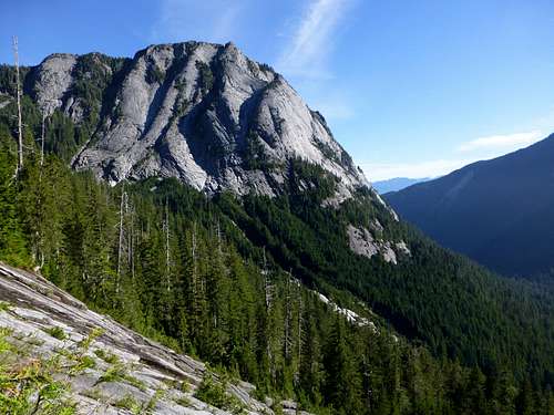
![Squire Creek Wall from 3200' on Mount Bullon approach]()
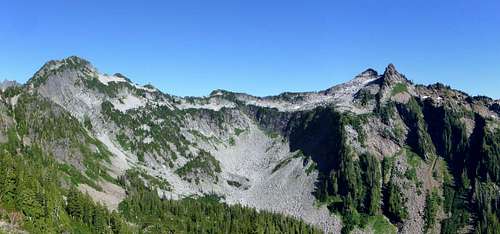
Squire Creek Wall from 3200' on the Mount Bullon approach. Several big wall routes have been put up on this impressive hunk of granite. On the ridge on the right hand side of this photo, you will notice the landslide that knocked out the Squire Creek Road some years ago.
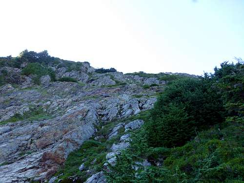
The granite slab is just steep enough to discourage travel, so ascend in the brush on its far left edge. Upon arriving on top, there will be one of two possibilities. If you were smart, and made the climb in June or July, you should be able to ascend snow fields to the top of the ridge ahead of you. If you were not smart (like us) and made the climb in August or September, prepare for a battle with thick blueberry bushes until near the 4000' level. The one consolation for us was an incredible supply of berries - however, bear scat was also plentiful. From 4000' to the ridge crest, continue straight up on a combination of creek beds, granite slabs, and talus. (Running water will be available into September on this side of the ridge.) We initially tried to cross the ridge at a notch directly ahead of us (0.3 miles NE of Salish Peak), but found the downclimb on the other side to be a little distasteful. We found an easier crossing at a point 0.2 miles NE of Salish Peak - this ended up working out very well for a side trip to Salish Peak.
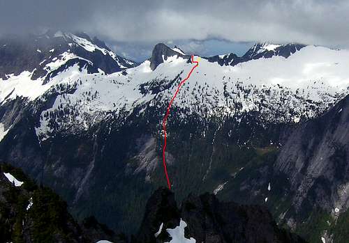
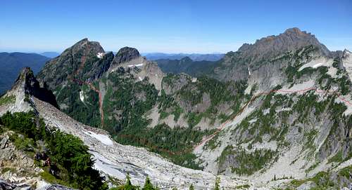
![First half of Mount Bullon approach as seen from Jumbo Mountain]()
First half of Mount Bullon approach as seen from Jumbo Mountain. Red line shows our final route, short yellow line shows where we first attempted to cross the ridge. This photo was taken in early July - under these conditions, gaining the top of the ridge and crossing to the other side should be much simpler than in late season.
![Salish Peak from the northeast]()
Three Fingers and Salish Peak from the northeast on our approach to to Mount Bullon. The point at which we crossed the ridge is hidden behind the trees on the right edge of the photo.
It was unknown to us when we started, but the most difficult part of the trip would be the descent from the ridge into the Mount Bullon Lakes basin. In early season, one would probably have several choices for making this descent. For our late season trip, the most obvious gully was just a little too steep and slick for our comfort. We ended up making a near level traverse on the west side of the ridge (roughly 5000' +/- 100'), finally making our descent directly under Ohio Peak's summit (marked as Point 5931 on the USGS map).
![Ohio Peak and Salish Peak from Mount Bullon]()
Ohio Peak and Salish Peak from Mount Bullon. Our traverse took us from near Salish Peak towards Ohio Peak at roughly 5000' (right to left). When almost directly below Ohio Peak, we made our descent into Mount Bullon Lakes basin.
Unfortunately, it will be necessary to drop down to 4200' (just 200' above Bullon Lake) to approach Mount Bullon. We made our camp at N48 11.604 W121 41.065, if for no other reason than the fact that it was the first flat spot with running water (there are plenty of choices if you are picky about such things). From camp we made a slightly rising traverse towards the mountain for about 0.3 miles, until reaching an obvious talus slope. Ascend this talus slope until another talus slope joins from the left, then continue to the base of the cliff immediately above this conjunction (N48 11.644 W121 41.663 Elev.4900').
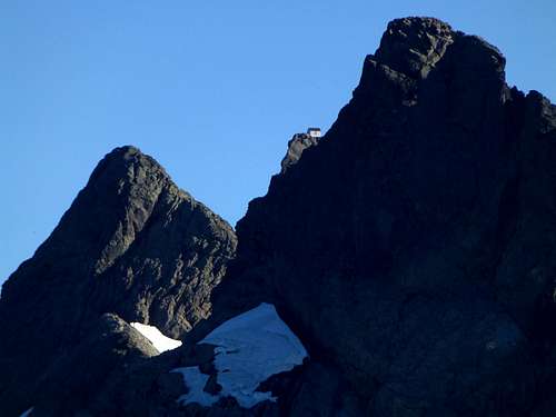
![Goats at 4900' on Mount Bullon]()
Goats at 4900' on Mount Bullon. Unlike their friends higher up, these guys did not kick rocks on us.
![The upper scramble route on Mount Bullon]()
The upper scramble route on Mount Bullon. Notice the three goats, who managed to kick a few rocks at us - if I didn't know better, I'd have thought they were aiming at us. Scramble is mostly class 2 (goat trail), with a few class 3 moves.
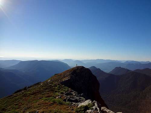
![Looking down the scramble route from Mount Bullon summit]()
Looking down the scramble route from Mount Bullon summit. Mount Bullon Lakes seen below.
If you do your best to follow the goat trail, the scramble will be mostly class 2. If you choose to make your own route, expect mostly class 3. Rockfall did not seem to be too much of an issue on this slope, once the goats stopped kicking rocks at us. The summit area of Bullon is very pleasant, with a nice heather meadow on the south side, and big cliffs on the north side for contrast. In hindsight, we should have brought the overnight gear to the top, as a bivy on top of Bullon would be nothing short of spectacular. ![Mount Bullon summit from false west summit]()
Mount Bullon summit from false west summit
![Mount Bullon summit pano]()
Mount Bullon summit pano
![Mount Bullon's false west summit from main summit]()
Mount Bullon's false west summit from main summit
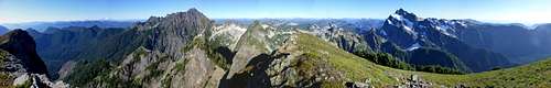
![Three Fingers lookout from Mount Bullon]()
Three Fingers lookout from Mount Bullon
![Mount Bullon from Salish Peak]()
Mount Bullon from Salish Peak. Red line shows the second half of our route to the mountain. Small "x" shows our campsite.
![Mount Bullon (Mount Bullen) route map]()
Mount Bullon (Mount Bullen) route map. This is a freehand drawing of our approximate route (not a GPS track), so please do not rely on this for precise navigation.
If you have extra time built into your trip, be sure to visit the three other summits in the area: Salish Peak - 5645', Ohio Peak - 5931', and Buckeye Peak - 5896'. If you are into lakes, you will find the three Mount Bullon Lakes at the base of Mount Bullon, or the three Craig Lakes on the south side of Salish Peak.
Route
Follow the Squire Creek Pass trail for 0.5 miles, where you will notice a sign for the Boulder River Wilderness (N48 11.259 W121 38.521). On the off chance that the sign is missing, you will notice an abrupt change from second growth to old growth at the wilderness boundary. At a point about 100-200' past the wilderness boundary sign, turn right off the trail, and proceed directly towards Squire Creek. Ordinarily, fording Squire Creek and thrashing through the associated brush would be a truly miserable experience. Much to our delight, however, we discovered a brushed out trail that began at N48 11.265 W121 38.664, and led to the creek crossing at N48 11.296 W121 38.700. Several hundred feet from the creek, the trail abruptly disappeared, but at this point we found ourselves starting uphill in easy, open timber. Continue straight uphill, keeping any cliff bands to your left, and an obvious creek gully to your right. At about 3000', the cliff band will force you over to the creek gully, which will widen into an open granite face.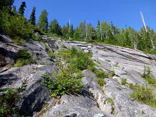
Granite slab at 3000' on Mount Bullon approach
Squire Creek Wall from 3200' on the Mount Bullon approach. Several big wall routes have been put up on this impressive hunk of granite. On the ridge on the right hand side of this photo, you will notice the landslide that knocked out the Squire Creek Road some years ago.
First half of Mount Bullon approach as seen from Jumbo Mountain. Red line shows our final route, short yellow line shows where we first attempted to cross the ridge. This photo was taken in early July - under these conditions, gaining the top of the ridge and crossing to the other side should be much simpler than in late season.
Three Fingers and Salish Peak from the northeast on our approach to to Mount Bullon. The point at which we crossed the ridge is hidden behind the trees on the right edge of the photo.
Ohio Peak and Salish Peak from Mount Bullon. Our traverse took us from near Salish Peak towards Ohio Peak at roughly 5000' (right to left). When almost directly below Ohio Peak, we made our descent into Mount Bullon Lakes basin.

Goats at 4900' on Mount Bullon. Unlike their friends higher up, these guys did not kick rocks on us.
Now contour along the cliff base a short distance to the left, and soon you will notice a well used game trail. Follow this a short distance, until reaching a well defined gully at (N48 11.584 W121 41. 724 Elev. 4950'). The game trail will follow this gully just a few hundred feet - when the gully starts to steepen, the trail will exit the gully to the right. After several hundred feet, the path with lead you to the final long slope leading to the summit.
The upper scramble route on Mount Bullon. Notice the three goats, who managed to kick a few rocks at us - if I didn't know better, I'd have thought they were aiming at us. Scramble is mostly class 2 (goat trail), with a few class 3 moves.
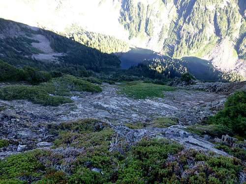
Looking down the scramble route from Mount Bullon summit. Mount Bullon Lakes seen below.
Mount Bullon summit from false west summit
Mount Bullon summit pano
Mount Bullon's false west summit from main summit
Three Fingers lookout from Mount Bullon
Mount Bullon from Salish Peak. Red line shows the second half of our route to the mountain. Small "x" shows our campsite.

Mount Bullon (Mount Bullen) route map. This is a freehand drawing of our approximate route (not a GPS track), so please do not rely on this for precise navigation.