|
|
Mountain/Rock |
|---|---|
|
|
48.83640°N / 121.3422°W |
|
|
8236 ft / 2510 m |
|
|
Overview
Mount Challenger...I can't think of a more appropriate name... First Climbed on September 7, 1936.
Mount Challenger stands as the northern anchor of the Picket Range of Washington State. This area is the most rugged and remote mountain wilderness in the lower 48 states (somewhat arguable, but not very) deep in the northern section of North Cascades National Park. Challenger and the majority of the Picketts are not visible from any road and no trails offer particularly good views of the area. The climate is quite atrocious, probably the worst in all the Cascades. The valleys surrounding the Pickets are filled with wild and all but impenetrable temperate rainforest choked with brush and blowdown. The terrain is steep and cliffy from valley bottom to peak and the whole area is riddled with wildly disrupted glaciers calving off seracs to the valleys far below. There are no walk up routes in the Pickets. Here one must deal with the peaks on their own terms, over days of real hardship. All of this conspires to make climbing in the Pickets a unique, incredible, but challenging experience at best, and a full on epic at worst. The vibe here is very different than anywhere else in the Cascades. There are fewer climber's trails, more and rougher gound to cover, and less people.
Because of the remoteness, bad weather, and overall ruggedness, people are comparatively few here, although the area has become somewhat legendary and thus, everyone at least wants to go there. Few actually make it to the peaks though.
If all that sounds dark and gloomy, sorry, it's all true, but it's also true that a perfectly clear summit day anywhere in the Pickets, after the challenges of the approach have passed is pretty much climbing Nirvana for all the same reasons that make this place so challenging.
Note: I tried to climb Challenger, but did not make it (take warning). There are also numerous other approaches and routes that I have not even seen. I'm hoping this site will prod those who have climbed this mountain but are too lazy to make their own page to share their information so others may do so also.
I am preserving the above comments by meganerd because he is the original owner and he describes things so well. Additional observations are after my 4 attempts with climbing partner Nick from three different approaches, we finally summited in 2010. Anyone who summits one of the Pickets should get a medal. There are certainly mountains that are higher and many that are more technical, but Challenger has that unique "Picket, North Cascade" flavor that is appealing, reachable, and so memorable. A reasonably fit climber can climb a short rock summit that is described as 5.7 in "Selected Climbs" book by Nelson and Potterifield, the rest is the approach and mild glacier. You can do this if you have a minimum of 5 days (every day on the move), some route finding skills and good weather. This area is amazing. Please note the Picket Range tab associated with this mountain from StephAbeg for some outstanding info on Challenger and the Pickets in general.
Getting There
There are two main corridors of approach to Mt. Challenger. However, each corridor has numerous options. A really interesting trip is to traverse from Hannegan Pass to Ross Lake going either way. This allows several peak options in addition to Challenger such as Fury, Luna and Whatcom, all doable peaks no more difficult than Challenger. All you need is time and legs. Now the approaches:
1.Hannegan Pass Trailhead (3,110 feet) which has two options:From Hannegan Pass Trail travel on a good trail to Hannegan Pass (5,066 feet)then down Chilliwack River crossing (2,750 feet and not signed) wade or find log-good luck. This crossing is 9 miles from cars.Now up to Easy Ridge at 6,000 feet plus for another 5 miles of super scenic vistas along the Easy Ridge. Just past Easy Peak you will find the anchor points for the old Fire Lookout. To get to Perfect Pass you must get through the "imperfect pass" by descending off Easy Ridge near Whatcom Peak about 1,000 feet getting around this amazing gap then fight your way up to Perfect Pass at 6,300 feet to one of the best bivy sites you've ever seen.( There is a second way through "imperfect pass", by not descending the 1,000 feet, staying close to lowest rib of Whatcom Peak then staying above the gap climbing through what is described as unprotected, exposed class 4. Never done that, but there is a least one pic showing the route somewhat.) Or... from trailhead, all the way to Whatcom Pass 17 miles from trailhead. Now you have two options, at Whatcom Pass you go up and over Whatcom Peak (7,574 feet) via North Ridge or Traverse Whatcom Glacier on the East side of Whatcom Peak. Elevation for this traverse is about 5,500 feet depending on conditions. I have never done this route, but I have read reports of those who have and I guess it works. Nelson and Potterfield describe it as an option too. Nick and I came from Perfect Pass over Whatcom Peak and down the North Ridge to Whatcom Pass and out. North Ridge was steep and exposed in places.
To get to the Hannegan Trailhead, drive north from Seattle or south from Vancouver BC on I-5 to the college town of Bellingham. Take the exit for Highway 542 and drive this east lots of miles through the towns of Maple Falls and Glacier. Just before the highway crosses the Nooksack River and begins a steep climb, take a left onto the gravel Ruth Creek Road. A sign mentions Hannegan Pass Trailhead. Drive this road about four miles to the trailhead.
2. Ross Lake/Dam and Resort trailhead. Most pay the Resort for the boat ride to Big Beaver River Camp on Ross Lake.
To get to the Ross Lake Trailhead, Drive north from Seattle or south from Vancouver BC on I-5 to the town of Burlington (just past Mt. Vernon from Seattle). Get off at the exit for Highway 20. Drive this east for lots of miles through Sedro Woolley, Marblemount, and Newhalem. Pass Diablo Lake and find the Ross Lake Trailhead on the north side of the highway ( signed for Ross Lake Resort/ Ross Lake Dam). Hike downhill about one mile to Ross Dam and the Ross Lake Resort (1 206 386-4437 for boat info). A boat can be taken ($50 in 2010 for up to five people, and they make you pay for round trip and tell them when you are returning! Yipes, we messed up one year, day late,missed the boat, finally a group from North Cascades Institute showed up in canoes with a radio. Paid for another trip to Ross Lake Resort for boat to come up just for us.) or a trail hike six miles up the west shore of the lake to the Big Beaver Creek Trailhead. Anyway, once at the boat dock at Big Beaver Trail at 1,600 feet, hike 14 miles to Beaver Pass at 3,620 feet where there is a camp and an old run down shelter. You need reservations for any camp on the trails and a zone permit for off trail multiday travel. Get the permit at Glacier (360 599-2714) or Marblemount Ranger (360 854-7245) stations. We felt some anxiety to find the right line up Wiley Ridge, but it turned out ok. If you look up from camp you can see the forested ridge. You are looking southwest. Stay on the south side of Wiley Ridge, progressively angling up to treeline. Views are amazing. There is some up and down plus the ridge seems to go on forever to me. Check your topo, find Eiley Lake finding a route down. On past Wiley Lake, up to Point 7,374 but through a notch at 7,250 feet. Challenger should have been seen along the ridge, but at this point you get real views of Challenger and the route. there are a few ways down to Challenger Glacier from here, north around Point 7,374 or through the notch and down. you just have to figure it out here. Now you should be on Challenger Glacier! Make camp where you want. The route follows a south direction toward the summit you can see from here.
2b. This approach uses the Ross Lake/Dam boat ride, but instead of going all the way to Beaver Pass for the Wiley Ridge, you can take Access Creek to Luna Col. I think the only reason you would choose this route is if you wanted to include Luna Peak and Fury with a traverse to Challenger. Otherwise it is way to long and more elevation gain loss than the other two routes above if Challenger were your only goal. We camped at Luna Camp at 11 miles from boat landing at Big Beaver Camp on Ross Lake. About 1.5 miles past Luna Camp on Big Beaver Trail you head into the bush and locate Access Creek drainage to the west.

Nick crossing Access Creek taking climbers to Luna. We lucked out and found it, but you might spend some time locating creek and crossing.
Locate crossing and follow this relatively small creek on either side (we stayed on north side) for some steep and brushy cross country travel and a valley that opens up beautifully to the east side of Luna Peak at approximately 4300 feet. From here travel south and climb up to a notch in the ridge at about 6100 feet. Continue traversing heather covered slopes (or snow) along the south side of Luna Ridge and Luna Peak to Luna Col at 7200 feet. This is a fantastic bivy site and you are only an hour away from scrambling to Luna summit. To get to Challenger Glacier from here you must descend to Luna Lake (we've done it going both ways, but traversing southernly was better the second time. We went all the way to Lousy Lake first trip and bivied there in a thunderstorm) It's tricky here not to cliff out, but you must find your way up to the Challenger Ridge and Glacier.

Looking down from Luna Col to Luna Lake covered here in snow. It's a long way down then back up to Challenger Arm and Glacier. Stay with the talus and snow you see in this picture left of center on your way back up.
Perfect Pass
Climbing Route
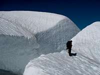
Our first attempt stopped here. Really close to summit. It is possible to find alternatives around this, but tricky.
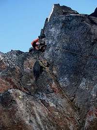
All approaches to Challenger end at the foot of the Challenger Arm at approximately 6800 feet. If it's clear weather, you see the route is straight forward from here. Aim south for the rock summit. We were stopped by a gapping bergschrund the first year we came. Last trip in you could drive a truck over it and never know it's a problem some years. You can find ways around it, mostly east... it would be up to you to figure it out. A short snow arête leads you west to some rock ledges and easy scrambling to the final 50 feet of real rock rated 5.7 in the Potterfield/Nelson book. There are some old pitons in place, but we placed a couple of nuts too. The final block is a rewarding summit after so much energy spent to get here! Your camera will enjoy the views for sure.
Perfect Pass
This bivy spot at Perfect Pass is one of my favorite places in the North Cascades for many reasons. I hope others will post pictures here when they visited this very remote, scenic place that few others put a boot down.
Red Tape
A Northwest Forest Pass ($5/day, $30 annual) is required to park at Hannegan Pass. A call to Marblemount Ranger station says that the Ross Lake Resort parking area is not in the National Park and therefore does not require a Northwest Forest Pass. A free backcountry camping permit is required for each night spent in the National Park. Be aware if you're planning to stay at the major valley backcountry camp grounds along the Big Beaver Trail, Luna Camp or Big Beaver Pass, that they do fill up even during the week. We have never had a problem getting a spot at any of these camps. From Hannegan Pass east, there are numerous choices. All of them have fire pits which is kind of unusual for us, but very nice evening fires and some cooking the first night out. This permit can be obtained at the Glacier Public Service Center 1360 5992714 or the Marblemount Ranger Station. 13608547245
When To Climb
meganerd's description follows: I wouldn't suggest doing this one until the snow has at least melted out of the forested areas, usually early July. The season usually last through late September, early October if you're lucky. It has been climbed in the winter, but that would be an excercise in misery.
Camping
From the Hannegan Trailhead, there are camprounds at Hannegan (no Ntnl Pk permit required), Boundary, Copper Creek, and one other just past the turnoff from the Chilliwack River Trail to the Easy Ridge Trail. These campgounds all have quotas. Cross-country camping (still requires a permit) is allowed on Easy Ridge and pretty much any suitable place in the Pickets (there aren't many).
From Ross Lake, quota camping is allowed at Big Beaver, 10-Mile, and Luna. Cross country on Challenger Arm.
Mountain Conditions
This one probably isn't climbed enough to get really accurate conditions, but the North Cascades National Park website has good general information. As far as the weather goes, if the forecast is looking unstable at all for Seattle, don't go. It will be raining. Note my confidence.
External Links
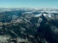
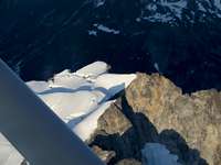
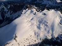
Airplane Views of Challenger
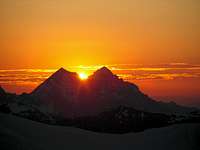
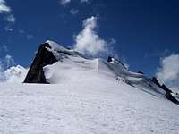
I have enjoyed four trips around the North Cascades from a small airplane from Mt. Rainier to American Border Peak. These are added to Challenger page for another look at this remote peak. I'll put most of them on here even though my hind sight view realizes the picture could have been framed better or the focus is not perfect. We are "flying by", shooting out both side of the airplane, leaning over someone...click,click, click and then we are by the mountain and on to the next. So, these won't be in the coffee table album for sale... Our first trip into the North Cascades in a small airplane was around Baker and Shuksan.
The next trip was from Bellingham Airport, around Baker again, Shuksan then off to Glacier Peak. That's the upper right pic in this heading. We had climbed Glacier recently and wanted some different pictures and perspectives. Since then we have been visiting the Pickets and recently summited Challenger, Fury, West McMillan Spire and Whatcom. So last August we were able to fly over Challenger and the Pickets. It is this last flight I was able to obtain the other three photos in this heading.







gordonye - Oct 9, 2002 12:36 pm - Hasn't voted
Untitled Commentthe correct format is 48.8364 lat, -121.3422 long. Your current format for lat/long is degrees/minutes/seconds.
Eric Sandbo - Oct 9, 2004 10:18 am - Hasn't voted
Untitled CommentAfter climbing Challenger in the mid-80's, my partner & I dropped down into Luna Cirque, SE of the summit. What must be a lake during spring runoff was warm, deep, soft sand. We needed our ice axes to stake the tent, but what a joy to bare feet after days of trail, bushwhack, glacier, and sharp rock!
Then we climbed out to the South to Luna peak & ridge.
pkmystr - Nov 24, 2004 12:26 am - Hasn't voted
Untitled CommentThe normal route, up the Challenger Glacier, has an easy exit to 3rd class, short scramble to a single pitch, 5.6 rock climb to summit, bombproof and quite climbable in boots. There are sufficient pitons so that all you need is slings and biners and a 30m rope, but it wouldn't hurt to bring a few small pieces to sew it up. We did the Wiley Ridge approach in 2004, well described by others in a report you can see from a link called "Challenger" at the bottom of the Mount Fury page. Eiley Lake was a nice camp that we used nights 2 and 3, Beaver Pass (permit required) was a good camp for nights 1 and 4. As with all approaches to the Pickets, Devil's club and heinous brush abounds, be prepared to dry tool in dirty, cliffy areas, and wear clothes you don't mind shredding in the brush thrash. Your party should research both Beckey and Potterfield/Nelson, and have excellent map and compass skills to have a fighting chance in the Pickets.