
|
|
Mountain/Rock |
|---|---|
|
|
39.28190°N / 119.6174°W |
|
|
Storey |
|
|
Hiking, Scrambling |
|
|
Spring, Fall, Winter |
|
|
6351 ft / 1936 m |
|
|
Overview
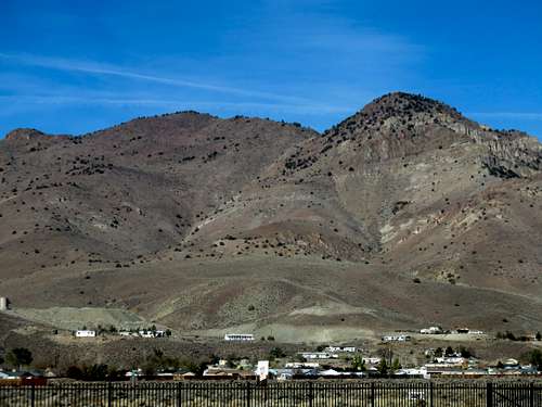
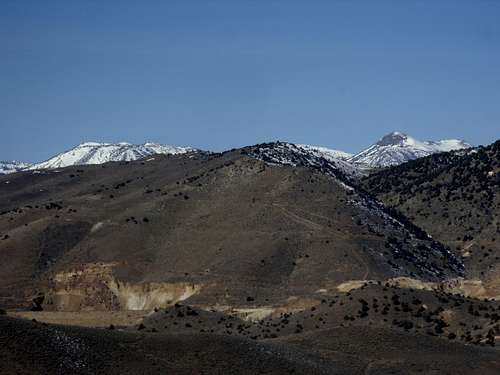
Mount Grosh and Rose Peak from US 50
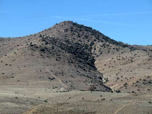
Katy Peak 6,120' from US 50
Mount Grosh 6351’, Rose Peak 6292’, and Kate Peak 6,120’ are three named summits in the Flowery Range, an offshoot of the Virginia Range of Northwest Nevada. They sit along what is referred to as the Flowery Ridge, east of Virginia City,which rises up to the north above Dayton, NV and US Highway 50. The "Flowery Ridge" should not be confused with the much longer (and larger) ridge where the higher summits of the Flowery Range are located. Mount Grosh, Rose Peak, and Kate Peak are actually on the south side of Six Mile Canyon Road, and follow a parallel ridge heading east.
Mount Grosh is the main prominent summit, with a prominence of 431', while Rose Peak and Kate Peak are its less prominent shoulder summits, with less than 300' of prominence.
These three summits are all easily accessed from the cities of Reno and Carson City. They are located on mostly public lands, so there are no access issues. Dirt roads lead up to the base of both Mount Grosh and Rose Peak which are separated by less than ½ mile. They also share a saddle at about 6070’, which is why Rose Peak isn’t an official peak, although Mount Grosh is an official summit. Mount Grosh and Kate Peak are about 1 mile apart, and share a saddle at 5,893’, which is why Kate Peak also isn’t an official peak.
These three peaks can be hiked in a few hours, and make a great combination with Emma Peak 6442’ just to the northeast. Several other nearby summits can be hiked around these mountains, such as Flowery Peak, and the spectacular Sugarloaf rock formation to the south.
The best time to hike up Mount Grosh, Rose Peak and Kate Peak is probably late fall through early spring (October through March). During late spring and summer months, temperatures are far too high. Also try and avoid this area in muddy conditions, after rain storms or snow storms. Wait at least three or four days of dry weather. Not uncommon in the desert, even in winter or springtime.
Getting There
There are two primary routes and one alternative route to these summits.
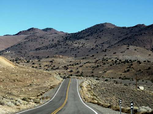
For the two primary routes, from Reno take 395 South to exit 57B, or take exit 61 (Virginia Street) and drive south. Either way leads to Highway 341, the Geiger Grade. The Geiger Grade is a mountain pass road from Reno to Virginia City. It winds through the hills of the Virginia Range for about 15 miles after leaving Virginia Street in south Reno.
The shortest primary route is hard to spot because it is at a round-about off a curvy highway. From the Northern 341/342 junction, take 341 south from Virginia City for about 3 ½ miles. If coming from Dayton via US 50, it is 4 miles from US 50 and about 1.4 miles north of the Southern 341/342 junction. The coordinates are 39.2725, -119.6261. This is on federal lands and directly below Mount Grosh and Kate Peak. There is only space for 2-3 cars.
View towards Mount Grosh (left) and Kate Peak (right) from the south
A slightly longer, but more scenic route is accessed from the Six Mile Canyon Road. Once in Virginia City, look for signs to Six Mile Canyon Road. This is a narrow paved road that leads from Highway 341 to US Highway 50 in the Dayton Valley.
The parking area is a dirt road, on the north side of the road (left side of the road if coming from Virginia City). Find a place to park on the dirt road, just past the pavement.
An alternative route is from the south via US 50 in Dayton. Take Sutro Tunnel Road until passing neighborhoods. From there, you can hike up to the ridge between Emma Peak and Rose Peak. Grosh Peak can be reached in about 3 miles, and Kate Peak in 4 miles. You can head down Kate Peak and cross-country back to the starting point in a little over 6 miles round trip. The total gain for the three peaks is about 2,450’. If adding Emma Peak, you add another mile and gain another 615’.
Route Description
The shortest primary route is very direct. From the parking area, hike up the road towards the ridge. The road peters out as you gain 400’ in ½ mile to the ridge just below Mount Grosh. Kate Peak is another 0.6 miles away. Mount Grosh is a similar distance, abeit the other direction. All three summits can be reached in 4 miles round trip, gaining about 1,700’ total for the trip. Add Mount Emma for another 700’ total and 6 miles round trip.
For the longer route, once at the parking area, get back on the paved road and take a left, following it for just under ½ mile until you reach a dirt road on the right, with a metal gate. Walk around the metal gate and follow the road for about ¼ mile until it makes a 180 degree turn. You will see another road on the left just below it. This is the road to take up the into the mountains. Once on this road, follow it for about ¾ miles and there is another road cutting uphill on the right. Take this road as it heads west. It will eventually turn around and head back uphill, and cuts towards a ridge between Rose Peak on the left and Mount Grosh on the right. It ends at a t-junction with another dirt road. Take a right on this road and follow it to the base of Mount Grosh. Try to approach from the right side, as opposed to the left, because the right side gets more sun, and should have less snow in winter and less mud in spring. It is about 370’ up the slope to reach Mount Grosh. It is a mile further to Kate Peak. On the way back from Kate Peak you can take a dirt trail/minor road which bypasses Mount Grosh and leads towards the saddle between it and Rose Peak, which is about 6070’. Walk straight up Rose Peak which has some brush, but it is manageable.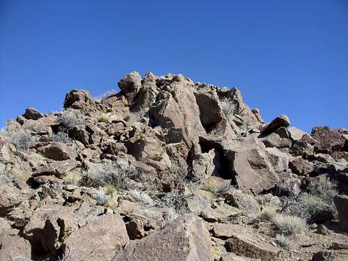
Rose Peak summit rocks
To descend, go back to the saddle, and back the way you came. This is about a 8 mile round trip hike, with a total elevation gain of about 1600’ to get all three summits. You can add on Emma Peak by descending to the saddle and back to the road. You would descend the face of Emma Peak on the return. Emma Peak adds only another ½ miles net because the descent is quicker once on top of Emma Peak. Emma Peak adds another 620’ of elevation gain.
Mount Rose 10776' and Slide Mountain 9698' peaking out from the summit of Grosh