
|
|
Mountain/Rock |
|---|---|
|
|
35.30300°N / 82.928°W |
|
|
6110 ft / 1862 m |
|
|
Overview
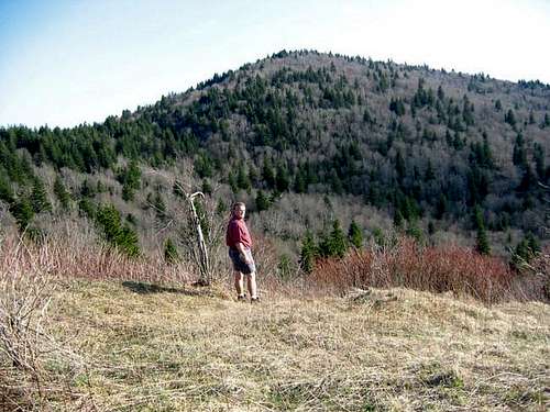
Mount Hardy is another of North Carolina's 6,000 foot peaks. It offers a very distinct and recognizable outline between the heights of Shining Rock Ledge and the conical peak of Richland Balsam. The Blue Ridge Parkway slabs along one side of the mountain, but the rest of the ridge lies within the Parkway right of way (owned by the NPS) or within the Middle Prong Wilderness Area, which leaves the bulk of the mountain protected from development.
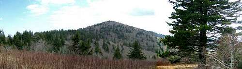 Mount Hardy
If you are looking for an area that is truly isolated here in the southeastern USA, then the wild lands in which Mount Hardy looms are among the finest one can locate. Miles of trails wind on and around this mountain, and with use limited by most hikers, solitude is easily found. Be aware that the trails in the Middle Prong Wilderness are unblazed and without signs. If you hike here, be sure to have an up to date topo map and compass. A GPS is also a good addition, but these are often ineffective in some of the thick forests here. Needless to say, don't bother with a cell phone.
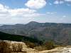
 Mount Hardy, from Sam Knob.
Mount Hardy is the only peak I've posted here that I failed to summit. I did get within about 150 vertical feet of the top, but had to turn back. I was trying to bushwhack in from the saddle between Hardy and the Green Mountain ridgeline and couldn't find a suitable route.
There is a trail to the top via the Blue Ridge Parkway at the Mount Hardy Gap overlook. Next time I make the attempt, I'll use that trail to summit the mountain.
 |  |
Getting There
I tried to summit via a bushwhack off of the Mountains to the Sea Trail at its intersection with the Green Mountain Trail. I failed, and have been told there is a much easier access from a trail at the Mount Hardy Gap overlook on the Blue Ridge Parkway at milepost 423.2.The Mountains to the Sea Trail crosses Highway 215 near the intersection with the Blue Ridge Parkway. This parking area is the main access point for getting close to Mount Hardy via MTSTrail.
A great description of the trail to Green Knob and over the flanks of Mount Hardy can be found here.
Good information regarding The Mountains to the Sea Trail can be located here.
 |  |
Red Tape
None. All wilderness area rules apply: specifically that there are no fires, and no camping groups in excess of ten persons. |  |
When To Climb
Mount Hardy can be climbed all year, but access to the trailheads can be limited by heavy snowfall. The Blue Ridge Parkway is gated during heavy snow and ice events, and the trailhead on 215 can also be limited during such times. |  |
Camping
 Not far from Hardy.
There are many great campsites within the Middle Prong Wilderness Area, in which Mount Hardy is located. Nearby developed or semi-developed campgrounds can be found at Sunburst or Davidson River, both administered by the Pisgah National Forest.
 |  |
Mountain Conditions
Check the weather for Mount Mitchell which is some miles farther north, but is roughly the same elevation and has similar weather.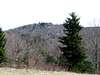 |
External Links
- Middle Prong Wilderness.
Nice site for information regarding the Middle Prong Wilderness Area, in which Mount Hardy is located.