
-
 3545 Hits
-
 81.84% Score
-
 14 Votes
|
|
Mountain/Rock |
|---|---|
|
|
29.28118°N / 103.28928°W |
|
|
Hiking, Trad Climbing, Scrambling |
|
|
Spring, Fall, Winter |
|
|
6380 ft / 1945 m |
|
|
Overview

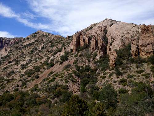
Mount Huffman is not labeled on all maps, a bit strange since the USGS quad it is on bears its name. Perhaps because of that, it (seemingly) gets little traffic even though it is close to a road and the way up is as easy as Class 2.
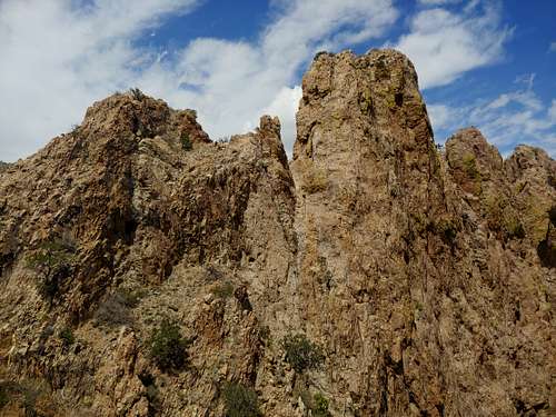
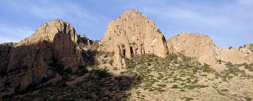
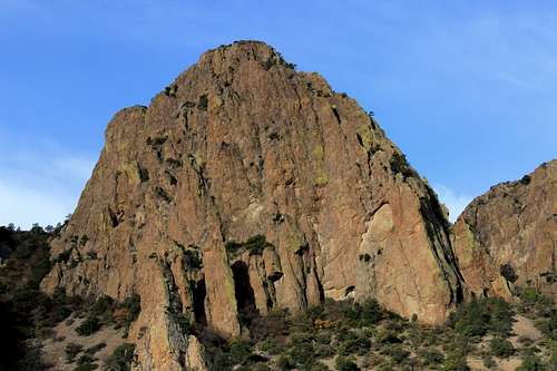
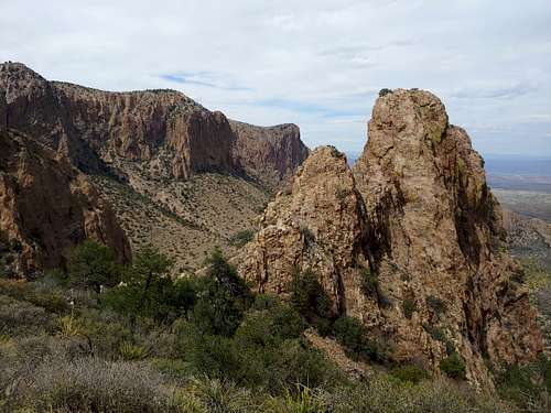
There are two main summits, and there is a third subpeak. The two main summits are walkups, but the easiest way up the subpeak, which is also the most striking peak of the complex, looks to be low 5th Class on questionable rock with little opportunities for protection. The day we were there, I got to the base of the pinnacle and wanted to climb it, but it was very windy. That and the lack of apparent protection made me decide to try it another time when conditions are more favorable or I can bring a rope and build a belay anchor.
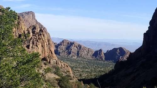
The westernmost summit is the highpoint. Views of the Chisos Mountains and the surrounding desert are expansive and spectacular.
If you're lucky, you may see a Chisos Black Bear. We saw a small young adult near the lower of the two main summits. It kept on eye on us but never threatened us. Nor did it seem frightened by us.
Getting There
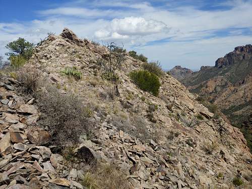
In Big Bend National Park, drive south on the road into Chisos Basin. Pictures on this page will make it easy to identify the peaks as you drive in. You can park below the peaks at a pullout with an interpretive sign and take an adventurous way to the summit, or you can park at the Lost Mine Trail parking lot (get there before 9 during busy seasons and holidays) and make an easy Class 2 hike to the summit.
Routes
We started from the aforementioned pullout after being dropped off and ended at the Lost Mine Trail and then walked back to the lodge. After some desert bushwhacking, we ascended a scree-filled gully. When it became really brushy near the top, we cut off onto rock and started scrambling on exposed Class 4 rock. There could be easier ways and there probably are. Once we were up to the "plateau" above, it was easy hiking. First, we hit the highpoint. Then we contemplated the pinnacle and decided against it, and finally we hiked up to the lower of the two main summits and from there down to Lost Mine Trail parking. Distance to the main summit was 1.5-2 mi with around 1000' of elevation gain.
If you go up from Lost Mine Trail parking, you'll shave a few hundred feet of elevation gain without affecting the one-way distance much at all. It took us 15 or 20 minutes to get down from the lower summit.
Red Tape
The park entrance fee is now $30 for a car for a week.
When to Climb
Spring, fall, and winter. The elevation here makes this the coolest area of the park in summer, but daytime highs are still going to be in the 90s and 100s a lot of the time.
Camping
There is a lot of camping at the Chisos Basin Campground nearby. During certain portions of the year, you can reserve spots at recreation.gov, and it's a good idea to do so.
If you're willing to spend the money, the Chisos Mountain Lodge makes for much better accommodations.