
|
|
Mountain/Rock |
|---|---|
|
|
44.39558°N / 72.64527°W |
|
|
Hiking |
|
|
Spring, Summer, Fall, Winter |
|
|
3539 ft / 1079 m |
|
|
Overview
This is an awesome mountain in the Worcester range with a semi challenging hike in the Stowe area. It is a good solid hike with great views of Mt. Mansfield, Camels Hump, much of the Greens and on a good day the Presidentials. Towards the top there is even a bit of easy pleasurable scrambling that leads to the open summit. Considering it's height, there are not many mountains as fun to climb and with such excellent views as Hunger.
When the Von Trapps moved from Austria to the USA, they chose Stowe for thier new home. I'ts not the Greens that you see from thier front doorstep, it's Mount Hunger and the Worcester range.
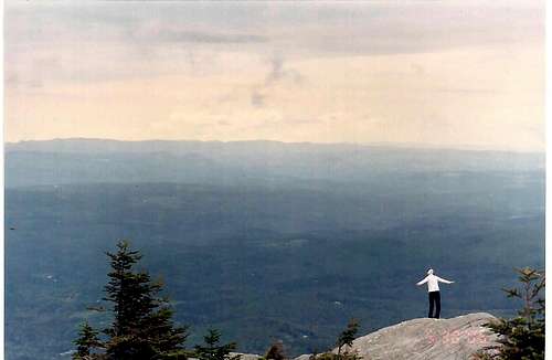
Facing East towards New Hampshire
Getting There
Waterbury Trail:
From downtown Stowe, turn east on School st. At .3 mile, bear right onto Stowe Hollow Rd. Continue up until Stowe Hollow Rd. ends and Barnes Hill Rd. bears right and turn left onto Waterworks Rd.-Sweetfarm rd. (dirt). When I was there there was no sign so be patient, (any contributions welcome). The trailhead to the Waterbury trail is on the left. It is a small dirt parking lot.
From the town of Waterbury: Head north on Vermont 100. Take first right after Ben & Jerry's onto Kneeland Flats. Take next right onto Guptil rd. (.9 mi.) which turns to Ripley rd. At Sweet rd. intersection(4.7 mi.), turn right. Trailhead parking is on right.
Middlesex Trail:
From Montpelier, head north on Rt. 12 past Wrightsville Resovior boat launch sign. Turn left onto Shady Rill rd.(0.0 mi.) Drive through Shady Rill, turn right after Rumney School onto Worcester rd.(2.2 mi.) Take left fork onto Bear Swamp rd.(2.8 mi.) At 2.9 mi. bear left again, continue to clearing and trailhead (4.9 mi.)
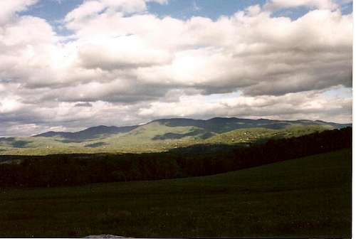
Mount Hunger seen from the Trapp Family Lodge.
Red Tape
The gmc (green mountain club)closes many of the popular hikes in the greens and strongly encourages hikers to avoid higher elevation trails from april 15 to memorial day because of trail erosion due to the wet conditions of spring so check with thier website for more info. Green Mountain Club</a7Otherwise Not much. there is a nice sized parking area alloted for the Waterbury trail.
Jmattvt - Aug 13, 2009 7:18 am - Hasn't voted
DirectionsI have found that the directions to the Middlesex trail are not quite correct. There is no Worcester Rd, You turn right on Story Rd, not Worcester Rd. Just thought people should know, otherwise you may find yourself driving around for a while.
rasgoat - Aug 13, 2009 9:28 am - Hasn't voted
Re: DirectionsThank you Jmattvt. Is that the only correction necessary? let me know so I can change it.
Carline1316 - Mar 3, 2013 7:51 am - Hasn't voted
DirectionFrom waterburry trail After Ben & Jerry Turner take the first right on Guptil rd (.9miles) turn right on Kneelands flat which turn into Ripley rd and the end of the road(4.7 miles), turn right on Sweet Rd.
terrie10 - Apr 21, 2021 8:05 am - Hasn't voted
Missing GoldenWe are desperately searching for a beautiful male Golden Retriever who may have been spotted in this area. If anyone does see him please message me at 315-244-4473. His name is Yogurt and he has been missing for 4 weeks, we need to try and bring this baby home!