![At the split]() At the split
At the split
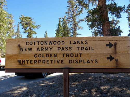
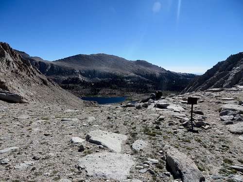
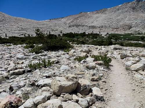
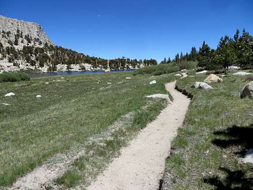
I took right and I continued to Cottonwood Lakes, a very nice, easy hike. The elevation gain is very small and every turn unveils beautiful landscapes. At one point, while at the lakes, the trail splits in two and I had to pull the map out and make sure I go the right way. I continued toward the OAP and got to the last of the lakes (so I thought) where I stopped and ate an energy bar. As I continued up the trail I came by another lake (this was the last lake) which is a little bit elevated compared to the other lakes, therefore out of sight while going up. It is also where most of the two day hikers to the summit like to camp.
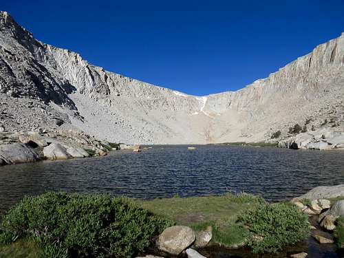
![Lake before the OAP]() Old Army Pass in the background. Last lake before the Old Army Pass. The trail goes around the right side of the lake and up toward the left side of the mountain over the small patch of snow on the middle, top left.
Old Army Pass in the background. Last lake before the Old Army Pass. The trail goes around the right side of the lake and up toward the left side of the mountain over the small patch of snow on the middle, top left.
There were a bunch of tents there with a bunch of kids getting ready to summit the mountain. It was almost 8 o'clock by now. I was looking at the pass in front of me and I could not make out the trail no matter how hard I tried. However, I started to notice very small, colorful dots, moving up. These were hikers going up the OAP. Now I was able to see how the trail switchbacked up the pass. There were a lot of kids no more than 16-17-18 years of age going up the mountain. They were all split in many groups, each group having an older guy as a group leader. I got on talking to them and they were all from Queens, NY, going on a summer camping trip. They were definitely not prepared for it, two of them already hiking down due to altitude sickness, although they were only half way up the pass.
![Group of Hikers]() Group of Hikers resting on OAP
Group of Hikers resting on OAP
| ![Hikers]() Hikers going up OAP - mid picture, right side
Hikers going up OAP - mid picture, right side
|
Hiking the pass for me seemed like an easy thing. A little problematic was at the top of the pass where a lot of snow covered everything, including the trail. Lucky for everyone, by this time in the day the Sun hit that snow for a couple of hours, enough time to melt the snow to allow the shoes to sink in for a good footing. About 20 steps and I cleared the snow. Not without being a little scared, I have to admit, since the exposure at that point on the trail is definitely the worst on the whole hike. If one slipped there on that patch of snow, one would've been in serious trouble. But neither the kids nor myself had trouble negotiating that difficult part of the trail without an ice axe, crampons or trekking poles. It took me 40 minute to hike to the top of the OAP.
![Top of OAP]() Top of OAP. Right here, after passing the Yosemite Park sigh, turning right is the trail to Langley. I am actually on the trail here while taking this picture. The trail on the right side of pic comes from Cottonwood Lakes, up OAP and continues down on the other side of the mountain.
Top of OAP. Right here, after passing the Yosemite Park sigh, turning right is the trail to Langley. I am actually on the trail here while taking this picture. The trail on the right side of pic comes from Cottonwood Lakes, up OAP and continues down on the other side of the mountain.
From here there is a trail going to the right (North) towards Langley, gaining a little elevation on that Langley Plateau. From the plateau Mount Langley appears as such an easy to hike mountain. But it is not, "my ferend." Not at all. It is as deceiving as it could be. Going up this plateau the altitude jumps on everybody that is not prepare. Quite a few hikers were trying to get their bearings sitting on rocks. But not this one kid. No Sir. He was ahead of his group of 6 hikers, doing jumping jacks, waiting for his friends to catch up, yelling at them to rush up. I was thinking to myself: there is something to be said about being 16. Boy, the endurance on this kid! He would not stop with the jacks, screaming at his buddies in the same time. I had no trouble hiking and the altitude didn't bother me but I wouldn't have done a jumping jack at this elevation neither for money nor fame. I passed the people sitting on rocks and the group of kids who seamed really tired, but at least moving.
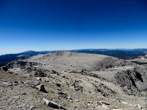
![Mount Langley]() Mount Langley. It is hard to distinguish from this view point but there is another hill in front of Mt Langley. Once I climbed this hill there is another small plateau and then the ascent starts on the actual mountain.
Mount Langley. It is hard to distinguish from this view point but there is another hill in front of Mt Langley. Once I climbed this hill there is another small plateau and then the ascent starts on the actual mountain.
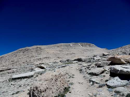
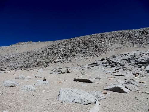
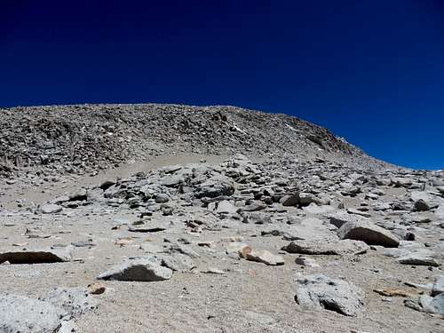
I kept walking up toward the mountain and trying to determine the easiest way of getting to the summit. It was clear at this point that the whole mountain was a big hill of scree with no one defined trail to reach the summit. I followed what appeared to be the most used way of going up, a trail which drifted left (West), although the summit was to the right.
![Trail to the summit]() Trail to the summit. I drifted left here and switchbacked right at the sandy looking slope up on the hill's left side.
Trail to the summit. I drifted left here and switchbacked right at the sandy looking slope up on the hill's left side.
| ![Trail to the summit]() Trail to the summit. The other way going up was turning right here, hike to the slope all the way to the right of this pic and climb a class 3 to the summit.
Trail to the summit. The other way going up was turning right here, hike to the slope all the way to the right of this pic and climb a class 3 to the summit.
|
There is a seemingly shorter route, class 3 hike to the summit going right (East) but I was not interested in it since I had my class 3 fill the day before on Mount Russell. Plus, the guy at Lone Pine hiking store did not mention it and I have the habit of sticking with what I know, if I had any concrete info. Looking back I noticed that one group of kids went that way, another followed me. I kept moving up the scree hill noticing two groups of rangers building cairns. I exchanged a few words with each group and continued on my way. Good for them; on Langley there is a heard of mountain goats. Keeping hikers on one defined path keeps goats happy.
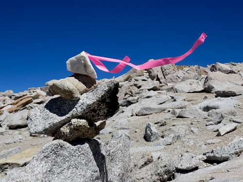
![Cairn]() Cairn made up by hikers.
Cairn made up by hikers.
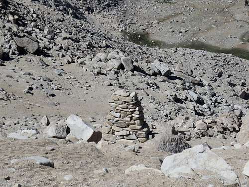
| ![Cairn]() Cairn made by rangers.
Cairn made by rangers.
|
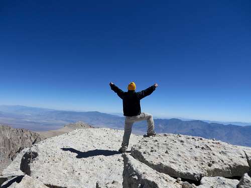
I finally made it to the summit where the views were great, the satisfaction guaranteed and the wind fierce. I had the summit to myself for the entire time since no hiker or group appeared during the almost an hour time I enjoyed the solitude.
![Mount Langley]() Mount Langley, nice to meet you!
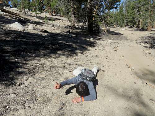
Mount Langley, nice to meet you! I started down and in about 15 minutes of going downhill I came up the group of kids that followed me. They all looked discouraged by the never ending hike; seeing the summit the whole time but taking them 5 hours to reach it is no easy thing. It took me 5 hours too, but at least I started from the parking lot. They started at Cottonwood lake 6. I encouraged them a bit, pointing to the summit in view, and continued my way down. 5 minutes later I came across the kid that was doing jumping jacks! He was flat on the ground complaining of altitude sickness! It made me laugh. I couldn't just let it be and I had to tell him about how stupid it was to do jumps at 12,000 ft. elevation. I cracked some jokes on his behalf while he was smiling back, agreeing with me, but barely keeping is head up. He entirely lost his will of bonding with nature or to continue, and was almost out of water. I encouraged him to go up, step by step, and reach the summit. When I told him he'd be on the summit in 30 minutes his heart dropped. I really did not want him to come all the way from NY, spend all that time and money and not summit the mountain. After all, he was just tired. The weather was as good as it could be. His friends had water to help him get back to the lakes. Plus, it was a sunny but cool day; going down he wouldn't need more that .5l of water. Moreover, if he continued to stay there who knows what way his buddies would've gone down and leave him there. Moreover, there were seven rangers within 100 yards of him, so he was in good hands. I left him there contemplating his existence.
![Cirrque Peak]() Cirque Peak
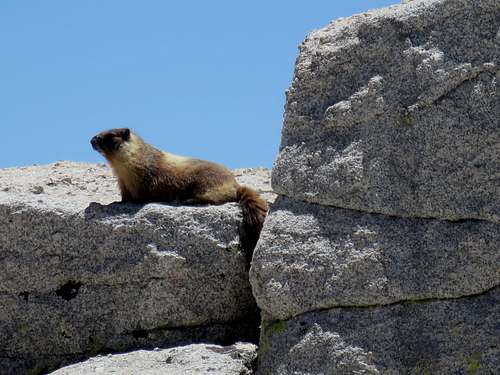
Cirque PeakI continued down toward the OAP. My plan was to go passed the OAP and hike up to the New Army Pass and from there to Cirque Peak, and then turn back and hike down the New Army Pass. However, when I made it to the New Army Pass I checked my bag and realized that I only had a half a bottle of water left. That wasn't a problem if I had to go down, since once clear of the pass there is water everywhere. However, going up to Cirque, which is right there but at least 1.5 hours round trip, I'd needed another bottle of water and I didn't want to risk it. It was very windy and the wind makes me thirsty. I knew it would have been stupid to push it, so I didn't. Oh yes, and I meet a marmot.
![Marmot]() Marmot
MarmotI continued down the New Army Pass. As I hiked down for a few minutes I ran into a ranger going up. We talked for at least 20 minutes about everything a ranger does, flora, fauna etc. I continued down the NAP and I realized how not fun this hike would be going uphill. Lots of switchbacks, direct sun, no wind. No wind indeed and I was getting hot. So I stopped and took down my windbreaker. While packing the windbreaker in my backpack I found another bottle of water! What? How was this possible? I have a very small, one pocket, day backpack! How is it that I didn't see it at the top of the pass? Darn. I could've successfully go to Cirque Peak and back. Now it was too late. There was no incentive for me to go back up this strenuous New Army Pass just to bag Cirque Peak. Maybe some other time.
![New Army Pass]() Looking back at New Army Pass
Looking back at New Army PassOnce I cleared the pass I felt I was getting tired. My feet hurt a little. The New Army Pass seams very long going down. I can only imagine how never-ending might seem going up. When I was almost at the bottom of NAP I met a group of 7 day hikers, all at the retiring age or older, going up. They look very badly out of shape. One lady told me they were 13 of them and they split in two, one group going up OAP and the other going up NAP. They planned to meet at the top of the passes and then hike down the other pass. At the top, the distance between OAP and NAP is a quarter of a mile. However, NAP has a higher elevation. I told her that she definitely draw the shortest stick and the hike to the top of the pass is going to be demanding. She laughed at me, secretly hoping that I was kidding. She found out the hard way that NAP is no easy hike. And then I saw Mr. Chip.
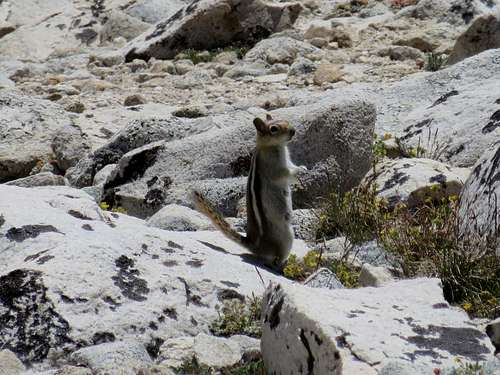
![Chipmunk]() Chipmunk
ChipmunkI continued down and after I cleared the pass I felt I needed to stop for a few minutes. I found a shady place by the one lake next to the trail and I sat down for five minutes. It was getting hot. I took pictures of the impressive cliffs, I admired the nature and enjoyed the solitude of this place. Then I got up and continued my way town the trail. I started seeing hikers trying to fish in the lakes or just walking around this lower trails. I was still about 6 miles to the parking lot. I set on going at a fast pace since I knew I was getting tired and bored with walking.
![New Army Pass]() At the bottom of New Army Pass, going down (East view) away from the pass
At the bottom of New Army Pass, going down (East view) away from the pass
At one point a guy with fishing gear came from a side trail right in front of me. Down between the trees the trail is very sandy and dusty and he probably realized that. He kept a very high pace and was not about to let me get in front of him to stir up dust for him to breath in. I followed him for about half hour until he just couldn't keep it up the high pace. He let me passed.
![Trail to Langley]() Trail to Langley
Trail to LangleyThe last two miles I basically ran. I just couldn't take the hiking anymore. It felt like I'll never end this hike and make it to the parking lot. I run until I saw the cars. Surprisingly I more minded the backpack bouncing on my back rather than the soreness in my feet. Frankly, this was my 5th hike in 7 days, 5 summits over 14,000 ft and 2 over 13,000ft. This also turned out to be the longest hike by both time and distance: 21 miles in 11 hours. Even if the 11 hours included one hour on the summit and at least 45 minutes talking to other hikers and rangers, plus some small breaks here and there, being on my feet for that long, at the end of a hiking week, I felt like a needed to stop. Lucky me, the car was right there.
![Back at the trailhead]() Back at the trailhead. I'm good, I'm fine! No worries! Victory indeed!
Back at the trailhead. I'm good, I'm fine! No worries! Victory indeed!I felt great accomplishing this and while I was drinking my recovery drink, looking back at the mountain, I thought with pleasure that a year will pass very fast and I'll be back in 2015 for more hikes. I love Eastern Sierra.
And this is how I added Mount Langley to my collection of fourteeners. Langley is my 5th 14er.