
-
 100137 Hits
-
 91.75% Score
-
 36 Votes
|
|
Mountain/Rock |
|---|---|
|
|
48.53673°N / 120.95252°W |
|
|
Download GPX » View Route on Map |
|
|
Skagit/Chelan |
|
|
Hiking, Mountaineering, Scrambling |
|
|
Summer, Fall |
|
|
9087 ft / 2770 m |
|
|
Overview
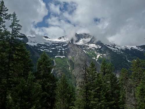
 Mount Logan's North Face
Mount Logan is listed under the Washington Top 100 and is located in the North Cascades National Park. It is among the top ten non-volcanic peaks over 9,000 feet in Washington state. It also is the 4th highest peak in North Cascades National Park. The mountain is named after George Logan, a miner who had a cabin in the Thunder Creek Vally in the late 1800s. It has three glaciers on its flanks which are the Banded, Fremont, and the Douglas. Any route to the summit will involve some fourth class rock at the top, the majority of climbers use one of these glaciers. The Logan massif sits on the Cascade crest, with Park and Bridge Creeks flowing East to Lake Chelan, while Thunder Creek flows West and its water ends up in the Skagit River. By far the most common climbing route is the Fremont Glacier route. Because Logan is so remote and surrounded by other peaks such as Goode, Storm King, Black, and Buckner, it is often climbed on the same trip as these other peaks. Mount Logan affords one of the best views of the North Cascades, from Diablo lake to the Boston Glacier, and Glacier Peak to the Pickets as well as much more.
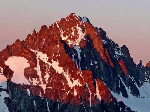
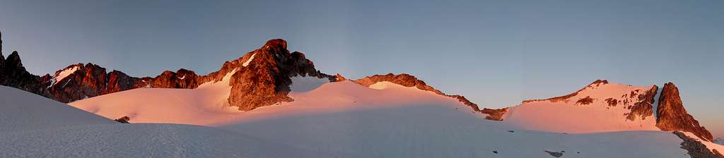 Alpenglow on Mount Logan from the Fremont Glacier
 Hogsback Glowing Hogsback Glowing |  Alpenglow on Logan Alpenglow on Logan |  Final Snow Section Final Snow Section |  Looking Down Looking Down |  Above Park Creek Pass Above Park Creek Pass |
Getting There
 Diablo Lake Reflection
 Logan from Fisher Creek
 In the city of Stehekin
Routes
 Logan with Fremont Glacier
 Douglas Glacier
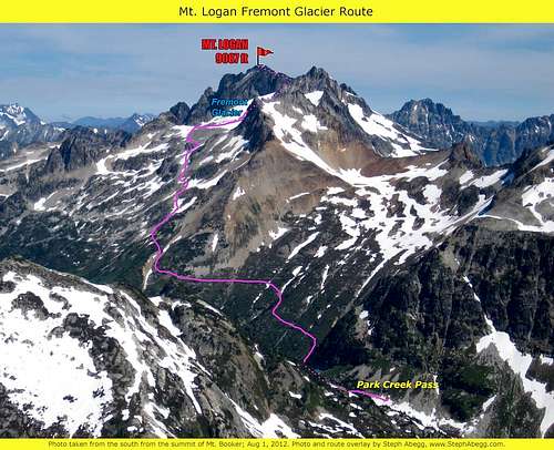 Mount Logan Fremont Glacier Overlay
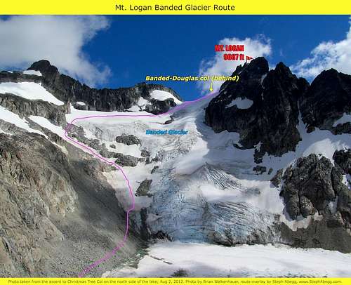 Banded Glacier Diagram by Steph Abegg
Standard Climbing Route
 Ruby Mountain from a Mile in Ruby Mountain from a Mile in |  Forest Spot Lights Forest Spot Lights |  The Half Way Point The Half Way Point |  One of the Many Creeks One of the Many Creeks |
Technical Facts: Distance: Around 40+ Miles Round Trip Elevation Gain: About 10,000 Feet Technical Level: Class 3-4 near the Summit Plus Glacier Travel Time is Usually Takes: 3-4 Days Rating: 5 Stars, very high quality route! The hike from Colonial Creek Campground starts out as a well maintained trail that is relatively flat for the first few miles of travel. Although eventually you gain around 6,000 feet of elevation to Park Creek Pass, a good majority of the trail is flat or lightly going up the side of a mountain. Be warned that the trail to Park Creek Pass is monotonous and does not offer much mountain views until your 16 miles in due to it being covered up by thick forests.
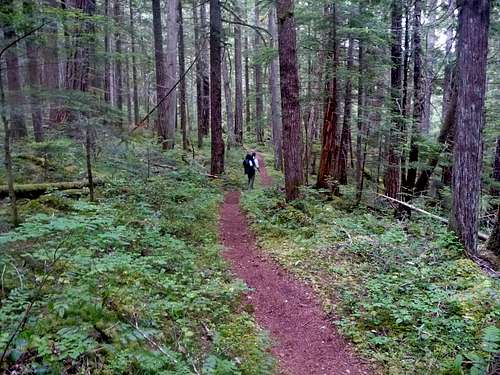 Walking through the Forest
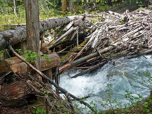
After hiking 1.5 miles of the Thunder Creek trail, you reach one of the many bridge crossings on your way to Mount Logan. After crossing the bridge the trail then mildly switch backs up hill for a few minutes, and then goes toward Thunder Creek again. Brace yourself for miles of forest lands, but if your like me, you will enjoy the nice shade that the woods provide. After reaching Tricouni Camp (7 miles in) you encounter a series of switch backs until you get views of Fisher Creek. A Couple miles later from Tricouni Camp you come to "Junction" which is the official halfway point to Park Creek Pass. This is a great place to cook or filter water as well as take a nice breather. There is also a campground near by here.
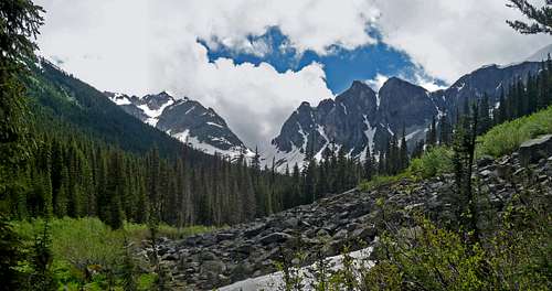
 Tricouni Peak though the Clouds
After Junction you lose 1,000 feet of elevation down the valley, this part makes the trip on the way back more difficult because you have to regain the elevation, and you have to regain it when you go up the next valley. But anyone who is climbing Logan should know that they are in for a challenge. Once you start going up hill again you cross a double logged bridge which is easy for people to travel, but not for horses (people used to bring their horses through here).
 Near McAllister Camp Near McAllister Camp |  Thunder Valley Thunder Valley |  Waterfall on Tricouni Waterfall on Tricouni |  Near Skagit Queen Near Skagit Queen |
Depending on how far you plan on going on your first day, there are two good choices for camping. The Skagit Queen or if you feel like going further, Thunder Basin (also known as the Horse Stock Camp). After passing by the Skagit Queen Camp you will soon see to your right an old broken down mining house that was in use over 100 years ago. You will also see an old pipeline that goes right through many of the switch backs you go up. After the many switch backs you are now officially in the same valley at Mount Logan itself. As you go further into the valley, the mountains finally come into view which you can see Logan, Buckner, and perhaps a few others if your lucky. Depending on what time of year you come here you may encounter snow by this point. Even in July there can be a lot of avalanche debris in the valley.
 Avalanche Debris Avalanche Debris |  Point 8248 Above Point 8248 Above |  Old Mining Home Old Mining Home |  Cornice on near by Peak Cornice on near by Peak |
Eventually the trail ends up crossing Thunder Creek with no bridge, fortunately the water is manageable but would still get you a bit wet. So to avoid this you may be fortunate enough to find a log crossing before encountering this part of the trail. I happened to find one a 100 foot to the left of where the trail traditionally crosses the creek. But I will warn you, I had to edge my way over it.
 Log Crossing during July of 2011
After crossing Thunder Creek you are soon in Thunder Basin which in summer time has flowers, wildlife, and bushes that start growing over bits of the trail. Hopefully you get lucky like me and a ranger/trail maintainer comes by and makes traveling through this part a little less bushy. After a few more miles the trail starts switch backing up towards Park Creek Pass. Once the switch backs end, you come onto a boulder field. From here you leave the main path just shy of Park Creek Pass and start heading North East. Now if you want to do a mini side trip for more views, by all means go on over to Park Creek Pass and then head back to the boulder field.
 Park Creek Pass as seen in July of 2011
The route now goes North East and up to avoid the trees below. In a sense it kinda curves in a bowl like fashion as you travel. Depending on your luck you may or may not encounter a trail up here. It was snowy when I was here so for me it was hit and miss deal. As you traverse the lower part of Mount Logan, be sure to aim for a set of trees on the minor ridge to the North. You do not want to gain too much elevation here, as long as your in tree line your fine. After crossing over the ridge point it is fine to be above the trees.
 Heading into the Basin Heading into the Basin |  Evening on the Mountain Evening on the Mountain |  Rising Clouds from Below Rising Clouds from Below |  Primus Peak Clouded Over Primus Peak Clouded Over |
 Looking Towards the Route up Mount Logan
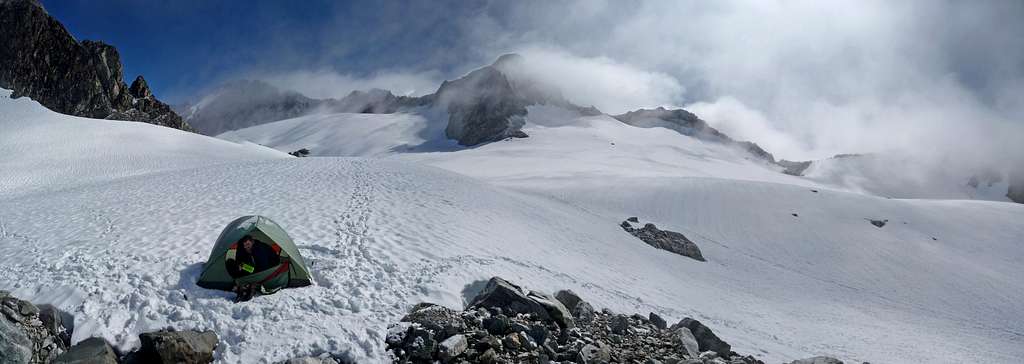
Now navigate your way through the Fremont Basin which you do so by heading north and gradually picking up on how far east you go. No matter what way you approach the Fremont Glacier from here, it is hard to get lost on a clear day on this part of the mountain. On the edge of the Fremont Glacier and near Point 8248 there is a great place to pitch your tent, or simply a good place to cook food and filter water.
 View from the Edge of the Fremont Glacier
Finally we start getting technical for the climb, on the outer most edge of the Fremont Glacier it is highly recommended that you rope up. When I came though here, my partner and I were completely socked in which made navigation a bit difficult. Whether the weather is bad or not, head literally north east from here. If visibility is poor, head a little more to your right to stay closer to the rock walls. If visibility is fine, it will be quite obvious which way you have to travel to a part of the route people call "The Hogsback". At first glance it is an amazing formation on the mountain which has a almost perfect semi circle going from one edge of the mountain to the other. The part of the Hogsback that is on the left and is the higher one is the main way you want to go. If you reach a rock wall without traveling up this, you are off route.
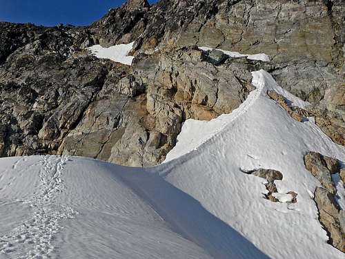 The Hogsback at the Edge of the Fremont Glacier
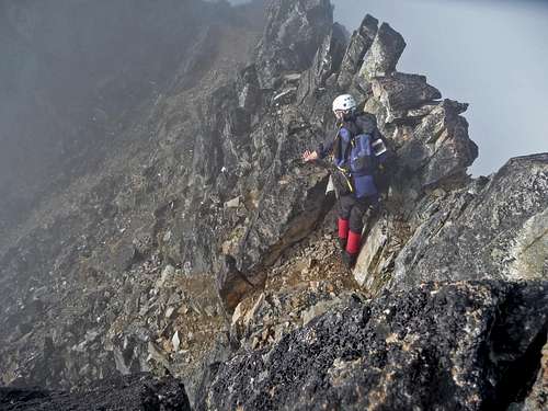
Once your off the Hogsback you can ditch the rope (depending on what time of year it is you may be able to ditch crampons and ice axe). Now it is time to starting heading north again (left) which traverses a dicey spot or two. This should be taken with cation. After this you reach a easy scramble that takes you off the west face and onto the south ridge. This spot is not for the faint of heart, if your not used to exposure with some class 3 and 4 scrambling, perhaps this is not for you. But for those of us who climb class 3 and are fine with a bit of exposure, this is quite the treat. Remarkably the rock is incredibly solid with many places to grab onto and great foot holds. Some of the best alpine scrambling I have ever had.
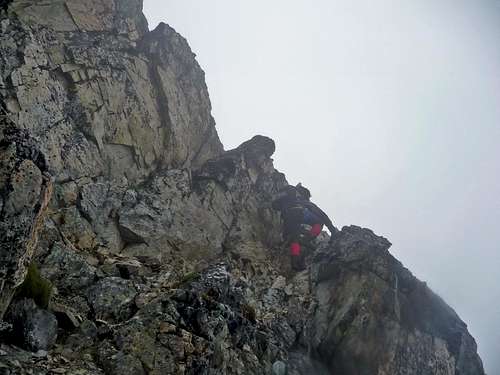 The left side is actually easier here
Much of the ridge traveling your not gaining much elevation until you start getting near the summit. After a few fun scramble spots you now start heading up to the top of the ridge for safer traveling.
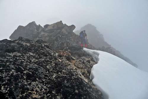 Traveling Along the Ridge
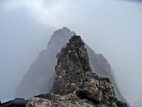
You come across at least 1 false summits before obtaining the real summit. At the false summit you have to now carefully descend a class 4 move to get down to the gap between the two summits.
 Down Climbing from the False Summit
Once you get down, stay on the eastern side of the ridge which leads you to the final summit scramble which may be considered class 3-4, but with great holds. From here you crawl over to the summit. Congratulations, you earned the moment of success! Now keep in mind that 80% of all mountaineering accidents happen on the way down, so please do be careful while descending the summit ridge.
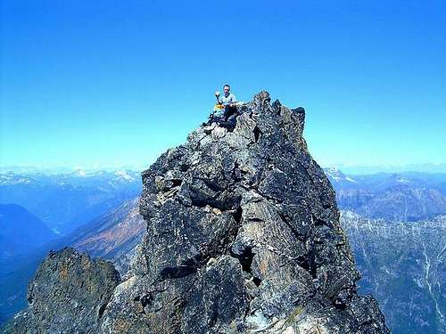 Enjoying the Summit
 Looking Back to the Other Summits
There is also a variation to getting to Park Creek Pass which is accessed from Stehekin. The hike goes up the Park Creek Pass Trail, which it is 14 miles one way (5.6 less miles than the standard route) to Parks Creek Pass. This route meets up with the Thunder Creek route up the mountain.
Red Tape and Camping
 Skagit Queen
 Camping on the Mountain
| Camp Name | Distance | Elevation | Image |
| Colonial Creek Campground | 0 Miles | 0 KM | 1232 ft. | 375 m |  |
| Thunder Camp | 1.8 Miles | 2.9 KMs | 1261 ft. | 384 m | 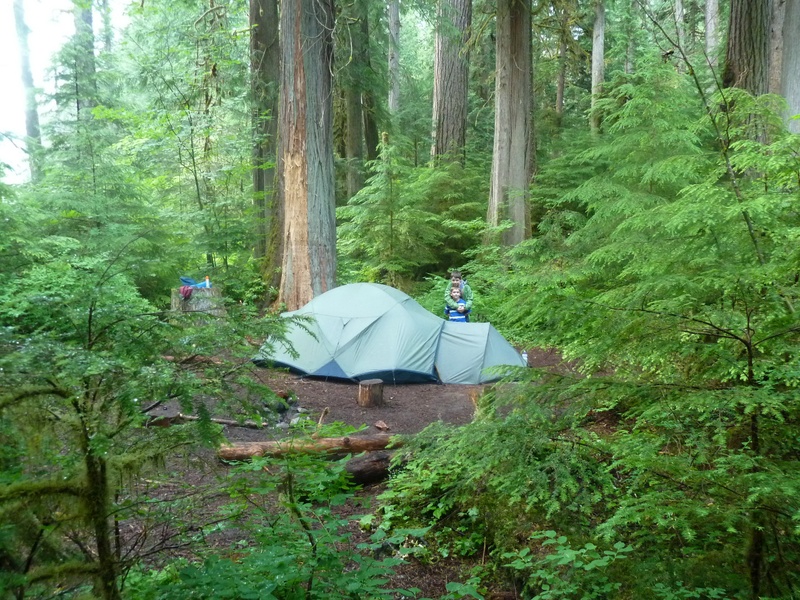 |
| Neve Camp | 2.1 Miles | 3.4 KMs | 1461 ft. | 445 m | 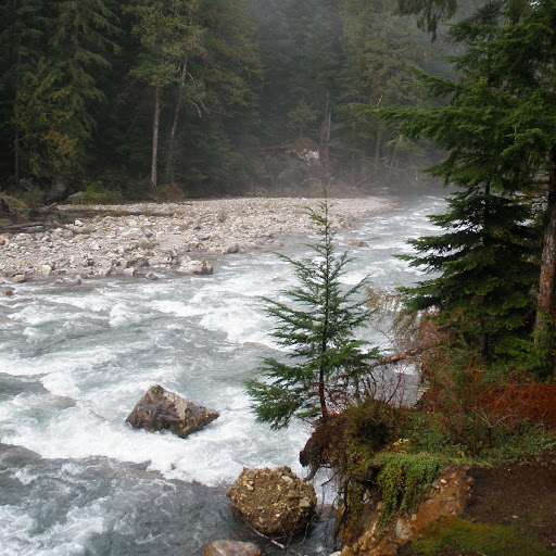 |
| McAllister | 5.7 Miles | 9.2 KMs | 1887 ft. | 575 m |  |
| Tricouni | 7 Miles | 11.3 KMs | 1950 ft. | 594 m |  |
| Junction | 9.2 Miles | 14.8 KMs | 3101 ft. | 945 m | |
| Skagit Queen | 13 Miles | 20.9 KMs | 2407 ft. | 733 m | |
| Thunder Basin | 15.9 Miles | 25.6 KMs | 4405 ft. | 1342 m |  |
| Fremont Glacier | 19 Miles+ | 30.6 KMs+ | 7961 ft. | 2426 m |  |
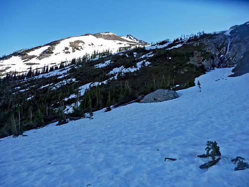
When To Climb
 Hiking Above the Clouds
 Hogsback Glowing Brightly
Weather and Mountain Conditions
 Winds on the Mountain
 Misty Summits
Gear for the Climb
 Using an Ice Axe
 Pack Cover
 Bring Approach Shoes
This is not the trip to under pack your gear, as I recall my shoulders were hurting by the end of the trip from how much gear I carried up. I had used everything that I carried (besides the picket, rescue pulley, ect). Mandatory Gear for the Climb:
- Ice Axe
- Crampons
- Helmet
- Rope
- Tent/Bivy
- Glacier Rescue Gear (prusiks, carabiners, webbing, ect.)
- 2 Snow Pickets (for standard glacier travel)
- Sleeping Bag
- Ground Pad
- Shell Jacket
- Inner Layer Jacket
- 2-3 Liters of Water Per Person
- Enough Stove Fuel for 3-4 Days
- Stove, Pot, and utensils (for cooking)
- Water Filter/Tablets
- First Aid Kit
- Glacier Glasses/Goggles
- Nylon Shell Pants
- Sun Screen
- Map and Compass
- Toilet Paper/Blue Bag
- Full Scale Mountaineering Boots (or plastics if your up to it)
- Long and Short Sleeve Shirt
- 3-4 Day worth of Food! (I carried more food than any other trip and ate everything)
Optional Gear you may Want:
- Approach Shoes (this saved my feet a lot of trouble)
- Bug Spray (Certainly handy here!)
- Bug Net
- Camera (Highly Recommended)
- Tooth Brush and Paste
- Shorts
- Cover for your Backpack
- Trekking Polls
- GPS
Topographic Maps
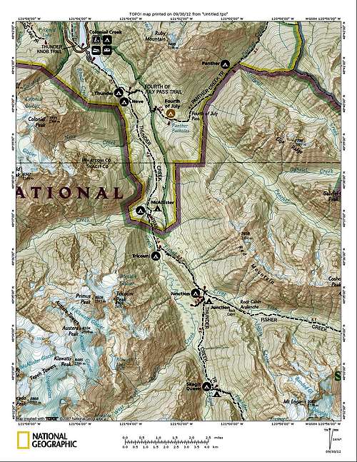 Thunder Creek Camping Spots (North) Thunder Creek Camping Spots (North) | 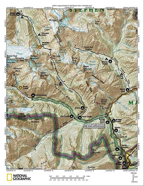 Park Creek Trail Variation (South) Park Creek Trail Variation (South) |
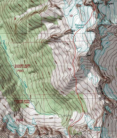 Mount Logan Upper Mountain Topo Mount Logan Upper Mountain Topo | 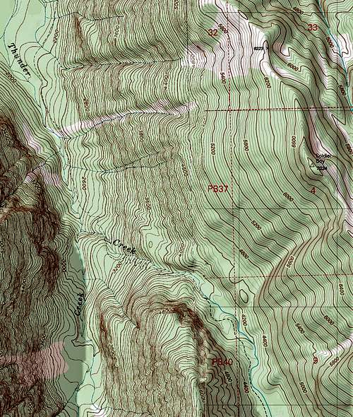 Thunder Creek Topo Thunder Creek Topo |
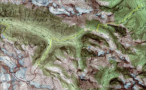 Douglas Glacier Route
Sunsets and Sunrises on Mount Logan
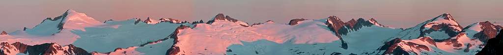 Sunrise on Eldorado, Klawatti, and Primus Peak from High Camp
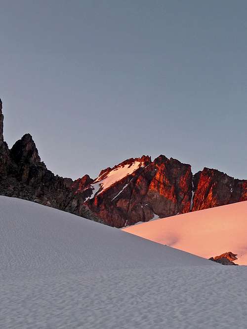 Alpenglow on Mount Logan's True Summit Alpenglow on Mount Logan's True Summit | 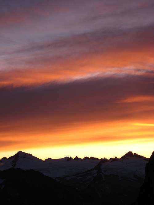 Eldorado Peak Sunset looking West Eldorado Peak Sunset looking West |
 Sunset over Primus Sunset over Primus |  Sunset on Eldorado Peak Sunset on Eldorado Peak |  Sunset from Logan Sunset from Logan |  Sunset on Bonanza Sunset on Bonanza |
 Evening on Logan Evening on Logan |  Above the Clouds Above the Clouds |  Sunrise on Jack Mountain Sunrise on Jack Mountain |  Sunrise on Eldorado Peak Sunrise on Eldorado Peak |
 Sunrise on Ripsaw Ridge Sunrise on Ripsaw Ridge |  Boston Peak Alpenglow Boston Peak Alpenglow | 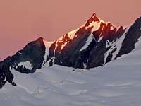 Sahale Mountain Sahale Mountain |  Forbidden Peak Forbidden Peak |
 Primus Peak Primus Peak |  Sunrise on Klawatti Peak Sunrise on Klawatti Peak |  Brooker Mountain Brooker Mountain |  Boston and Sahale Mountain Boston and Sahale Mountain |
 Sunrise on Buckner Mountain
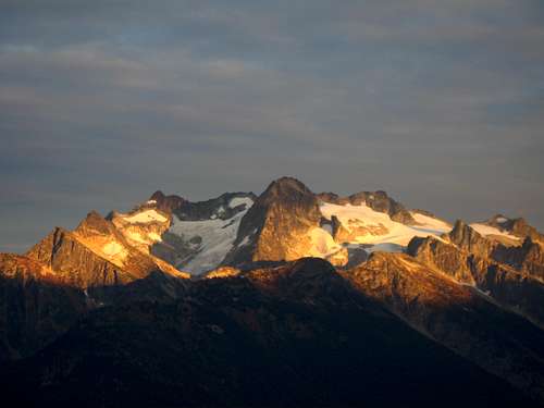 Sunset on Mount Logan from Primus Peak
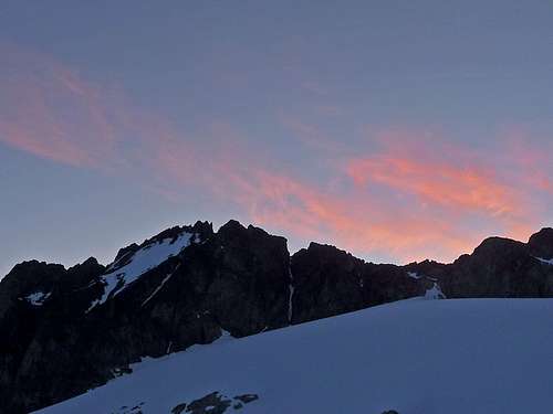 Morning View of Mount Logan
Wildlife and Flora
Despite it's ruggedness, it still manages to have some wildlife on the mountain and is abundant in the valley. If your lucky you can spot Marmots, Deer, Birds, Bears and other animals in the area as well as wild flowers.
 Snake in the Woods Snake in the Woods |  Marsh Marigold Marsh Marigold |  Mushrooms on a Tree Mushrooms on a Tree |  Purple Flower Purple Flower |
 White Flowers White Flowers | 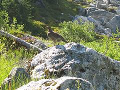 Ptarmigan by Jim Kuresman Ptarmigan by Jim Kuresman |  Monkey Flowers by Jim K. Monkey Flowers by Jim K. |  Bear in the Thunder Cr. Valley Bear in the Thunder Cr. Valley |
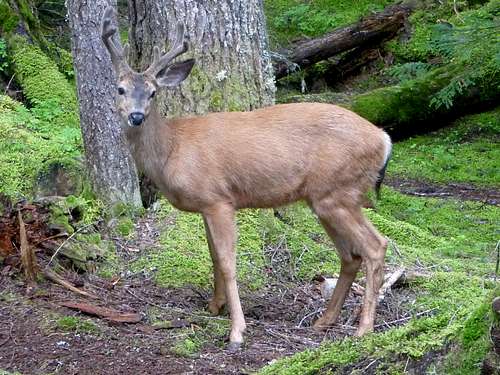 Deer at Skagit Queen Camp
Views from Logan
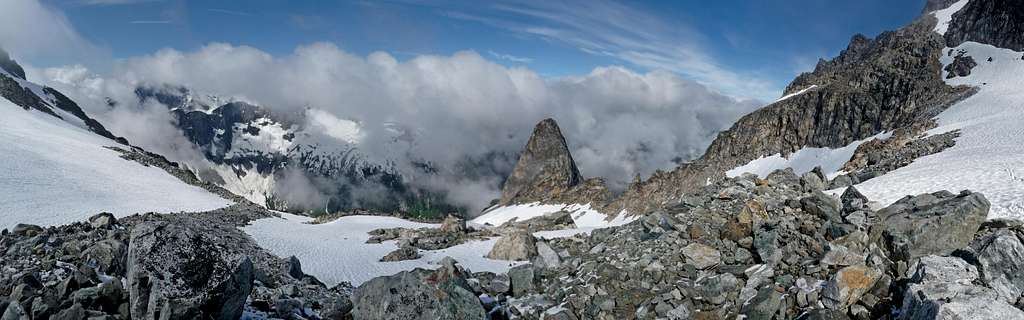
On a clear day one can see a wide range of peaks, this is perhaps what one would call "The Heart of the North Cascades" which has spectacular views of peaks like Eldorado, Buckner, Forbidden, and Sahale Mountain. The views alone make traveling to this peak worth while.
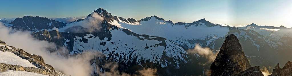 Views to the Southwest from the Base of the Fremont Glacier
 Mount Logan through the Clouds
 Mount Goode Mount Goode |  Brooker Clearing Up Brooker Clearing Up |  Eldorado Peak Eldorado Peak |  False Summit Clearing Up False Summit Clearing Up |
 Logan's South Summit Logan's South Summit |  Logan's Ridge Logan's Ridge |  Boston Glacier Boston Glacier | Logan's Middle Summit |
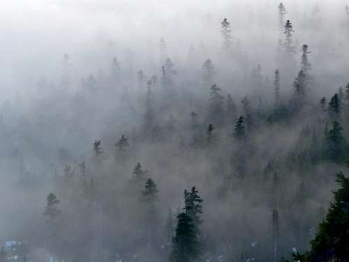 Misty Woods near Park Creek Pass
External Links
- Mount Logan via Douglas Glacier on July 22, 2006.
- Banded Glacier Climb as seen on CascadeCrusades.
- April 23 Ski Trip up via the Banded Glacier.
- Douglas Glacier 7/7-8, 2012 - A more recent report with some nice pictures.
- For more information on the Thunder Creek approach, check out the NPS Page.
- Here are some photos from Panoramio as seen near Park Creek Pass