Day 1 - Drive to High Peaks
I love to go on road trips more than almost anything else, and going on a substantially long road trip with friends is even better. Originally I had planned on a 4 day trip to Michigan (including Mount Arvon) with some friends from college, but we eventually settled on summiting the closer Mount Marcy instead, since this trip could be done in 3 days. Gradually, they were called off by other obligations, but I still wanted to go, so I asked my best friend to accompany me for this abbreviated Man Weekend. He complied and we made our preparations.
Steve was a boy scout, and whereas most of my camping has been from a trailer (I know, I'm a softie), I have been tenting a time or two and know my way around a fire and tent. We packed our tent, food, sleeping bags, and water (LOTS of water), and on September 9th, 2011 we headed out for the Adirondacks.
In the wake of Hurricane Lee, this initial travel day was almost the trickiest part of the trip. There were lots of road closures due to flooding, including I-81 and US-222, the two main routes north-east out of Lancaster County, PA. For a while I thought we would have to suck it up and pay tolls on the PA and NJ turnpikes just to get to New York, but after checking the 511 in the morning (great resource!), I found that while US-222 S was still closed, the northbound lanes were open. We were on our way.
We did have to use the Northeast Extension of the turnpike, but this toll was manageable (a little over 4 bucks with EZ-pass). Surprisingly, compared to the still very wet and dreary weather over Lancaster and Lebanon counties, the weather was mostly bright and sunny on the turnpike as we neared Scranton. We headed across I-84 (my first time) and into New York, noting how high the Delaware River was from the flooding.
![New York Welcome I-84 E]() New York welcome sign on I-84 eastbound
New York welcome sign on I-84 eastbound
In our continued effort to avoid tolls we skipped past the New York Thruway and crossed the Hudson River on the Newburgh-Beacon Bridge. The bridge has a toll, but it's only $1.00, cheaper than the Tappan-Zee Bridge to the south and cheaper than taking the NYTW north to Albany and crossing there.
![Newburgh-Beacon Bridge]() Newburgh-Beacon bridge on I-84 eastbound
Newburgh-Beacon bridge on I-84 eastbound
We then headed up the Taconic State Parkway to Pleasant Valley, where we had lunch. I had brought a Restaurant.com gift certificate which was worth $25 but required a minimum purchase of $35. $18 per person was a tall order, but we manned up and ate our fill of steak, burgers, and fries. We enjoyed it, not only because it was meat, but also because our next 5 meals would be self-prepared.
![Taconic State Parkway]() Taconic State Parkway northbound
Taconic State Parkway northbound
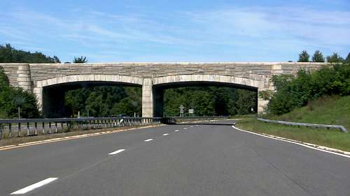
Back on the parkway, we continued north and continued to build excitement. The Taconic State Parkway was (and is) a marvel of engineering. This is not so much because it traverses rugged terrain or employs tricky bridges, but because it moves so naturally with the land, and attempts to provide the driver with the best possible views. It also has many masonry overpasses, providing a nice contrast to the steel and concrete seen on the interstate.
![Taconic State Parkway Overpass]() NY-23 overpass on the Taconic State Parkway northbound
NY-23 overpass on the Taconic State Parkway northbound
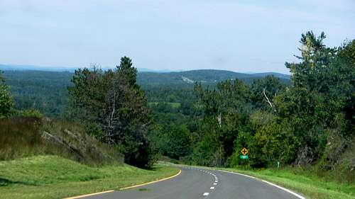
After a short stint on the eastern leg of the thruway ($0.38 toll) we passed through Albany, hitting our first real traffic of the trip. The merge onto I-87 N was very slow, and traffic remained tight for the next 15 minutes or so. Steve and I reminded ourselves, however, that the further north we went the less traffic we would see. This proved correct, and as we neared our exit both the scenery and traffic improved greatly. Finally, we were headed west on NY-73, approaching the lodge. As we turned onto Adirondack Loj road Steve snapped this photo. While it is a great shot, Marcy is unfortunately just out of frame to the left.
![Adirondack High Peaks]() High peaks of the Adirondacks from NY-73
High peaks of the Adirondacks from NY-73
Regardless, we arrived at the campground and set up camp. We checked in at the AMC info cabin, but declined purchasing a map after hearing how well marked the trail was. Dinner was hot dogs and baked beans, but our lack of rolls (oops) and the poor taste of the beans dampened our evening. We turned in early, knowing we'd need lots of extra energy the next day.
Day 2 - The Climb
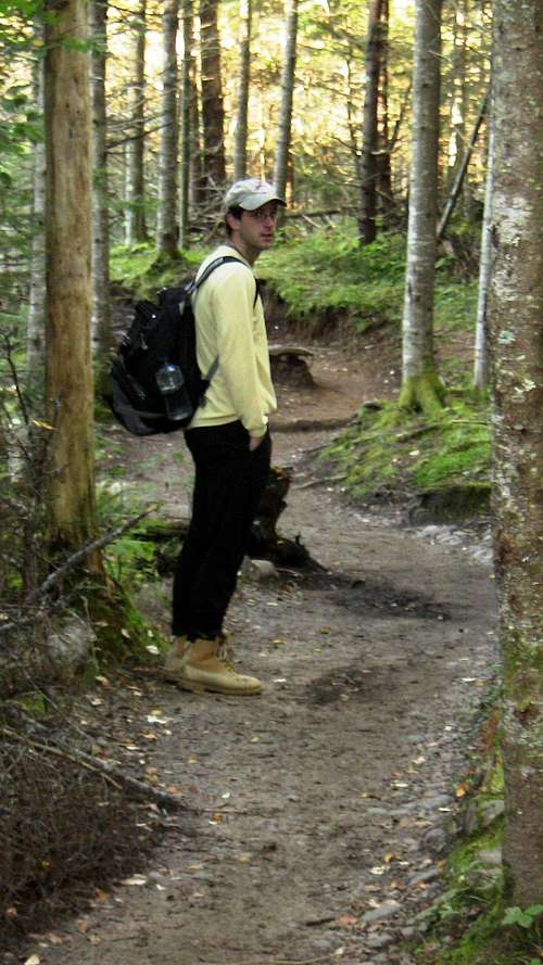
We got up early the next morning - around 6am - and began preparing for the hike. We stuffed ourselves full of chocolate chip cookies (I love my wife!) and bread, perhaps not the most rounded breakfast but it provided plenty of sugar and carbs. We packed Steve's mess kits with sandwiches and put those, the apples, and more cookies in his pack. We both filled our water bottles and I put another gallon of water in my pack, along with my camera.
![Van Hoevenberg Trail]() Steve heading out on the Van Hoevenberg Trail
Steve heading out on the Van Hoevenberg Trail
We headed out on the Van Hoevenberg Trail from the parking lot of the Adirondack Mountain Club around 0730 and found the going fairly easy early on. Our first real excitement was crossing Marcy/Phelps Brook near their merge. We soon came upon Marcy Dam, which was still somewhat functioning but not safe to use as a bridge (hence why we had to cross the brooks on foot). Heading out from the dam the trail quickly became steeper and much rockier. Most of the time the trail is followed by a tiny creek, not enough to be "rushing" or moving, but enough to make the ground between the rocks soggy and muddy. This encouraged us to step from rock to rock, which was fine enough but also quite slippery.
![Marcy Creek Crossing]() Phelps Brook
Phelps Brook![Marcy Dam AM]() View from beneath Marcy Dam
View from beneath Marcy Dam
I set my watch for a 25 minute repeat timer, and every time it went off we stopped to hydrate. I am quite certain that this is a major reason why our hike went so smoothly. Every two hydrations we'd also eat something; an apple, a cookie, or one of our sandwiches. Eventually we came to a spot where the trees to our left opened up and we got a glimpse out over the High Peaks.
![View from Van Hoevenberg Trail]() View of the High Peaks from the Van Hoevenberg Trail
View of the High Peaks from the Van Hoevenberg Trail
Although a little tired from so much climbing, after a few pictures we were ready to go again. We continued climbing and finally got our first view of the summit.
![Mount Marcy]() Mount Marcy summit
Mount Marcy summit
I'd never before hiked a mountain of such height. Sure, I've driven Mount Evans and Pike's Peak, which far exceed Marcy, but driving to the summit makes it too easy. You don't get the sense of accomplishment that you do from hiking, especially over such a long trail. Heartened, we continued our climb and finally crested the tree line.
![Above the Tree Line]() Me on the final approach to the summit
Me on the final approach to the summit
The trail got considerably steeper, and our pace had started to make my calves cramp up (read - out of shape!). This was more frustrating than debilitating, however, and soon we finally summited.
![User Profile Image]() Me in my awesome summit conquering pose
Me in my awesome summit conquering pose
It could not have been more perfect. The day was bright, sunny, with only a few clouds far in the distance. The wind was only slight, but we kept our hoodies on most of the time to ward off the sun. After hiking over 7.5 miles to this point, the view was breathtaking.
![Marcy 360 Panorama]() Photo-stich of the summit view
Photo-stich of the summit view
I don't think I'll ever forget that feeling, of having striven so hard for something and achieved it. The physical effort and reward were very tangible. As my first "real" summit (drive-ups, while nice for checking off high-point lists, are not real summits), I got a taste for what I could expect from the more challenging western peaks. After 3.5 hours of hiking, we spent 45 minutes on the summit, and I spent most of it thinking about how I wanted to do this again, only higher, harder, more remote. It was the hike, the comradery with my friend, the constant drive to make the summit, to pass the next hiker; I had enjoyed all of these, and I wanted to enjoy them again.
![Mount Marcy USGS Marker]() Proof ;)
Proof ;)
Eventually, though, we had to turn back, so after eating our last sandwiches we headed down the mountain. Above the tree line the trail is less easy to mark, and without a summit to watch it is easier to wander from the trail. Once, we "detoured" a bit through some chest-high shrubbery ("a shrubbery?!"), but soon found our way back to the blue blazes.
![Tree Line]() Near the tree line
Near the tree line
Descending the mountain was actually one of my least favourite parts of the day. Besides losing the drive of "the summit," the rocky trail was also very hard on joints. Mostly, however, it was probably due to fatigue beginning to catch up with us. Steve's dad (John) had hiked and fished this area many years ago, and has a funny story to tell from it. He and a few friends were fishing separately, and John got tired and decided to lay down on the rock he was fishing from to rest. His friends found him, asleep, on his rock in the middle of the roaring creek. The picture was so funny that Steve decided to recreate it.
![Marcy Brook nap]() Steve sleeping amongst the thunder
Steve sleeping amongst the thunder
Fatigue and hunger, however, were starting to demand a return to camp. The final two miles from Marcy Dam to camp were quick-paced and quiet; both of us simply wanted to get back to camp. When we finally did, we both took to our camp chairs and just "sat" for 30 minutes. We marveled at how wonderful it was just to sit and do nothing else. When the body very much desires something, it often rewards you for providing it by giving you a sense of euphoria; such was the case now. We sat for over half an hour and enjoyed every minute.
Fifteen miles of mountain hiking, with or without cookies, takes a lot of calories, and we were ready to refuel. We busted out our dishes and prepared our "gold" that we had saved especially for our after-hike dinner: seasoned pork chops. After fighting with our stove for a bit we gave up on that and simply "grilled" the chops in the mess kits over the fire. This turned out quite nicely and we ate ourselves silly with 5 chops and a whole box of Kraft macaroni and cheese (no vegetables allowed on Man Weekend).
Sleep that night was wonderful, and we both turned it at the (normally) insane hour of 2030. It was that "good" kind of tired you'd like to end every day on.
Day 3 - Heading Home
We were up early again on Sunday and quickly ate and packed. Knowing we had a bit of a drive ahead of us we were on the road by 0700. I don't like to see the same things twice, so we headed west (mostly on NY-3) across the top of the state to Watertown. This was a wonderful drive; we saw Lake Placid's Olympic facilities, as well as countless lakes and mountains across New York. Further west the topography flattened out and more familiar farmland rolled into view.
In Watertown we got on I-81 and began the long journey south. This is a fairly scenic interstate for much of its length, but we were glad to finally be home. One more highpoint down, 46 to go!
![Pennsylvania Welcome I-81 southbound]() Pennsylvania Welcome sign on I-81 southbound
Pennsylvania Welcome sign on I-81 southbound


Comments
Post a Comment