Mount Norris Route

Mount Norris Route

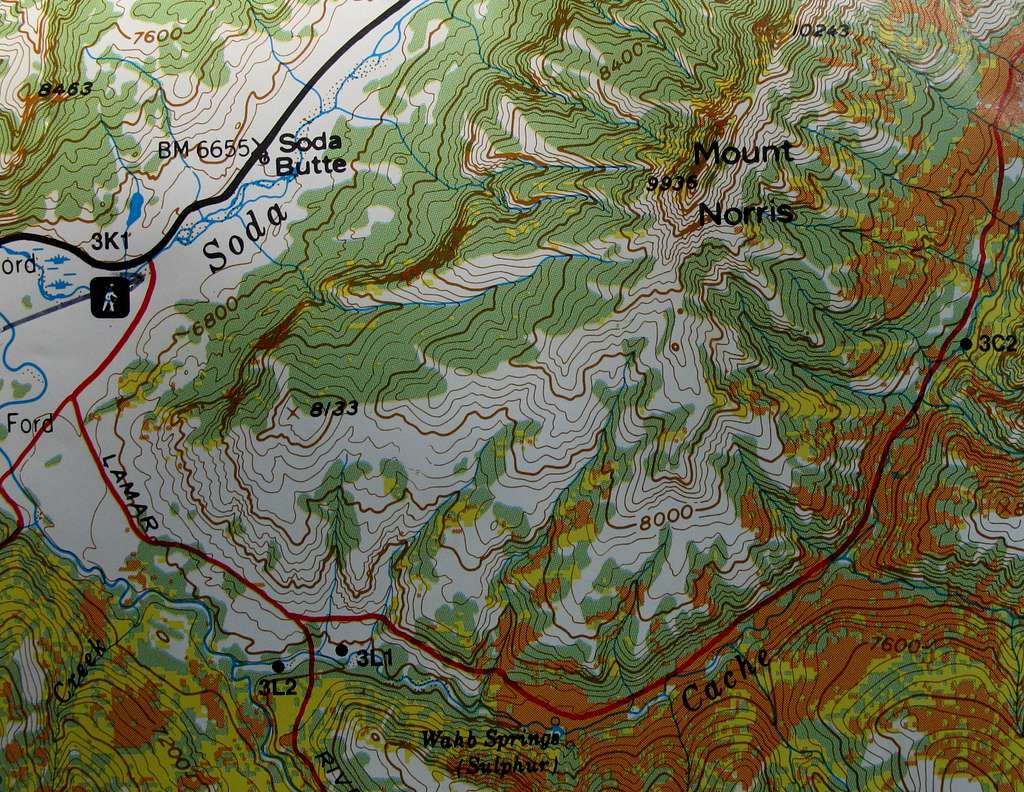
This is a shot from my Earthwalk Press Yellowstone National Park map. The contour intervals are 80'. Shortly after the first trail intersection shown here (there is actually an earlier intersection with a horse trail), head up the slopes in the direction of Point 8133 and then follow the ridge east and northeast to the summit. Some Class 3 scrambling on loose breccia is required to attain the actual summit area. Total distance from the trailhead is about 7 miles; 5 miles is off-trail travel through some of the wildest, most pristine country in America.
Bob Sihler
on Aug 13, 2010 10:17 am
Image Type(s): Topo/Diagram,  Informational
Image ID: 648648

Comments

No comments posted yet.