
|
|
Mountain/Rock |
|---|---|
|
|
48.44605°N / 121.31737°W |
|
|
Skagit |
|
|
6780 ft / 2067 m |
|
|
Overview
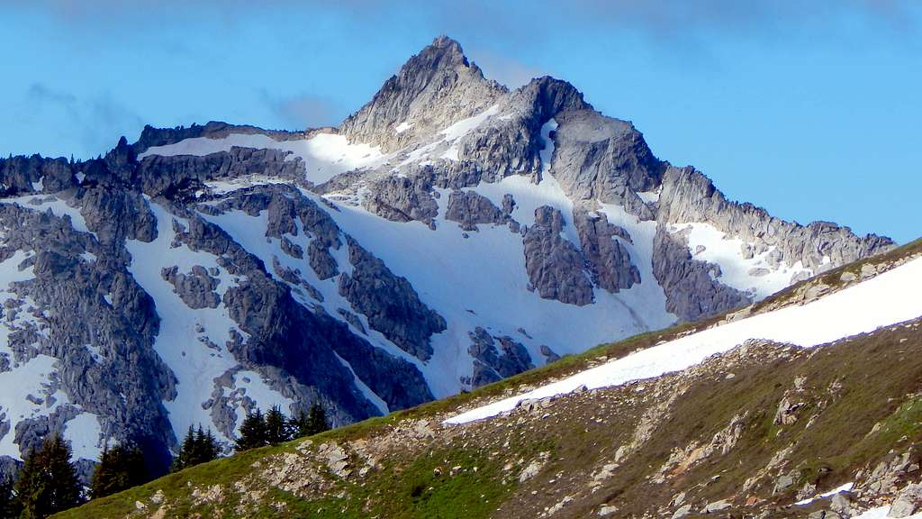
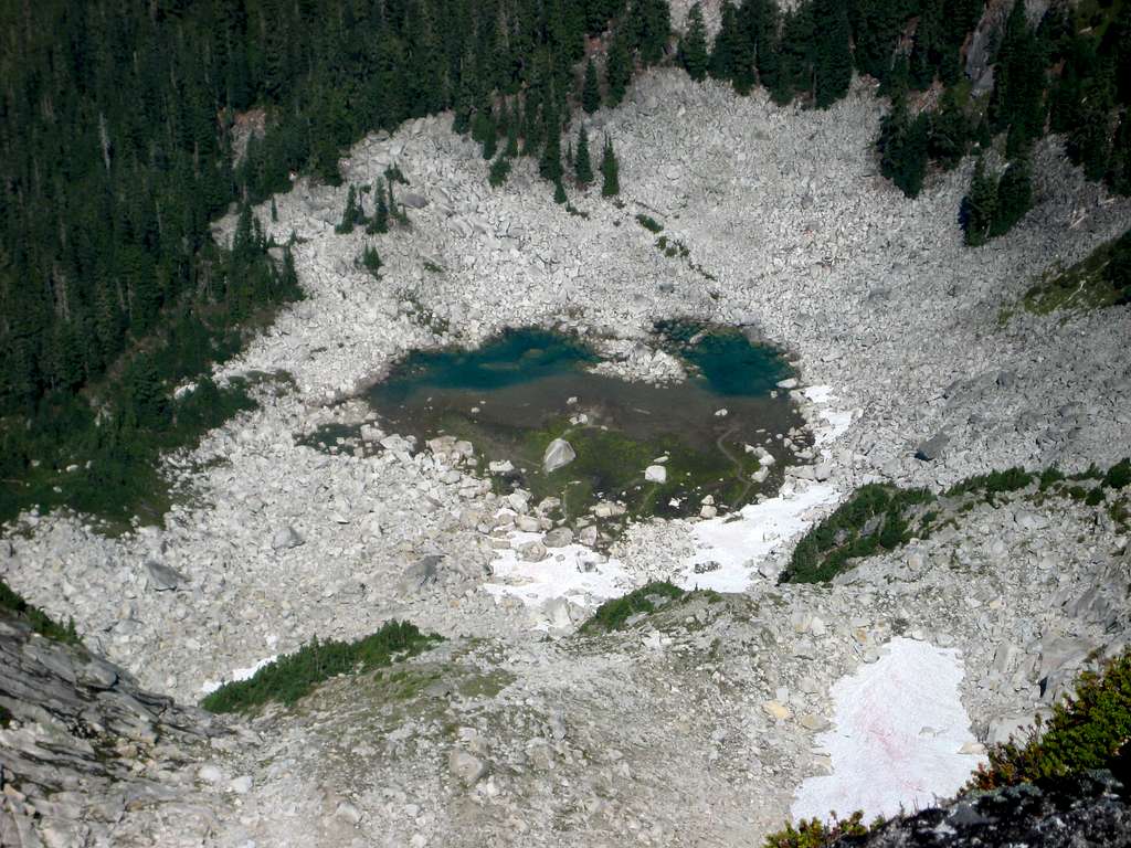
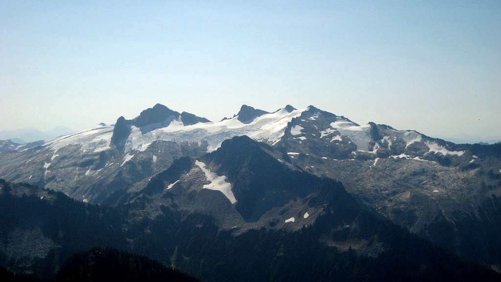
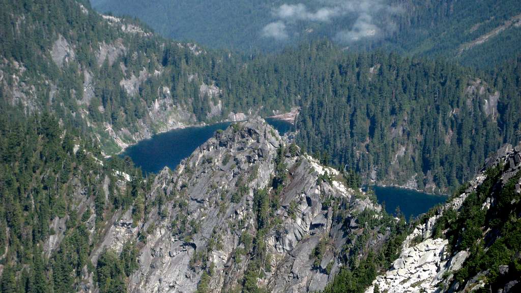
Mount Tommy Thompson is a 6780' (1640' prominence) peak located 13 miles E/SE of Rockport, and 19 miles NE of Darrington. In terms of elevation, prominence, and isolation, it is the monarch of the Buckindy-Illabot Group's north end. It is an aesthetically pleasing peak with a sharp summit pyramid, and has 11 named alpine lakes distributed about it's flanks.

Despite these qualities, Mount Tommy Thompson has received little attention from local peakbaggers, and averages (according to the summit register) one ascent every three years. I can only speculate as to the reasons why (it is easier to climb than nearby Chaval and Snowking), but it may have something to do with the fact that it was never officially named by USGS cartographers.
Mount Tommy Thompson is unofficially named for an early Skagit district ranger who conducted numerous explorations in the area. First ascent is credited to Bruce Bryant on August 14, 1953.
Getting There
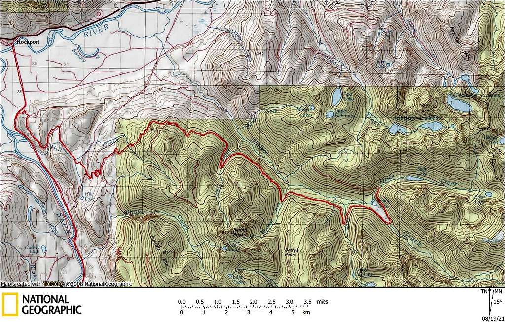
Navigate yourself to Illabot Creek Road, which turns east off of SR530 at a point two miles south of Rockport, and 16 miles north of Darrington. Now simply follow the mainline 20.8 miles to it's end. The parking area is obvious, and is used for both the Slide Lake Trail and the unofficial trail to the Jordan Lakes. Four wheel drive is not required, but low clearance vehicles are not recommended. Overall, the road is in good shape, with just a few rough areas.
Route
The Cascade Alpine Guide guesses at possible routes for climbing Mount Tommy Thompson - the routes described sound unnecessarily difficult. A quick perusal of the summit register suggests that all ascents since 1995 have come in from Slide Lake or Jordan Lakes, and finish via the south face gullies. Overall, it appears that the Slide Lake option is slightly easier (and is the only route I have done), so it will receive the most attention here. I will attempt a brief description of the Jordan Lakes route based on secondhand information. Please note that the drawn routes are approximations only.
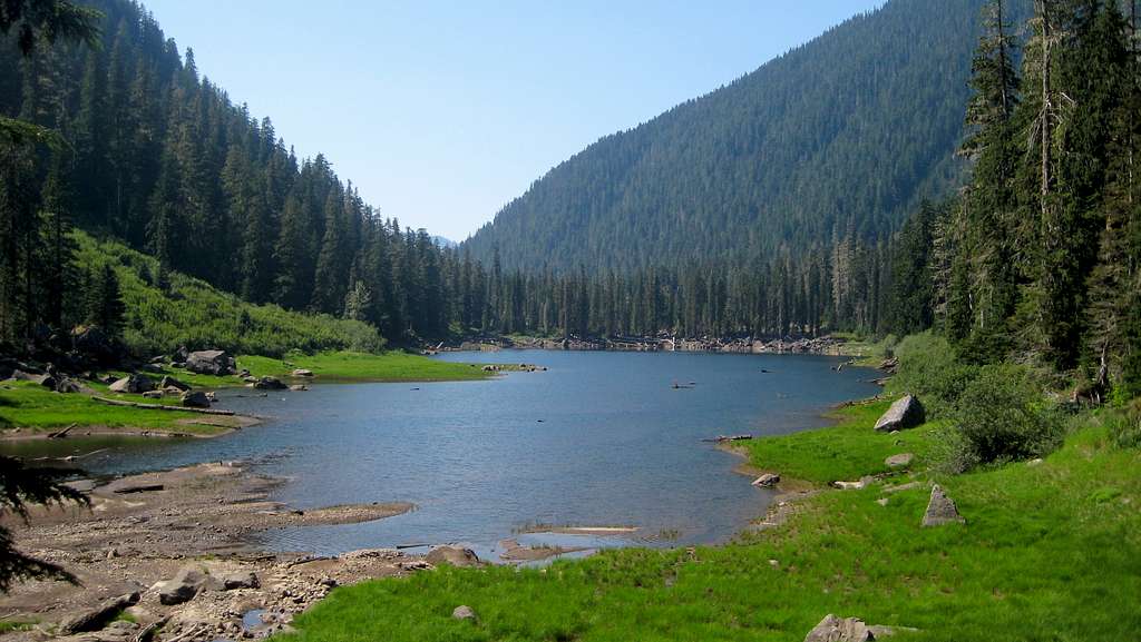
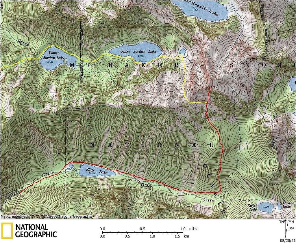
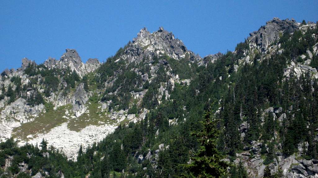
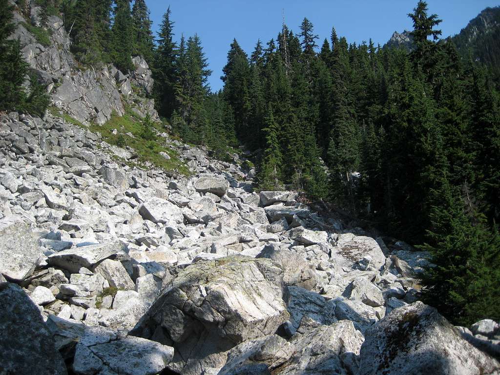
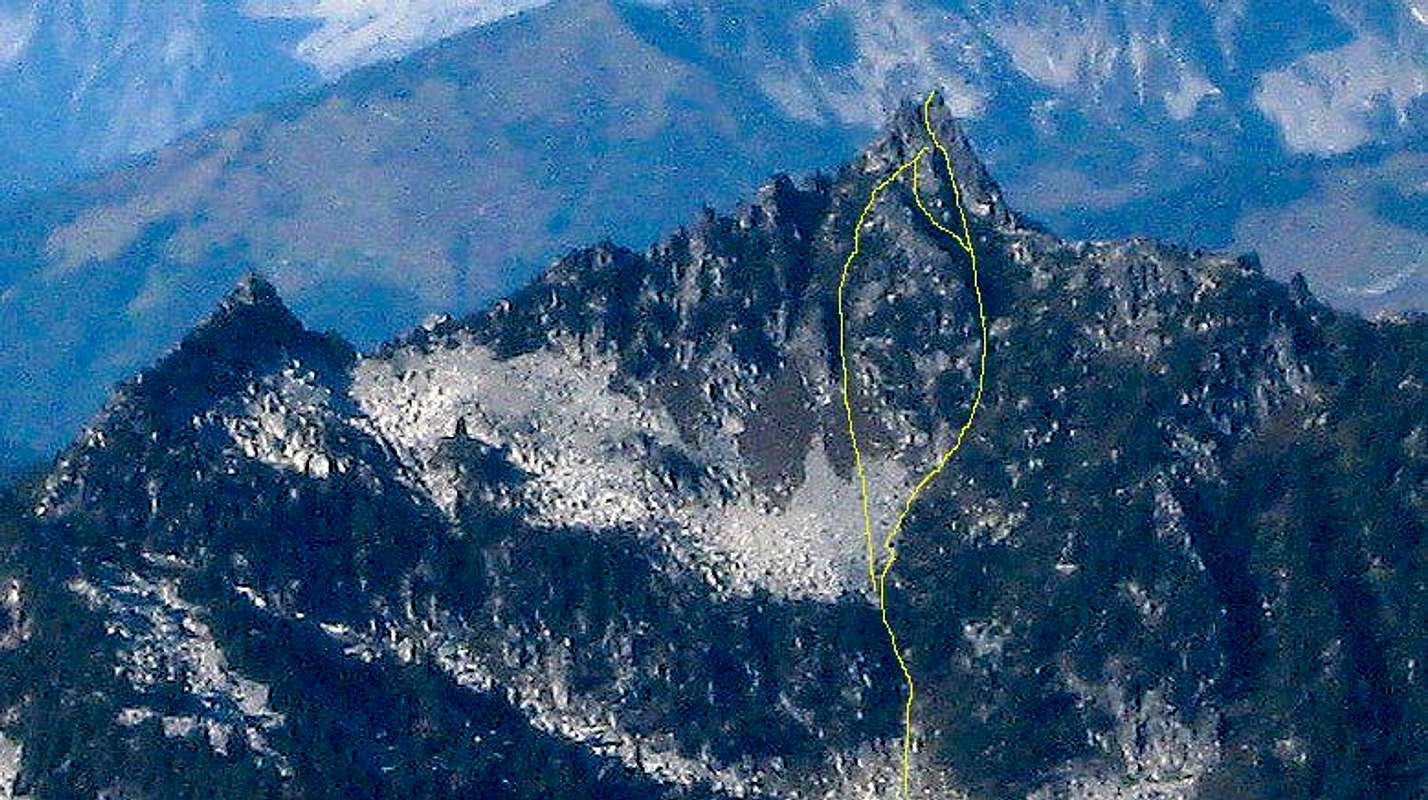
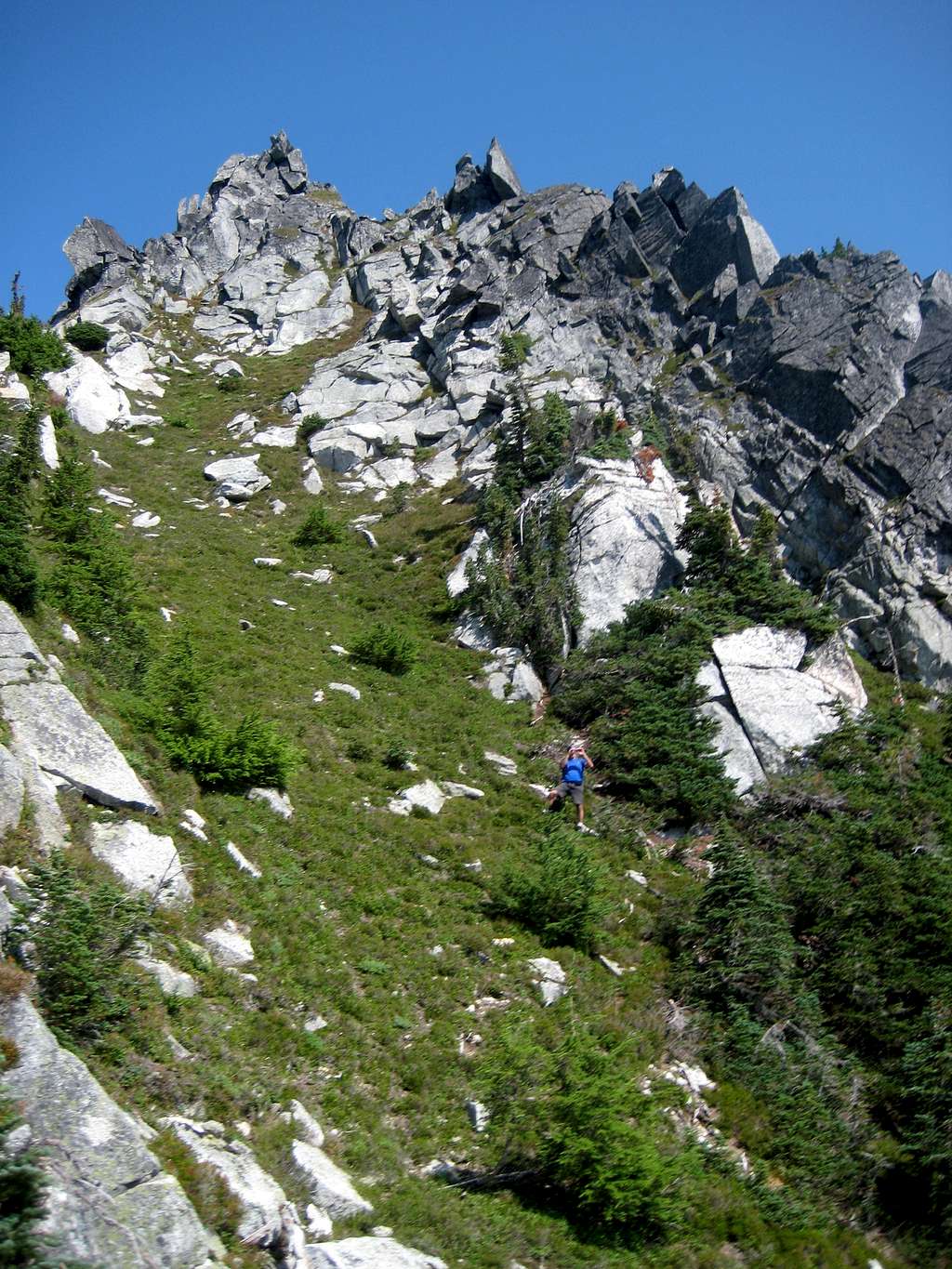
Hike the 1.25 mile trail to Slide Lake. The trail is in good condition, and all blowdowns have been removed. After Slide Lake (heading toward Enjar Lake), the trail deteriorates considerably. For the next 1.5 miles, you will be wading through brush (not fun if wet), and going over and under blowdowns. For us, this represented the 'crux' of the route. Hike the trail to roughly 3700'. We left the trail at N48.42688 W121.31485, which worked out fairly well. Now, generally head due north uphill, aiming for a 5200' high point 0.7 miles south of the summit. This slope will present very little difficulty in terms of brush. Shortly after passing the 5200' high point, keep your eyes open for filtered views of your objective, and take a moment to study the route. As seen in the photo below, you will have the option of a gully system that curves left, then right to the summit, or a gully system that curves right, then left to the summit.
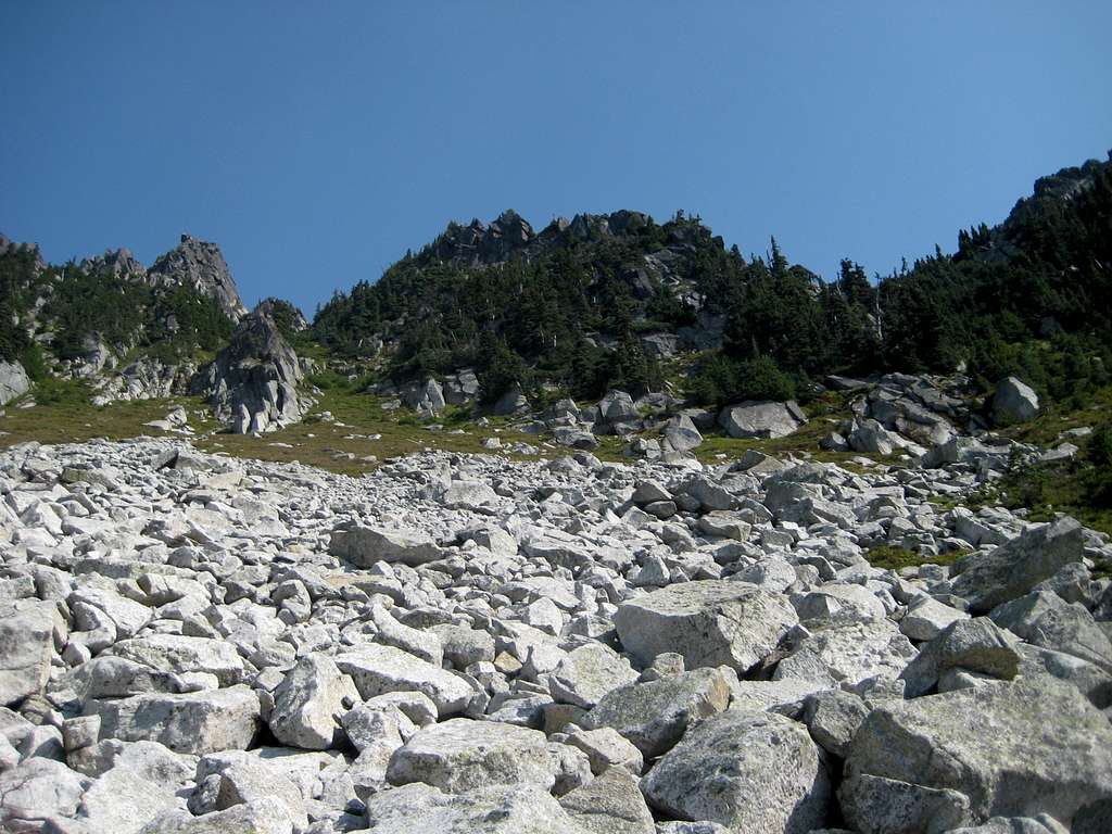
Now follow the ridge crest NW 0.3 miles, at which point you will arrive at an open rock slope at 5400'.
Follow a narrow gully up to 5600', then exit right to top a small ridge crest at 5700'.
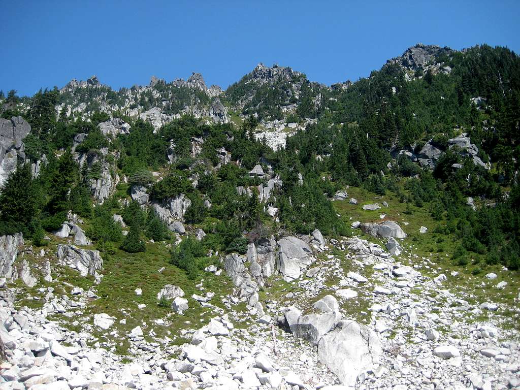
From this point, you will once again have a good opportunity to preview the gully options (see photo below), all of which will come to a common point about 100' below the summit. The right gully appears most direct, but the left gully appears 'cleaner' in terms of scrubby trees.
The final 800' of scrambling will be mostly class 2, with a few moves of class 3.
For the Jordan Lakes route, hike the closed portion of Illabot Creek Road for about three miles to the unofficial Jordan Lakes trail. My understanding is that the trail to Lower Jordan Lake involves 600' of elevation gain, followed by a 600' descent to the lake. It is also my understanding that one should travel around the north side of Lower Jordan Lake, and around the south side of Upper Jordan Lake.

From Upper Jordan Lake, continue east to a tarn located NW of the summit, at an elevation of 5000'.
From the tarn, head south up a gully (likely snow-filled, plan accordingly) to a 6100' pass between Point 6496 and Mount Tommy Thompson. After crossing the pass, travel east when convenient to connect with the 'standard' route.
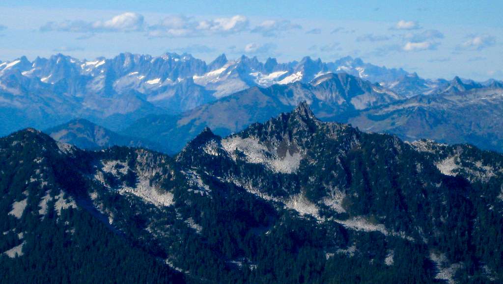
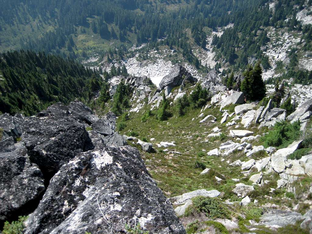
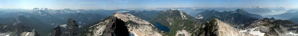
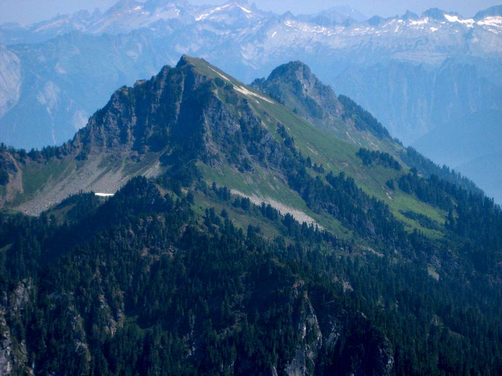
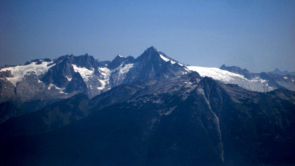
Mount Tommy Thompson is well positioned for great views. The quality of the following photos was affected somewhat by forest fire smoke from the Cascade Pass area.
Red Tape
At the time of this writing (2021), a Northwest Forest Pass was not required at the Slide Lake trailhead.
When to Climb
June through September would probably provide the best climbing conditions. For the Slide Lake route, plan to carry an ice axe for June and July climbs. For the Jordan Lakes route, plan to carry an axe in early and late season for the north-facing gully.
Camping
Slide Lake and the Jordan Lakes provide plentiful camping sites. For those who wish to camp higher on the Slide Lake route route, there are several areas between 5200' and 5700' that would be suitable. For those wishing to camp higher on the Jordan Lakes route, the area around the tarn at 5000' would likely be adequate.