
|
|
Mountain/Rock |
|---|---|
|
|
49.12061°N / 122.12758°W |
|
|
Hiking |
|
|
Spring, Summer, Fall, Winter |
|
|
2986 ft / 910 m |
|
|
Overview
Sumas Peak is a lowland mountain located in southern British Columbia, Canada, east of Vancouver but west of Chilliwack. The official name of the mountain massif is Sumas Mountain, with a regional park of the same name comprising a majority of the massif, with its summit area referred to as Sumas Peak. Many hiking and peakbagging enthusiasts, especially Americans, refer to the entire massif as Sumas Peak rather than Sumas Mountain, so as not to confuse it with another Sumas Mountain which is located south of the Canada-United States (USA) border and less than 20 miles away.From a distance, Sumas Peak appears to be a forested mountain of little interest. However, Sumas Peak has the distinction of being a peak with at least 2000' (610m) of clean prominence. Sumas Peak is what is known by prominencians as a Napoleon... a mountain that has large prominence despite small stature. Several higher peaks are in the area and also have over 2000' of prominence (most notably Vedder Mountain, Sumas Mountain, and Deroche Mountain), but those peaks do not have as much prominence... and especially in relation to their elevations.
In fact, Sumas Peak has one of the highest prominence-to-elevation percentages in all of North America for non-island 2000' prominence (or higher) peaks. Sumas Peak has 2911' of clean prominence (compared with 2986' overall elevation), so its prominence-to-elevation percentage is 97.5%. In comparison, Mount Logan (the highest point in Canada) only has a prominence-to-elevation percentage of 88%, and Mount Whitney (the highest point in the contiguous USA) only has a prominence-to-elevation percentage of 69.5%. To give further perspective of how rare Sumas Peak's prominence-to-elevation percentage of 97.5% is, nearby Washington (USA) has 143 non-island peaks with at least 2000' of clean prominence but only two of those peaks have prominence-to-elevation percentages over 90% (Mount Olympus-98.4%, Mount Rainier-91.7%). Sumas Peak is truly in an obscure category and standing for prominence peaks.
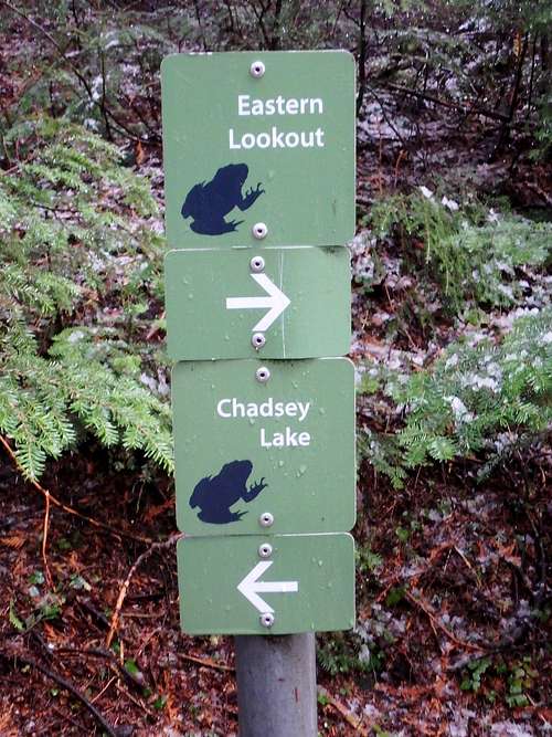
Maps imply that the eastern highpoint contender (known in Sumas Mountain Regional Park as "Eastern Lookout") is the highest point, although several contenders in nearby contours also should be visited by peakbaggers. The "Eastern Lookout" location is worth visiting, not only as a highpoint contender but also because it has peek-a-boo views of Chilliwack Valley and nearby higher mountains. The eastern highpoint contender can be reached via trail. Another highpoint contender is a repeater station site, perhaps the most popular choice due the summit road ending at the location; the trail leading to "Eastern Lookout" continues beyond the repeater station site. Another highpoint contender is a forested hill located west of the main repeater station site. The forested hill is largely avoided by general visitors as it currently has no trails or roads, but this hill is worth visiting because its highest point rivals in elevation when compared to the other contenders.
Eastern Lookout
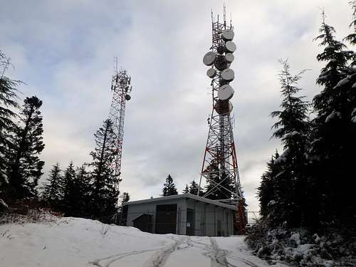
Main Repeater Station Site
Forested Highpoint Contender
In addition to prominence, Sumas Peak, and more specifically Sumas Mountain Regional Park, is very popular for hiking, walking, bicycling, and horseback riding. Certain areas of the mountain have also been popular for hang-gliding, para-gliding, and ridge flying. The mountain can be visited year-round, which makes it a desirable location for locals as well as a nice lowland hiking destination when poor weather conditions in the region hinder possibilities on higher peaks.
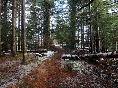
Eastern Lookout Trail
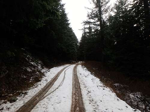
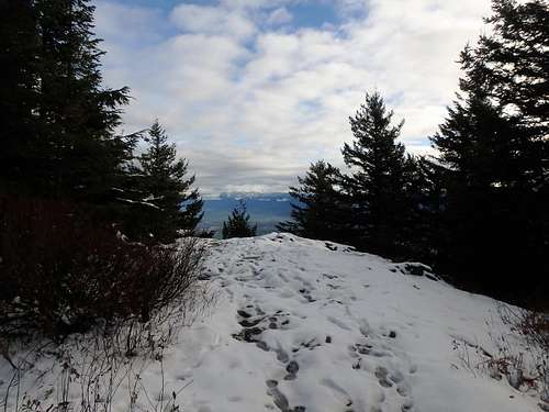
Snow Does Not Deter Visitors
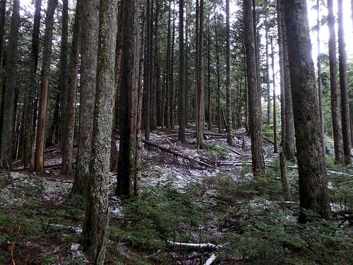
The mountain has much wildlife, ranging from small animals (such as birds, raccoons, and squirrels) to larger animals (such as cougars and bears). The trees are mostly coniferous, although some deciduous trees are present.
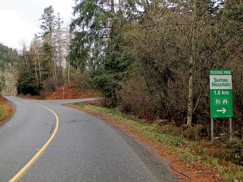
Getting There
FROM EXIT 92 ALONG HIGHWAY 1 (a.k.a. Mission/Sumas USA junction):1) Drive east on Trans-Canada Highway 1 for 3.1km, until Exit 95.
2) Take Exit 95 (Whatcom Road), turning left to go over the highway.
3) Upon arriving on the north side of the highway, turn right on North Parallel Road.
4) Follow North Parallel Road for 2.3km, then turning left onto Sumas Mountain Road.
5) Follow Sumas Mountain Road for 7.8km (it is known as Upper Sumas Mountain Road north of the Dawson Road junction).
6) Turn right on Batt Road. There should be a "Sumas Mountain Regional Park" sign just prior to the road junction.
This way to the park!
7) Follow Batt Road for 1.1km to a "T" intersection. Turn right onto Taggart Road, which becomes a dirt/gravel road.
8) Follow Taggart Road to the Chadsey Lake Trail Parking Lot, also known as the Upper Sumas Mountain Parking Lot. Elevation: 2395' (730m)
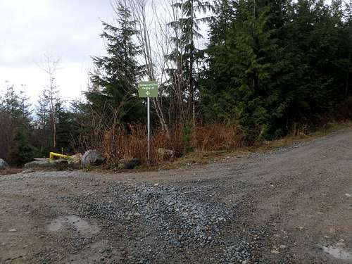
Chadsey Lake Trail Parking Lot
Route
The simplest way to reach the Sumas Peak highpoint contenders is by hiking or bicycling up Taggart Road to the main repeater station site, which is one of the highpoint contenders. A trail system can be found to the south/east of the repeater site, leading towards "Eastern Lookout"... another nearby hill which is obstructed from view due to thick forests in-between the highpoint contenders. On the west side of the road from the main repeater station site is a forested hill which is another highpoint contender. For peakbaggers seeking to reach the highest point of Sumas Peak, it is recommended that all three contender hills be visited. Total roundtrip distance: 4.5 miles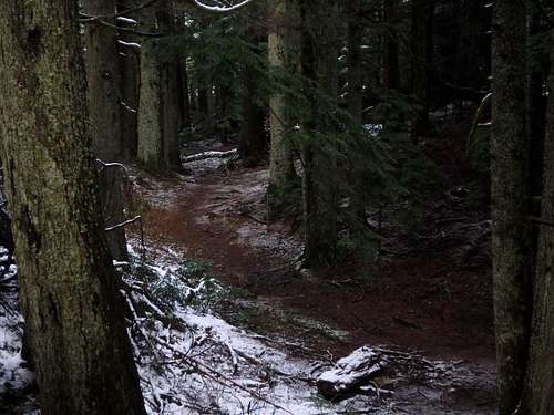
Other routes exist on the mountain, as well. Sumas Mountain Regional Park has an extensive trail system. Some people opt to make a big loop to/from the Chadsey Lake Trail Parking Lot, first heading down to Chadsey Lake via trail, then going up to the summit contenders via trail, and then going back to the parking lot along the upper road.
Some people opt for even longer (10+ mile) loops and journeys. An easy-to-miss trailhead is located in a road-bend along Upper Sumas Mountain Road, 1.6 miles north of the Batt Road junction. That trailhead has only a tiny sign and roadside parking, but many people like using this route due to its longer route options and lower starting elevation (in case of snow higher on the peak).
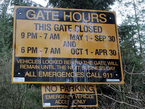
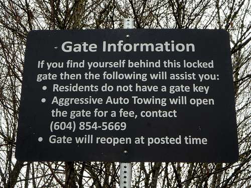
Red Tape
Sumas Mountain Regional Park is open year-round. However, there are specific park hours depending on season. Currently, the gate to the access road (Taggart Road) closes from 9:00 PM - 7:00 AM from May 1 through September 30, and closes from 6:00 PM - 7:00 AM from October 1 through April 30. Specific details shown in photos below.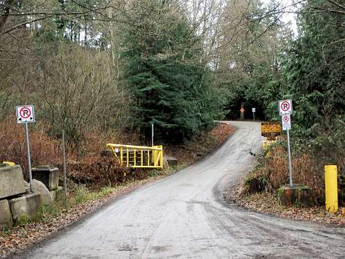
Park Entrance Gate
Currently, there are no fees or permits necessary to visit Sumas Peak.
gimpilator - Dec 26, 2017 11:09 pm - Voted 10/10
Fire Risk ClosureI tried to drive up this peak for the short hike this summer. The gate on the road was open, however the road was technically closed to foot and motorized traffic because of dry conditions and fire danger. After leaving the area, I inquired among locals and this seems to be a regular occurrence now during the summer.