Overview
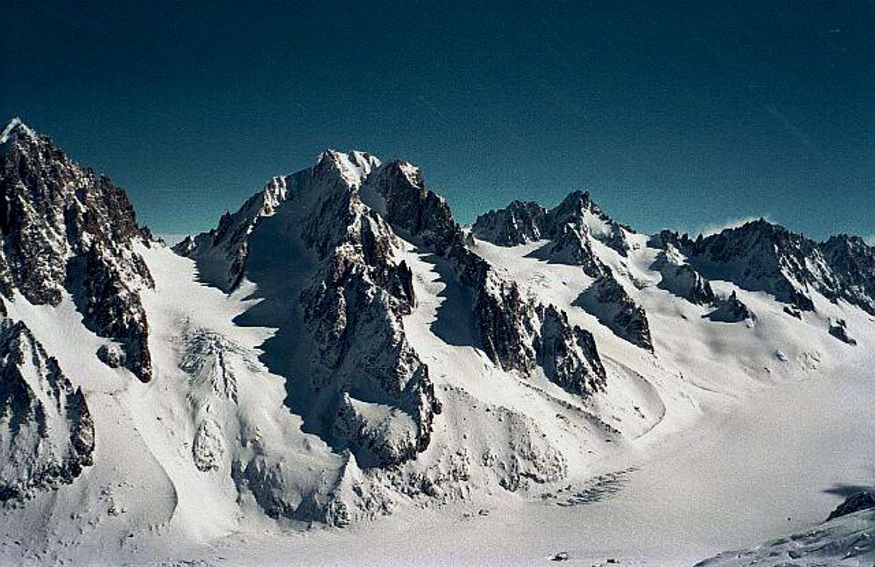
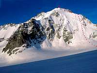
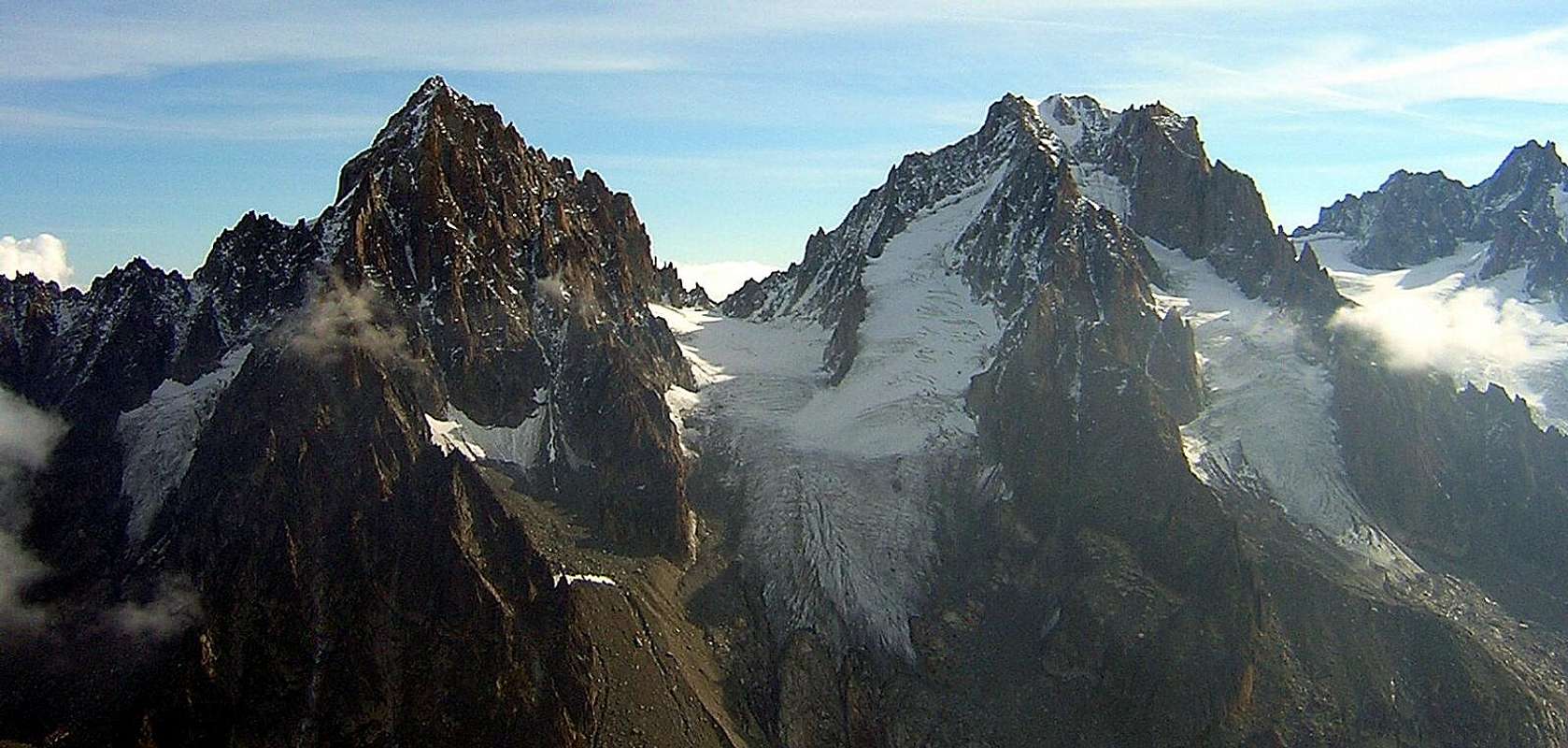
![]() Aiguille d'Argentière seen from Grands Montets (March 2001) - Photo by Rahel Maria Liu
Aiguille d'Argentière seen from Grands Montets (March 2001) - Photo by Rahel Maria Liu |
|
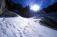
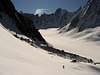
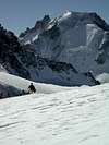
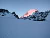
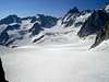
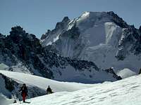
![]() | ![]() | ![]() | ![]() | ![]() |
| Sunrise | Glacier du Milieu | Adenostyles | Sunset | Glacier du Milieu |
The Aiguille d'Argentière (3902 m) is situated in the Mont Blanc Massif, in the North of some major peaks as the Mont Blanc and Les Droites and south-east of Aiguille du Chardonnet.
It is a very beautiful and interesting mountain concerning its shape and with regard to the ascents. According to Eberlein, there exist more than 50 ascents (although he does not name all).
Most famous are the Normal Route and the North Face ascents. But also the SW Ridge and the many ridge towers provide many interesting climbing routes. There only more in the Aiguilles of Chamonix.
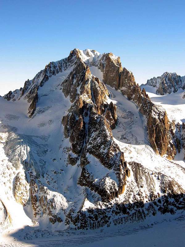
![]() Aiguille d'Argentière - Photo by andrea.it
Aiguille d'Argentière - Photo by andrea.it |
|
First ascent: E. Whymper and A. Reilly with M. Croz, M. Payot and H. Charlet on the 15th of July 1864.
Routes Overview
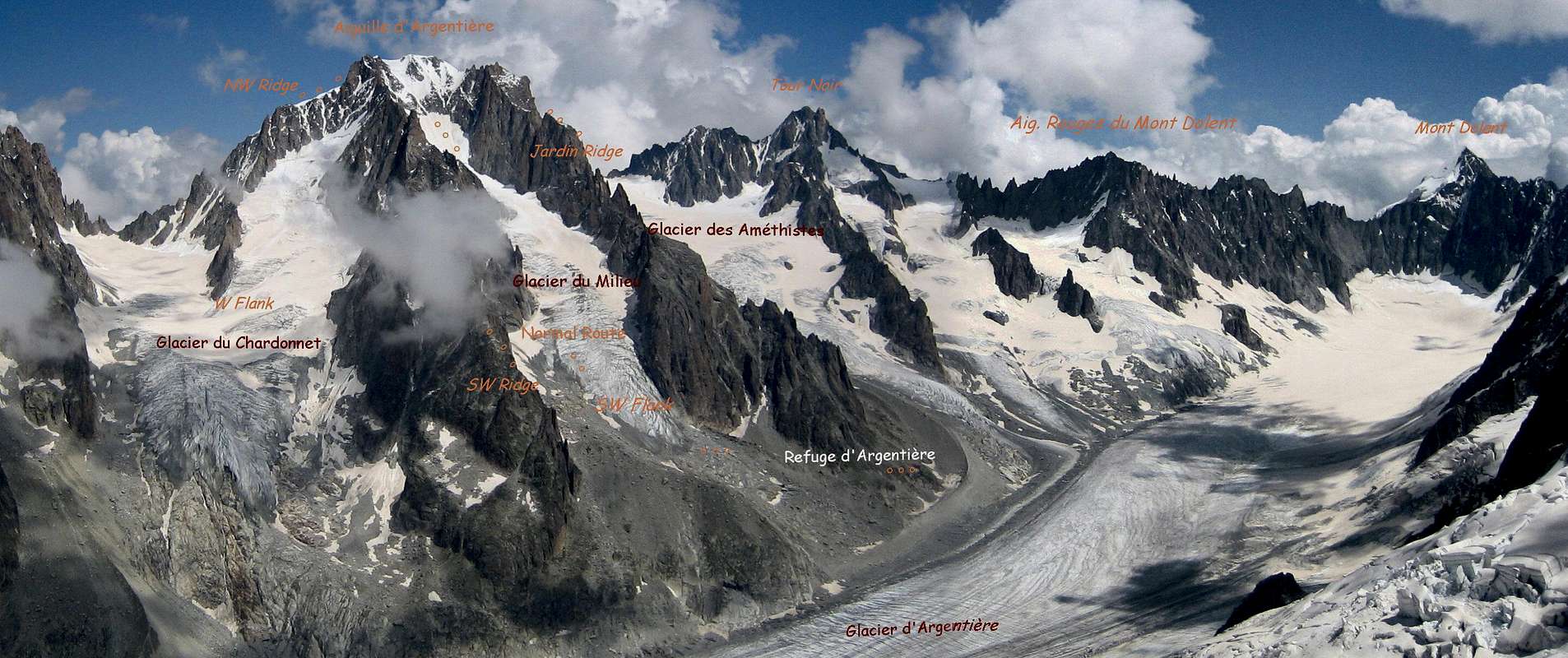
* Panoramic View of Aiguille d'Argentière - Glacier du Milieu - Glacier d'Argentière - Photo by Rahel Maria Liu
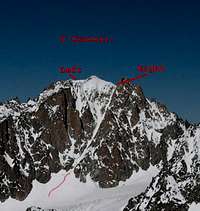
* ROUTES - Photos by andrea.it - gabriele/Jeroen Vels - El Tigre Valderrama - schadik
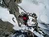
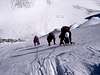
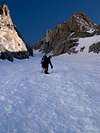
![]() | ![]() | ![]() | ![]() |
| Ski route
W Side | North Face
N Side | Y Couloir
S Side | ESE & NE Ridge
E Side |
![]() | SW Flank - Glacier du Milieu: |
![]() | W Flank and NW Ridge - Ascent from Ref. d'Argentière: |
![]() | N Face - Ascent from the foot: |
![]() | NE Face - Ascent from Ref. d'Argentière: |
![]() | ESE Ridge - Ascent from Ref. d'Argentière: |
![]() | Y Couloir (S Couloir) - Ascent from Ref. d'Argentière: |
![]() | Jardin Ridge - Ascent from Ref. d'Argentière: |
![]() | Ski Route - Glacier du Milieu - Ascent from the Cable Car Station Grands Montets: |
*
Climber's Logs
Getting There
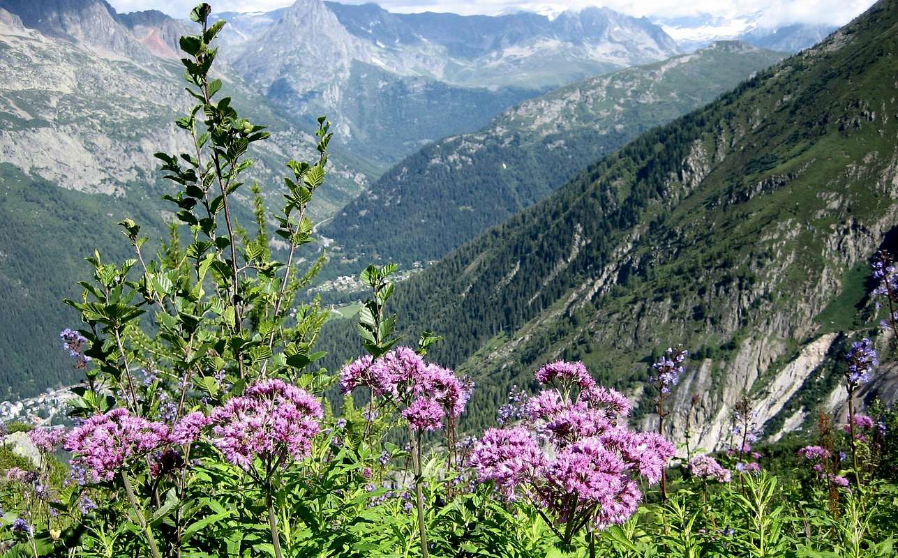
![]() Adenostyles (Grauer Alpendost) and Cicerbita (Blue Thistle) - Photo by H. Liu
Adenostyles (Grauer Alpendost) and Cicerbita (Blue Thistle) - Photo by H. Liu |
You come from the Ref. d'Argentière.
To the Ref. d'Argentière
In order to reach the hut, you have 3 possibilities:
From Croix de Lognan (1970 m) in 3 - 3,5 h, to Croix de Lognan with cable car from Argentière: From Croix de Lognan, you go on foot up over the morainecrest till about 2250m. Than you continue horizontally to the glacier, which you follow on the orographically left side. After about 1 km, the glacier becomes steeper and more torn. You climb onto the morain of the Rognons, first over a slippery shelf, than via a marked way which you follow until you reach the upper end of the ice break. You climb the glacier in SE direction and reach over the moraine the hut.
On foot from Argentière in 5 h: From the ground station of the cable car, you follow the wide aisle of the ski-run. You leave it at the height of about 1750m and reach the way of the middle station of the cable car (2 h). Now, you need 3 h to the hut.
From Aiguille des Grands Montets (summit station of the cable car from Argentière; last train up: 4:45 p.m.) in 2 h: From the summit station, you go via a stairway to the Col des Grandes Montets. You traverse a bergschrund (maybe with the help of a rope) and go up the steep hang to the Glacier Rognons. You go in ENE direction on the western side along P. 3000 to P. 2754m. You go down southeastern to the glacier d'Argentière, which you reach above the icebreak. From here in 2 h to the hut.
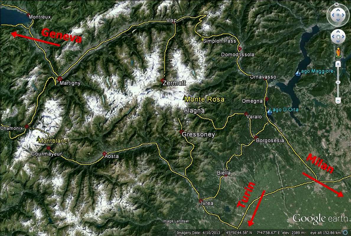
You reach Argentière by train (from Martigny/CH or Geneva or Annecy - TGV to St. Gervais), bus (from Annecy, Geneva, Grenoble, Courmayeur, Aoste and Turin) or car from Geneva or Martigny (Switzerland) via Vallorcine and the Col des Montets.
You reach the Chamonix Valley by train:
From Martigny (Switzerland) via Vallorcine.
From Geneva (airport) via Anncey (TGV till here) and St. Gervais.
You reach the Chamonix Valley by bus:
From/via Annecy, Geneva, Grenoble, Courmayeur, Aoste and Turin
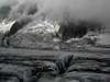
* Ascent 1860 - Mer de Glace - Crevasse 1890 (Photos from om)
![]() Ascent 1860
Ascent 1860 | ![]() Mer de Glace Mer de Glace | ![]() Crevasse 1890 Crevasse 1890 |
:
From Geneva (from the NW) on the A40 till St. Gervais and from here on the N205.
From Martigny (from the NE, Switzerland) via Vallorcine and the Col des Montets on the road no. N506.
You reach the Val Ferret (Italy) by bus or car:
From Chamonix through the Mont Blanc Tunnel from the NW.
From Torino (from the SE) on the A5 via Villeneuve.
Mountainhut
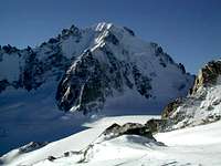
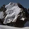
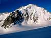
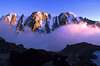
* Views of Aiguille d'Argentière - Photos by barrys, Jurgen Mesman, om, schadik
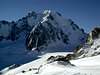
![]() | ![]() | ![]() | ![]() | ![]() |
| Summit View | SW Flank | N Side | W Side | E Face |
(2271 m)
![]() | Refuge d'Argentière is a modern big hut with a view directly to the northfaces on the opposite side: from Aiguille Verte to Mont Dolent. It is situated near the corner where the Glacier d'Argentière and the Glacier des Améthystes come together. |
from Croix de Lognan (1970 m) in 3 - 3,5 h, to Croix de Lognan with cable car from Argentière
on foot from Argentière in 5 h
from Aiguille des Grands Montets (Summit Station of the cable car from Argentière) in 2 h
Infos
![]() View of Aiguille d'Argentière - Glacier d'Argentière (Photo by H. Liu) View of Aiguille d'Argentière - Glacier d'Argentière (Photo by H. Liu) |
Phone: 0033/450 53 1298 - 0033/8 36 35 35 35
0033/450530702 (Train station Chamonix)
Phone of the Montenvers-train: ++33(0)450/531254
Ticket shop
BUS CHAMONIX VALLEY
Phone: 0033/450 53 0555 - 0033/450 53 0115
CABLE CARS
CAMPINGPLACE
Map&Books
* Sunrise ... With this beautiful panorama of all the major mountains of the Mont Blanc Group - Photo by Jurgen Mesman
![]() Mont Blanc - Aiguille Verte - Aiguille d'Argentiére
Mont Blanc - Aiguille Verte - Aiguille d'Argentiére |
1:25000 no. 3630 OT Chamonix - Massif du Mont Blanc
Instituto Geografico Centrale
* Ski route Glacier de Milieu Map - Photo from andrea.it
![Route map]() Milieu Map
Milieu Map<> Mont Blanc Area - Photo from Antonio Giani
![]() Mont Blanc Area Mont Blanc Area |
<>Hartmut Eberlein, Mont-Blanc-Gruppe. Gebietsführer für Bergsteiger und Kletterer, 2000 or 2012.
Helmut Dumler/Willi P. Burkhardt, The High Mountains of the Alps.
Gaston Rébuffat: The Mont Blanc Massif. The 100 Finest Routes. London 1996. ISBN 1-898573-03-4.
Erich Vanis, Im steilen Eis. 80 Eiswände in den Alpen. Munich et al. 1980. ISBN 3-405-12158-2.
Damilano/Perroux>, Neige, Glace Et Mixte: Mont Blanc. Editions Ice 1996. ISBN 2950986803. UKClimbing.com
Laroche/Lelong: Die Gipfel des Montblanc. Munich 1999. ISBN 3-405-15693-9.
Helmut Dumler/Willi P. Burkhardt, Viertausender der Alpen. 11th ed. Munich 1998. ISBN 3-7633-7427-2.
Lindsay Griffin, Mont Blanc Massif, Vol. 2 - Published Alpine Club (2002) - ISBN 0-900523-58-1.
Rother Skitourenführer - Hartmut Eberlein, Mont Blanc, 2009 (S. 100, 104, 106)
Link MountainArea
* Argentière (JA Linck, 1830) - Photo from om
![]() | MountainArea |
* Glacier d'Argentière - Cicerbita Alpina - Glacier d'Argentière - Glacier de Saleina - Photos by Modi, Hiltrud Liu - Andy Kennedy and noah
![]() | ![]() | ![]() | ![]() | ![]() |
| Glacier d'Argentière | View from Grands Montets | Cicerbita | Crossing the Glacier | Glacier de Saleina |
Google Map
*
Google Map Mont Blanc Area
![]() Google Map - Photo from markhallam Google Map - Photo from markhallam |


 71663 Hits
 97.16% Score
 66 Votes
 Aiguille d'Argentière seen from Grands Montets (March 2001) - Photo by Rahel Maria Liu
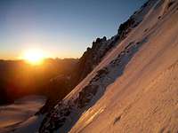


 Aiguille d'Argentière - Photo by andrea.it
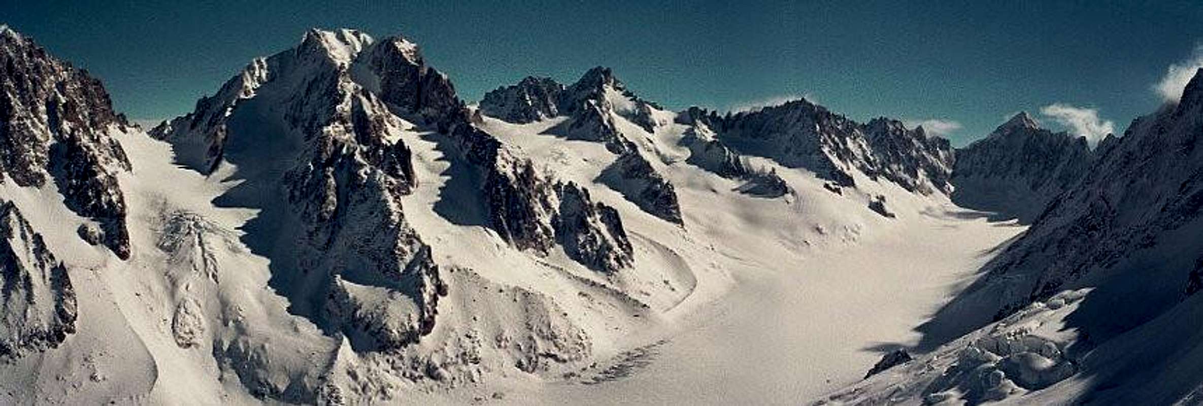


 Adenostyles (Grauer Alpendost) and Cicerbita (Blue Thistle) - Photo by H. Liu
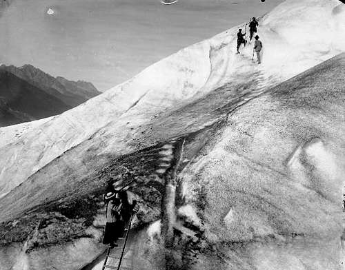 Ascent 1860
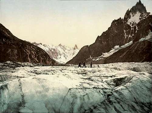 Mer de Glace
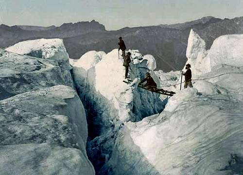 Crevasse 1890


 View of Aiguille d'Argentière - Glacier d'Argentière (Photo by H. Liu)
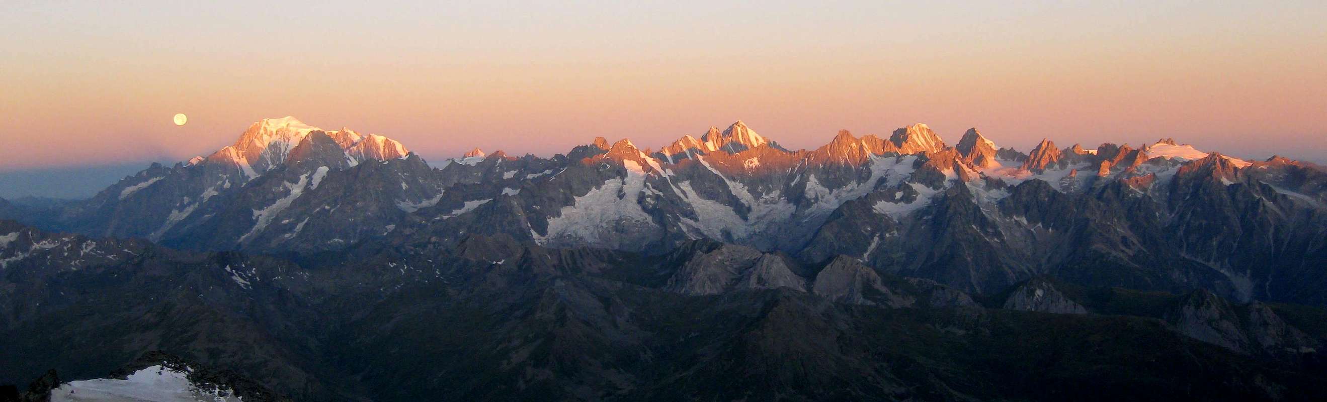 Mont Blanc - Aiguille Verte - Aiguille d'Argentiére
 Milieu Map
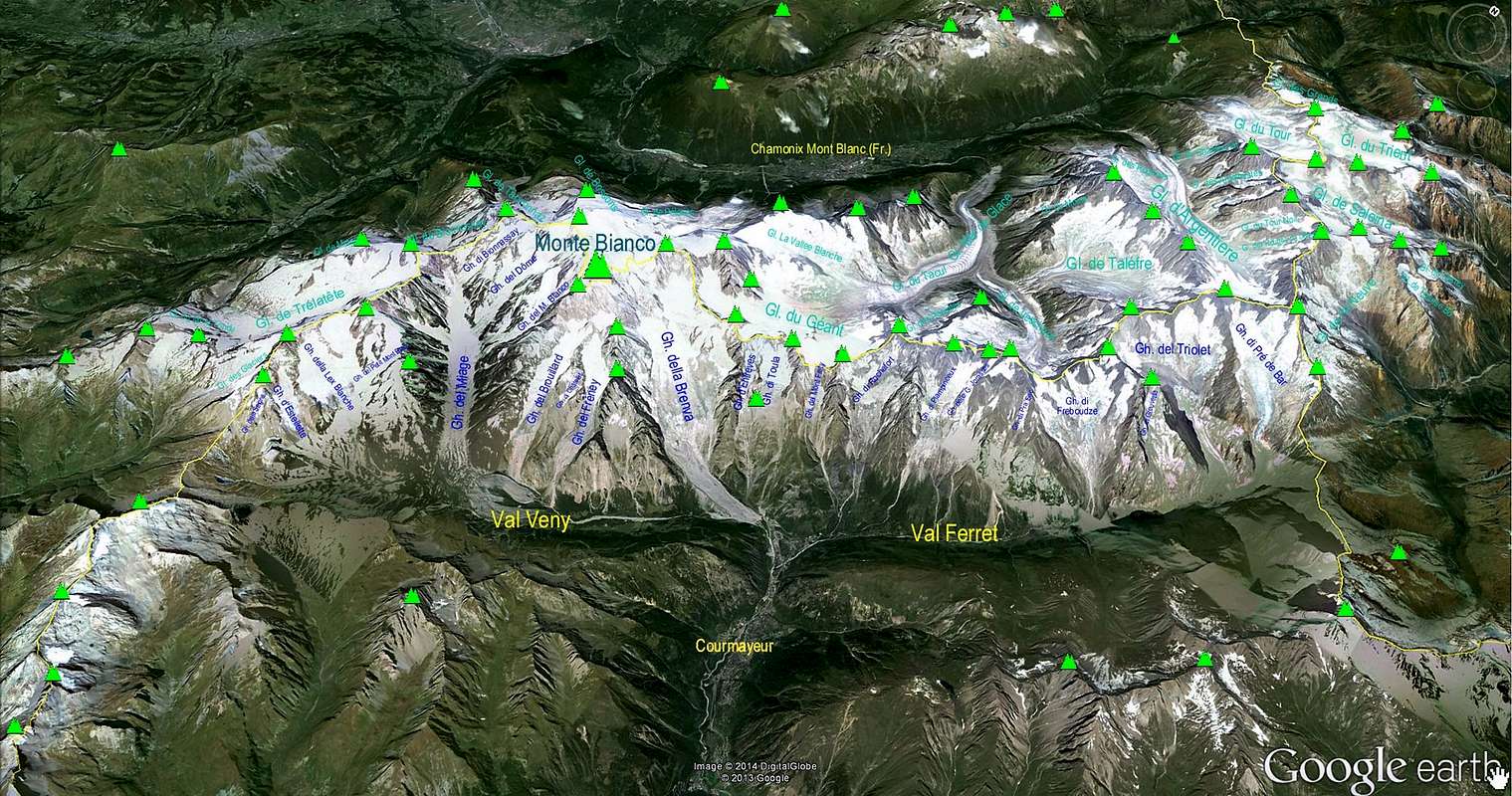 Mont Blanc Area


 Google Map - Photo from markhallam