
|
|
Mountain/Rock |
|---|---|
|
|
36.92840°N / 118.49098°W |
|
|
Fresno |
|
|
12959 ft / 3950 m |
|
|
Overview
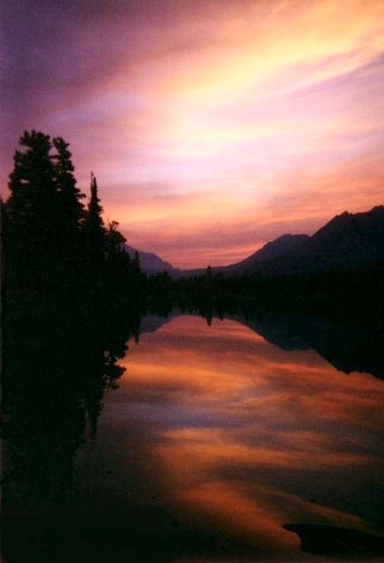
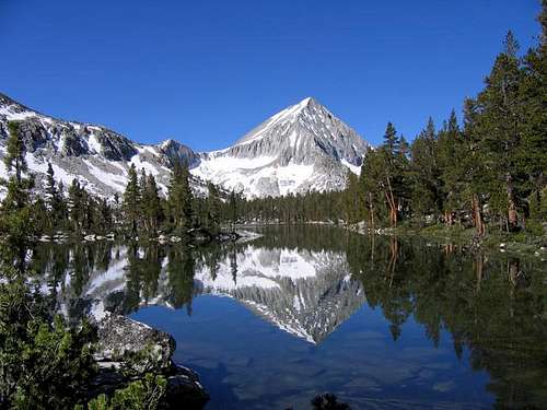
Arrow Peak is probably best known for the often photographed view of it rising over and reflecting on Bench Lake. Sitting alone above the South Fork of the Kings River in the heart of Kings Canyon National Park, the north face in combination with Arrow Ridge forms the impressive Muro Blanco (south wall above the Kings River canyon). Because Arrow Peak sits apart from the other high peaks of the area, the views from the summit are outstanding. To the north the views look across Cartridge Pass and Lake Basin to the Palisades. Looking northeast over Mt. Ruskin, there is a fine view of Split Mountain (it is from this vantage point that Bolton Brown named Split Mountain in 1895). To the east is Bench Lake, Taboose Pass and Mount Pinchot.The Southeast Slope (first climbed in 1930 by Walter A. Starr Jr.) is an easy class 2 route over talus and scree from the top of Arrow Pass. The Northeast Spur (first ascent route, 1895 by Bolton Brown) is a class 3 ridge climb on mostly good rock with a few knife edge sections. The Southwest Ridge (first climbed by in 1902 by Joseph LeConte, Tracey Keley, and Robert Pike) is also class 3.
For those who really enjoy pain, it is possible to climb Arrow Peak as a day hike. The shortest route is over Taboose Pass (11,370 feet) to Bench Lake then easy cross country to the base of Arrow Pass followed by about a mile of talus. Total round trip is 28 miles and 10,500 feet of elevation gain. From the west the round trip is about 30 miles and 8,500 feet of elevation gain (about 11 miles of cross country, some class 3).
If you are afflicted with a fascination with lists, Arrow Peak is a Mountaineers Peak on the Sierra Club's Sierra Peak Section SPS List. Due to its remote location, many visitors to Arrow Peak will also be interested in including other nearby peaks on the list on their itinerary. Popular options include Pyramid Peak, Mount Ruskin, Mount Pinchot, Mount Wynne, Striped Mountain, Goodale Mountain, and Cardinal Mountain.


Getting There
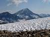
 Taboose Pass from the Summit
 Taboose Pass from Bench Lake
Arrow peak can be approached from the east or west side of the Sierra or as a side trip on the popular John Muir Trail. The closest trailhead from the east is Taboose Pass in Inyo National Forest, while sensible approaches from the west will begin at Roads End in Kings Canyon National Park.
Taboose Pass Trailhead (37.0094° N, 118.3272° W)
Turn west off highway 395 onto Taboose Creek Road (12 miles south of Big Pine and 14 miles north of Independence). The road quickly turns to graded dirt. Continue following the main road, which turns right at intersections 1.7 miles and 3.7 miles from 395. The trailhead is at the end of the road 5.5 miles from 395 at 5425 ft. There are no facilities at the trailhead, but Taboose Creek is very close and available for water and rinsing.
Roads End (36.79616° N, 118.58342° W)
Turn east off Highway 99 in Fresno onto Highway 180 towards Kings Canyon National Park. Simply follow the highway 92 miles all the way to Roads End in the back of the canyon (37 miles past the park entrance). Take care not to miss the left turn 21 miles from Highway 99 to stay on 180. If coming from the south, Highway 180 is best reached by using Highway 137 or 198 to connect to Highway 63 northbound in Visalia.
Red Tape
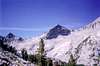
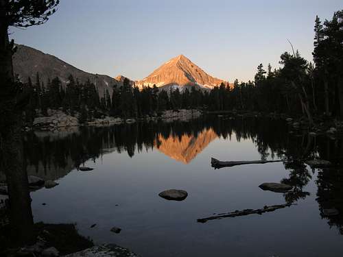
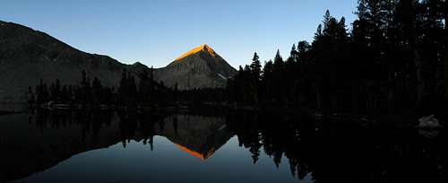
 Dawn at Bench Lake
Entrance Fees:
There are no fees if starting from the Taboose Pass Trailhead in Inyo National Forest. Roads End lies in Sequoia National Park, however, and an entrance fee is required. The Sequoia and Kings Canyon fee page has full details.
Wilderness Permits:
No permits are required for day trips but overnight trips require one throughout the year. For trips via Taboose Pass in Inyo National Forest permits can be picked up at the White Mountain Ranger Station in Bishop or the Mt. Whitney Ranger Station in Lone Pine. Quotas are in place May 1 through November 1. Check the Inyo National Forest wilderness permit website for the most current information and reservation availability. In Kings Canyon National Park, the Woods Creek Trailhead has quota of 25 people per day in place from late May through late September each year. Outside the quota season permits can be self-issued anytime at the Roads End Permit Station, otherwise they must be obtained from the same location during open hours. Check the Sequoia and Kings Canyon permit page for full details on hours, the reservation process, and reservation availability.
Food Storage:
Bear canisters are required along Woods Creek in Kings Canyon National Park. Outside of the Woods Creek area cannisters are not required but proper food storage is a good idea.
Campfires:
Fires are prohibited above 10,000 feet in Kings Canyon National Park.
| Inyo National Forest Wilderness Permit Office 351 Pacu Lane, Suite 200 Bishop, CA 93514 Wilderness Information Line: (760) 873-2485 Permit Reservation Line: (760) 873-2483 | Sequoia & Kings Canyon National Parks Office 47050 Generals Highway Three Rivers, California 93271 (559) 565-3341 |
When To Climb
Most ascents of Arrow Peak are done in the summer from June through September. However, those willing to make the long approach over snow may climb in winter. There are several winter ascents (and ski descents) listed in the summit log, so you won’t be the first.Current NOAA / National Weather Service Forecast
 |
 |
 |
 |
 |
 |
Camping
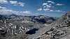
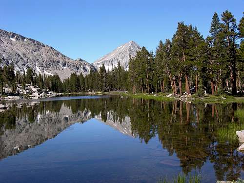
 Arrow Peak and Bench Lake from the Taboose Pass Trail
Backcountry camping is unlimited in the Arrow Peak vicinity. The obvious choice on the east side is at Bench Lake which has great fishing, lots of shade, and the classic view of Arrow Peak from the eastern shore. Even here just over one mile from the very crowded (and stunningly scenic) Lake Marjorie basin you are likely to have the area all to yourself. Complete solitute is almost guaranteed to the southeast in remote Arrow Creek basin. If you are climbing the Northeast Spur then there are options all along the South Fork of the Kings River.
Roadside camping is not allowed at Roads End, but dispersed camping is permitted not far away outside the park in Sequoia National Forest if approaching from the west. If approaching via Taboose Pass there are dispersed camping options along Taboose Creek Road and at the trailhead.
Established campgrounds to the east include county run Taboose Creek Campground for $10/night with water, vault toilets, tables, etc… It is located along Taboose Creek Road 1.5 miles from 395. Goodale Creek Campground is run by the BLM for $5/night and also nearby.
In Kings Canyon there are four established camping locations (Sheep Creek, Sentinel, Canyon View, and Moraine) with over 300 total sites available. All but Sentinel are open on an as needed basis, making it sometimes difficult to spread out even when usage is low. Each campground has full amenities, costs $18/night, and all sites are first-come, first served. The Sequoia and Kings Canyon Campgrounds page also lists other sites in the area.


Bob Burd - May 27, 2008 7:41 pm - Voted 10/10
West approach"From the west, the round trip would be about 30 miles and 8,500 feet of climbing (about 11 miles of cross country, some class 3)." The total was closer to 36mi RT, 12mi on trail, 6mi cross-country, each way. Also the gain is closer to 10,000ft since you have to drop down from a saddle on Pyramid's long SW Ridge to get to the Arrow Creek Basin. The route directly up from Arrow Creek can avoid this extra gain, but it looks a lot tougher than the class 3 Secor describes.