
|
|
Mountain/Rock |
|---|---|
|
|
42.69800°N / 0.3769°W |
|
|
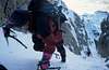
Hiking, Mountaineering, Trad Climbing, Ice Climbing |
|
|
Spring, Summer, Fall, Winter |
|
|
9068 ft / 2764 m |
|
|
Overview

The second highest peak in the Sierra de la Partacúa, Peña Telera is a part of the limestone ranges in the Pyrenees that stretch from Monte Perdido to Pic d' Anie and the Karst of Larra. It was first climbed by E.Wallon in 1877 and offers an impressive north wall overlooking the valley of Tena from a height of over 1500 meters. Its south face access is easier, but nevertheless should never be attempted lightheartedly. All climbs in this range should be reserved only by experienced and well equipped mountaineers. Locals usually know this, and therefore you will not find many climbers here.
Getting There

Northern access: Piedrafita de Jaca, 18 kilometers north of Sabiñánigo (Huesca) on the road (N-260) to the french border. Some two or three kilometers after passing by the Búbal Dam you must turn left following the sign to Piedrafita de Jaca. Do not stop in the village. There is an obvious road going on afterwards, which will lead you to the "Parque Faunístico La Cuniacha". If you find that the barrier of the dirt road is open, go on for a little bit more to the signs of "Ibón de Piedrafita" (on your left, marking a path). If the barrier is closed, you can leave your car in the parking lot placed on the right side of the road and go on walking up the dirt road.
Southern access: Refugio del Barranco del Puerto (mountain hut). It is reached from Biescas, some nine kilometers north of Sabiñánigo on the same road to the border. Just after passing by Biescas and leaving on your right the road to Ordesa, you will find a sign on the left of the road: "Aso de Sobremonte/Yosa de Sobremonte". Follow this road, which you will have to leave after 3.5 km to take a dirt road leading to the Hut. If you find that this road is closed by a barrier, there are two available options: either leave the car on the spot or drive back to Biescas in order to ask for the key in the Town Hall (information by rbartolome - September 2003)
 |  |
Red Tape
No need for any kind of permits. No restrictions at the very moment of writing this text (August 2003). Right now, the car park at "La Cuniacha" is not restricted to Park visitors but that might change without any notice.When To Climb
Best for a summer or autumn climb. The normal route includes some exposed and dangerous crossings (see "Canal de Cachivirizas y Terrazas norte" route) that might become deadly in winter time, even for experienced climbers.
 |
 |
 |
Camping
Refugio del Barranco del Puerto (South face)Free camping is officially not allowed, but some people do so. A good camping site is placed in the nearby village of Escarrilla (some six kilometers or so from Piedrafita de Jaca, on the road to France), check the links section below
External Links
- Peña Telera
Pictures and route (in spanish) for this mountain.
- Peña Telera with snow
Pictures of P.Telera with snow and route in winter (spanish).
- Web page of Parque Faunístico "La Cuniacha"
Includes information on how to approach to the north face of Peña Telera and the Canal de Cachivirizas
- Camping Escarra
Information on the camping site at EscarrillaAdditions and CorrectionsPost an Addition or Correction
Diego Sahagún - Feb 15, 2005 9:41 pm - Hasn't voted
Untitled Commentnamed Telera in the maps 1:40.000 of Editorial Pirineo
Rafa Bartolome - Oct 25, 2008 5:57 pm - Voted 10/10
It's not the highestThe highest peak of Sierra de Partacua is Peña Retona (2775m) and not Peña Telera. I'm sorry.
eza - Oct 27, 2008 10:28 am - Hasn't voted
Re: It's not the highestThanks, I already changed it. I seem to remember you told me it was the third highest, am I right?
Rafa Bartolome - Oct 27, 2008 2:31 pm - Voted 10/10
Re: It's not the highestno, Telera is the second one. The list: -Retona (2775m) -Telera (2768m) -Puerto Rico (2753m) los 3 están ya en mendikat.net por si te interesa pa consultar