
-
 37411 Hits
-
 84.51% Score
-
 23 Votes
|
|
Mountain/Rock |
|---|---|
|
|
45.79140°N / 110.9375°W |
|
|
Hiking |
|
|
Spring, Summer, Fall, Winter |
|
|
9162 ft / 2793 m |
|
|
Overview
Saddle Peak is one of the more prominent peaks on the long sharp ridge of the Bridger Range in southwest Montana. Impressive views from the summit include the Gallatin and Madison Ranges as well as the Crazy Mountains and the Absorkas. Much of southwest Montana is visible from this highpoint and the Gallatin Valley sits just below you with views of the Bozeman Airport and if you are lucky, maybe a closely flying plane. There are a few ways to summit this peak with the most common taking advantage of the Middle Cottonwood Trail on the west side of the range. Another way this peak can be reached is by utilizing the trail up to the college "M" and continuing onwards along the spine of the range over Baldy and then to Saddle Peak.
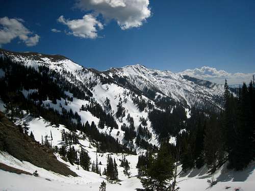
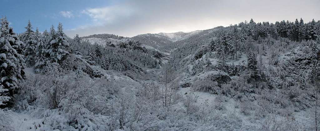
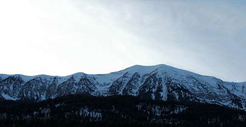 Saddle Peak under snow
Getting There
College M Trail and Route - Driving Directions
From Bozeman, Montana head north from town on Rouse Avenue, which begins from Main Street near the Montana Ale Works restaurant. Go about 5 miles to a parking lot accessing the "M" trail and the Bridger Ridge Trail. There are two trails to choose from at the trailhead; the steep one or the easy one. Take the steep one as it's shorter and arrive at the large M in perhaps 30 minutes. Continue up the main trail as it ascends above the M and follow signs for Mount Baldy. Once reaching the ridge, follow it north over a small rocky peak where you will get awesome views of the remaining ridge hike to Mount Baldy. Descend 150 feet or so and continue over Mount Baldy, and then Bridger Peak, before reaching the final 700 foot ascent to the top of Saddle Peak. Total time from the trailhead is roughly 5 hours one way and has 5,000 feet of gain round trip. The route never exceeds Class 2.
An alternate route is to gain the ridge at the Bridger Bowl ski area. Continue past the M Trailhead on the same road and continue about 12 more miles to the Bridger Bowl Ski Area. From the parking area there are numerous trails leading to the ridge where you then traverse south on the ridge about 2 miles to the summit. This route involves less distance than the route from the M trail. Each year people start the bridger ridge run from Fairy Lake which involves passing over Saddle Peak along the 22 mile trek.
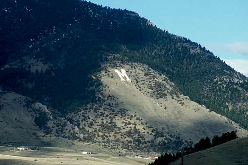 The M which the trail passes by The M which the trail passes by |
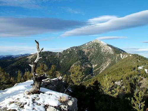 Baldy Mountain from the south Baldy Mountain from the south |
 Looking towards Baldy from the summit Looking towards Baldy from the summit |
Middle Cottonwood Trailhead and Route - Driving Directions
You can also access this peak from Middle Cottonwood Canyon on the West side of the Bridgers. The trail is steep but well marked and easy to follow. This trail is a very popular place for locals to take the kids or walk the dog so expect company at least on the first couple miles of the trail. This is probably the best round trip hike and the route I recommend. From 19th street head north and cross over I-90 and turn right onto Springhill Road and go north for 1.4 miles. Turn right (east) onto Sypes Canyon Road and go another 1.4 miles. Turn left onto Summer Cutoff Road and go up the hill around two hairpin turns and turn right onto Saddle Mountain Road. There will be a 90 degree bend in the road at which point it turns to dirt. Just past this bend turn right and follow the dirt road another mile to the trailhead.
The trail initially is a rather slight incline and makes for a nice hike along Middle Cottonwood Creek. Within the first 10 minutes it will cross the creek twice on good bridges, and then cross it again, back to the north side on some rocks just before it reaches a signed junction 1 mile from the trailhead. The trail is well marked along the lower portions and would be difficult to miss. Continuing straight, the trail weaves through meadows, and crosses the stream four more times (no bridges) before leaving the creek and ascending steeply above the north side. Once you reach the head of the valley, the trail continues up the now steeper drainage and parallels the crest of the Bridger Range. Ascend a steep 800 feet to the 8,270 foot saddle just west of Saddle Peak. When there is no snow cover, a small trail heads southeast, bypassing a small cliff to the south and continues directly up the ridge to the south summit of Saddle Peak, 900 feet above the small saddle. The trail can be followed the entire way to the summit at Class 1. In early season, a huge cornice typically blocks this saddle and may take some creativity to get around, also the trail will be covered and post-holing may be an issue even on the ridge above the saddle. Once atop the south summit, it is a very easy 5 minute walk to the north (and higher) summit.
 Middle Cottonwood drainage under snow Middle Cottonwood drainage under snow |
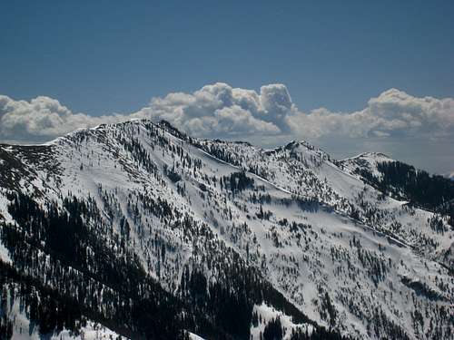 Baldy from Middle Cottonwood Baldy from Middle Cottonwood |
 Navigating the small saddle Navigating the small saddle |
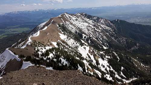
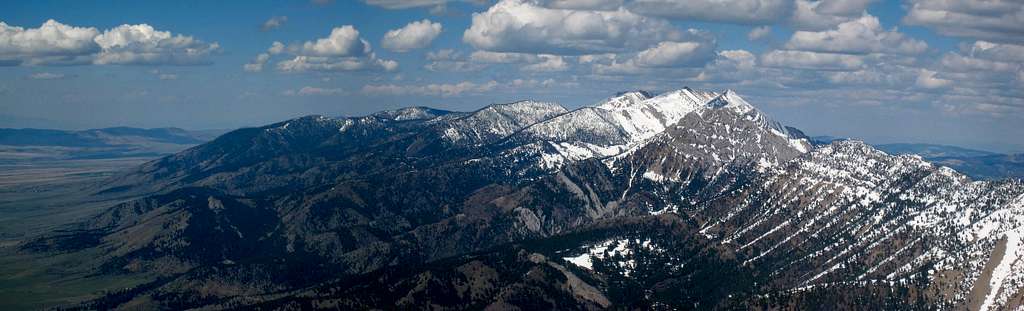 Ross Peak Panorama from Saddle Peak
Camping/Red Tape
Camping is allowed but not needed. There aren't really any places to camp along the trail but the trailhead would make for a good place to car camp for the dirt-bags lurking here. The peak is in the Gallatin National Forest, and no permits are needed. Starting from Bridger Bowl depends on the ski area not being in operation. All other trailheads are open to foot traffic year round.
When To Climb
Most any time of year that is snow free or when snow conditions are stable which is typically June-October. Early season and winter ascents are very possible and only requires an ice axe, and maybe crampons and avalanche beacons/probes. Back-country skiing is also common given the relatively easy access.
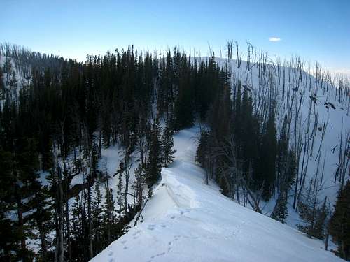
 Middle Cottonwood Canyon in winter
Map
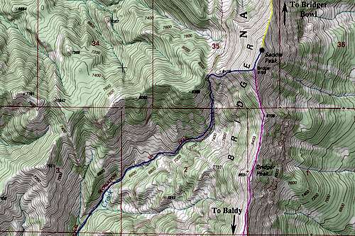 Saddle Peak Map
The standard Middle Cottonwood Trail and west ridge route is in blue
Bobber - Jun 14, 2015 12:15 pm - Hasn't voted
Length and VertI did Saddle yesterday. Today I was fiddling around on Google Earth trying to get the distance of the trail. Most of the trail is visible and using the path tool I came up with 4.24 miles from the Middle C parking lot. That's a vertical gain of about 3692'. And that one mile sign at the intersection of the trail that goes to the M is about 1.2 miles. I can gauge my distance by time and I knew it was longer than a mile or else I'm gettin' slower. Also the twin Saddle peaks are really close in elevation with a difference of only a few feet if that. I was told that the north one was higher but the topo has the mark on the south one so I did both just to be sure. What is interesting on GE is it shows a small plane which evidently crashed on the low hill northeast of the parking lot. I wonder if it's still up there?
midwestcoast - Oct 16, 2015 9:04 pm - Hasn't voted
Re: Length and VertI noticed the plane in GE too, but it's definitely not crashed, it just got caught flying in the satellite imagery and wasn't removed.