
-
 53268 Hits
-
 90.21% Score
-
 33 Votes
|
|
Mountain/Rock |
|---|---|
|
|
1.46923°S / 78.44543°W |
|
|
Hiking, Mountaineering |
|
|
Summer, Winter |
|
|
16456 ft / 5016 m |
|
|
Overview
Tungurahua 5023 m
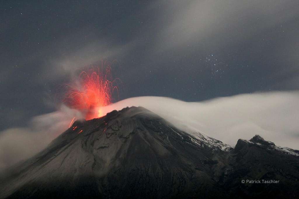
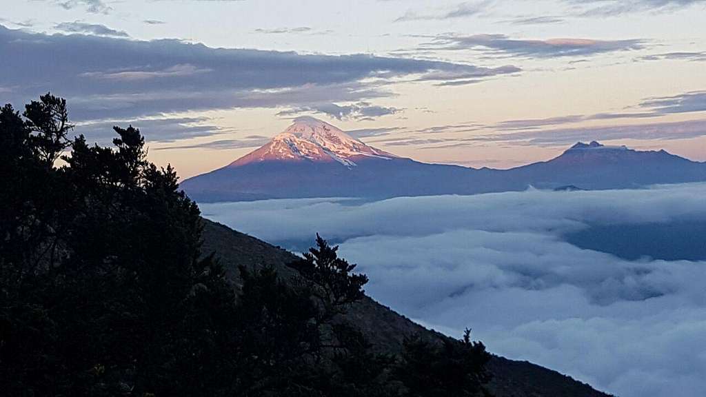
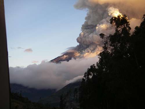
Tungurahua 5023 m, the 10th highest peak in Ecuador, is an active stratovolcano located in the homonymous province about 10 km South of Baños and part of Parque Nacional Sangay. Tungurahua is a perfect cone and at its summit it has a large crater 183 meters in diameter. In the recent past most of the volcano was covered by snow despite the equatorial latitude, but now the snow cap is largely reduced and the summit is often rocky. This steep-sided volcano towers more than 3 km above its Northern base. Tungurahua was first climbed in 1873 by the Germans Wilhelm Reiss and Alfons Stübel and is also known as the "The Black Giant", actually the word "Tungurahua" means "burning throat" in Quechua language.
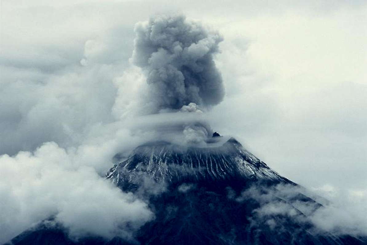
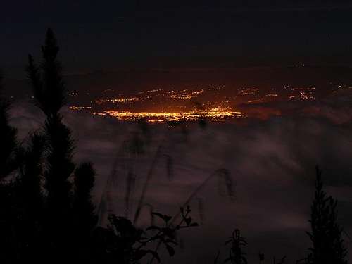
It sits about 140 km South of Quito, the capital of Ecuador, and is one of Ecuador's most active volcanoes. The eruptions have been accompanied by strong explosions and sometimes by pyroclastic flows and lava flows that reached populated areas at the volcano's base. The last major eruption took place from 1916 to 1918, then minor activity continued until 1925. The latest eruption began in October 1999 when the volcano became active again and initially prompted the evacuation of the entire town of Baños on the N side of the volcano.
Last news about Tungurahua volcanic activity
It is nowadays dangerous to climb (since 1999) as its increased volcanic activity has unpredictable eruptions as a consequence. You do not want to be caught on the volcano when major explosions of gases, ashes and lava occur! When the volcano increased its activity in 1999, the ice cap melted away and the peak is since then ice free.
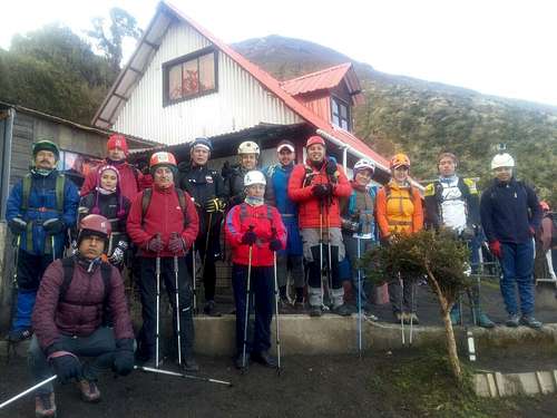
During a long period starting from the year 1999 the climbing of the volcano was prohibited as dangerous due to repeated eruptions. In spite of this many people still attempted to climb the volcano. In September 2016 Tungurahua area officially reopened, there were rangers up there at the entrance and the ascent was possible - same regulations apply as for other Ecuadorian mountains >5k. The Refuge was re-opened, but without the manager, climber had to bring their own food etc. but could sleep there (mattresses) and use the stove (gas) for USD 5,-- per person.
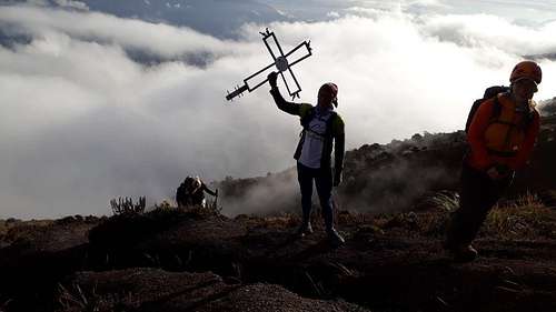
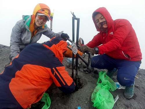
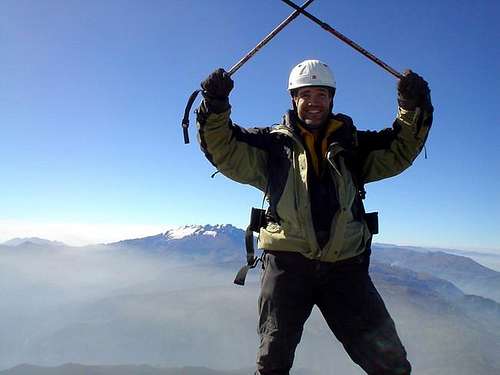
In the year 2018, January 13th, after almost twenty years of intense volcanic activity, a group of 20 mountaineers from Baños with the permits of the Ministry of Environment climbed Tungurahua to install a cross on the summit. After an early approach to the park entrance in 4x4 starting from Baños, the group started the climb at approx. 2.800 m of altitude, getting the Refuge at 3.800 m and then continuing to reach the summit in only one day, a demanding ascent. The complete trip report is visible on Summitpost by clicking on this link: Tungurahua summit now with a cross.
According to the latest information, currently (February 2020) it seems that the western side of the volcano is collapsing, therefore it is necessary ALWAYS check with locals about the mountains condition. The researchers advise to carefully monitor Tungurahua in order to predict the eventuality of a landslide sufficiently in advance. Furthermore don't be fooled by descriptions of this mountain as "easy." People have died on this mountain and you need to be in good physical condition to climb it and enjoy it.
Getting There
The town of Baños (20.000 inhabitants) is is the reference center for climbing Tungurahua. It is located 25km from the province capital Ambato. It's easy to reach by bus from all over the country as it's a main tourist spot. The bus from the capital Quito takes 3,5 hours.
You can start walking from Baños (this is a very long option): follow the road on the Ambato side of town, then take the first trail to the right of the store and follow this path to town of Pondoa --don't follow the road to the baths.
Alternatively you can hire camionetas (small trucks) in Banos to take you to Parque Nacional Sangay where Tunguraghua is located. The camionetas will take you to the entrance to the park.
Walking to the refuge
The trail from the Park Entrance to the Refugio Nicolas Martinez 3,800 m is obvious and well-marked but fairly steep and takes 3-4 hours.
The Normal route from Refuge Nicolas Martinez
Based on weather the itinerary to the summit may require no gear, however there are times in the year when the last part requires a harness, crampons, ice axes and sometimes ropes. As mentioned, the snow on the summit has retreated a lot, but sometimes may be present. It is difficult to know in advance what the conditions of the mountain are, the ascent to the summit can therefore vary from a strenuous hike to a more demanding climb. In case of snow or ice the last hour may requires ropes to keep ones grip as the gradient is severe in parts. However there is little ice only during the final 40 minutes of the climb. Crampons may be useful. The rest of the climb is scree and demanding, especially if it is muddy. During my climb in August 1991, I found some snowy sections, but it was not necessary to use crampons. My advice is to get information about the conditions of the mountain at the Baños guide office.
After having spent the night in the refuge, as early as possible head for a summit push. It is best to leave at 3 or 4 am in the morning. The last portion is tough as you trudge steeply upward through deep volcanic ash. Descending to the Refuge is then only around 90 minutes and a further 2 to 3 hours walk back down to the entrance of the park.
Essential gear
Normal hiking gear with sturdy boots, sticks and warm clothing (the weather can quickly turn ugly).
Red Tape
Baños, at 1800m, is still the main entry into the climb and you will enter initially Sangay National Park which encompasses the Volcano, normally you'll pay $10 but if on a single day trip the fees are not charged. I have climbed the volcano in the year 1991, but some friends of mine came back in July 2003, and when they entered the National Park the office on the mountain was closed and deserted.
Most guides/climbers depart early in the morning from the refuge between 3 to 6 am for a 4 to 6 hours climb to the summit with the last hour sometimes through snow and ice parts. The glacier is small and represents only the final 40 minutes of the climb.
 |
 |
When To Climb
Best months for ascent to Tungurahua are from December to March for clearest views, but the weather is as unpredictable as Ecuador itself.

The hut
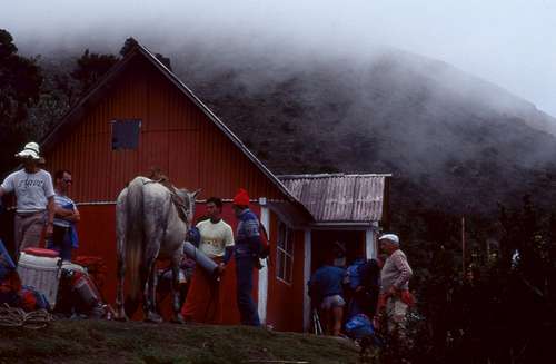
The Refugio 3800 m is around 4 hours ascent from the Park entrance and has two structures. One in stone housing 40 persons and one wooden slightly warmer. Don't forget your sleeping bag or hammocks. Cost is $5 per person.
Altough there were rumours the refuge has been destroyed by the eruptions it's still standing and OK. The Refuge building has gas and rainwater for guests to use (usually).
Mountain Conditions
About the volcanic activity: Smithsonian Institution
ncst - Feb 19, 2010 6:43 pm - Hasn't voted
No climbing allowedTo bad, but you're not allowed to climb Tungurahua at the moment (February 2010). In fact, it's illegal to do so. They've even put signs at the bottom of the volcano.
NatureGirl - Nov 24, 2016 1:52 pm - Voted 9/10
Tungurahua reopenedIn September 2016 Tungurahua area officially reopened, there are rangers up there at the entrance and you can climb - same regulations apply as for other Ecuadorian mountains >5k. Refuge is open but nobody is there, you have to bring your own food etc. but can sleep there (mattresses) and use the stove (gas) for USD 5,-- per person.
MattieQuigley - May 26, 2018 4:39 am - Hasn't voted
More infoFor more information and a good wikiloc go here! https://hikeecuador.wordpress.com/2018/02/14/tungurahua/