
|
|
Mountain/Rock |
|---|---|
|
|
39.47270°N / 106.1023°W |
|
|
Mountaineering |
|
|
Summer |
|
|
12987 ft / 3958 m |
|
|
Overview
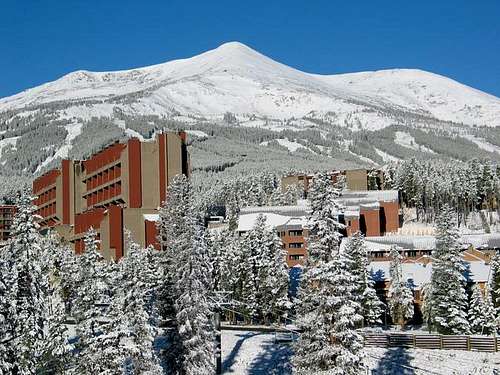
A beautiful peak that towers above the town and ski slopes of Breckenridge.
Peak 8 belongs to central Colorado’s Tenmile Range which stretches from Hoosier Pass to the south to Dillon Reservoir to the north. The 10 peaks that form the northern-most portion of Tenmile Range create an 8.5 mile long wall that is only one peak wide and runs north-south separating the valley of Blue River to the east (where Route 9 runs) from the valley of Tenmile Creek to the west (where Route 91 runs). North to south, the 10 peaks are as follows:
Peak 1 (12805 ft)
Tenmile Peak (12933 ft)
Peak 3 (12676 ft)
Peak 4 (12866 ft)
Peak 5 (12855 ft)
Peak 6 (12573 ft)
Peak 7 (12655 ft)
Peak 8 (12987 ft)
Peak 9 (13195 ft)
Peak 10 (13633 ft)
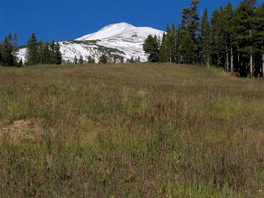
The eastern slopes of these 10 peaks are gentler than their western slopes and can provide easier access to their summits. Breckenridge Ski Area sits on the lower eastern slopes of Peak 7 to Peak 10. These lower slopes are covered by a Pine forest. In summer, the network of ski runs that have been clear cut through the forest can serve as beautiful grass covered pathways that take the hikers to the timberline at the base of the summits of these peaks.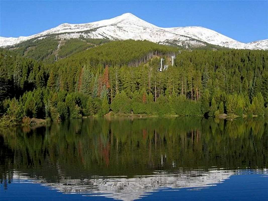

Imperial Bowl
Peak 8 rises directly to the west of the town of Breckenridge and is officially the highest point of the ski resort. From the top of Peak 8 skiers will gain access to a few double diamond slopes including the “Imperial Bowl”, an area to the south of the summit that leads down to a small lake at 12250 ft.
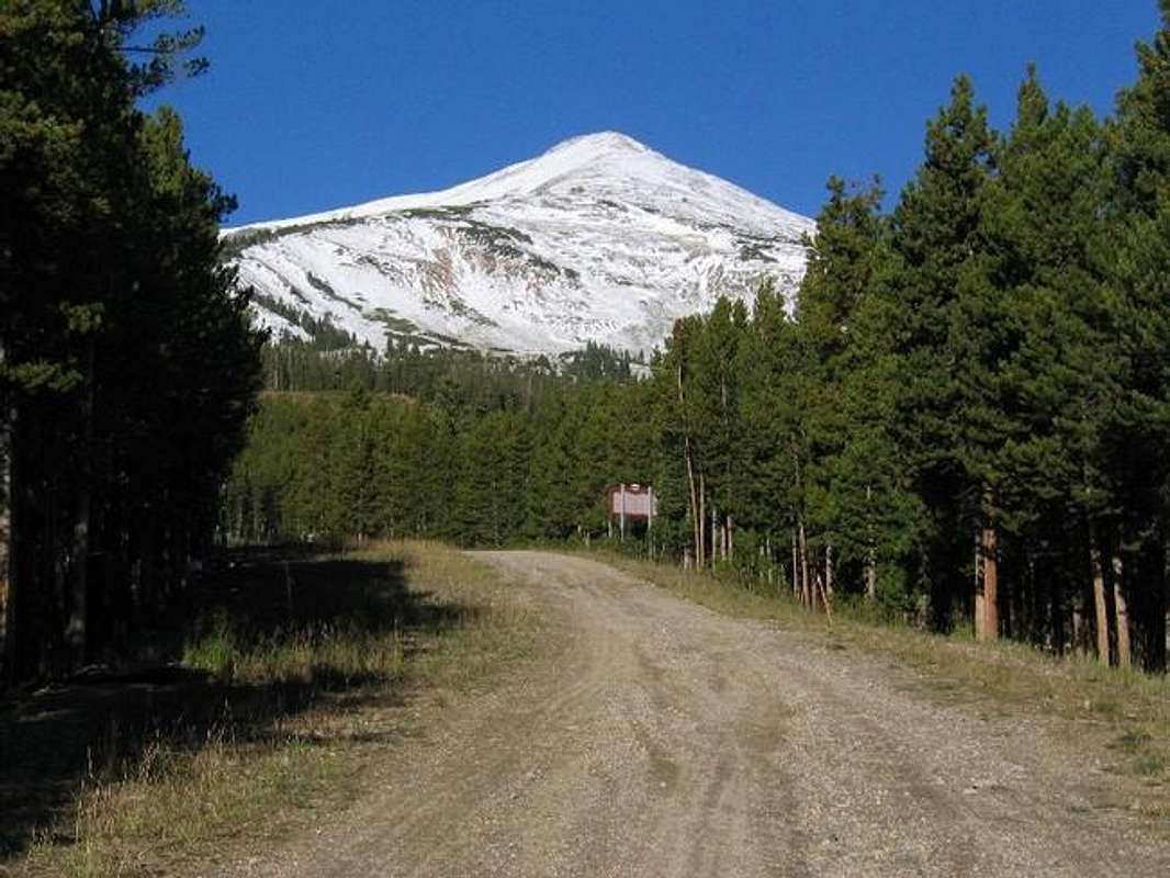
A hike to the summit of Peak 8 will require a 6 mile round trip with 3000 ft of vertical. From the base of the mountain, you can choose your own route through the maze of the ski runs to reach the “Vista Haus” Restaurant at 11200 ft. You can then follow the top of Peak 8’s southeastern ridgeline to reach the summit. A chair lift known as “Colorado” is usually operational in summer and brings tourists to the Vista Haus but as you hike farther up, you encounter fewer and fewer people.
From the beautiful summit of Peak 8, you will have great views of the peaks of the Tenmile Range, Gore Range, Front Range, Elk Range and northern Sawatch Range. Dillon Reservoir as well as portions of I-70, Route 9, Route 91, the town of Breckenridge, Summit Mine and Copper Mountain Ski Resort will also be in good view.
 |
 |
 |
 |
 |
Getting There
Take Exit 203 on I-70 to Route 9 and drive 9 miles south to the town of Breckenridge.
The easiest way to reach the Vista Haus (see above) is to follow the “Colorado” chair lift. For this option, in Breckenridge, turn west onto Ski Hill Rd. and follow it uphill to the end of it at the bottom of the ski slopes where “Colorado” and a number of other lifts start. Parking is available in that area.
Another option is to start at the “Beaver Run Resort” (see Route). This trail takes you through a beautiful Pine forest to a small pond that reflects the peaks. Drive to the south end of Breckenridge, turns west onto South Park Ave. and then take the first left to Village Dr. Just on the north side of Beaver Run Resort’s Building #4, you will find a trailhead marked as “Select 10” I did not see any public parking in that area.
 |
 |
 |
 |
 |
Red Tape
No fees or permits required for summer day hikes.
 |
 |
 |
 |
When To Climb
Easiest in summer.
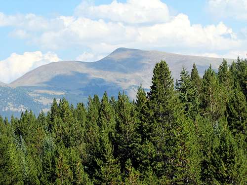
 Peak 8, east face
Camping
No campsites on the mountain but plenty of lodging available in Breckenridge and the nearby communities.
 Peak 8, west face
Mountain Conditions
External Links
- Breckenridge Ski Area
Lots of info. including maps.