|
|
Mountain/Rock |
|---|---|
|
|
43.85170°N / 114.5808°W |
|
|
11108 ft / 3386 m |
|
|
Overview
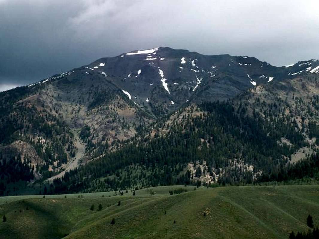
Easley Peak is located along the main crest of the Boulder Range in central Idaho. It is one of the many impressive peaks along the Boulder Front near Ketchum, Idaho, rising more than 4,000 vertical feet in 2.5 miles. It looms ominisouly above Highway 75 and boldly presents its grayish colored east face to those driving north.

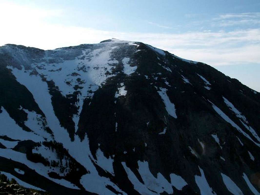
Easley Peak, by most, is identified by its aforementioned large, gray face. Perhaps the beauty of this feature though comes when the charcoal color contrasts with the layer of pink colored rock below it- this is the Boulder Front's best characteristic. Its lesser known west face is a massive wall of loose scree, subject to spectacular winter avalanches. But the steepest, and most rugged portion of the peak is its complex north face that is made up of a series of rotten spires and gullys that spike steeply above the awesome Middle Fork of the Salmon River.
Easley Peak is relatively isolated compared to other Boulder Front Peaks, making this a challenging and strenuous climb. Although there is little technicality involved in the main routes, elevation gains of more than 4,000'+ can be expected on an ascent.
Like most other mountains in the area, Easley Peak sees very little traffic throughout the year. Two small summit cairns tell the story of less than 40 people ever ascending this peak.
From the summit, a spectacular view of the upper portions of the Wood River Valley, the mighty Middle Fork Salmon River, and the rest of the Boulder Mountains awaits you.
Getting There
Easley Peak is easily accessed from the Ketchum/Sun Valley area via Highway 75.
Requirements For Climbing Easley Peak
There are two primary routes that climb up Easley Peak.
South Ridge Acess
North Ridge Acess
Drive notheast along the banks of Spring Creek on this rough dirt road. After .8 miles the road will veer sharply north and switchback from the creek bottom. At the beginning of the switchback, a faint jeep trail continues heading northeast, take this little road.
Although not rough, this jeep trail hardly seems adequate to be driving on. The road continues for another .6 of a mile and dead ends in a forest. Park here.
North Ridge Route
From the small parking area in the forest, hike up this trail-free valley for a little less than quarter of a mile. Here, a small tributary of Spring Creek flows in from the east.
Leave Spring Creek and take this small, short gully to the east. This will lead you to a large basin at the base of a large avalanche chute. Start hiking up this chute until you are able to gain the tree-studded ridge just to the north.
Follow this progressively, steepening ridge east. At about 9,200' the trees will begin to thin and terrain will turn to scree. Even though it appears to be quite loose, these scree, and boulder fields, are relatively stable.

Stay on the small, indistinctive ridge as it heads towards some small cliffs just below the south ridge of Cerro Ciento(Peak 11,154). Once you have reached the cliffs, you may either bypass on either side, or add some minimal exposure class 3 climbing to your hike by scrambling up and over them to thee other ridge.
Now, turn northeastward and hike up this class two ridge for a short distance. Once you have approached some more small cliffs below Pt. 11,046, contour around them to the south. Begin working your way across the massive scree slope that sits at the head of King Creek, aiming for the saddle that seperates Easley Peak and Cerro Ciento.
Once you have maneuvered across the face to the saddle, turn south and begin climbing the summit ridge for Easley Peak.
Avoid some rotten terrain right above the saddle by remaining on the west side of the ridge. Once you have passed this area, climb to the ridge and walk up and over two minor saddle on the way to the summit.
From the third small saddle it is a short and easy walk to the top!
Stats
South Ridge
From the parking area at the Prarie Creek Road turn off, cross the highway and ford the Big Wood River, which is quite dangerous until late-August.
Cross the valley aiming for a broad north trending slope than eventually narrows into a ridge highher up. Once on the ridge, head for Pt. 8,775.
Just below Pt. 8,775 you will enter a forest and encounter some small rock ledges. Bypas these to the west and then turn due north on the ever-steepening south ridge of Easley Peak.
At roughly 10,000' you will meet another ridge coming from a westerly direction and break through the forest onto a somewhat mellow boulder covered ridge.
Follow the obstacle-free south ridge to the summit.
Stats
Red Tape
No red tape or permits required.
There are many mountain goats that call this area home, please respect them and stay away if you encounter one.
When To Climb
Conditions warrant for a snow free climb from about late-June through early September.
The steep nauture of this mountain would make a winter ascent dangerous. However, because of its close location to Highway 75, it is not at all out of the question.
Camping
.
Mountain Conditions
Easley Peak is an isolated mountain and is not located near any major weather reporting sites.
This will give you a general idea of the forecast in the area.


desainme - Jun 26, 2005 7:13 pm - Voted 10/10
Untitled Commenthttp://www.topozone.com/map.asp?lat=43.85167&lon=-114.58083