
-
 8070 Hits
-
 78.27% Score
-
 9 Votes
|
|
Mountain/Rock |
|---|---|
|
|
36.34994°N / 115.48339°W |
|
|
Hiking |
|
|
Spring, Summer, Fall, Winter |
|
|
5751 ft / 1753 m |
|
|
Overview
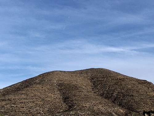
Kyle Peak lies on the East side of the Spring Mountains. It is located on the south side of Lucky Strike Canyon. This is west of HWY 95 between HWY 157 (Kyle Canyon Road) and HWY 156 (Lee Canyon Road).This desert peaks offers some of the greatest views that can be had of the Sheep Range and the La Madre Mountains. Harris Mountain and the upper parts of Mummy Mountain can also be seen. The Las Vegas Strip as well as Charleston Peak are out of sight here.
Getting There
From Las Vegas take HWY 95 north. When you get to Exit 93 set your odometer to zero.At 2.5 miles you will drive by the turnoff for Mt. Charleston. Keep going straight.
At 16.5 miles you will see the sign for Corn Creek Road. It is a brown sign on the east side of the highway near mile marker 101. Start slowing down and get ready to make a left turn.
At 16.7 miles turn left at the turn off for Corn Creek Road, you will have to drive about 50 feet the wrong way on HWY 95 before you turn left onto the dirt road.
From here reset your odometer to zero.
Drive on the dirt road for 1.9 miles and take the left fork.
After this continue driving down for a total of 6.4 miles and look for a place to park on the right side of the dirt road right next to a power pole. This is where you park.
The Road up to this point is in great condition, a passenger car could make it!
Red Tape
There is none.Camping
You can campgrounds over in Kyle and Lee Canyons around Mt. Charleston.Primitive camping can be enjoyed in the area around. There is no water.
When to climb
Mountain Conditions for the Spring Mountains can be obtained by contacting the Kyle Canyon Visitors Center. Their number is 702-872-5486.The summer months could be unbearably hot if you don’t start early though.
Here is a link for the weather at nearby North Las Vegas, NV.
The Hike
Refer to the Kyle Peak from the North route.
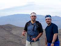
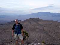
Summit Shots
Weather for nearby North Las Vegas

jtellis - Oct 29, 2012 12:07 am - Hasn't voted
Road impassible to passenger carsAs of 10/28/12 the road going in is no longer passable to passenger vehicles. Two heavy rainstorms from this past summer have washed out huge sections of the road. It took me more than 30 minutes to get a mile and a half down the road in a Corolla before bailing. You could do it with a truck, but hopefully the road will be repaired for those of us who don't have one.
redsplashman23 - Oct 29, 2012 2:14 pm - Hasn't voted
Re: Road impassible to passenger carsThanks for the info!