
|
|
Mountain/Rock |
|---|---|
|
|
47.88381°N / 121.29543°W |
|
|
Snohomish |
|
|
Hiking, Mountaineering |
|
|
Spring, Summer, Fall, Winter |
|
|
4872 ft / 1485 m |
|
|
Overview
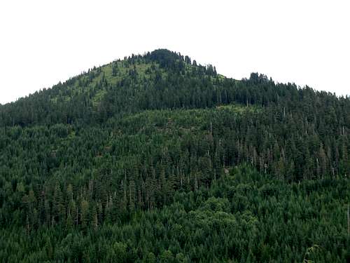 West Side of Frog Mountain in Summertime
Frog Mountain is a peak located within the "West Cady/North Fork Region" of Wild Sky Wilderness of Washington State. Like most peaks within Wild Sky Wilderness, no official roads, routes, or trails lead to the summit. However, despite this, Frog Mountain is a semi-popular recreational destination for backcountry enthusiasts.
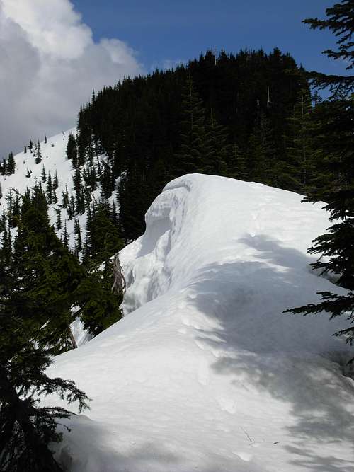
 Ascending Steep Upper Slope
With its western base located at Jack Pass, a very popular driving destination along Forest Road 65, Frog Mountain surprisingly has few visitors on its slopes. The mountain is not overly technical, with the standard western summit approach being most-to-all YDS Class 2. The mountain can be summited during any month of the year. However, thick underbrush grows during Summer and Fall months, and the upper western slopes are very avalanche-prone during Winter months. Frog Mountain summit attempts might be best recommended between late April until early-June, when firm (consolidated) snow covers the steep upper slopes and is less avalanche-prone.
 Forested Slopes
Easily accessible Jack Pass (2580' elevation), the standard starting point for climbing Frog Mountain, is located at the western base of the mountain, at the northern intersection of Forest Road 65 and Forest Road 6550. The key to summiting Frog Mountain is to ascend the lower west ridge, located slightly northeast of Jack Pass, either by directly climbing up the ridge (the shortest route) or by finding an old switchbacking logging road that spurs from Forest Road 6550 south of the ridge and ends above 3100' elevation on the ridge. From the lower west ridge the approach is simple: Keep climbing up and east.
 Western Summit Ridge
The west side of the mountain is heavily forested, then considerably thins out at approximately 3800' elevation. This begins the climb of very steep, open slopes to the false summit (4600' elevation). Note that these upper west slopes are VERY avalanche-prone when covered with unconsolidated snow. Once the false summit is reached, keep heading east along the top of the fairly level western summit ridge. At the eastern end of the western summit ridge, steeply climb the forested crest of the ridgeline to the summit (4872' elevation). There are actually two possible summit hills, both nearly equal in elevation: a western slightly-forested one and a eastern open one. It is quite possible the forested one is the true summit, but the eastern open one by far has the best viewpoints. Both are close to each other, only a short walk away from each other. Due to the thick treecover in the western summit area, the best viewpoints are found either where the treecover opens up barely south of the summit or by continuing east along the ridgeline to the eastern summit area.
 Approaching Eastern (Open) Summit Area...
Views from the mountain are spectacular, especially west towards the North Fork Skykomish River Valley and south towards Beckler River valley. On clear days, Mount Rainier and some Alpine Lakes Wilderness mountains can be seen in the distance to the south. The Monte Cristo range, Sloan Peak, Painted Mountain, and Glacier Peak can be seen in the distance to the north. San Juan Hill, Bear Mountain, Spire Point, and Spire Mountain can be seen to the west. The Chiwaukum range and Arrowhead Mountain can be seen to the east.
 The Monte Cristo Group, As Seen From Frog Mountain Summit
The total hiking distance from Jack Pass to the true summit is approximately 5-6 miles roundtrip, with 2300' elevation gain.
Getting There
1) Drive along Highway 2 until reaching Beckler Road, just 0.6 miles east of the town of Skykomish.2) Follow Beckler Road north for 12.3 miles to Jack Pass.
3) Several Forest Roads (FR-6500, FR-6550, FR-6570) intersect at Jack Pass. Find a place to park in the open area at Jack Pass, making certain not to block or obstruct any of the intersecting roads.
Red Tape
As a result of no official route or trailhead for Frog Mountain no Northwest Forest Pass (Parking Permit) is officially required, but the use of one is highly recommended so any vehicles do not appear abandoned when parked at or near Jack Pass.Please note that Forest Road 6500 is not continually snow-plowed during winter months. If uncertain of road conditions, check with the Skykomish Ranger Station or U.S. Forest Service website in advance of the trip.
Camping
Backcountry camping is allowed within Wild Sky Wilderness, including on Frog Mountain. No campfires are allowed.Essential Gear
Trekking poles are highly recommended.An ice axe is advised for snow climbs, especially for the steep upper slopes leading to the false summit and summit ridge. Crampons or micro-spikes might be useful for hard consolidated snow sections, as well.