
|
|
Mountain/Rock |
|---|---|
|
|
47.88594°N / 121.1301°W |
|
|
Chelan |
|
|
Hiking, Mountaineering |
|
|
Spring, Summer, Fall |
|
|
5594 ft / 1705 m |
|
|
Overview
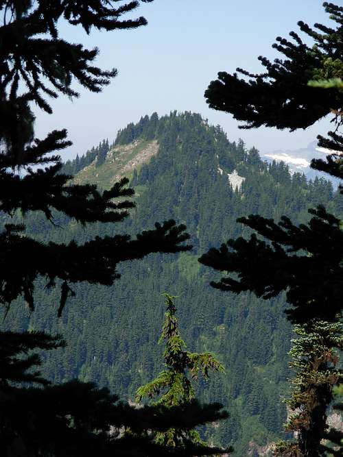 Fall Mountain, As Seen From Shoofly Mountain
Fall Mountain is a peak located on the western side of Chelan County in Washington State. The peak is modest in elevation, only reaching 5594', and is located adjacent to semi-popular Top Lake Trail #1506. The peak only requires YDS Class 1 hiking for the first 3.2 miles of the trek, with the final 0.2 miles of the trek being straightforward YDS Class 2 off-trail hiking, with only 1800' elevation gain in that total 3.4 mile span.
 Fall Mountain Summit
The peak was named by former U.S. Forest Supervisor A. H. Sylvester, who claimed he named the mountain after the nearby creek bearing the same name. However, local people claimed that the creek was actually named after the mountain.
But despite its modest elevation, location in proximity to semi-popular hiking trails, and low-level mountaineering skills needed, Fall Mountain is a fairly neglected peak. With no official trail leading to the summit, most hikers continue along Top Lake Trail #1506 to Top Lake and beyond. And honestly, due to treecover at the summit, there is not a 360-Degree panoramic view. However, the summit has very good views of Glacier Peak, Sloan Peak, Shoofly Mountain, and Wenatchee Ridge (a.k.a. Poets Ridge). These views alone could make the summit a worthwhile objective for many levels of hikers and outdoor enthusiasts.
 Steep Meadows On South Slope
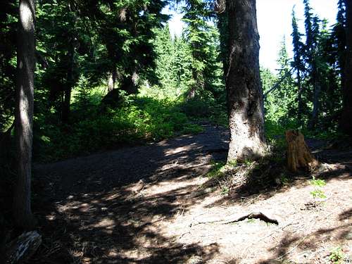
The shortest and most straightforward way to summit Fall Mountain is to start at the trailhead (~3800' elevation) for Top Lake Trail #1506. Hike approximately 3.2 miles along the Top Lake Trail. The trail hike will lead through evergreen forest, pass a small stream crossing (and backcountry campsite), climb a switchbacked section of trail, and then continue heading west along the ridgeline southeast of the peak. After 3.2 miles, Top Lake Trail reaches its highest point at ~5200' elevation, and begins to descend. But rather than descend, there is an old path leading up the southeast ridgeline of Fall Mountain. However, that path soon disappears. The objective is to continue following the top of the ridgeline. It is not recommended to ascend the meadow-filled south or east slopes, as those slopes are very steep and unstable in various places. Try to stay as close to the ridgeback as possible during both the ascent and descent of Fall Mountain.
 Unofficial Turnoff For Fall Mountain
Although in theory Fall Mountain can be summited year-round, access roads leading to the Top Lake Trailhead tend to be closed during months when snow covers them. The mountain is most recommended to be climbed from late Spring to early Fall.
 Glacier Peak, As Seen From Summit
Both Fall Mountain and Top Lake Trail are shown on Green Trails Map #144.
Getting There
Eastbound From Stevens Pass:1) From Stevens Pass, follow Highway 2 eastbound for 4.0 miles (approximately MilePost 68.6).
2) Turn left and cross the (divided) highway onto Forest Road 67 (FR-6700).
3) Follow FR-6700 for 12.2 miles, to the intersection with FR-6701.
4) Turn left onto FR-6701, and follow for 5.4 miles.
5) Turn left onto Road 500, towards Top Lake Trailhead, and follow for 2.7 miles.
6) Turn left onto an unmarked road towards Top Lake Trailhead, and follow for 0.4 miles to the trailhead (on the right/north side of the road). The road ends shortly after the trailhead, and there is a small turnaround at that location. Space is limited; only side-of-the-road spots are available.
No trailers or motorhomes are permitted on the road.
------------
Westbound from Leavenworth:
1) From Leavenworth, follow Highway 2 westbound for approximately 15.3 miles to Highway 207 (approximately MilePost 84.7).
2) Head north (right) on Highway 207.
3) After 11.5 miles, continue straight through a gate. This is the beginning of Forest Road 65 (FR-6500). An “End of County Road” sign is located at the gate.
4) Turn left at the intersection with FR-6700, and follow for 0.4 miles to the intersection with FR-6701.
5) Turn right onto FR-6701, and follow for 5.4 miles.
6) Turn left onto Road 500, towards Top Lake Trailhead, and follow for 2.7 miles.
7) Turn left onto an unmarked road towards Top Lake Trailhead, and follow for 0.4 miles to the trailhead (on the right/north side of the road). The road ends shortly after the trailhead, and there is a small turnaround at that location. Space is limited; only side-of-the-road spots are available.
No trailers or motorhomes are permitted on the road.
Red Tape
A Northwest Forest Pass (trailhead parking permit) is required for Top Lake Trail #1506.Fall Mountain is located within the Henry M. Jackson Wilderness Area. Wilderness Area rules and regulations apply.
Shortcutting switchbacks is prohibited.
Maximum group size is 12 people (combined people and stock).
No motorbikes or bicycles allowed. No motorized tools, either.
Camping
The Rainy Creek Campground (of the Wenatchee National Forest) is located 8.0 miles from the Top Lake Trailhead, along FR-6701.At least one backcountry campsite is passed en route to Fall Mountain, near a small stream crossing along Top Lake Trail #1506.
Other backcountry campsites are found at Top Lake, along the Top Lake Trail #1506, approximately 1.6 miles further from the off-trail turnoff for Fall Mountain.
Camping in excess of 14 days in a 30-Day period is prohibited in the Henry M. Jackson Wilderness Area.