
|
|
Mountain/Rock |
|---|---|
|
|
47.02012°N / 115.80779°W |
|
|
Shoshone |
|
|
Hiking |
|
|
Spring, Summer, Fall |
|
|
6994 ft / 2132 m |
|
|
Overview
 Monumental Buttes
Summit Elevation: 6994 feet
Round Trip Distance: 1.5 miles
Elevation Gain: 704 feet
South Butte is the highpoint of a long ridge called Monumental Buttes. South Butte, despite the drab name has many claims to fame. At 6994 feet it has and isolation of over 15 miles and reaches the magic number
 Summit
 MB rock lettering
The great prominence of this peak is most likely due to the fact that a branch of the Clearwater river runs almost completely around the mountain and cuts the surrounding landscape away. This prominence of course results in fantastic 360 degree views. More than just being a prominent point though, South Butte has a few more cards to play.
It had a fire lookout on it until 1969 and some of the remnants can still be seen. The summit itself is a rectangular stacked platform where the lookout used to stand and just before the summit a series of rocks were assembled into the shape of an "MB" this can be seen in satellite imaging. It was of course meant to signify "Monumental Buttes."
The geology of this region is quite interesting. Mica schist rock makes up much of the underlying rock and all of the steep folded "monuments" that the ridge is known for. The ground is littered with these shimmering rocks and make your trek feel like walking on a pathway of diamonds.
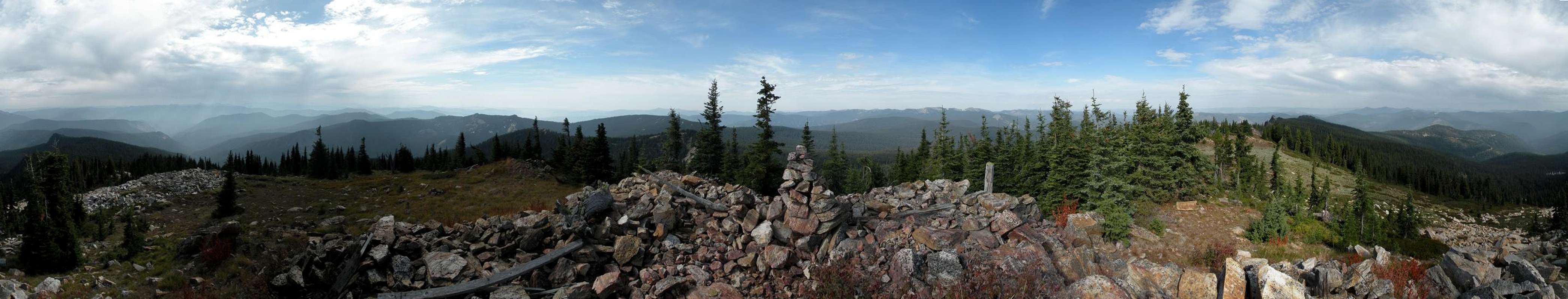
Panoramic View
  |
Getting There
Getting to this trail head is an adventure in itself. From the small town of Clarkia, ID it is no less than two hours of driving to go 36 miles on a nice forest service road that gets worse and worse until you can hardly do 15 miles per hour without rattling your head off your shoulders. No less than 8 miles of this approach road is done at over 1 mile of elevation.Directions from Clarkia:
 Topo of route
After entering town off Hwy 3 take a Left on Cedar St.
.5 miles turn Right on Sunrise St.
1.5 mile Sunrise becomes dirt
2 miles At intersection go straight onto FSR 301
6.4 miles from intersection follow FSR 301 Left
14.9 miles Follow FSR 301 Left again
18.2 miles Grandmother Mountain trail head and Sign
20.4 miles Follow FSR 301 Left again
23.7 miles Crater Peak trail head
26.4 miles Left to Lookout Mountain trail head parking lot
29.5 miles false Right turn quickly labeled "road closed"
31.9 miles Right on FSR-457
34.6 miles Left on FSR 363 (falsely labeled 220)
36.7 miles Park at turnout on Left 50 feet ahead follow ATV track up hill
After getting on the ATV track their are two possible locations of confusion. The first is a left turn off the ATV track at about 6500 feet. It is marked with two small cairns that may or may not still be there. The next location that may become confusing is once the ridge is attained the trail fades out but is found again by traveling left uphill. Last, once reaching a sub-summit with a fairly sheer face the trail sneaks back between some trees to the true summit.