
|
|
Mountain/Rock |
|---|---|
|
|
40.44652°N / 120.35789°W |
|
|
Lassen |
|
|
Hiking, Scrambling |
|
|
Spring, Summer, Fall, Winter |
|
|
6735 ft / 2053 m |
|
|

Shaffer Mountain at Dusk

Shaffer Mountain

Shaffer summit views
Overview
Shaffer Mountain (6735') is a major peak along the Honey Lake Valley rim. It is located on the western edge of the Great Basin Desert, and offers views of the northern Sierra Nevada and southern Cascades. It ranks # 132 on the California list of prominence , with 2175 feet. It is located on the north end of massive Honey Lake (73 square miles when full). The mountain is composed of tertiary volcanic rock, as are most of the desert peaks in this region.The prominence and location of Shaffer Mountain resulted in a California Department of Forestry and Fire Protection lookout being placed atop its summit from 1931-1947. Nowadays, the peak has multiple wind measuring "met" towers (meteorological towers), and the location above US Highway 395 has led to multiple cell towers and communication facilities being placed on the summit, leased through the BLM.
While one can drive or hike to the summit, mountain biking is another popular method. According to publiclands.org:
Description: 16 miles of dirt road, a few rocky areas, and sagebrush. You will be presented with views of Honey Lake Valley to the southwest and, to the east, open range country seemingly unchanged for thousands of years. This trail is designated for the advanced biker. It will take about 4 - 5 hours, depending on ability level.
Getting There
A public road practically goes to the summit; a gate restricts access only 1/4 mile from the top. This road begins at US Hwy 395, approximately 20 miles north of the US-395/CA-36 intersection (~6 miles north of the town of Litchfield).The aggregate access road is 8 miles long and gains approximately 2200' to the summit.
Hikers and bikers can choose their trip length, depending on how far they wish to drive vs. walk or ride.
 historical map
Red Tape
Shaffer Mountain is located on BLM property, managed by the Eagle Lake Field Office. As with much of the Great Basin Desert area managed by BLM, there is little red tape to deal with. Several communication and meteorological tower locations on Shaffer are leased to private companies; these are obvious and some are fenced or signed.Stop by the BLM office in Susanville for hard-copy maps, or check out the online, interactive BLM map HERE.
Camping
Camping is generally available anywhere on BLM property. Ths area has little water, so plan accordingly for a trip to the desert - especially when the weather is warm.Conditions
Late spring, summer, and fall are the best times to visit the peak. Snow is common in late fall through early spring, which could make for a more adventurous outing. You're not likely to see many people anytime of year.The road is generally well maintained, but there are some rocky spots along the way where bedrock and subgrade cobbles are exposed. There's not much shade or water, so make sure to bring sunscreen and beverages. A breeze is likely on the summit, which is a nice reward for the hike or ride to the top.
Here's a 5-photo summary of my ride to the top in August 2011:
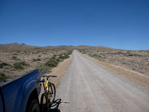 starting view from US-395 starting view from US-395 | 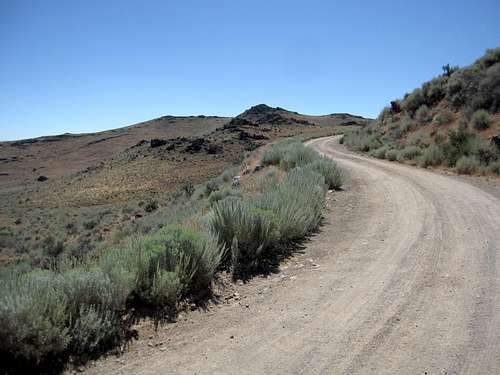 about 1/3 of the way about 1/3 of the way |
 switchbacks switchbacks | 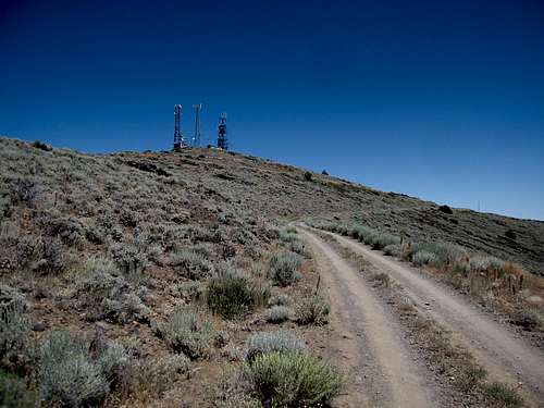 nearing the summit nearing the summit |
 nice views on top
Summit Video
video link