

|
|
Mountain/Rock |
|---|---|
|
|
34.11187°N / 109.57443°W |
|
|
Apache |
|
|
Spring, Summer, Fall, Winter |
|
|
10133 ft / 3089 m |
|
|
Overview
Greens Peak is the highest of a set of rounded knolls sitting atop a raised highland north of Mount Baldy and the White Mountains of Eastern Arizona. The White Mountains and surrounding terrain are part of the Springerville Volcanic Field, the second-largest such field in the country (the largest also being in Arizona, the San Francisco Volcanic Field in Northern Arizona). Greens Peak is named after Major John Green, who was a principal figure in the creation of Fort Apache (source).
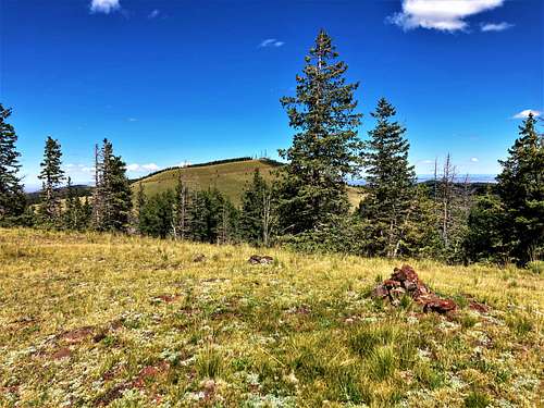
The knolls that sit atop the highlands north of Mount Baldy all have a consistent round shape, usually rising about 500-800 feet above the meadows and forests below. The knolls, including Greens Peak, are apparently single-event eruption cones, or monogenetic cones. The eruptions came and went, never often enough to form into one giant mass with a sophisticated magma system.
A hike to the top of Greens Peak is very easy, and many hikers come to this region to hike many of the surrounding cones such as Antelope Mountain, Saint Peters Dome, Pole Knoll, Wahl Knoll and many others. The surrounding countryside is a mix of open meadows and forests of ponderosa. In summer, conditions up here are very mild, but prone to thunderstorms. In winter, this region gets considerable snow (Sunrise Park Ski Resort is nearby), but the terrain is gentle enough that cross-country ski treks to Greens Peak and various surrounding knolls would be possible.
The town of Greer is located nearby with rustic accommodations including cabins and old-time hotels. The giant Wallow Fire of 2011 burned much of the White Mountains including parts of Greer, but the areas around Greens Peak came out unscathed.
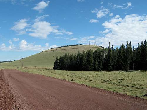 Greens Peak from FR-61
Thanks to Scott Surgent for these details.
Getting There
From State Route AZ-260, find Apache-Sitgreaves National Forest Road 117, located about 3 miles east of the junction of AZ-273, which leads to Mount Baldy and the Sunrise Park Ski Area, and about 5 1/2 miles west of the junction with AZ-373, which leads to Greer.
Drive north on FR-117 for four miles, then ease left onto FR-61. Greens Peak stand directly above. Drive to a Y-junction and go right. Park where convenient.
The roads are well-graded hard-pack and suitable for passenger vehicles in dry conditions. In winter, access will be severely restricted due to snow.
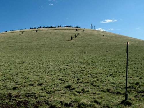 Looking up the slopes.
The Route
Hike the road to the top, which is about 1.5 miles each way from the Y-split in FR-61. You can cut up the slopes directly, if you desire, although that is discouraged and unnecessary.
The views up here are wonderful, with perhaps the best view of the sprawling Mount Baldy located south.
Several other knolls rise up all around and can easily be hiked with Greens Peak. The easiest is Grassy Top 9,910' just southwest of Greens Peak, which requires just about 1 3/4 miles round trip. Peak 9947 and Cow Hill 9,913' are other nearby options right off the 117 Road.
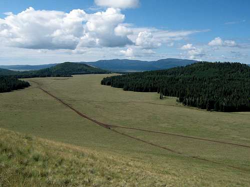 The best view of Mount Baldy is from the top of Greens Peak.
Red Tape
There is no red tape to hike Greens Peak. However, some of the surrounding mountains are on lands owned by the Fort Apache Reservation and have limitations for hiking.
Camping
There are countless wonderful camping areas in and around Greens Peak. Just drive until you find one that catches your interest. The land up here is beautiful meadow with low bunch-grass, interspersed with mature forests.
Formal camping is available in Greer, plus its blend of cabins and lodging, which range from basic (as in "rustic") to pricey. There are no chain operations in Greer. There are also many campsites south on AZ-273 heading toward Mount Baldy.
The city of Springerville, about 20 miles east along AZ-260, has chain hotels, grocery stores, gas stations, restaurants, and so on. To the west, lodging and sundries are available in abundance in the cities of Show Low and Pinetop-Lakeside, roughly 50 miles away. You can also stay at the Hon-Dah Resort and Casino on the White Mountain Apache Nation.
External Links
Trip Report (surgent.net, July 2012) • Apache-Sitgreaves National Forest • Town of Greer • Sunrise Park Ski Resort