
-
 20296 Hits
-
 78.86% Score
-
 10 Votes
|
|
Mountain/Rock |
|---|---|
|
|
37.22227°N / 113.61963°W |
|
|
Washington |
|
|
Hiking |
|
|
Spring, Summer, Fall, Winter |
|
|
4869 ft / 1484 m |
|
|
Overview
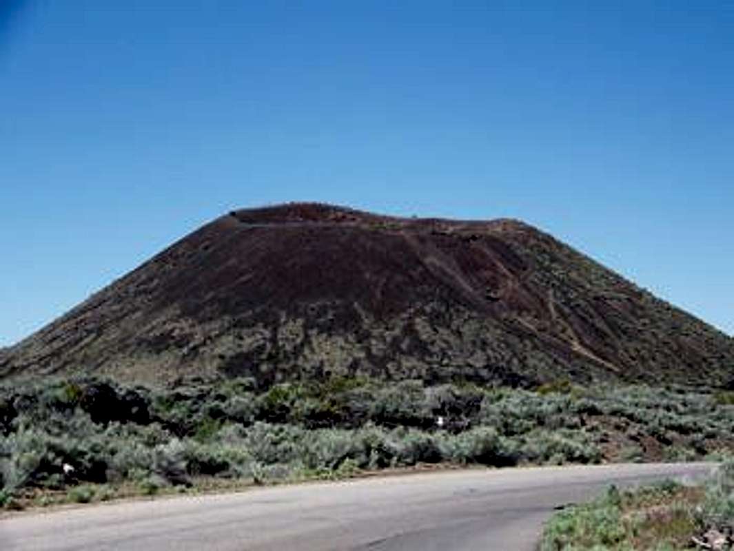
view of the cinder cone from SR-18
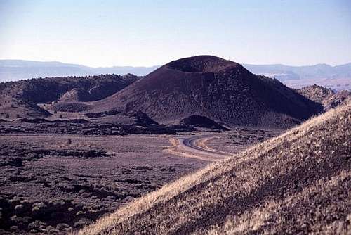
a view of the Diamond Cinder Cone from the smaller cinder cone to the north
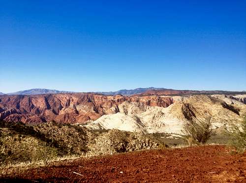
view of Snow Canyon from the summit of Diamond Cinder Cone
The hike from the Cinder Cone Trailhead makes for a relatively easy and accessible way to experience some volcanism/ancient tectonics firsthand. Because the terrain is largely covered in sharp volcanic rock, you will want to make sure that you are wearing footwear that adequately protects your feet (sandals are not recommended). There are some loose rocks, especially as you approach the summit. Though the terrain isn't technical, a slip or fall would likely mean some nasty scrapes or gashes, so be cautious, especially with children.
![Route]()
route from Cinder Cone Trailhead
Route KMZ: http://trails360.com/maps/cinder_cone_snow_canyon_state_park.kmz (source: http://www.trails360.com/hikes/view/cinder_cone_snow_canyon_state_park)
Getting There
From I-15, take exit 8 (St George Blvd), and head west about 2 miles to N Bluff St/State Route 18. Make a right, and continue on SR-18 for about 10.5 miles. The trailhead will be on the east side of the road. If you reach Diamond Valley Drive, you have gone too far -- the trailhead will be just before this juncture.Route
The route from Cinder Cone Trailhead is about 1.5 miles roundtrip and gains about 500'. From the trailhead, the trail wraps around to the south side of the cinder cone before ascending to the summit via a saddle on the southwest side of the cone. You may see a faint trail ascending the north side of the cone from the trailhead, but do not be tempted to take this route -- stick to the official trail!
route from Cinder Cone Trailhead