

|
|
Mountain/Rock |
|---|---|
|
|
33.53829°N / 116.46175°W |
|
|
Riverside |
|
|
8070 ft / 2460 m |
|
|
Overview
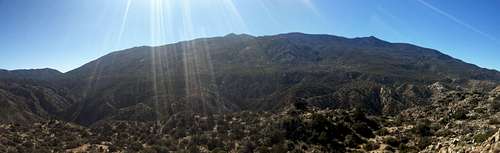
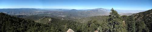
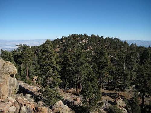
Santa Rosa Mountains from the Cahuilla Tewanet Viewpoint. Santa Rosa Mountain on right side, Toro Peak just left of center.
Santa Rosa Mountain from the east. True summit on the right, SW summit on the left. The large version of this photo clearly shows the rock pinnacle of the SW summit.
Santa Rosa Mountain is an 8070' peak located 13 miles S/SW of Palm Desert, CA. It is the sixth highest peak in Riverside County, and the second highest peak in the Santa Rosa Mountains. Despite these qualities, Santa Rosa Mountain has a rather diminutive prominence of 330', and is hopelessly outclassed by Toro Peak, just 2.3 miles to the southeast.
Santa Rosa Mountain, however, does have two distinct advantages over Toro Peak. The first advantage is near-drive-up access almost year round (assuming the appropriate gate is open). In the dead of winter, when most of the out-of-state visitors (like me) come to the Desert Southwest, the upper portion of road 7S02A can be covered with snow and ice, particularly on the north side of the ridge between Santa Rosa Mountain and Toro Peak. The portion of road 7S02A leading up towards Santa Rosa Mountain generally does not have this problem.
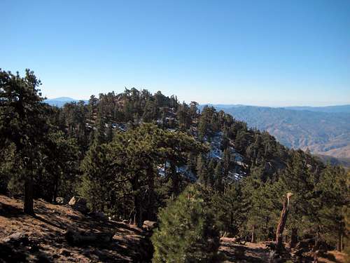
The second, and perhaps more important advantage of Santa Rosa Mountain, is that it can be accessed legally. While summiting Toro Peak requires trespassing on the Santa Rosa Indian Reservation, Santa Rosa Mountain resides on public land in the San Bernardino National Forest. It may be of little consolation to prominence peakbaggers, but views from Santa Rosa Mountain are almost as good as Toro Peak's, and there are numerous locations on and near the summit for picnicking and camping.
Getting There
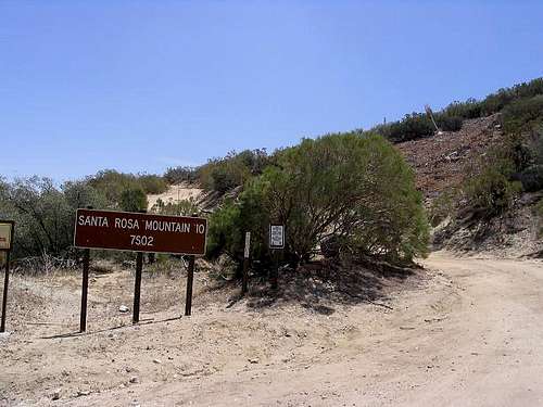
Photo stolen from 'surgent'
Approaching from the northwest or southwest: From the intersection of Highway 371 and Highway 74, follow Highway 74 east for 5.2 miles to the start of road 7S02A. The road will be found on the south (right) side of Highway 74.
Route
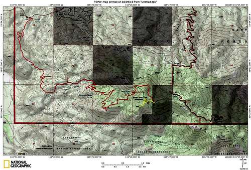
Santa Rosa Mountain route map
From Highway 74, simply follow 7S02A as it switchbacks up the west slope of Santa Rosa Mountain. The mainline will be obvious, and the few possible spurs that turn off will be of significantly lower quality. At the 8.3 mile mark, you will pass the turnoff for the Santa Rosa Campground. During the winter season, this might be a good place to park if snow and/or ice is starting to show up on the road. From this point, an easy cross country scramble (shown in green), or a two mile road walk, will put you on the summit.
If the road is clear, continue another 1.5 miles (9.8 total miles from the gate) to a three way intersection. Unless you are equipped with four wheel drive, park at this point, and walk the remaining distance to the summit. The 'summit road' will be a sharp right switchback, which will lead to the northeast summit in 0.6 miles (shown in yellow).
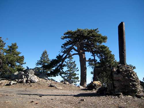
Santa Rosa Mountain NE summit. 'Desert Steve' Ragsdale's fireplace and chimney on the right side of photo.
Upon arrival at the northeast summit, you will notice a large stone fireplace. This is the last remnant of a cabin belonging to 'Desert Steve' Ragsdale. A brief Wikipedia article on this interesting individual may be found here. Be sure to take a moment to sign the summit register, which is located in the large rockpile adjacent to the fireplace. The views from the main summit, while pleasant enough, will probably have you wishing for just a little bit more. Thankfully, the southwest summit, located just a short distance away, provides unobstructed views from two rock promontories.
Santa Rosa Mountain SW summit from NE summit
Backtrack the 'summit road' a few hundred yards to the small campground and picnic area. From here, a quick scramble to the southwest will put you on top. There will be a couple of class 3 (and possibly 4) moves to get to the top, depending on which rock and which route you choose. The southwest summit (8058') is actually surveyed as being 12' lower than the northeast summit, but it didn't look any lower to my untrained eyes.
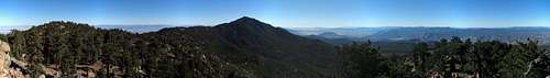
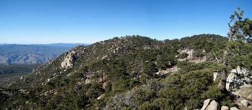
Santa Rosa Mountain SW through north pano. Thomas Mountain in center, San Jacinto and San Gorgonio just right of center.
Santa Rosa Mountain NE summit from SW summit