
|
|
Mountain/Rock |
|---|---|
|
|
33.82080°N / 111.0109°W |
|
|
Gila |
|
|
Hiking |
|
|
Spring, Fall, Winter |
|
|
7310 ft / 2228 m |
|
|
Overview
Armer Mountain is the second highest mountain in the Sierra Ancha range in Central Arizona and it has 1350 feet of prominence earning it the 200th spot on the Arizona mountains promince list. The highest mountain in this range is nearby Aztec Peak. . The peak sees very few visitors judging by the summit log and it seems only highpointers trying to complete prominence lists have any interest in the peak; we were the first party to summit in 2015 according to the summit log. This is somewhat surprising as Armer is only 3 miles away from highway 288 and offers one of the best views in the Sierra Anchas from a rocky ledge about 200 yards away from the actual summit which is completely forrested and does not offer any views. However, the hike itself is not so easy as there are no trails and the route follows a very old mining road which in some places is easy to follow but it in other place is completely non-existant anymore or heavily overgrown or covered with fallen trees. According to an informative sign at the Sawmill Flat campgorund where the hike starts (see below) the old logging road had been used to haul timber from the upper slopes of Armer Mountain which was used to build the nearby Roosevelt Dam.
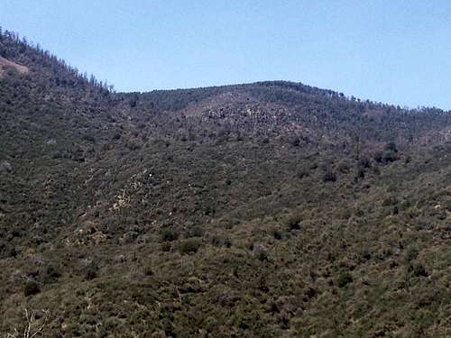
Upper slopes of Armor Mountain from further down; the actual summit is behind the bump in the center
Getting There
From the Phoenix metropolitan area take highway 60 towards Globe. Then go North on highway 188 for 14.6 miles. Turn right onto highway 288 for 23 miles until you get to Sawmill Flat Campground on the left side of the road. You will reach the campground about half a mile after the pavement ends. The drive itself is very scenic and would be worth doing just as a road trip as well.Route
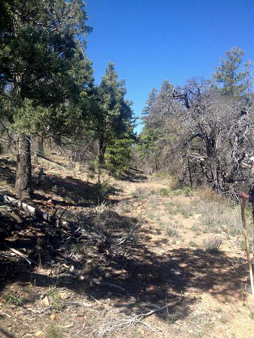
The hike starts at the North end of the campground past the toilet where you will find the start of the old logging road. Follow the road as it makes a sharp left turn right after the campground. Initially the road is easy to follow and quick progress can be made. After less than 0.5 miles you will start to encounter more and more deadfall that you have to climb over, crawl under or get around slowing down the progress.
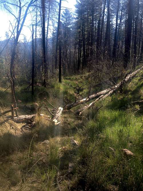
The old road further down with some deadfall
After about 1 mile you will come to some sort of a meadow where the road seems to end. From here follow the drainage up on your left hand side.
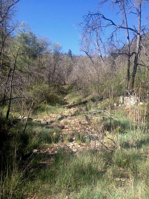
Follow this drainage up
The drainage is very overgrown and full of deadfall in parts which slows down the progress, however towards the top it becomes steeper and rockier and traveling becomes much easier. As you top out of the drainage you come to a saddle where you have to turn right.
Turn right here at the saddle
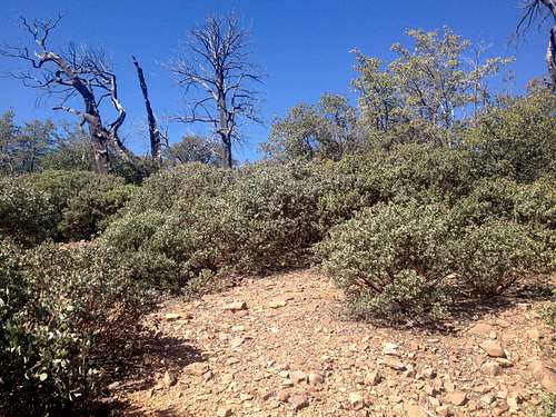
This right turn is not obvious and we missed it initially. However, right after the right turn you will come to a very obvious cairn telling you that you are on the right path. This is now the trickiest part of the hike and it is very easy to get off route. As you are hiking through manzanita bushes the road occasionally reappears and there some cairns marking the route. If you loose the cairns, you generally want to aim up to your left hand side from the saddle to get to the top of the ridge. Once you get over the ridge and drop down 100 feet or so you will encounter the old road again which is now very easy to follow.
Follow the old road here
You will encounter some deadfall or overgrowth but the road is now generally easy to follow as it makes one more right turn and continues on North up the ridge to the summit area. The summit itself is completely surrounded by forrest and does not offer any views. There is a rock pile where you will find the summit log.
The summit
About 200 yards West of the summit the mountain drops dramatically off for a couple of thousand feet affording some of the best views in the Sierra Ancha overlooking Roosevelt Lake with the Four Peaks in the distance which is well worth the hike.
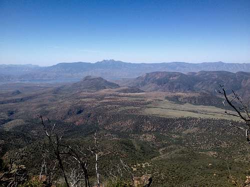
Incredible view from the rock ledge near the summit
As the old logging road is sometimes very faint or even non-existant, map and a compass and/or a GPS unit should be carried.
Roundtrip: 6 miles
Elevation gain: 1500 feet
Hiking time: It tooks us 2 hours up and 1.5 hours down
Red Tape
None.When to Climb
The best time to climb would winter, spring or fall. It gets too hot in summer even at this altitude. The ideal time would be winter or early spring as the overgrowth is at its lowest.Camping
The nearest campground is Sawmill Flats CG where the hike starts. There are a few other campgrounds in the Sierra Ancha; for more information check the Tonto National Forrest webpage.
External Links
Arizona Mountains with at least 1000 feet of prominence