
-
 11237 Hits
-
 86.85% Score
-
 23 Votes
|
|
Mountain/Rock |
|---|---|
|
|
43.77599°N / 21.89372°E |
|
|
Hiking |
|
|
Spring, Summer, Fall, Winter |
|
|
5118 ft / 1560 m |
|
|
Topographic isolation: 65 km
Nearest higher peak: Golaš (1583 m)
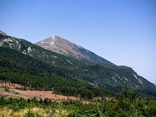
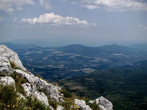
Prominence: 1045 m![Rtanj - view from south east]()
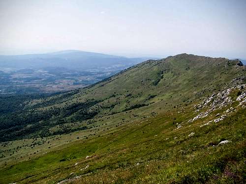
Rtanj - view from south eastThere is a dispute among geographers whether the Carpathians cross the Danube in southern direction or not – and if yes, how far. Those who vote for the definition that the Carpathians cross the Danube, call this mountain range as the Serbian Carpathians. Serbian Carpathians link the ![The mild southern slopes of Rtanj]()
The mild southern slopes of RtanjSouthern Carpatians of Romania and Stara Planina of Bulgaria.
Rtanj (Ртањ with Serbian Cyrillic letters) is the highest mountain of the Serbian Carpathians. It is 7 km long in western-eastern direction. Its highest peak is called Šiljak (Шиљак), and it is 1560 meter high. Šiljak simply means ‘Peak’ in Serbian language.
Rtanj can offer something for every kind of people:
There are other beliefs about the mountain, too. Doomsday fanatics believe that alien visitors have left behind a 'pyramidal' structure is thousands of years ago, and the mountain is this pyramid having special energy. Fanatics believe that the mountain would protect them on the day of Armageddon if they stay in the vicinity of it. According to the Maya Calendar this day came on the 21st December 2012. On this day the vicinity of this mountain was full of people… You can read more about this story in a Daily Mail article:
http://www.dailymail.co.uk/news/article-2246305/Doomsday-fanatics-flock-Mount-Rtanj-believers-say-houses-alien-pyramid-magic-powers.html
![Old Turkish Bath in Sokobanja]()
Old Turkish Bath in Sokobanjapeople arrive to this hill from the direction of the E75 highway connecting Belgrade with Niš. The trailhead of the normal route to the mountain is in the village called Rtanj. There are two routes how you can get from the E75 highway to this village:
![Rtanj normal route]()
Rtanj map
![Star gentian]()
Star gentianiate spots on the western hillside for wild camping. If you prefer to stay in a formal camping, then you can find two camping sites in the vicinity:
Nearest higher peak: Golaš (1583 m)
Prominence: 1045 m
Overview
Rtanj - view from south east
The mild southern slopes of Rtanj
Rtanj (Ртањ with Serbian Cyrillic letters) is the highest mountain of the Serbian Carpathians. It is 7 km long in western-eastern direction. Its highest peak is called Šiljak (Шиљак), and it is 1560 meter high. Šiljak simply means ‘Peak’ in Serbian language.
Rtanj can offer something for every kind of people:
- Geographers should visit it since this is the highest point of the Serbian Carpathians, and it is a typical limestone Karst terrain of the Balkan Peninsula- Peakbaggers must visit it because its prominence is more than 1000 meter, and also its isolation is quite big: 65 km- Biologist can study its rich flora and fauna- And finally this mountain is a real paradise for people having various transcendent believes. Let’s see some details about the legends!
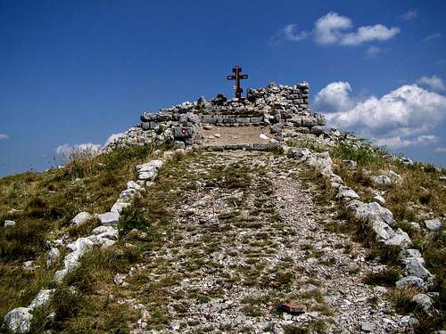
According to the oldest legend a wizard had a castle on the top of this mountain, guarding a great treasure. But the castle can’t be seen now because it has sunk into the mountain, together with the treasure. The story doesn’t end here. The wife a former local miner built a chapel dedicated to St. George in 1932. But there are people believing the legend of the treasure! One of them destoyed the chapel with dynamite while hunting for the treasure. Now there are small ruins of the chapel. It seems that every year it is getting smaller. I checked the location on Panoramio before climbing the mountain, and on some older photos still an arch of the chapel could be seen. In 2016 there was no arch any more, just low walls.
There are other beliefs about the mountain, too. Doomsday fanatics believe that alien visitors have left behind a 'pyramidal' structure is thousands of years ago, and the mountain is this pyramid having special energy. Fanatics believe that the mountain would protect them on the day of Armageddon if they stay in the vicinity of it. According to the Maya Calendar this day came on the 21st December 2012. On this day the vicinity of this mountain was full of people… You can read more about this story in a Daily Mail article:
http://www.dailymail.co.uk/news/article-2246305/Doomsday-fanatics-flock-Mount-Rtanj-believers-say-houses-alien-pyramid-magic-powers.html
And there is another curiosity of the mountain, too. If you go to the village Rtanj, you see that in many houses they sell Rtanj Tea (Rtanjski čaj). It is made from winter savory, and it is famous about being antiseptic and a kind of aphrodisiac.
The area is a natural reserve since 1958. Up to now 644 plant species have been identified on Rtanj mountain. 25 of them are endemic. The fauna is also very rich with 102 identified species. It's not possible to list all species here. Just some examples of the Fauna:
- Northern goshawk (Accipiter gentilis)
- Eurasian sparrowhawk (Accipiter nisus)
- Common buzzard (Buteo buteo)
- Common wood pigeon (Columba palumbus)
- European green woodpecker (Picus viridis)
- Bicolored shrew (Crocidura leucodon)
- Lesser mole-rat (Spalax leucodon)
- European mole (Talpa europaea)
- Eurasian red squirrel (Sciurus vulgaris)
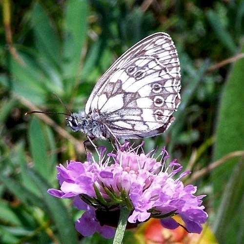
- Marbled white (Melanargia galathea)
- High brown fritillary (Argynnis adippe)
- Large blue (Phengaris arion)
- Alcon blue (Phengaris alcon)
- Lesser marbled fritillary (Brenthis ino)
- Iranian argus (Esperarge climene)
- Banded demoiselle (Calopteryx splendens)
- Migrant hawker (Aeshna mixta)
- Balkan goldenring (Cordulegaster heros)
- Sombre goldenring (Cordulegaster bidentata)
 Melanargia galathea | 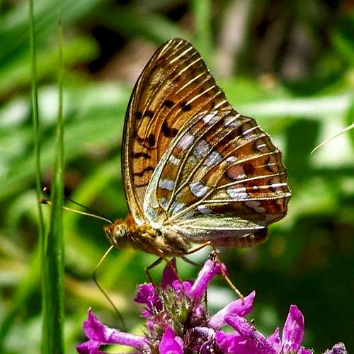 Argynnis adippe | 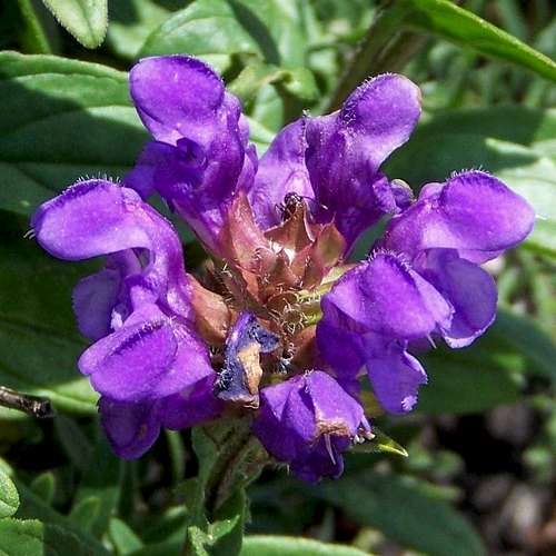 Prunella grandiflora |
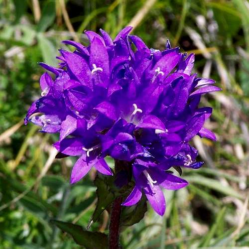 Campanula glomerata | 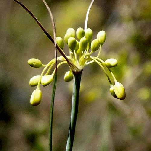 Allium flavum | 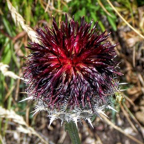 Centaurea kotschyana |
… and some species of the Flora:
- Winter savory (Satureja montana)
- Allium flavum
- Foxglove (Digitalis ferruginea)
- Yellow foxglove (Digitalis grandiflora)
- Star gentian (Gentiana cruciate)
- Clustered bellflower (Campanula glomerata)
- Field scabious (Knautia arvensis)
- Large-flowered selfheal (Prunella grandiflora)
- Betony (Stachis officinalis)
- Great mullein (Verbascum Thapsus)
- Centaurea kotschyana
How to Get There
Most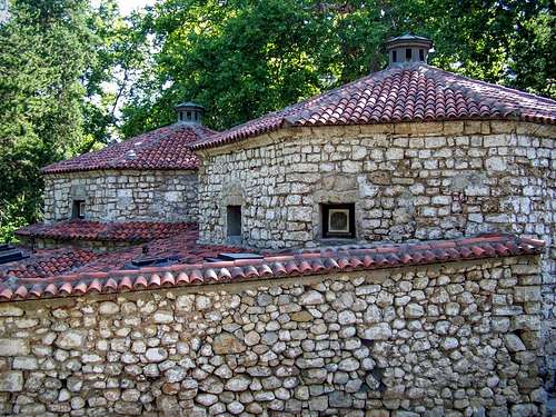
Old Turkish Bath in Sokobanja
- Coming from Belgrade drive on the E75 highway until the junction at Paraćin. Continue your way on road no. 36. Drive 30 km, and after Lukovo village turn right. Within 10 minutes you will be in Rtanj village. The distance from Belgrade is 205 km. The roads of this route are in very good quality
- Coming from Niš drive on the E75 highway until the junction at Aleksinac. Continue your way on road no. 217. Drive 30 km, and after Sokobanja turn left. Further 20 km, and you will be in Rtanj village. The distance from Niš is 80 km. The road after Sokobanja is narrow and slow but it doesn’t represent danger.
And some history: if you come through Sokobanja, don't miss to have a look on the Turkish bath that was built in the 16th century!
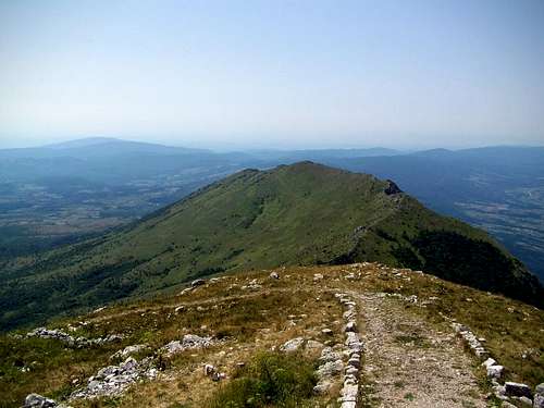
Normal Route
The ![The normal route to Šiljak]()
The normal route to Šiljaknormal route to the peak is a marked trail (red dots) with its trailhead in Rtanj village. The trailhead is at 610 meter elevation above see level, and since the peak is 1560 meter high, this route represents 950 meter elevation gain. The length of the route is 6.7 km. So 13.4 km if you want to return to the trailhead.
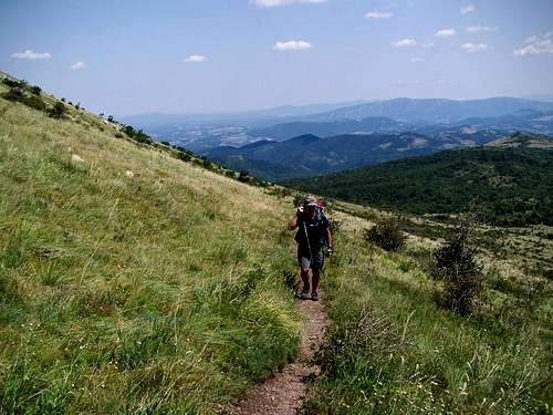
The normal route to Šiljak
From the trailhead you can see the peak in W-NW direction. But the trail starts in S-SE direction. Don’t worry, in the end all will be OK! Here is a self-made map:

Rtanj map
Camping
There are appropr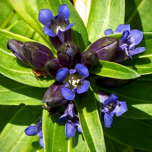
Star gentian
Kamp Borsko Jezero
The campsite is 55 km far from the trailhead of the normal route to Rtanj peak.
The camp is at a lakeside, in elevation 450 meter above see level.
Phone: + 381 30 482 110
The campsite is opened between 1st May and 1st October
Website in Serbian language: http://borskojezero.info/portal/index.php/smetaj/kampovi/kamp-borsko-jezero
Campsite Ruža vetrova
This campsite is not far from the E75 highway, on a hillside in elevation 210 meter above see level.
The campsite is 72 km far from the trailhead of the normal route to Rtanj peak.
Phone: +381631686733
Website: http://campingruzavetrova.com/