
|
|
Mountain/Rock |
|---|---|
|
|
46.43330°N / 11.85000°E |
|
|
10964 ft / 3342 m |
|
|
Overview
 |
 |
 |
 |
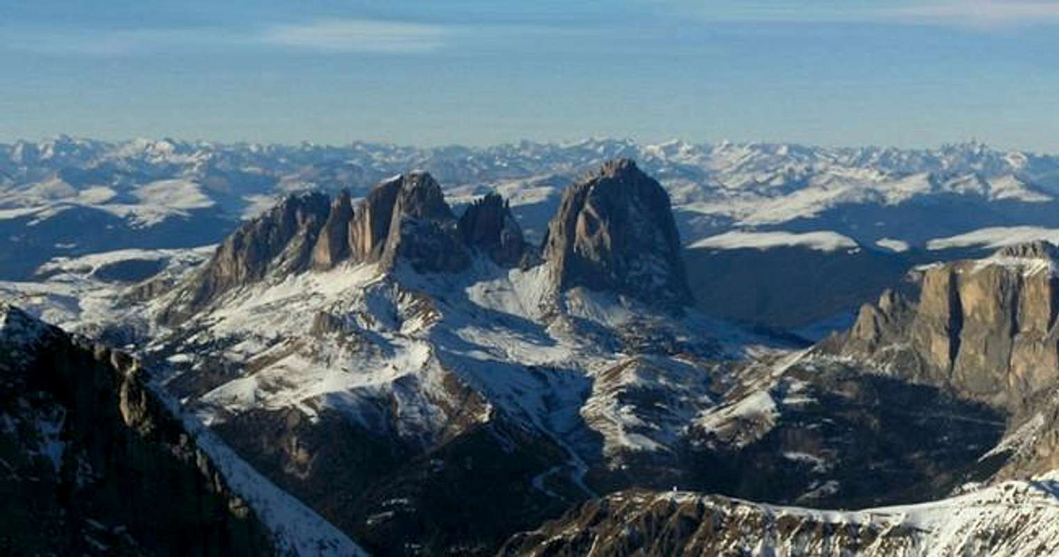
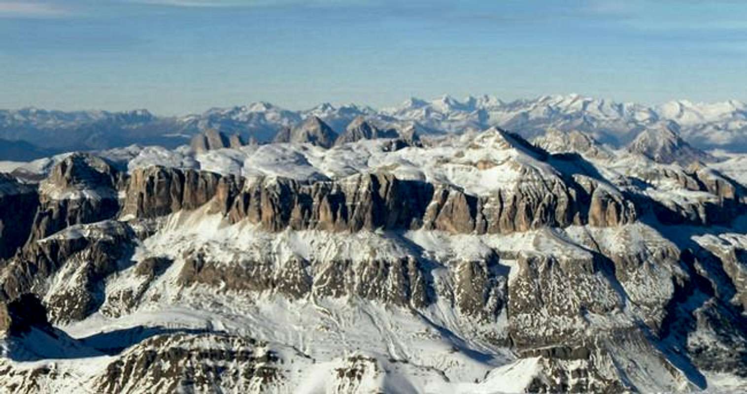
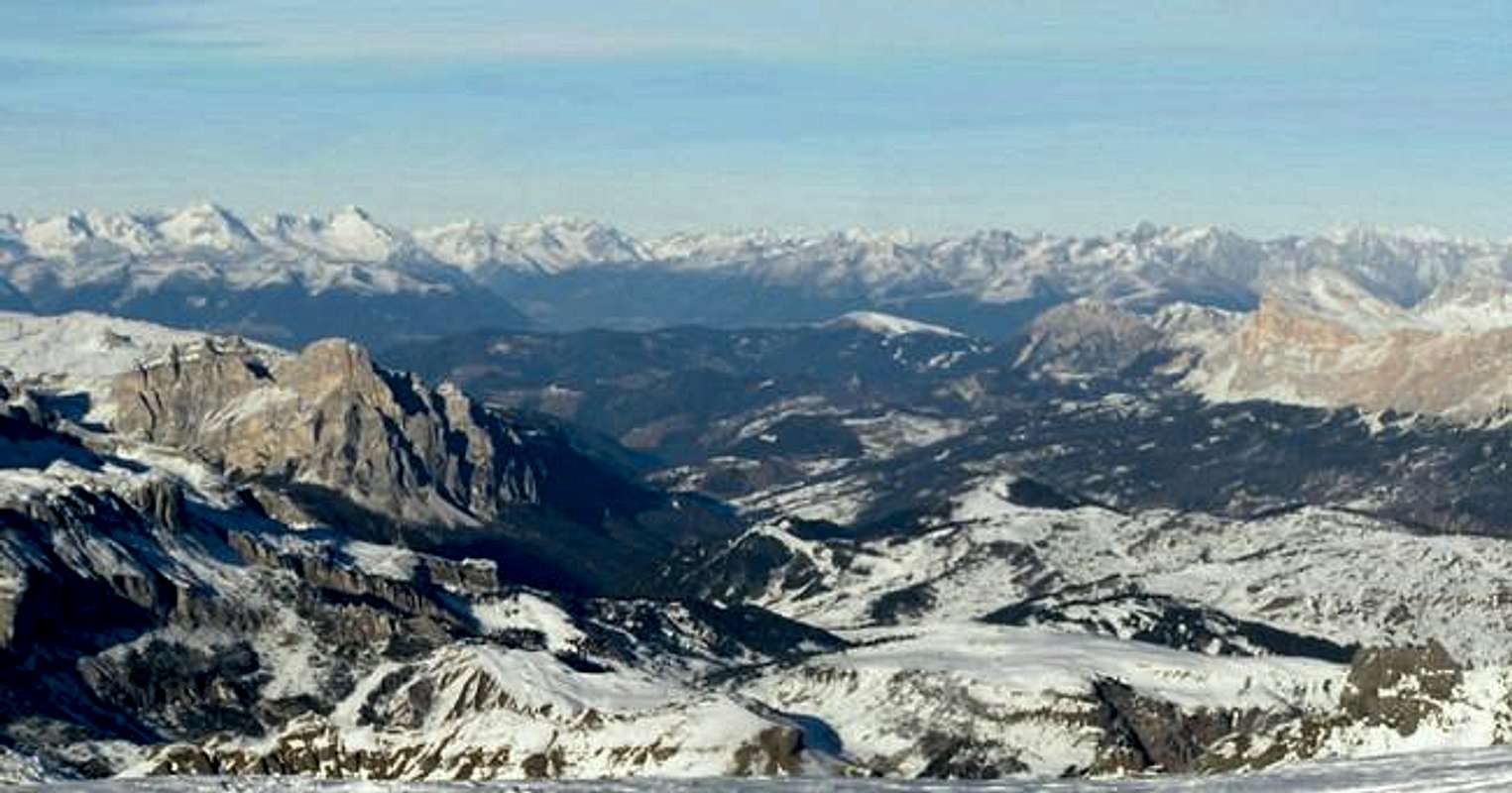
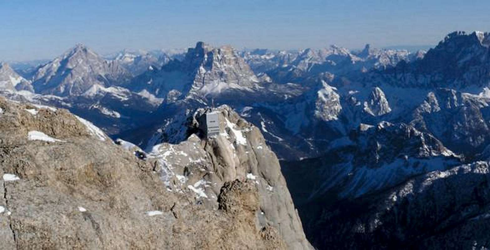
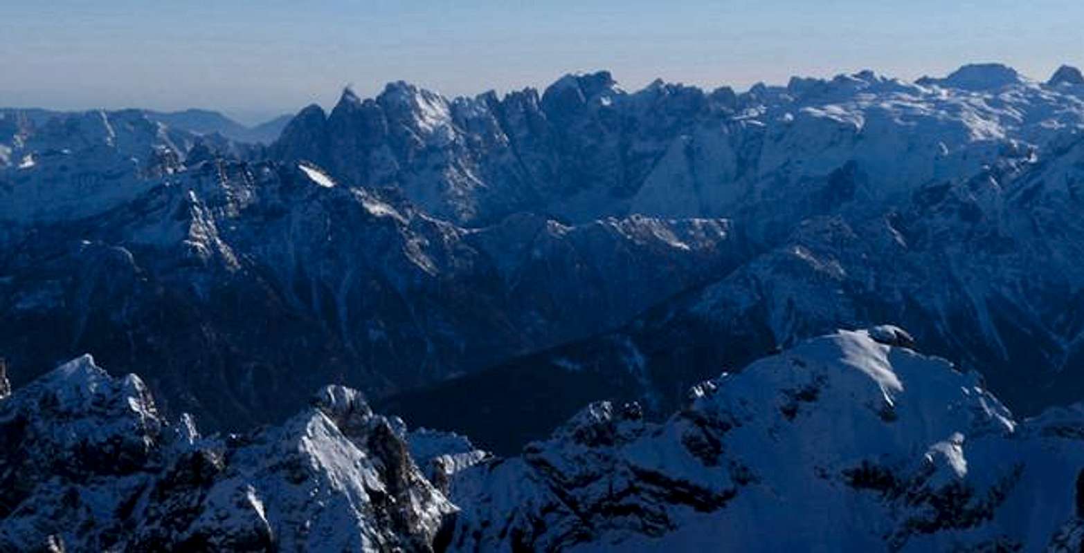
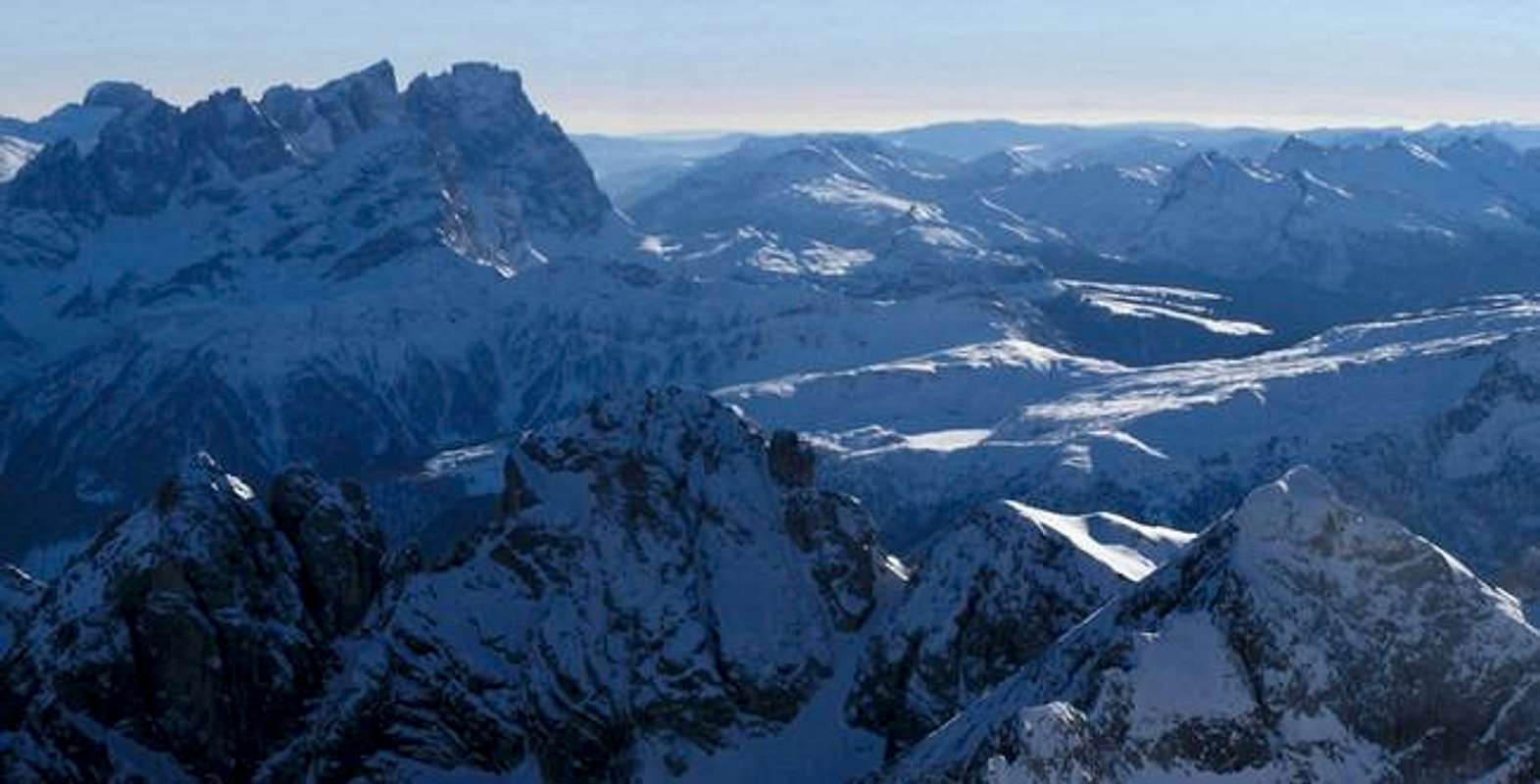
Marmolada is the highest Dolomites Mountain and, since these last years, the only with a big glacier (north-face). Its surname is "The Queen of the Dolomites" and it is situated between Sella Group (north) and Pale di San Martino (south). Its ridge is a border between two Dolomites regions: Trentino and Veneto. From its peak is it possible to admire all Dolomites (Tofane, Antelao, Pelmo, Civetta, Pale di San Martino, (Sassolungo, Catinaccio, Latemar), the Ortles-Cevedale Group, the Adamello glacier (near Brenta Dolomites) and, with a good sky, the autrian alps (GrossGlockner and GrossVendiger groups). Its main peak is considered the “Punta Penia” but it has other 4 peaks:
Punta Penia 3343
Punta Rocca 3309
Punta Ombretta 3230
Monte Serata 3069
Pizzo Serauta 3035
Its second peak, Punta Rocca, is reaching by cable car while its main peak, Punta Penia, is leading only climbing its wonderful face: north (ice and rocks), south (rocks) and west (rocks, via ferrata). On the Punta Penia there is a little refuge (open in summer, 8 beds, 0462-764207).
Getting there
A good point to start for climbing/hiking on marmolada is Fedaia Pass (2054 meters), situated between Canazei and Malga Ciapela (the start point of Punta Rocca cabla car). On the pass is situated a very nice lake.
- From ora/AUer (exit Brennero highway) through Predazzo, Moena, Vigo di Fassa, Pozza di Fassa, Campitello di Fassa, Canazei by SS48, 77 km.
- From Cortina d'Ampezzo through Arabba and Passo Pordoi by SR48 (50 km) or through Giau Pass and Selva di Cadore.
- From Belluno through Agordo and Alleghe SP563, 83 km
 |
 |
 |
 |
Routes Overview
NORTH FACE AND WEST RIDGE ROUTES
The north and west face routes leave from Fedaia Pass (2057 meters), situated at 30 minutes by car from Canazei (Trentino) or 40 minutes from Selva di Cadore (Veneto). From Cortina Pass through Giau Pass (1h30 by car). At Fedaia Pass there is a cable-car to Pian dei Fiacconi (2700 meters) where there is a refuge (2626 meters, 0462-601412, 25 beds, open between 20 June and 20 Sept).
To sleep around Fedaia Pass: Ref. Castiglioni (2054 meters) 0462-601107, 67 beds, open all year, and Ref. Alla Seggiovia (2074 meters), 0462 – 601181, 18 beds, open between 20 June and 20 Sept.
SOUTH - FACE ROUTES
The south face routes are more difficult than north and west face routes. They started from Ref. Contrin (2016 meters, 0462-601101, 90 beds, open between 20 June and 20 Sept, 1h45 by walk from Alba di Canazei, Trentino.
Marmolada south wall is a huge wide wall with difference in elevation up to 900 m.!!
It hosts some of the most difficult (classic and modern) routes of the Dolomiti (more difficult than the more famous routes of Lavaredo!)
To be remembered, as the finest (between the classic ones):
to Punta Penia (the highest one)
the Tomasson route, the classic (and the "easier) - 650m - Dsup (5.6)
via Soldà - 700m ED
pillar Micheluzzi - 700m - ED
to Punta Rocca
the Vinatzer route (opened in 1936!! ) - 800m - ED (5.10)
the Messner variant (opened in 1969) - high part of the wall, over the big ledge - ED (5.10)
the Mariacher route (Tempi Moderni - 1982) - 800m - ED sup (5.11)
to Marmolada d'Ombretta
the Castiglioni route - D sup
the Giordani route (via Fortuna - 1985) - 900m - ED sup (5.11)
the Aste route (Via dell'Ideale) - 900m - ED
The oldest Dolomites refuge
In the year 1874 borned the idea to build a cave-refuge for the Alpinists that climb Marmolada through normal route (North-Face). Two years later the refuge was ready: it was the first in the Dolomites! Inside there were beds and blankets. But, with the retire of the glacier, the refuge became uncomfortable to reach (like show the photo).
First times on Punta Penia
Through East-Face:
Paul Grohmann (with the help of Angelo and Fulgenzio Dimai, two alpin-guides of Cortina d’Ampezzo), September 1864.
Through West-Ridge:
Francis Fox Tuckett (with the help of Santo Siorpaes and Christian Lauener), 1872. Between 1902 and 1903 this route became “Via Ferrata”, one of the first in the Dolomites.
Through South-Face:
Beatrice Tomasson (with the help of Michele Bettega and Bortolo Zagonel, IV+), summer 1901.
Marmolada History...
During the First World War, the Austrian-Hungarian soldiers built 8 kilometres of ice-caves inside Marmolada glacier. Their idea was to reach the Italian positions on Marmolada without the danger of enemy-fire. The “City of Ice”, called "Eisstadt" was built in 11 months (May 1916 - April 1917): inside there were beds, kitchens, deposits for the munitions. The main problem was the movements of the glacier: in the 1918 the city disappeared.
In the sixty years another army arrive on the Marmolada Glacier: the army of a particular kind of tourism, wich one that not respect the environment. The weapons of this army are: cable car, big pylons, big buildings for the cable car stops.
The result of the war of this army is a monster called "Marmolada cable car" against wich many ambientalist associations (like Mountain Wilderness) fight every day! The famous south wall became a big bin. Fortunately every year many voluntaries clean the "dirty" Queen of Dolomites.
Refuges
FEDAIA LAKE
- refuge Passo Fedaia (2055 meters) 0437.722007
- refuge Ettore Castiglioni (2055 meters) 0462.601117
- refuge alla Seggiovia (2080 meters) 0462.601181
ON THE SOUTH ROUTE
- refuge Ombretta O. Falier (2080 meters) 0437.722005
- refuge Contrin (2016 meters) 0462.60110
MARMOLADA PEAK
- refuge Punta Penia (3343 meters) 0462.764207
ON THE NORMAL ROUTE
- rifugio Pian dei Fiacconi (2628 meters) 0462.601412
- rifugio Ghiacciaio Marmolada (2730 meters) 348.3539282
OTHER SIDES
- rifugio Monzoni (2045 meters) 368.3577617
Maps
TABACCO MAP 06 - 1:25.000 "VAL DI FASSA E DOLOMITI FASSANE, Sella - Marmolada, Costabella, Monzoni, Latemar, Catinaccio, Sassolungo".
sich - Aug 25, 2007 10:03 am - Hasn't voted
remarksWell, I have two remarks about part "First times on Punta Penia". First is that Grohmann & co summited via east face of punta Penia. North face of punta penia is something else. And second thing id that Tuckett's route is west ridge, and not face. Otherwise, this is good page.
summitboy - Jul 27, 2014 9:05 am - Hasn't voted
Marmolada Via FerrateJust climbed this peak and there are three Via Farratas: West Ridge (VF FASSA13 - Grade 4C in the Cicerone Guide) to Punta Penia, East Ridge (VF Eterna Brigata Cadore - 5C) to Punta Serauta and the South Ridge "normal route" from the glacier to Punta Penia. The latter is short VF2 that has probably been created recently, as I could not find it in any book. It's a busy tourist route in the summer as it is accessible from the Seggiovia lift and non-technical, apart from one crevasse crossing. [Ref Via Ferratas of the Dolomites: Vol.1, by John Smith and Graham Fletcher for more info]