
|
|
Mountain/Rock |
|---|---|
|
|
36.36940°N / 50.95440°E |
|
|
15354 ft / 4680 m |
|
|
Overview
Click for an Introduction to the Central Alborz Mountains.Click for Introduction to Takhte Soleyman Massif.
Click for a map of Central Alborz.
Click for a map of Takhte Soleyman Massif.
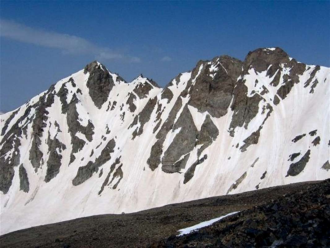
Right to left: North Khersan, Middle Khersan, Viran Kooh & South Khersan. The eastern slopes rising above the Khersan Glacier
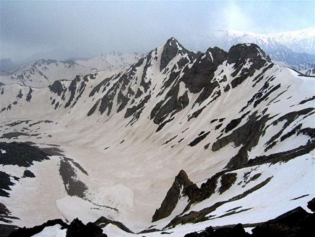
The western slopes of (L to R) North Khersan, Middle Khersan & Viran Kooh rising above the Haft Khan Glacier
The western slopes of Viran Kooh (L) & South Khersan (R) rising above the Haft Khan Glacier

The three Khersan Peaks along with Viran Kooh form a group of rugged peaks that rise to the south of the 4850 m (15912 ft) Alam Kooh Peak in the Takhte Soleyman Massif of Central Alborz Range. North to south these peaks include:
1) North Khersan 4680 m, 15354 ft
2) Middle Khersan 4620 m, 15157 ft
3) Viran Kooh 4609 m, 15121 ft
4) South Khersan 4659 m, 15285 ft
The eastern slopes of these peaks drop very steeply to the bottom of the valley of Khersan Glacier (4200-4400 m) and their western slopes drop just as steeply to the bottom of the valley of the Haft Khan Glacier (4100-4300 m). To the north, a 4600 m saddle separates North Khersan from Alam Kooh. To the south of South Khersan, two ridges develope. One veers west to a 4400 m saddle before rising up again to form the Haft Khan Peaks while the other continues south beyond the 4296 m Setareh Peak and onto the Menareh Peak.
Unfortunately, the 1:50 000 map does not give an exact elevation for the North or Middle Khersan Peaks. Other maps quote an elevation of 4680 or 4710 m for North Khersan. While the North and South Khersan Peaks are very prominent peaks that rise far above their surrounding saddles, the Middle Khersan and Viran Kooh can be thought of as sub-peaks rising on the ridgeline that connects North to South Khersan.
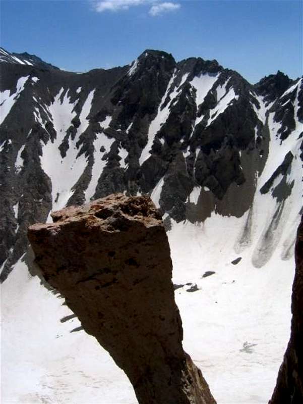
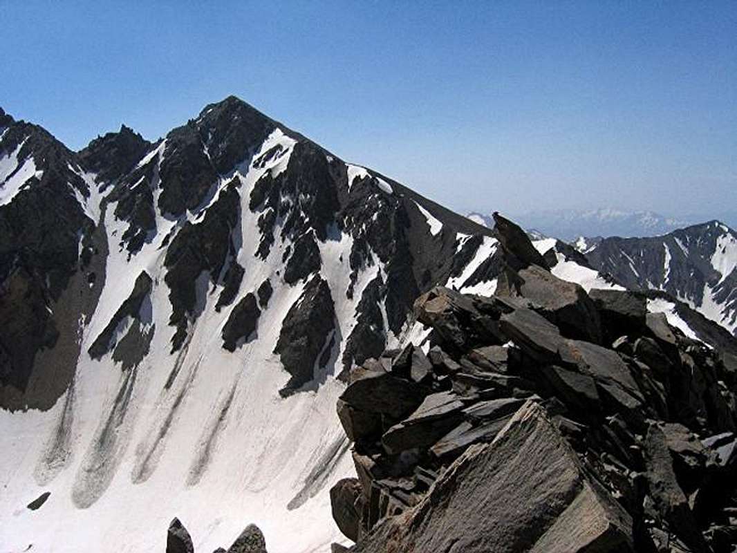
Climbing the Khersan peaks will require at least 3 days. The traditional starting place is the village of Roodbarak (1400 m, 4700 ft) to the northeast of the massive (an approach from the west via the Sehezar River Valley and the Haft Khan Glacier is also theoretically possible but this will be very long and difficult). On day one, you will go from Roodbarak to a valley known as Hesar Chal where the tail ends of Khersan and Marji Kesh Glaciers meet (3800-4000 m). On day two you can climb the peaks and descend back to Hesar Chal. Please note that the eastern slopes of these peaks (above the Khersan Glacier) are very steep are are usually snow covered well into mid summer turning into nasty scree slopes in late summer and are therefore not a good choice. North Khersan can be most readilly climbed by going from Hesar Chal to the southern slopes of Alam Kooh and then to the Saddle between Alam Kooh and North Khersan (see photo of this saddle) where you will find a small shelter. From there you can turn south to do Class III-Class IV climbing to reach the top of North Khersan. South Khersan can be reached by going from Hesar Chal to the saddle between Setareh and South Khersan and then following the ridgeline to the top of South Khersan (see photos of this ridgeline PIC 1, PIC 2). Please note that traversing from the North to the South Khersan via the Middle Khersan and Viran Kooh is a technical climb over very unstable rock that is at times on top of a knife-edge.
 |  |  |
Getting There
See Map.From downtown Tehran drive 40 km west to the town of Karaj and take the Karaj-Chalus Road north (This road crosses the Alborz Mountains taking you through the Kandovan Tunnel to the Caspian Coast). 30 km south of Chalus, you will reach the town of Marzan Abad. Turn left and follow a side road into the Sardab Rood River drainage and to the town of Roodbarak. Distance from Tehran to Roodbarak is roughly 200 km (125 miles)
 |
Red Tape
The Khersan Peaks & Khersan Glacier from the summit of Shakhak #1
No fees/permits needed.
 |  |
Damavand - Nov 21, 2004 3:22 pm - Hasn't voted
Untitled CommentYou can see also map of this area in Takhte Soleyman map page .