


-
 52367 Hits
-
 73.06% Score
-
 3 Votes
|
|
Mountain/Rock |
|---|---|
|
|
38.50980°N / 79.1844°W |
|
|
4360 ft / 1329 m |
|
|
Overview
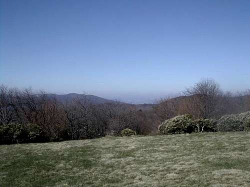
Flagpole Knob is located in the George Washington National Forest, along the border of Virginia and West Virginia. From the summit, you have very nice views of both states. The summit is void of trees and has been used for camping. Unfortunately there is a fire road leading to and past the summit and the mountain is heavily traveled by off-road vehicles and mountain bikes. There are trails leading to the summit as well as the fire road.
Getting There
From Washington, D.C., take Interstate 66 west to Interstate 81 and head south towards Harrisonburg, Va. Exit off 81 and head west on Route 33. Be alert in Harrisonburg for signs to Route 33. There are several turns to make in town which (I think) aren't well marked. Follow Route 33 thru Hinton and after several miles make a left hand turn at Route 613. Follow Route 613 thru some beautiful country (make note of the signs warning of carriages as I saw 2 on this trip). Stay on the main road and go thru Cloverhill and Ottibone. The road turns into Route 924 and this road will lead you to the top of the ridge. At the top, make a right and you can either hike in on the fire road or drive if you have a 4x4.
Red Tape
There are no fees associated with this area.
There are no closures but I would imagine that the road would get pretty challenging in the winter as it is very steep.
When To Climb
This mountain could be climbed year-round although the winter would make it more challenging. Obviously, come prepared.
Camping
There are numerous camping spots along the fire road. There are no fees for these spots. There are no facilities with these areas.
At the bottom of the mountain is Hone Quarry. It offers fee camping ($5.00 per night) and has facilities. It is located along a beautiful trout stream. In addition, there is a small lake which is stocked with trout for fishing.
There are also several trails originating from this area which lead up to Flagpole Knob.
Mountain Conditions
Park Service can be contacted at: Dry River Ranger District @ 540-828-2591.
southernregion.fs.fed.us/gwi/
Average Temperature / Precipitation
Averages shown are for the city of Harrisonburg, Virginia. Average temperature shown are monthly averages of highs and lows.
January 32.1 / 1.56
February 39.0 / 0.76
March 38.6 / 3.57
April 55.0 / 1.49
May 59.8 / 2.54
June 68.5 / 2.79
July 70.3 / 3.68
August 72.8 / 4.45
September 63.1 / 1.13
October 54.2 / 0.65
November 49.9 / 0.45
December 41.2 / 1.72
Weather Forecasts
theme=default&user=default&forecast=hourly&place=Harrisonburg&state=va&zipcode=&icao=KSHD&country=us&bgc=&tc=&t=&metric=0&display="border="0"width="175"height="90">
theme=defaukt&user=default&forecast=zone&zipcode=&place=Harrisonburg&state=va&country=us&bgc=&tc=&t=&metric=0&display="border"0"width="330"height="203">
RadioOp - Sep 11, 2010 2:00 pm - Hasn't voted
Mostly VirginiaSince you are almost a mile inside of Virginia, most of your views are of Virginia. You can see some West Virginia ridgelines in the distance off to the West. Also, the little community you drive through is called "Ottobine" instead of "Ottibone".