
|
|
Mountain/Rock |
|---|---|
|
|
5.21011°N / 60.83116°W |
|
|
8793 ft / 2680 m |
|
|
Overview
Kukenan Tepui is an interesting mountain in southeast Venezuela. The mountain is known as a Tepui, which describes a flat-topped mountain with vertical sides. Kukenan Falls at 2,211 vertical feet (674 meters) spills off Kukenan Tepui right next to the climbing route and is one of the world’s highest waterfalls. Angel Falls, which spills off another nearby Tepui is the world’s highest waterfall (3212 feet-979 meters). There are many interesting plants that grow on the summit, including many carnivorous plants, i.e., ones that eat insects. There is little soil on top because the constant rains wash it away. Monte Roraima is Kukenan’s famous neighbor. Kukenan is climbed much less frequently than Roraima and is a more difficult climb.You have to be quite lucky with the weather to stand on the summit. We were not so lucky and had rain, rain, and more rain (February 1995) on our visit to the Tepui's, though we did get brief views on the approaches when the clouds would breifly part. The Gran Sabana around all the peaks was often clear, but not so on the mountains. In bad weather, you can climb the mountain part way, but summitting (or even attempting to do so) during heavy rains is not recommended and can be extremely dangerous.
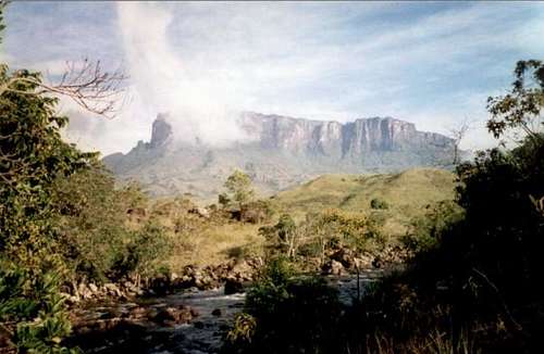 Kukenan Tepui rises above the Rio Kukenan
Peak Closure!
I have just found out (September 2006) that Kukenan Tepui was closed to all climbers beginning in 1997. This is apparently due to it having a reputation as a dangerous mountain and because of the sensitive environment. Apparently you can still visit with a special permit, but there isn’t hardly any information on this mountain available on the internet. If you know more, please post your updates under additions and corrections. Thanks.Getting There
To reach the trailhead, you must make your way to San Francisco de Yurani. San Francisco can be reached by bus. Most people ride the bus all the way there from Caracas, Ciudad Boliviar, or Ciudad Guyana. Others fly to Santa Elena which is only a few hours south of San Francisco de Yurani, and take the bus up from there. There are some rather grubby hotels in San Francisco de Yurani, and a few restaurants. We were allowed to camp in the futbol (that’s soccer for gringos!) field. There is a small selection of food in some stores, but I would recommend bringing most items from a larger city.The actual trailhead is in Paratepui, which is 22kms (14 miles) east of San Francisco de Yurani. Most hire a vehicle in San Francisco de Yurani, but it can be walked in a day for those who wish to save a few bucks (not recommended). A vehicle cost $100 in 1996 and can hold 6 people with gear.
 Paratepui.
Routes Overview
The Salto Kukenan/Paratepui Route, is by far the most popular route on the mountain is is probably use by at least 99.999% of the people climbing the peak. This is also the only non-technical route available for climbing the mountain, though some sections and short pitches are definately borderline technical, and a rope is certainly needed for packs. The route crosses the Gran Sabana and climbs a very rugged, steep, and slippery route to the summit. There are several river crossings, which you must do on foot (no bridges). The Rio Tex and Rio Kukenan crossings can be problematic after rains. The trek out to the base of the peak can be hot, sunny, and shadeless across the Gran Sabana. It usually takes 1 to 1 1/2 days to reach the base of the peak. The trek to the top and back usually takes four or five days, plus any days you may spend on top.Other routes other then the one described are very seldom attempted. Rock climbers can find several "first" all over the sides of this peak. All other routes will be big-wall routes for expert climbers only.
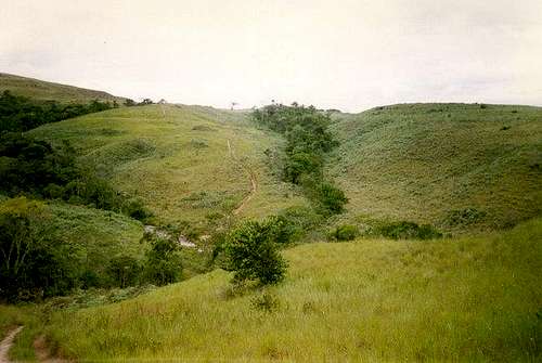 The section of the trail near Rio Tex
 Tok River and Kukenan Tepui.
Red Tape
Update: See Peak Closure Section above. If the peak still is open, see the below:Locals will probably try to talk you in to climbing Monte Roraima with a guide instead of climbing Kukenan Tepui. Kukenan is not a popular climb and guides don't really go there often. If you want to climb Kukenan, insist that this is the mountain you want to climb and they will probably will leave you alone and let you pass through without a guide.
If you are lucky enough to find a guide that will climb Kukenan Tepui, and you desire to have a guide, you will find that a guide who has actually been there might know where campsites are on the summit. Otherwise expect to wander around a bit and get lost in the perpetual fog for a while trying to find a campsite! A GPS is recommended and a compass is mandatory for the summit area!
Time Needed for Climb
It takes at least two days to summit (some may want 2 1/2 days) and two days to return, making the trip a minimum of four days if just reaching the summit and back. Five or six days are recommended so that you can spend at least one day on the summit plateau.When To Climb
The only time to safely make this trek is December through March, which is the "dry" season. The river crossings would be very dangerous in any other season, as is the mud in the gully.Here is a link showing climate graphs for Santa Elena, but it is much, much wetter and cooler on the mountain:
Climate
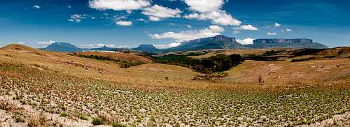
 Kukenan above the clouds
Camping
There are several campsites along the way up to the peak. There are a few campsites on top, but expect wet (!) conditions. A guide will come in very useful, to point out the campsites on top.Mountain Conditions
The walk to the base of the mountain can be hot and shade-less, but anyone who has spent the night on the summit, can attest that this must be one of the wettest places on earth. Take a good rain-suit, and a waterproof tent. There are several river crossings as well, be prepared for that. Temperatures are usually near 10 degrees C (50F) on top, night or day, and it's usually very windy and rainy. On top, clear weather is extremely rare even in the "dry" season.Click HERE for a weather link to Santa Elena, but beware that the mountain will be much(!!) wetter and cooler than Santa Elena.
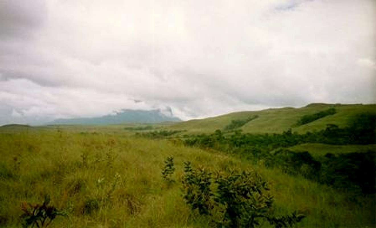 Kukenan in the rain