
|
|
Mountain/Rock |
|---|---|
|
|
44.05400°N / 16.48750°E |
|
|
6082 ft / 1854 m |
|
|
Intro
Dinara is large massif on the border between Croatia and Bosnia Herzegovina. With the length of 100km it is one of the longest massifs in the huge chain of Dinaric Alps and it gave it a name. Main characteristic of Dinara are endless grassy spaces on the long Croatian or Dalmatian slopes of the massif and beech forests on the short and steep Bosnian side of the massif. Parts of the massif have a profile of a simple crest which falls steeply and deep on both sides but bigger part has vast undulating grassy plateaus on at least one side of the massif. Hundreds of thousands of cattle used to graze on these pastures. Today picture is different. Dinara is deserted and empty. Interest among hikers is small and is concentrated on 3 peaks (Dinara, Troglav and Kamesnica). Marked paths can be counted with the fingers of both hands (all around these 3 peaks), refuges/huts with one hand and that is primary reason for such a small visit. Dinara, as a whole, has fantastic hiking potential and its long and panoramic crest could have beautiful and long transversal path. But several refuges had to be built first but because highest peaks belong to Bosnia where hiking is far less popular than in Croatia that seams like very distant future. Today Dinara is massif for those who like solitude and are not intimidated by the lack of marks. And when one thinks deeper it would be great if everything would remain like it is today because there are fewer and fewer places like Dinara, where chances to meet someone are smaller than winning a lottery, where civilization didn’t leave its mark and where you can interact with nature like our ancestors could. But then one must not forget this is mountainous Balkan, area where nature is so rich and rewarding but people unfortunate and sometimes less than smart, so not everything is peaches and cream. 90’s war after the dissolution of Yugoslavia left those ugly little devices we call mines scattered on some areas of Dinara and we cannot wander freely in many areas. Still you can enjoy Bat, peak this page describes, but you’ll have to stick to described route.
 |  |  |  |  |
Bat – Massive Peak Massive Solitude Massive Panorama
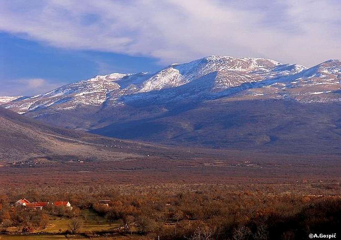 Bat (1854m) is third highest peak of Dinara massif, behind Troglav (1913m) and Konj (1855m). This giant grassy peak is placed in the main crest of Dinara massif, which is stretching as Dinaric Alps in NW-SE direction. Dinara massif is split into 5 groups: Ilica, Dinara, Bat, Troglav and Kamesnica. Although Bat seams to be in the middle it is in the NW half of the massif because Troglav and Kamesnica groups on the SE are long. Bat (1854m) is third highest peak of Dinara massif, behind Troglav (1913m) and Konj (1855m). This giant grassy peak is placed in the main crest of Dinara massif, which is stretching as Dinaric Alps in NW-SE direction. Dinara massif is split into 5 groups: Ilica, Dinara, Bat, Troglav and Kamesnica. Although Bat seams to be in the middle it is in the NW half of the massif because Troglav and Kamesnica groups on the SE are long.Narrow summit crest of Bat is parallel with the direction of the mountain and is part of the main crest. From the NW it rises from Velika Privija pass (1231m), which separates Bat group from Dinara group. Between the pass and summit there are two bumps in the crest; Mali Bat (1667m) (Small Bat) and nameless head 1761m. Main summit is called Veliki Bat (1854m) (Big/Large Bat). Towards SE crest of Bat descends towards Klanac pass (1610m) which separates it from the neighboring Janciji Vrh (1790m). Between these two passes Bat is 4km wide! NE side of Bat descends to vast, 4km wide and almost 10km long, undulating grassy/rocky plateau whose average altitude is above 1500m. Plateau is placed between the main crest of Dinara massif and streak of peaks above Livanjsko Polje, one of the largest karst fields in Dinaric Alps. Plateau contains many peaks above 1600 or 1700m while those that close it from NE exceed 1800m. Most notable among them is large Bunjevacko Brdo (1848m). Plateau used to be huge pasture for cattle. It is amazing terrain for tour skiing in winter but it isn’t easily accessible as you need 2.30h from Unista to reach its edge. SW side of Bat is much bigger than NE side. It rises uninterruptedly over 1100m above the valley and karst field of Unista (720m) village that is squeezed between Bat and massive Dinara (1830m) mountain/peak, highest in Croatia, on the west. It may sound confusing but name Dinara is related to Dinara massif, Dinara group and Dinara peak. Dinara peak, which is so massive and is really a mountain within a mountain, is pushed west of the main crest of Dinara massif and that is why it forms this valley with Bat. Side of Bat above the valley is up to 1150-1200m under oak forest. Although main crest of Dinara massif is natural and climate border between Bosnia (continental/mountain climate) and Dalmatia region of Croatia (Mediterranean climate) Bat belongs to Bosnia entirely. Border dates from times when Bosnian side was occupied by Turks and Croatian by Venetians. They determined the border and gave larger but lower part to Dalmatian shepherds and higher but smaller to shepherds from Bosnia. More about the border story you can find on Troglav page. Because of this all the highest peaks in the main crest, except Dinara which is pushed towards west, belong to Bosnia as border generally runs around kilometer below the crest on Croatian side of the massif. Here there is even exception to that because border enters Croatian side even more to make Unista Bosnian village. More about this read in ‘Unista’ section below. Bat isn’t marked. Shortest and probably only considerable approach leads from Unista village on Croatian side of the massif, which is in the Bosnia. Ascent lasts 3h15min during which you surmount bit over 1100 vertical meters. In the lower part of the ascent slopes are under oak forest, which is low and doesn’t obscure the view or prevents easy orientation. Upper two thirds are open grassy slopes. Bat dominates high above and easily recognizable from start to finish. Approaches from Bosnia, either from Livanjsko Polje field or Grahovsko Polje field, are long and unsafe because of the mines. Danger of Mines Area of Bat was war zone so use your own judgment. There were no big fights here and they didn’t last long. There is no damage to nature and there is no way one would notice anything happened here. There are only few remains of outlook positions by the way. Danger here is invisible and it comes from left mines. Klanac pass SE of Bat is mined as is area around Veliki Kurozeb. It also seams that torrent gorge which descends towards Unista is also mined. Locals confirmed to me that described approach is the only one safe and should be used for return also. |
 |  | 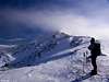 |  |  |
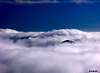
Views
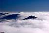
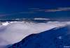
Bat is fantastic view point! Panoramas spread in all directions uninterruptedly. As you turn around there is so much diversity, from distant sea to distant mountains. Crest of Dinara massif which stretches in NW-SE direction indeed separates two worlds.
Towards SE numerous peaks of Dinara are lined up. Three in a row are easily recognizable: first is nearby cone of Janciji Vrh (1790m), then comes broad Lisanjski Vrh (1794m) and cone of Slime (1762m). Left of these peaks, on Bosnian side, is vast undulating grassy plateau, above which numerous heads rise. Behind it is high group of rounded heads; Klecari (1848m). Behind Klecari is Troglav (1913m), highest peak of Dinara massif, 15km away. Its summit has three small peaks and left of them is nice cone 1910m, also part of Troglav. Left of Klecari and Troglav, in the distance is SE most group of Dinara and second highest; Kamesnica (1855m), some 50km away.
On the S is Cetina river valley and Svilaja (1506m) mountain in Dalmatia.
Deep in the SW foot of Bat is Unista (720m) village. Behind the valley of Unista is large plateau of upper Cetina river valley with Svilaja (1506m) and Kozjak (1205m) mountains further back. Behind them is inner Dalmatian plateau and 70km distant coast. On the sea some islands of Sibenik archipelagos are visible.
W view is occupied by back or eastern side of huge Dinara (1830m) peak or mountain within mountain.
On the NW are some lower peaks of Dinara group, right of Dinara peak. Behind them almost entire Velebit (1757m) massif and its 150km of length is visible. Right of Velebit part of Licka Pljesivica (1657m) massif is visible.
On the N or right of Dinara massif on which we stand is Grahovsko Polje (861m) (Field of Grahovo). Just behind it is Jadovnik (1656m) mountain. Further behind are high summits of Osjecenica (1798m) (left) and Klekovaca (1961m).
On the NE-E is vast undulating grassy/rocky plateau, the same one mentioned in the SE section of panorama. On the opposite side it is closed by series of rounded grassy peaks; Veliki Cilj (1807m), Bunjevacko Brdo (1848m) and Zeleno Brdo (1783m). Behind these peaks and hidden by them is one of the largest karst fields in Dinaric Alps; Livanjsko Polje (700m) (Field of Livno). Behind Livanjsko Polje and mentioned peaks are numerous mountains beginning with Sator (1872m) on the NE whose 4 peaks are easily recognizable. Behind the right shoulder of Bunjevacko Brdo, in E direction, is distant Vitorog (1906m) (50km away). In front and right of it are huge open grassy spaces. Finally behind and bit right of the crest of Zeleno Brdo, some 30km away in E-SE direction, is Golija (1890m) mountain. Beyond and above the crest of Golija high dome of Cincar (2006m) peers (50km away). Right of Cincar and Golija, which brings us back to SE direction, are distant Vran (2074m) and Cvrsnica (2226m) mountains, 90 and 100km away.
 |  |  |  |  |
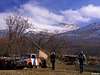
Unista
Unista (720m) is mountain village placed at the end of picturesque valley which is squeezed between Dinara (1830m) and Bat (1854m). At the end of the valley and just below the village is larger fertile karst field. Before the 90’s war Unista had 300 inhabitants. Today only 20 old people still live there. As countless other villages, like people, Unista was casualty of war so some houses have been burned down but most of the village is in tact. At the entrance into the village is large memorial museum to heroic Second Dalmatian Brigade of Partisans which fought fiercely in WW II against occupying Nazis. It even had small hotel with 18 beds. Today it is neglected, unused and in bad condition as old heroes are no longer interesting to most. Unista are on the Croatian side of Dinara massif but silly border puts it into Bosnia Herzegovina although it doesn’t have anything to do with it. Well in former Yugoslavia inner republican borders weren’t really borders so it didn’t matter. As those borders were accepted as new independent state borders after the dissolution position of Unista wasn’t questioned. But Unista are unapproachable from Bosnia from which they are separated by high Dinara massif. Asphalt road, electricity and supplies come from Croatia while border line is 1km before the village.
 |
Getting There
Starting point to visit Bat is Unista village at its SW foothill. Wider center of the region is Knin town, an important junction of rail and road traffic therefore well connected.
By Plane
If you are coming to Croatia by plane your first destination is certainly Zagreb. From Zagreb there are everyday flights to Zadar (140km from Unista, once a day) and Split (83km from Unista, few times per day). Look for info about flights on the official site of Croatia Airlines.
By Bus
There are numerous bus lines from Zagreb or Split to Knin each day. But there are no buses to Unista. If on the bus from Split towards Zagreb or from Zagreb towards Split you have to get out in Kijevo village, 19km from Knin in Split direction. From Kijevo it is 13km to Unista. You’ll have to walk that distance or hitch hike. Detailed bus timetables from Zagreb you can find on Zagreb bus station site.
By Train
Only Knin can be reached by train from Zagreb or Split few times per day. From Knin you have to catch bus towards Split and get out at Kijevo. Still 13km remain to Unista. Look for more info about trains on Croatian Railways site.
By Car
From Rijeka along the coast:
This route is suitable if you are coming from western Europe, via Trieste (Italy)
Trieste – Rijeka: 70km
Rijeka – Unista: from Rijeka head to Senj (74km); from Senj go towards Zagreb via Vratnik pass and behind the pass, at Zuta Lokva, enter the Zagreb-Split highway (24km); get off the highway at Sveti Rok exit (82km); continue towards Gracac (18km), Knin (58km); from Knin head towards Split and at Kijevo (19km) turn left towards Unista (13km): Total 288km from Rijeka
From Zagreb:
This road is suitable if you are coming from eastern or central Europe via Ljubljana (Slovenia), Maribor (Slovenia) or Budapest (Hungary)
Ljubljana – Zagreb: 138km, Maribor – Zagreb: 113km, Budapest – Zagreb: 347km
Zagreb – Unista: from Zagreb head towards Split using A1 highway, get off at Sveti Rok exit (206km); continue towards Gracac (18km), Knin (58km); from Knin head towards Split and at Kijevo (19km) turn left towards Unista (13km): Total 314km from Zagreb
From Zadar: from Zadar head via Benkovac towards Knin (100km); from Knin continue towards Split and at Kijevo (19km) turn left towards Unista (13km); Total 132km from Zadar
From Split: from Split head towards Knin/Zagreb via Sinj (29km); continue towards Knin and at Kijevo (41km) turn right towards Unista (13km): Total 83km from Split
Look for current road conditions in Croatia on the HAK page (Croatian Automobile Club). Curent conditions which are constantly updated are available on foreign languages only during the summer season.
 |  |  |
When To Climb
Winter: Despite being relatively close to the Adriatic sea (70km) climate of Dinara is harsh with lot of snow in winter. But the most dangerous factor is Bura wind. With mighty force it brings bitter coldness and unbearable wind-chill effect. Temperatures can drop to -30°C. If the forecast is good all you need is sunglasses and crampons. Ice ax is always good to have but mostly walking sticks will do. Since there are no shelters in the mountain climb must be done in a day. Bat ascent and descent can be done during the shortest days.
Summer: Summer on Dinara is hot. There is not much forest to shade you from the sun. Knin, town at the foothills of Dinara is hottest in Croatia. Temperatures easily reach 40°C. But, while the day is hot at the foothills temperatures high on the mountain rarely exceed 22°C. There is no water on the mountain.
Bat can be climbed all year round. It only depends what you prefer. If you don't like either hot or cold late May and June or October are months for you. In spring there is so much flowers that it is hard to imagine while in October autumn colors prevail and huge grassy slopes are nicely yellow.
Mountain Conditions
There is no altitude meteo station on Dinara but accurate forecast is not a problem because of the nearby Knin. To have some idea how things higher in the mountain are you can use Zavizan station on Velebit massif. Temperatures and snow depth are quite similar. Since Bat (summit) is some 200+ meters higher than Zavizan temperature is probably be 1-2°C lower.
WeatherOnline:
WeatherOnline home page
Croatia at WeatherOnline
Zavizan, Velebit at WeatherOnline
Croatian Meteorological and Hydrological Association (DHMZ):
DHMZ home page
DHMZ Forecast page
DHMZ 7 Day Forecast for Croatian and World wide cities and places, including Knin
Current Weather Conditions in Croatia, including Knin and Zavizan
Snow Depth's in Croatia
Wunderground:
Knin forecast page
Objects & Camping
There are no objects anywhere near Bat. You can erect a tent on the fields of Unista at the trailhead. Because Bat is from Unista comfortable one day peak there is really no need for mountain shelter except if you want to spend the night on the mountain. You can erect tent anywhere along the route when it comes to red tape but you won’t find the spot easily because there aren’t many flat spots and grass is mixed with rock.
These sites can help you to find accommodation in wider area and especially on the coast:
Adriatica.net
Adriatic.hr
Dalmatia Vacation
Red Tape
No red tape except the mentioned danger from mines.
Dinara pages on SP
~ Dinara (1830m), highest Croatian peak
~ Bat (1854m) (you are here), third highest peak on Dinara
~ Troglav (1913m), highest peak of Dinara massif
~ Kamesnica (1855m), SE most group of Dinara, Konj (1855m) peak is second highest on Dinara.