

|
|
Mountain/Rock |
|---|---|
|
|
49.10500°N / 20.08700°E |
|
|
Hiking, Mountaineering, Trad Climbing, Ice Climbing, Mixed |
|
|
7969 ft / 2429 m |
|
|
This page was created anew in September 2018.
Names & Glossary
|
Vychodná Vysoká (Slovak) Mała Wysoka (Polish) Kis-Viszoka (Hungarian) Kleine Vysoka (German) Vychodná translates as East/Eastern whereas Mała/Kleine/Kis translates as Little |
||
|
||
|
Glossary (Slovak/Polish = English)
štít (pronounced shtit)/szczyt = peak
hrebeň/grzebień = crest
sedlo/przełęcz (psheh-wentsch)/ = pass/saddle
dolina/dolina = valley
potok/potok = creek
pleso/staw (stahv) = tarn
chata/schronisko = hut
poľana/polana = clearing/glade
|
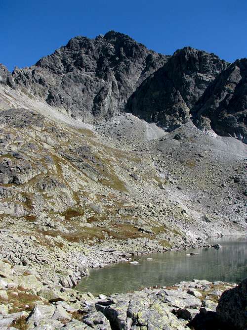
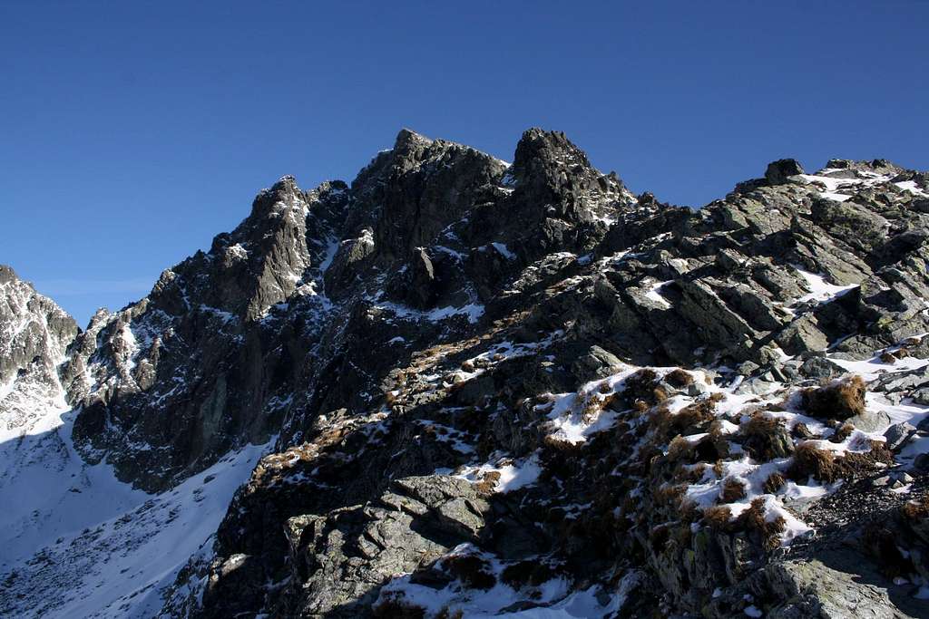
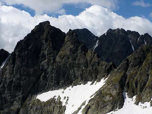
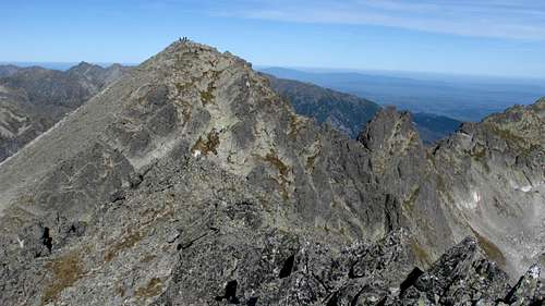
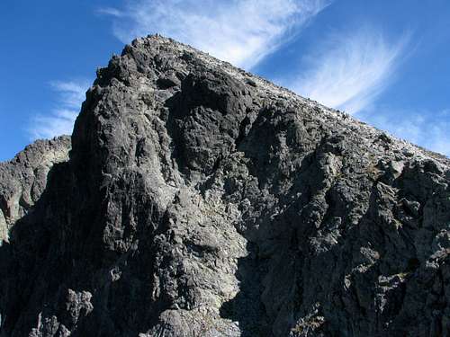
The peak stands on the main ridge of the High Tatras between Poľský hrebeň/Polski Grzebień (Polish Crest) and Prielom/Rohatka passes. It is the fourth highest Tatra peak accessible by waymarked trail. Its northwest walls form the imposing headwall of the Litvorová Valley (and arguably of the Svišťová valley as well!). At its foot, in the cirque at 2047 m sits Zamrznuté pleso/Zmarzły Staw (Frozen Tarn), which is the source of Litvorový Creek, a tributary of the Biela Voda/Biała Woda (White Water). Vychodná Vysoká sends a huge lateral ridge to the ESE, with such peaks as Bradavica/Staroleśny at 2476 and Slavkovský at 2452m. The ridge divides the Velická Valley from the Velká Studená Valley. The gentle side of Vychodná Vysoká is its southern side. Its northwest and northeast faces are precipitous. The same goes for the stretch of the main ridge dropping to Prielom pass (probably UIAA 3). As far as the waymarked crest between Poľský hrebeň pass and the summit is concerned, its lowest one third is a bit of a scramble, whereas the rest is a rather mundane walk-up. Vychodná Vysoká, which seems to attract few rock climbers, is climbed by many hikers for spectacular, panoramic views from the summit.
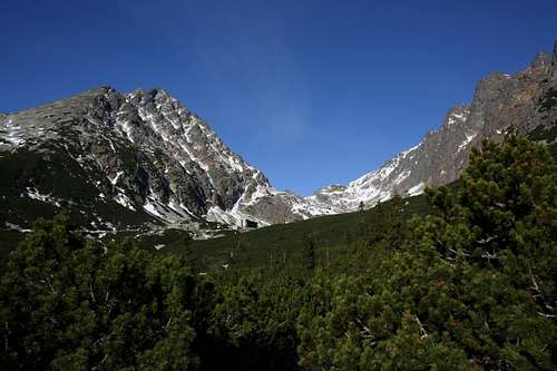
 The ESE ridge
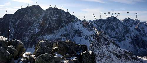 SW view from summit
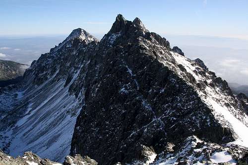
 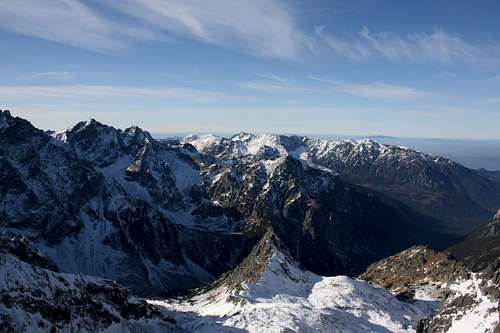 NW view
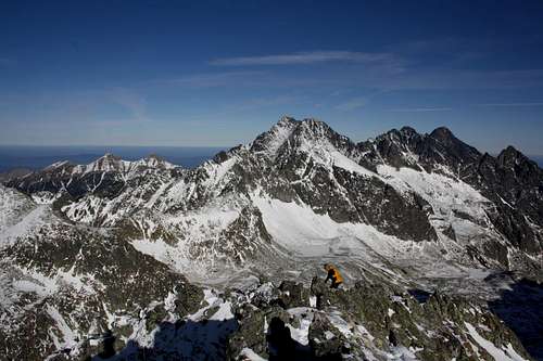 NE view
 Getting There
Polish hikers often start the walk at Lysá Poľana/Łysa Polana, right on the Poland-Slovakia border, at the mouth of the Bielovodská dolina (White Water Valley), where there is a Slovak bus terminus and car park. If you are travelling by Zakopane minibus (signed for Morskie Oko), this will be the second last stop. (Tell the driver you want to get off there as most passengers will be heading for Morskie Oko.) From Lysá Poľana buses go to Poprad via Starý Smokovec, where you can start your hike south of the Tatras. Starý Smokovec is part of Vysoké Tatry town, which is in fact a string of resort towns and villages along the southern boundary of the Tatras, served by a road and a railway (tram) line. A few of those settlements have a trailhead for either the Velická or the Veľká Studená valleys and Starý Smokovec have both.

- Slovak train and bus timetables
- Poprad-Tatry Airport
- Polish train and bus timetables - unfortunately Zakopane minibuses are not included here. In Zakopane you will find them (both minibuses and timetables :)) in front of the entrance to the railway station.
Red Tape
Hiking
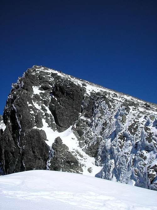
You must keep to waymarked trails. Bivouacking is not permitted. You are not supposed to hike after dark. The trails above huts are closed for hikers from 1 November to 15 June.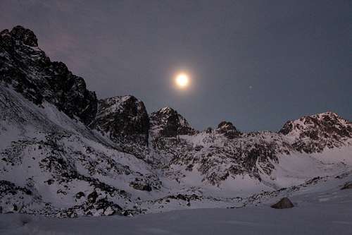 Moon over Vychodná Vysoká
Rock & Winter Climbing
You must be a member of a rock climbing club. Just before your climb, you should write it into the register kept in a nearby mountain hut/your hotel. (Make sure you sign it on return too!) During the approach you must stick to the traditionally used routes described in rock climbing guidebooks. Bivouacking on the wall is only allowed in an emergency. Except for winter, you must not do a route that is easier than UIAA grade III (approx. YDS grade 5.3) unless on descent. The funny thing is that the last rule does not apply to those hiking/scrambling with a licensed guide whom they have paid some €200 for looking after them.Trails
From Łysa Polana/Lysá poľana via Bielovodská dolinaDistance: 14 km Total elevation gain: 1570m Time of ascent: 5.5h
This is both the most scenic (at least in my opinion) and the least frequented trail as most Slovak hikers prefer a circuit from Vysoké Tatry town. Just bear in mind that bears like the valley as well!
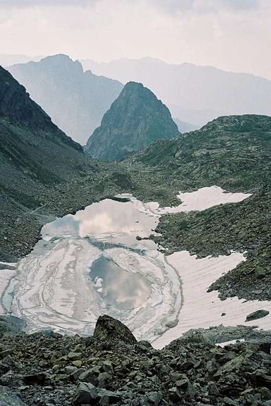
 Photo by Tomek Lodowy
Distance: nearly 12km Total elevation gain: about 1650m Time of ascent: 6h
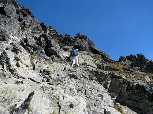
Stunning scenery. The quickest option would be to make use of the Starý Smokovec–Hrebienok funicular railway at the start of your hike. It would save you over two kilometres’ walk and 260m of ascent. Before you get to Poľský hrebeň pass, you will have to cross Prielom/Rohatka pass. The descent down its west side is exposed and has iron chains and rungs (YDS class 3).
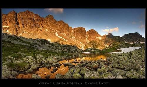 Photo by ond
From Vysoké Tatry town via Velická dolina
Distance: about 10km Total elevation gain: over 1450m Time of ascent: 4.5-5h
The shortest route of the three. Just before Poľský hrebeň pass is a short chain-assisted section, less demanding than the one on the trail through Prielom/Rohatka pass described below.
Surely you can combine two of the above trails instead of doing a there-and-back hike. Regardless of which trail you take, you will have to get to the pass of Poľský hrebeň before summiting Východná Vysoká. (The first two of the above trails join several dozen metres below the pass, northwest of it.) Above the pass the hike (there-and-back) is a walk-up combined with a bit of a scramble, taking up to three quarters of an hour on the way up. Its first part is more interesting, occasionally chain-assisted (going at YDS class 2 with a couple of class 3 spots) whereas the final stretch is rather tedious.
Maps
As for the analogue maps, there are many options readily available - my favourite is this plastic map by WiT.
Accommodation

- plenty of options in the town of Vysoké Tatry.
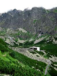
- a hotel called Sliezsky Dom in the Velická dolina at 1670m, 2.5hrs walk to the summit
- a mountain hut known as Zbojníčka (Zbojnícka chata) in the Veľká Studená dolina at 1960m, 4hrs walk to the summit
- NO mountain hut in the Bielovodská dolina
- Hostel by the Climbing Wall at 970m, 100m from the former border checkpoint at Lysá Poľana
Mountain Conditions & Rescue
 Below Prielom
 Below Poľský hrebeň
- Forecast for Vysoké Tatry town on AccuWeather
- Forecast for the Tatras on HZS site
- Avalanche risk
- Webcam on Lomnický štít
- Warning: In Slovakia - unlike in Poland - those who do not carry commercial insurance have to pay for any rescue services rendered by Mountain Rescue Service (HZS). Membership of the Austrian Alpine Club (Österreichischer Alpenverein) sorts the problem out. Mountain rescue team's phone number: Slovakia (HZS) 18 300 Poland (TOPR) 601 100 300
 End of July 2005 - by dalton1
Winter Climbing Photos
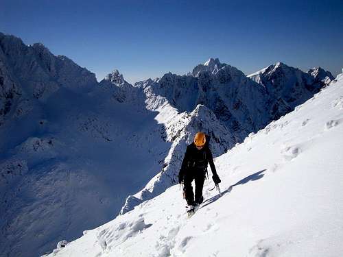 Photo by Ivona
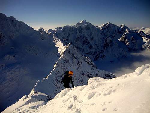 Photo by Ivona
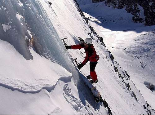 Photo by marlenka
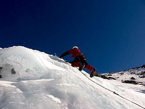 Photo by julesblaidd