
-
 18758 Hits
-
 88.92% Score
-
 28 Votes
|
|
Mountain/Rock |
|---|---|
|
|
47.04180°N / 13.01590°E |
|
|
10242 ft / 3122 m |
|
|
Overview
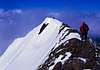
Both bastions watching the end of Rauris Valley (Raurisertal): Schareck (3122 m) on the left and Hoher Sonnblick (3105 m), on the right.
: Schareck (3122 m) on the left and Hoher Sonnblick (3105 m), on the right. July 2003")
Schareck with its 3122 m is one of the three tallest mountains in Goldberg Group, and one of two bastions, closing the Rauris Valley (Raurisertal). Another important mountains in this area are Hoher Sonnblick and Hocharn .
Goldberg Group lies in Austria, in Hohe Tauern, which are part of Eastern Alps .
Due to expanded skiing infrastructure on the glacier Wurtenkees and storage reservoirs, Schareck is not especially interesting for mountaineering in the South. In that side is lift station situated about 15 minutes from the summit and hardened roads (not public) reach up to about 2800 m.
But there are a few attractive routes to Schareck from the north, northeast and west, from the valleys of Rauris and Gastein. From the summit you can have a nice view to Hoher Sonnblick and Hocharn (at good weather also Grossglockner) in the west and to Ankogel Group in the east.
 |  |  |  |  |
Getting There
There are two good outgoing points to Schareck in the North:
1. Village Kolm-Saigurn. From Salzburg drive highway A10, later main road 311 towards Zell am See. In Taxenbach turn left towards Rauris/Raurisertal. Later through Rauris and Wörth to the end of public road (free parking). Here begins the toll road (9 euro or Salzburger Land card), which you can pass also by the post bus. Later you must leave your car at parking Lenzanger (no fees), later a short trip by bus, to Kolm Saigurn (the road from Lenzanger parking to Kolm Saigurn is open for public transport and inhabitants only).
2. Nassfeld (Sportgastein). From Salzburg drive highway A10, later main road 311 towards Zell am See. In Lend turn left into road 187, towards Bad Hofgastein/Gasteiner Tal. Then to the south, via Bad Hofgastein and Bag Gastein, in Böckstein turn right to the end of public road.
Getting there from the South
(Thanks to Vid Pogachnik for suggestion):
From Italian or Slovenian border (and from Graz/Klagenfurt) drive highway to Villach, then A10 towards Spittal. Later take the road 106 towards Lienz. After town Flattach, in Kleindorf or Ausserfragant village turn right towards Innenfragant and continue up to the end of public road. After Hotel Badmeister, on about 1200 m you will find a parking at the tunnel of Gletscherexpress (Glacier Express, it is like subway, one way takes 8 minutes). Later you can take marked route nr 145 to the hut Duisburger Hütte (2573 m), or gondola lift to the Eiseehaus (2795 m).
Here you can see skiing infrastructure and transport service in the south face of Schareck.
 |  |  |  |  |
Red Tape
No permits or fees for climbing are required. The mountain lies in the area of National Park Hohe Tauern.
Official site of the Park
When To Climb
The best season for hiking/climbing is from July to September.
 |  |  |  |
Routes overview
1. In Kolm Saigurn (1596 m) begins near the hut Naturfreundenhaus (1596 m). Later we have walk-up through the wood and meadows, to Naturfreundenhaus/Schutzhaus Neubau (2175 m) . Then to the pass Fraganter Scharte (2754 m), from here on northeast ridge to Herzog-Ernst-Spitze (2933 m) and later east to the summit (3122 m). The division from Herzog-Ernst-Spitze to the summit is partially secured by steel cable and steps (like via ferrata).
2. In Kolm Saigurn (1596 m) at Ammererhof take the marked route to Niedersachsenhaus (2472 m). Here begins the nice way called Pröllweg, on the long south ridge, through Riffelhöhe (2694 m) and Neunerkogel (with summit cross, 2827 m), to the Herzog-Ernst-Spitze (2933 m). Later on east ridge with some steps to the summit. The division from Herzog-Ernst-Spitze to the summit is partially secured by steel cable and steps (like via ferrata).
3. From the hut Zittelhaus on the summit of Hoher Sonnblick (3105 m), downstairs to the Rojacherütte (2718 m), later to the pass Niedere Scharte (2696 m), via Goldbergtauernkogel (2776 m) to the next pass Fraganter Scharte (2754 m). From here as route nr 1: on northeast ridge to Herzog-Ernst-Spitze (2933 m) and later west to the summit of Schareck (3122 m).
4. In Nassfeld (Sportgastein), at the hut Marie-Valerie Haus (1589 m) take the marked route „Arnoweg” to Niedersachsenhaus (2476 m). Later as route nr 2: on Pröllweg, on the long ridge, through Riffelhöhe (2694 m) and Neunerkogel (with summit cross, 2827 m), to the Herzog-Ernst-Spitze (2933 m). Later on west ridge with some steps to the summit.
5. In Nassfeld (Sportgastein), at the hut Marie-Valerie Haus (1589 m) take the marked route 112 “Neuwirthsteig”, later southwest to Aperes Schareck (2970 m) and to the summit.
5A. Description of a circuit route (ascent Pröllweg, descent Neuwithsteig) from Sportgastein
6. From Duisburger Hütte (2573 m) take the marked route nr 133 to the north, then northeast through the glacier Wurtenkees to the southeast ridge and summit.
7. From Eisseehaus (2795 m) take a chair lift, and then you have 15 minutes to the summit only...
Ice climbing routes
Added by: Mathias Zehring
Schareck has three characteristic couloirs at its northern flank. The middle and the left one are quite popular ice climbs:
- left couloir: most easy one, 45-50°
- middle couloir: most popular; 45-55°, 75° at the final ice clip that can be avoided; description on www.bergsteigen.at
- right one: most difficult, with mixed climbing at the beginning; description on www.bergsteigen.at
These routes are almost exclusively done in spring with ski on the back - and often skied down also.
One of these experts is SP member Ivana Filova ; here is (her report in German)
A recommended book is: Firn- und Eisklettern in den Ostalpen, Alpinverlag, 2003. ISBN: 3-9500920-0-5. (also with info in English)
 |  |  |  |  |
Maps
Alpenvereinskarte, Blatt 42 "Sonnblick", 1:25.000
Kompass, WK 40 Gasteiner Tal-Goldberggruppe, 1:50.000
Mountain Conditions
Actual weather in Goldberg Group can be proofed here:
Weather by OeAV
Accommodation
Accommodation:
There are the following huts (shelters) in Schareck area:
Niedersachsenhaus (2472 m) , belonging to DAV Hannover, phone +43/664/9143440
details about Niedersachsnehaus
Naturfreundenhaus/Schutzhaus Neubau (2175 m), privat, e-mail: schutzhaus-neubau@aon.at
details about Schutzhaus Neubau
and site of Naturfreundenhaus/Schutzhaus Neubau
Rojacherhütte (2719 m), beloning to OeAV Rauris, phone +43/6544/6384 and +43/6544/7329
details about Rojacherhütte
and site of Rojacherhütte
Zittelhaus (3105 m), on Hoher Sonnblick, belonging to OeAV Rauris, phone +43/6544/6412
details about Zittelhaus
Duisburger Hütte (2573 m), belonging to DAV Duisburg, phone +43(0)6644-453353
details about Duisburger Hütte
and site of Duisburger Hütte
Other possibilities of accommodation in Rauris Valley could be find in the following websites:
www.rauris.at
www.raurisertal.at
External Links
- Skiing infrastructure and transport service on the south face of Schareck
- Description of a circuit route through Schareck from sportgastein
- Description of the route Neuwirthsteig (in Geman)
filova - Jan 16, 2006 10:56 am - Hasn't voted
Untitled CommentTwo couloirs in the North Face of Schareck are possible descent with ski.
- left couloir - 45 - 50 degree, ski difficult: D+, S5.
- middle couloir - 45 - 55 degree, ski difficult TD-, S5.
(starting in the "Rechterinnenarm")
Ski Mountaineer - Apr 22, 2007 1:32 pm - Hasn't voted
The middle couloirwith the left exit avoiding the ice (75°) has max. 45°, perhaps with a few meters of 50°, but mostly 40-below 45°. So certainly not 45-55°