
|
|
Mountain/Rock |
|---|---|
|
|
52.82403°N / 3.98237°W |
|
|
Gwynedd |
|
|
Hiking, Mountaineering, Trad Climbing, Bouldering |
|
|
Spring, Summer, Fall, Winter |
|
|
2336 ft / 712 m |
|
|
Overview
The Rhinogydd are known for their rough and remote character, and Rhinog Fach (712m), the range’s fourth highest mountain, can justifiably claim to be one of the wildest little summits in Wales. Sandwiched between its more famous sister, Rhinog Fawr, in the north, and the largest mountain of the range, Y Llethr, in the south, it’s the perfect picture of what a Welsh hill should be. While smaller than its two neighbours, it is, in this author’s opinion at least, the most striking peak of the collective, and when viewed from Cwm Nantcol or Llyn Hywel strikes a highly impressive profile. The shores of the aforementioned Llyn by the way, make an ideal spot for a wild camp. |
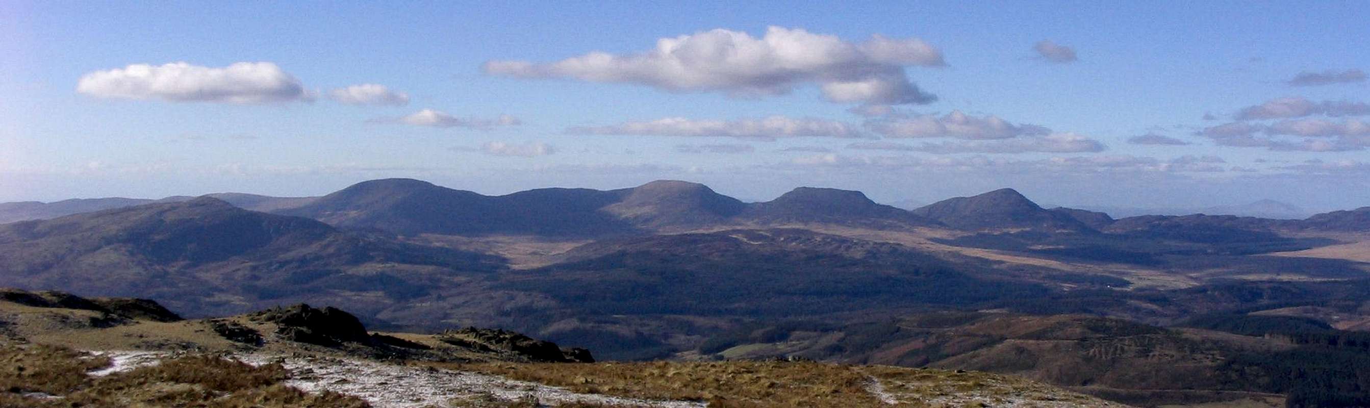
The Rhinogydd. From left to right - Y Garn, Diffwys, Y Llethr, Rhinog Fach and Rhinog Fawr (Photo by Nanuls)
Routes
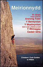
Rock ClimbingThe climbing on Rhinog Fach is split between two distinct areas, namely the high crags around Llyn Hywel and the lower ones around Bwlch Drws Ardudwy. Unless otherwise stated, routes are listed from left to right, and are graded and rated with the aid of the Climbers Club Guide to Meirionnydd, so for full descriptions, please refer to this source. The Climbers’ Club have also produced a free pdf, which provides details of first ascents recorded after 2001: download it here. Technical grades are generally only given to climbs graded adjectivally as Hard Severe (HS) or above. Please be aware that Rhinog Fach is a trad climbing venue and bolting is strictly prohibited. Routes are rated using the British Adjectival Grading System. A conversion table of international climbing grades by SP member Corax is available HERE! |


|
Route Symbols:
Llyn HywelThe routes around Llyn Hywel are quite easy to identify and are reached via Cwm Hosan. The South Ridge can clearly be seen rising from the lake to Rhinog Fach’s summit, reach the start of the route by scrambling over scree and heather to the ridge’s lowest point, then skirt around to its right to start at a short(ish) slab just to the right of a rock tower. Walking on Water takes the centre of the large and slightly vegetated slab on the far (eastern) side of the lake, reach it by walking along the lake’s northern shore and then delicately traversing in to its centre. |


| No. | Name | Length | Pitches | Adjectival Grade | Technical Grade | Quality | Restrictions |
|---|---|---|---|---|---|---|---|
| 1. | South Ridge | 170m | 6 | S |  | | |
| 2. | Walking on Water | 50m | 1 | S | | |
Bwlch Drws ArdudwyThe eastern approach to the Bwlch via the forest road leads to the stile on the forest edge from which, The Not so Roman Nose can be seen 300 metres away on the lowest slopes of Rhinog Fach’s north-east side. After 200 metres from the stile on leaving the forest on the main track cut off leftwards to follow the right edge of an old broken stone wall. The small buttress has a clean arête with a face each side, the right face ending in a chasm where the buttress leans away from the mountain. Two further walls sit up on the hillside facing north west. Follow a green sheep track by a stream directly up the hillside to SH 668 279. Here you will find Scatomancy and Praxis. The wall next right has several large flakes forming its top third. A flat rock sits on the ground by the centre of the face. This gives The boot is on the Udder and Bootslayer. Next right is a tower with a huge flake sitting on top like a head, which gives Baby Ozymandias and Baby Oz. There is an upper crag, which faces north-west and so gets afternoon sun. It is composed of the best rock in this area. Find it by continuing up past the lower face for 200 metres then contouring south to reach it in around 5 minutes (SH 668 276). Routes Reach for the Sky to Public Services can be found here. |
| No. | Name | Length | Pitches | Adjectival Grade | Technical Grade | Quality | Restrictions |
|---|---|---|---|---|---|---|---|
| 3. | Titantics Struggle | 8m | 1 | VS | 4c |  | |
| 4. | The Crocadile had a Napkin | 10m | 1 | E2 | 5b | | |
| 5. | Reaching for Air | 10m | 1 | E5 | 6a | | |
| 6. | Scatomancy | 10m | 1 | E1 | 5a | | |
| 7. | Praxis | 10m | 1 | E1 | 5b | | |
| 8. | The boot is on the Udder | 10m | 1 | HS | 4b | | |
| 9. | Bootslayer | 10m | 1 | HVS | 5a | | |
| 10. | Baby Ozymandias | 10m | 1 | HS | 4b | | |
| 11. | Baby Oz | 10m | 1 | E1 | 5b | | |
| 12. | Reach for the Sky | 12m | 1 | E3 | 5c | | |
| 13. | Snatches of Eternity | 12m | 1 | E4 | 6a | | |
| 14. | Just a bit further | 12m | 1 | E2 | 5c | | |
| 15. | Remote Supervision | 10m | 1 | HS | 4b | | |
| 16. | Public Services | 9m | 1 | S | 4a | | |
Mountain Conditions
This section displays the mountain conditions for Snowdonia, in which Rhinog Fawr is located. Click on the widget for maps and further details. This Snowdonia weather forecast is generated by the Met Office Weather Widget |
When To Climb and Essential Gear
|
Rhinog Fach can be climbed at anytime of the year however in poor conditions the mountain's rock routes are best avoided, particularly if the weather has been wet. March to April offer the most reliable conditions. Of course this all depends on ones ability as a mountaineer/climber, and what might be comfortable for some may seem daunting for others. If your lucky enough to climb the mountain in winter conditions then an ice axe and crampons are essential, there are however, no true winter climbs. |


Getting There
|
The Cwm Bychan (SH 644 313) and Maes-Garnedd (SH 641 269) car parks can be reached easily from the A496, which runs along the coast from Llanulltyd near Dolgellau in the south, to Blaenau Ffestiniog in the north. There is also parking available at Graigddu-Isaf (SH 680 300) on the eastern side of the mountains, which can be reached after from the junction (SH 711 307) just south of Bronaber on the A470. The area can also be reached by rail, however getting from the stations to the mountains themselves can be difficult as public transport is pretty infrequent and hitch hiking can be a nightmare. |
Red Tape and Access
No red tape or access issues here! For climbers, hill walkers and mountaineers, the British Mountaineering Council (BMC) runs a Regional Access Database, which holds mountain/crag specific information on matters of conservation and access, including issues such as nesting restrictions, nature designations and preferred parking. If you are in any doubt about any particular access arrangement, or need to report an incident, you should contact your local BMC Access Representative or the BMC Access Officers for Wales: Elfyn Jones. |

Rhinog Fawr (left) and Rhinog Fach (right) (Photo by Nanuls)
Camping and Accommodation
|
There’s an almost unlimited supply of accommodation within the Snowdonia National Park so it would be inappropriate to list it all here. For budget accommodation it’s worth checking out some of the following sites: Youth Hostel Association in Wales For more local options, there are a number of campsites that surround the range. There's a great little basic campsite at Cwm Bychan (SH 644 313) in the heart of the mountains and in an easy distance from both Rhinog Fawr and Rhinog Fach. Other nearby campsites can be found at Cae Gwyn Farm (SH 713 297) to the east of the range, and Merthyr Farm (SH 600 319) to the west. For wild camping, Llyn Hywel (SH 662 267) makes an excellent location. |


Maps
|
| Navigation Maps Ordnance Survey 1:25k Explorer Series OL 18 Harlech, Porthmadog & Bala/Y Bala Ordnance Survey 1:50k Landranger Series 124 Porthmadog & Dolgellau Harvey Map Services 1:25k Rhinogs/Rhinogydd Harvey Map Services/BMC 1:40k Snowdonia South Road Maps |
Guidebooks
|


External Links
 Rhinog Fach (Photo by Nanuls) Rhinog Fach (Photo by Nanuls) Bwlch Drws Ardydwy (Photo by Nanuls) Bwlch Drws Ardydwy (Photo by Nanuls) Rhinog Fawr (Photo by Nanuls) Rhinog Fawr (Photo by Nanuls) Rhinog Fach (Photo by Nanuls) Rhinog Fach (Photo by Nanuls)Government Bodies and Official Organisations Snowdonia National Park Authority Association of National Park Authorities Royal Commission on Ancient & Historical Monuments in Wales Hiking, Climbing and Mountaineering Organisations and Companies British Mountaineering Council Plas y Brenin National Mountain Centre Weather Tourist Information North Wales Tourism Partnership Local Information from Gwynedd.com Local Information from Snowdonia Wales Net Travel Welsh Public Transport Information Accommodation Youth Hostel Association in Wales Maps and Guidebooks Cordee Travel and Adventure Sports Bookshop Wildlife and Conservation |