-
 53592 Hits
-
 88.18% Score
-
 26 Votes
|
|
Mountain/Rock |
|---|---|
|
|
46.67466°N / 114.24359°W |
|
|
Missoula |
|
|
Hiking, Scrambling, Skiing |
|
|
Spring, Summer, Fall, Winter |
|
|
9139 ft / 2786 m |
|
|
Overview
Latitude & Longitude – 46.67466 N / 114.24359 W
Elevation – 9,139'
Route Types – Hike, Scramble
Class Levels – Class 2, 3, 4, & 5
Length of Time Required to Complete the Routes – One Day
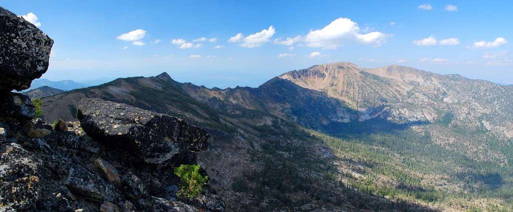
Lolo Peak is close to Missoula, one of Montana's largest cities. Because of that proximity, Lolo Peak (the northernmost 9,000+ foot summit in the Bitterroots) is one of the most-climbed, though many, if not most, fail to reach the actual summit.
The explanation for that is…
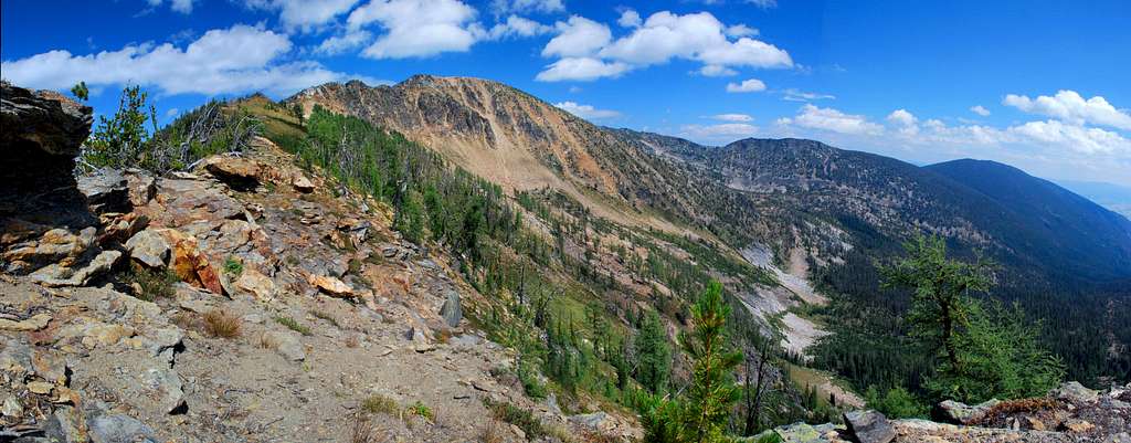
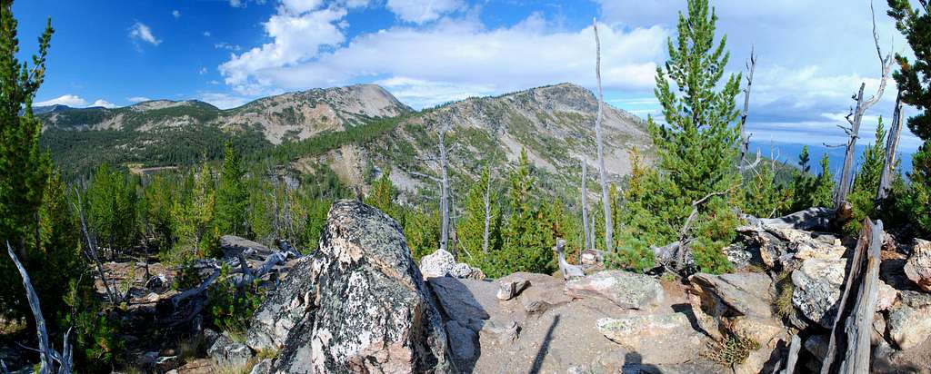
On my Topo map, Lolo Peak is the label applied to a fairly long north-south section of ridge which includes two highpoints separated by a saddle. The current Forest Service map applies the Lolo Peak label only to the north summit, a fact which adds to (or maybe causes) the confusion.
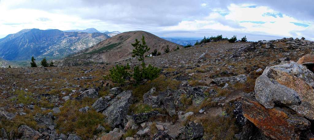
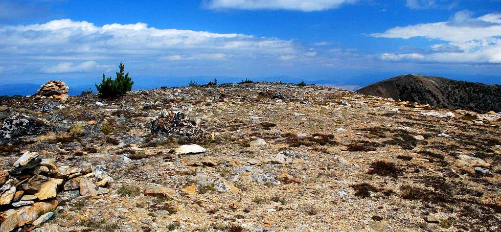
At 9,139',the southern summit is the actual highpoint of the ridge. But, the "standard" trail to Lolo Peaks reaches the north highpoint (9,096') first, and many are confused so don't make the trek over easy tundra to the south, and true, summit.
Strangely enough, the summit register is located in a rock shelter near the lower of the two highpoints.
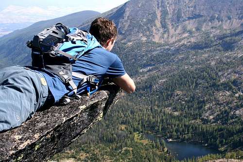
There is also some confusion as to whether or not Lolo Peak can be seen from Missoula. The north summit can just barely be seen as it peaks over Point 8694. This can be confirmed by a person standing at the rock shelter on the north summit and easily seeing much (but not all) of Missoula.
A person standing on the south summit can only see a small portion of the city of Missoula, an area around the airport. A person can also see several mountain ranges (on a clear day) from Lolo Peak.
The jagged peaks of the Missions, often snow-covered and eye-catching, appear to the northeast. Several other high peaks of the Bitterroots can be seen to the south. Even the Pintlers can be seen to the southeast, especially when capped with snow.
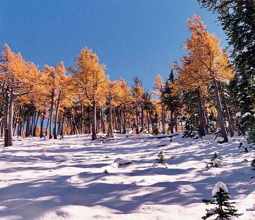
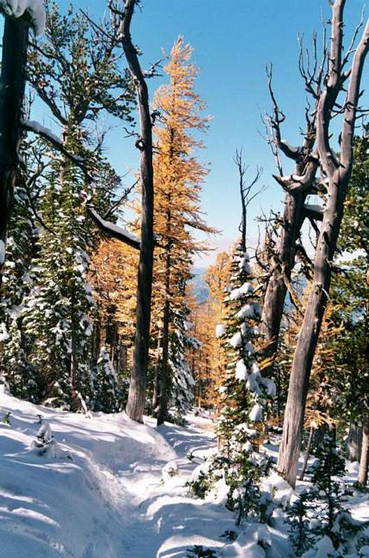
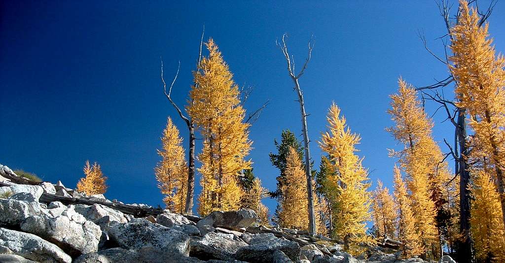
As is true on many Bitterroot peaks, the upper portions of the mountain are home to stands of Subalpine Larch, a deciduous conifer. During September and October these trees turn various shades of yellow and are especially beautiful on those special days when the mountains have a dusting of early-season snow.
Subalpine Larch
Larches, deciduous conifers, grow in cold boreal and mountainous regions throughout the world. In the Rocky Mountains, stands of Subalpine Larch (Larix lyallii) extend from the Salmon River Mountains of central Idaho, northward to just beyond Lake Louise in Banff National Park.
Within this distribution, Subalpine Larch is common in the highest areas of the Bitterroot, Anaconda-Pintler, Whitefish, and Cabinet Ranges of western Montana. It is also found in lesser amounts atop numerous other ranges and peaks in western Montana and northern Idaho.
In British Columbia and Alberta, Alpine Larch is common along the Continental Divide and adjacent ranges, and in the Purcell and southern Selkirk Ranges. Early in the fall they put on a brilliant display ranging from light yellow to deep gold, the exact color likely dependent upon the local soil chemistry. Generally, where these two species of larch co-exist there is an elevation gap in their distribution.
By reputation the Western Larch is a large straight tree, while the Subalpine Larch is shorter and often has a more "gnarled" appearance, though this may have more to do with where they are growing rather than a species difference. The branches are horizontal to the trunk, irregularly spaced and twisted. The twigs are finely hairy.
The two species of larch can and do hybridize in some locations, with the trees on Lolo Peak and Carlton Ridge being perhaps the most famous examples. The higher the elevation, the more likely the larch will be Subalpine. Subalpine Larch often occurs with Subalpine Fir and Whitebark Pine. (In the Bitterroot Mountains, this species is often found on north-facing slopes with Whitebark Pine on the adjacent south facing slopes.)
Western larch (L. occidentalis) is typically found in valleys or lower montane forests, often with Douglas-fir and sometimes ponderosa pine.
The seed cones are ovoid and slightly cylindrical, red-purple when young then turn dark brown with age, and are located upright on the twigs. They have thin scales and narrow bracts that extend over the scales.
Cones of the Subalpine Larch are slightly larger (1.5" to 2") than those of the Western Larch (1" to 1.5"). Note the potential for overlapping sizes. The Subalpine Larch has more needles per bundle (30-40 vs 15-30 in the western larch - again, note the potential overlap).
A cross-section of the needles from the Subalpine Larch are 4-sided to cylindrical, whereas those of the Western Larch are 3-sided. These two Canadian web sites have nice concise descriptions of both the Subalpine (alpine) Larch and the Western Larch.
Note: There is a controversy over the future use of Lolo Peak and some surrounding portions of the Bitterroot National Forest. A local owner of a large piece of land just east of the National Forest (and Lolo Peak) is developing what he calls, "A major ski resort." Part of his plan includes "asking" the Forest Service to give him access to the National Forest and Lolo Peak so he can extend ski trails all the way to the summit. If you want more detailed information, check out this web page posted by the Friends of Lolo Peak.
A Little History
The Origination of the Name – Lolo
According to Ralph S. Space, author of the Lolo Trail – A History of Events Connected With the Lolo Trail, there are several likely possibilities for the name Lolo which was apparently first applied to the creek and not the mountain.
There was a free-trapper (meaning, not connected to any fur company) Lawrence Rence who had a cabin on Grave Creek. There being no "R" in either the Flathead or Nez Perce languages, rather than Lawrence, they said Lou-Lou, Lo Lou, or Lo Lo. All three forms appear in early writings.
Space was unable to prove the existence of Lawrence Rence, but did confirm that a trapper by the name of Lou-Lou or Lolo was buried on Grave Creek.
Harry Wheeler, a Nez Perce who was very interested in local history, told Space that Lolo lived on Grave Creek and had a Nez Perce wife. Lolo was killed by a grizzly bear and buried along Grave Creek. Wheeler described the location of the grave to Space.
W. W. White (at one time the Supervisor of the Lolo National Forest) took Space to see the grave (a mound marked with a headstone) in 1939. Unfortunately the grave was destroyed by bulldozers when the area was logged at a later date. The earliest reference to this name was by John Work when he referred to the Montana creek.
His (hand) writing was not clear, and could have been either Lo Loo or Lou Lou. Wellington Bird and Major Traux widened and relocated portions of the Lolo Trail in 1866. According to Major F. A Fenn, who was Supervisor of the Clearwater National Forest at a later date, Traux named the trail in honor of Lola Montez, an Irish dancer and adventuress.
Because a map of the area prepared by DeLacey showed both Lolo Creeks prior to 1865, this explanation for the name is unlikely. Another possibility for the origination of Lolo is the Chinook word for pack – Lolo. Coincidence? Maybe. Space's conclusion is that the most likely source for the name, was the fur trapper who had a cabin on Grave Creek. Whether or not his name was Lawrence Rence is not known.
The Lolo Trail
An Ancient travel route, the Lolo Trail, sometimes called the Northern Nez Perce Trail, increased in importance with the arrival of horses to the region about 1730.
The trail corridor consisted of many braided and interwoven trails and was used by Lewis and Clark during 1805 and 1806. It was later used by John Work of the Hudson's Bay Company.
One of the earliest maps was produced by John Mullan who had explored the route. Miners and traders are thought to have used the trail but left no detailed records. When Wellington Bird and Major Traux relocated portions of the Lolo Trail during 1866, they actually turned it into a semblance of a road.
They did such a good job at locating the new trail (road), its location changed very little between the time they did their work and 1935 when it was officially turned into a road – a single track motor way.
Sources
- With Bird and Truax on the Lolo Trail: Building the Virginia City to Lewiston Wagon Road, 1865-1867. edited, with an introduction, by Dennis W. Baird. Moscow, University of Idaho Library, 1999.
- Lolo Trail: A History of Events Connected With the Lolo Trail, by Ralph S. Space. Printcraft Printing, Inc., Lewiston, Idaho, 1970.
Getting There
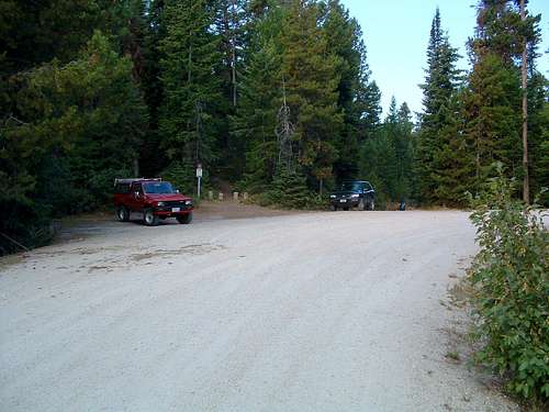
To reach the most-often used trailhead for Lolo Peak, go west on Hwy 12 from the town of Lolo, MT. In 3.8 miles, turn left (south) onto Mormon Peak Road (612).
The repairs to the lower (first) portion of Mormon Creek Road are complete. Though still the steepest and narrowest section of the road, it is much improved.
Follow the road for 8.5 miles to a right-turning switchback were the trail begins. There is now a sign marking the trailhead.
Parking is limited which I find strange, considering the popularity of the peak.
Note: This Mormon Peak trailhead is not accessible between December 1st and May 15th because the road is closed at Hwy 12.
So if you plan to ascend Lolo Peak during that time, drive west on Hwy 12 from the town of Lolo, MT, for 6.4 miles then turn left (south) onto Mill Creek Road.
Continue on the good gravel road through the residential area for a little over .5 mile to a some-times locked gate on the left side of the road and the Mill Creek Trailhead.
(Actually this is the end of the road, though it appears the road continues straight ahead. It doesn't, that's a driveway.)
There is no officially designated parking area, but there is room for a few vehicles along the side of the road. Just be careful not to block the road.
Area Restrictions (Red tape)
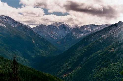
Both summits of Lolo Peak lie on the border of the Selway-Bitterroot Wilderness, and a major portion of the route to the summit is within the Wilderness.
Pertinent Wilderness rules and regulations apply.
The road to the standard trailhead is closed (to vehicular traffic) from December 1st until May 15th each year to give the wildlife a break from humans during the winter months.
If you wish to climb Lolo Peak during that time period and don't want to lengthen the route by too many miles, use the trailhead at Mill Creek(it adds several miles).
Camping
There are camp sites in the area of Carlton Lake, the best being to the south of the dam in the grassy areas where the route turns west toward the summit.
There also appear to be a couple of places on the Carlton Ridge which have been used for camping, this in spite of the fact that no water is available in the immediate area.
The Routes
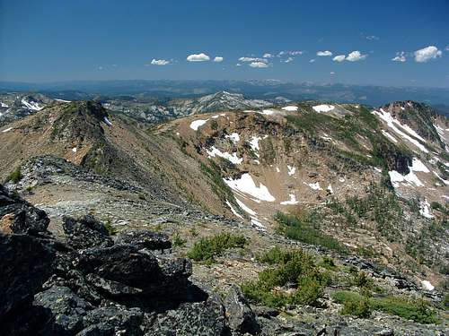
Currently there are two posted routes to the summits of Lolo Peak, the East Ridge (trail 1311) and the Lolo-Sweeney Connecting Ridge.
The East Ridge Route is the most used by far. For most of its length it is a simple hike and becomes a Class 2 climb on the upper portions of the ridge below the north summit.
The Lolo-Sweeney Connecting Ridge is a much more demanding route. Depending upon how you navigate the most complicated portion of the ridge, the climbing goes from Class 3 or 4 to Class 5.
When To Go
From the time the Mormon Creek Road opens in the spring until it is made impassible by snow, often as late as November or December, the route to Lolo's summit is doable.
The route is made more difficult (and longer) by the presence of snow. Using the Mill Creek Trailhead lengthens the East Ridge route by about 5 miles
