
-
 13704 Hits
-
 81.18% Score
-
 13 Votes
|
|
Mountain/Rock |
|---|---|
|
|
49.64300°N / 125.41946°W |
|
|
Hiking, Mountaineering |
|
|
Spring, Summer, Fall |
|
|
6178 ft / 1883 m |
|
|
Overview
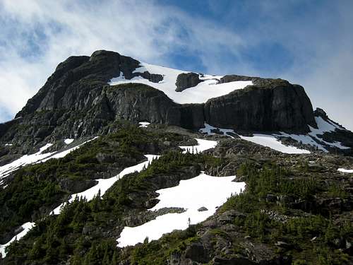 Mt George V from the Eric/Ralph Pass Mt George V from the Eric/Ralph Pass |
The summits of these dome-like mountains are infrequently visited and, only then, as part of the difficult weeklong traverse from Mt Washington to the Comox Glacier. However, the views offered by George V are more than worth the visit and, for the hiker with limited time – or limited energy – the summit can be reached in 3-4 days return from BC Parks Paradise Meadows trailhead via Mt Frink and the high Eric/Ralph pass.
Once across the pass, George is an extremely pleasant and easy hike across snowfields and open granite benches. The trip is no “gimme” however. The passage across the watershed from Mt Frink involves a 500 metres descent that will test the patience and energy levels of anyone going that way, particularly with a full multi-day pack. In the route and camping sections below, I will make suggestions as to how the impact of the difficult part of the trip can be best managed.
However well the overall trip is managed, it’s a 40 km round trip to Mt George V and involves a total of over 2,000 metres of relief. Once you’ve left the main route up to Mt Albert Edward, don’t expect to meet anyone else along the way.
Mt George V is named for …..er, wait a minute, I’ve almost got it………yes, of course, King George V. Grandfather of the present Queen and the last of the British monarchy to bear the surname Saxe-Coburg, George and his compatriots got into a real old spat with cousin Willi over in the fatherland that became known as World War I. Thereafter the British Saxe-Coburgs changed their name to Windsor.
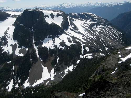
Mt George V and the Eric/Ralph Pass from the summit of Mt Frink.
Getting There
Vancouver Island can be reached by air from Vancouver to Victoria, Nanaimo or Campbell River and by ferry from Port Angeles to Victoria on The Coho and on BC Ferries from Vancouver to Victoria or Nanaimo. Public transport on the Island is relatively poor and anyone arriving by air would be advised to rent a car. Access in this case is all on paved roads and, therefore, fine with a normal sedan. Approach from north or south in the Inland Highway 19. Near Courtenay take the Strathcona Parkway exit west to Mount Washington Alpine Resort (the reason for the paved road to 1000m). Drive up 20km and just before reaching the resort make a left turn onto Henry Road, following Parks signs for Paradise Meadows. Pass the bottom of the ski lifts after 1.5km and drive a further 0.5km to the end of the paved road at the cross-country facility Raven Lodge.Parks have established a new trailhead and information booth right beside the lodge. If you get back from your trip before 5.30 pm, the Raven Lodge has a lovely view over to the mountains and is a great place for the beer you so rightfully deserve!
Approach and Route
1.Trailhead to Mt Frink
Complete the formalities (see below) and head out across the new, wheelchair accessible trail and onto Paradise Meadows. The first part of the approach is exactly the same as for Mt Frink – you’re going right over the summit of Frink after all – but will be repeated here for convenience sake.
Reference to this map illustrates the route. I recommend going out and returning on the somewhat shorter route via Helen Mackenzie and Hairtrigger Lakes. This will save at least an hour if time is a critical issue.
Good trail brings you in 3-4 hours to a marked trail junction for the campground at Circlet Lake. If you are staying here the night, turn right and along the shore of the small, unnamed lake before dropping down slightly into the bowl that holds Circlet. Otherwise, head straight on across the head of the small lake and up the trail towards Mt Albert Edward.
Five minutes up the trail watch for an old Comox and District Mountaineering Club (CDMC) wooden sign mounted high on a tree and indicating the way to Moat Lake. Keep right here for the Albert Edward route.
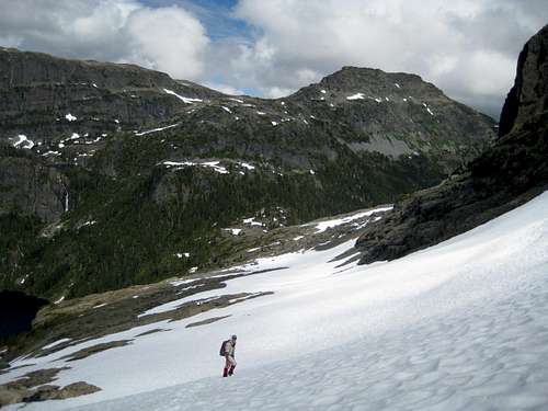
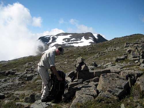 Approaching Mt Frink | Mt George V and the Eric/Ralph Pass |
From the cairn, walk up the ridge with views down to Moat Lake on your left. The ridge eventually turns right and northwest and broadens as it heads for the summit of Albert Edward.
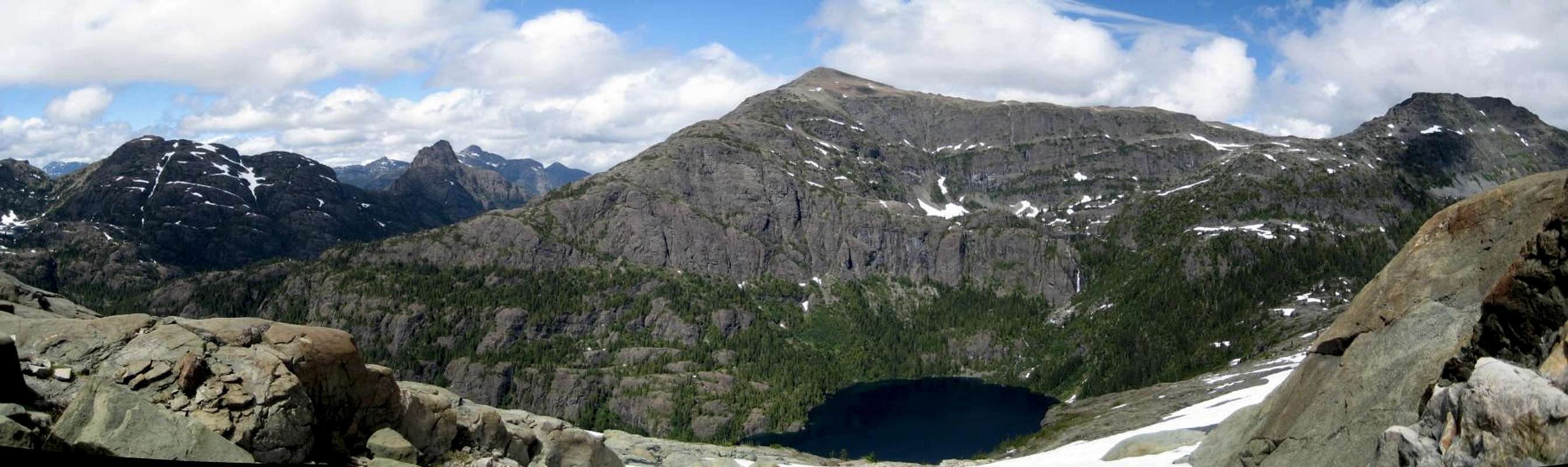
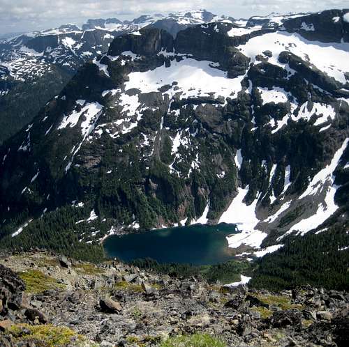
At N49° 40.531 W125° 24.363 you will reach a marked junction signed for “Castlecrag”. Leave the route up Albert Edward which bears west here and carry on south towards Mt Frink. The broad ridge ahead is rather featureless at this point and if visibility is questionable, this is the place to make a few notations on the map, or waypoints on the GPS. Proceed south and up to the wide open summit area of Mt Frink in about an hour. There are several cairned high points. Go to that on the right (west) side of the summit. Mts George V and 1931 are a spectacular sight across the watershed with the lovely Faith Lake cradled in the basin below the two summits.
2. Mt Frink to the Eric/Ralph Pass
This is the most difficult part of the route in terms of route finding and unfriendly terrain.
Go off the summit of Mt Frink and follow cairns and a rough path down the SW Ridge. For the first few minutes the ridge is narrow and your course very obvious. It soon becomes apparent, however, that all will not be that simple for long. On the ridgeline ahead is a red coloured bluff that must be by-passed. At this point also, the cairns and path disappear.
From the last cairn in the vicinity of N49° 39.746 W125° 24.702 look for a shallow ramp going off to your left (east). Follow it down and onto a mix of boulder and scree fields. Follow these down until you’re below the red bluff and can make a descending traverse onto the plateau below the bluff. You may find the occasional cairn on this stretch but don’t count on it. Once on the plateau you will probably notice a very distinctive and large cairn with a piece of wood mounted upright in it. Even more distinctive is the fact that the wood is obviously manufactured and has nails in it. I wonder how that got there? In any event, it’s a good place for a break and to orient yourself. Co-ordinates are N49° 39.699 W125° 25.135
From the “stick cairn” continue SW over the plateau for 5 minutes until you find yourself looking down and left at Charity Lake. Below are a series of bluffs and ledges that must be negotiated to reach the Eric/Ralph Pass.
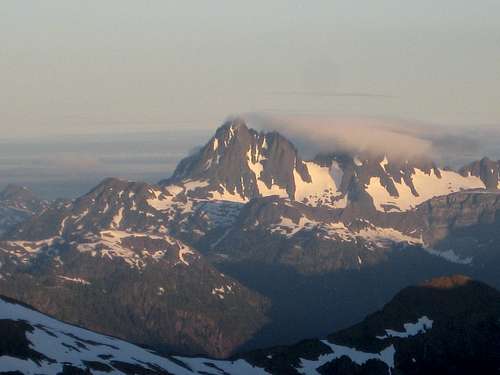 Leaving camp. The Golden Hinde at Sunrise | 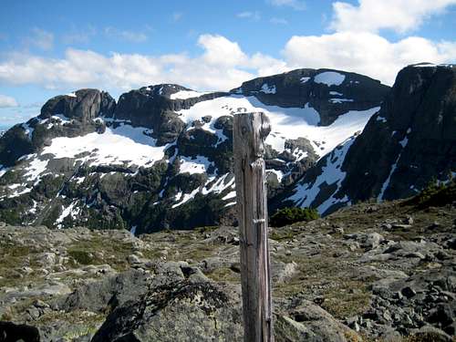 Peak 1931 and Mt George V |  Mt Frink SW Ridge |  Base of Mt Frink SW Ridge and the key bluffs. |
Once down the gully continue traversing south right at the foot of the bluffs above. If you find yourself hanging on to krumholtz for dear life, you’re in the right spot! The traverse leads to a scree chute. Go down it and finally on to flat ground below.
It seems to be a tradition on this route that only the easy bits are marked because cairns and flags now resume and take the hiker south and finally southwest down the last 100 vertical metres of easy snow and a bit of bush and into the Eric/Ralph Pass.
3. Eric/Ralph Pass to Mt George V Summit
  Augerpoint, Mt Mitchell, Mt Albert Edward and Mt Frink. Charity Lake directly below Albert Edward. Click at left. |
Having given up 500 metres of relief from the summit if Mt Frink, you’re now going to get almost all of them back again as you climb to the summit of George V. The good news is that it’s all wonderful open hiking from this point.
Exit the pass at N49° 39.321 W125° 25.529 and make an initial scramble up a short, steep and bushy gully. Thereafter traverse southwest across granite slabs and onto the northwest facing snowfield under the steep cliffs on George’s north face. After about 1 km on the traverse you will meet cliffs to the south that require an abrupt left (southeast) turn. Continue to make an ascending traverse in this direction for 600-700 metres until you spot any of a number of lines that take you northeast and up to George’s broad summit.
Take in the 360° views and enjoy the sense of privilege I always feel to be in such a place. All that effort is well worthwhile.
 Traversing under Mt George V North Slopes | 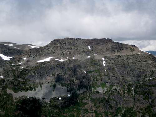 Mt Frink from George V |
If this is your turn-round point, get ready for the grunt back to and over Mt Frink. If not, head off the summit towards the George/Peak 1931 saddle and carry on along the route as described in the Peak 1931 page.
A MapSource GPS tracklog is available to any reader wanting to do this route. Simply email or send me a PM.
Camping
Choosing the correct camps on the route described above can be critical in minimizing the effort required to reach Mt George V.Up to and including the summit of Mt Frink you are in a “core area” of Strathcona Park where you must camp only in the designated areas. In the present example this means at Kwai or Circlet Lakes. Both of these are far too far away to hope to reach George V and return in a day. You might suppose, therefore, that carrying your gear all the way down to the Eric/Ralph Pass is going to be required – and, in fact, it’s a lovely place to camp. There are, however, other possibilities. The core area rules were set somewhat arbitrarily with the principle aim of protecting the most frequented and delicate areas of Strathcona. In practice, and as a through traveler, no-one is going to hassle you if you camp outside the regulated areas provided you practice strict no-trace methods and keep a low profile. With this is mind the following camps are eminently possible:
- on the plateau below the NE ridge between Albert Edward and Mt Jutland.
- a few metres below the summit of Mt Frink at N49° 39.773 W125° 24.560 is a flat space big enough for 2 tents. Water would be an issue here if all seasonal snow had melted.
- On the plateau below the red bluff on the SW ridge of Mt Frink in the neighbourhood of N49° 39.699 W125° 25.135
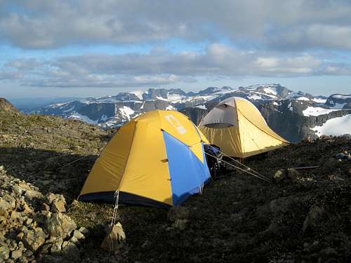 Camp on the Summit of Mt Frink - looking south | 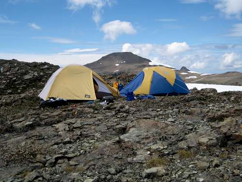 Mt Frink Summit Camp - looking north |
Wherever you choose to camp, note that fires are strictly prohibited, so you must pack a stove. Bear and cougar frequent the mountains and forests of Vancouver Island, so proper back country methods – hanging food bags out of reach, cleaning up all cooking scraps, good toilet practice etc – are essential. Giardia is well documented throughout Strathcona Park, so boil or treat all water.
Faith Lake and the east portion of Peak 1931 from the summit of Mt Frink
Red Tape
If camping at Kwai or Circlet Lakes, or anywhere else in the designated core area of Strathcona Park, there is a $10/person/day fee. There is a self-registration box and payment slot at every core designated trailhead. Payment can be by cash or cheque.Useful links
Strathcona Provincial ParkWeather:
Current Courtenay weather forecast to the east of the area.
OR
Check the weather at altitude right from Mt Washington’s webcam
Additional Information/Suggested Reading
The correct map is essential for this trip. Obtain a copy of the government topographical map sheet 92 F/11, “Forbidden Plateau”. Advance copies can be ordered on-line at this link. Copies are usually readily available in good bookstores and outdoor stores throughout the Island.Beyond Nootka – A Historical Perspective of Vancouver Island Mountains, Lindsay Elms, Misthorn Press, 1996, ISBN 0-919537-29-4
Island Alpine – A Guide to The Mountains of Strathcona Park and Vancouver Island, Philip Stone, Wild Isle Publications, 2003, ISBN 0-9680766-5-3