
|
|
Mountain/Rock |
|---|---|
|
|
36.97850°N / 118.4734°W |
|
|
Scrambling |
|
|
Summer |
|
|
12920 ft / 3938 m |
|
|
Overview
Poised over the upper limits of the wild South Fork Kings River valley, Mount Ruskin is one of the 35 Mountaineers Peaks designated by the Sierra Peaks Section of the Sierra Club Angeles Chapter. The designation is conferred upon the top 50 peaks in the High Sierra (the top 15 in this group are further recognized as Emblem Peaks). Located in this remote part of the High Sierra, Ruskin isn’t the first peak to catch the traveler’s eye – Arrow Peak usually garners that privilege. However, Ruskin’s sharply defined ridges quickly identify it as a worthwhile mountaineering goal.The first credited ascent of Mt Ruskin in 1895 is attributed to Bolton Brown, the Stanford professor, artist, and noted Sierra explorer. Bolton named the peak for the celebrated Victorian artist, author, and poet John Ruskin. Since that time, several additional routes have been documented, none easier than Class 3. There are a number of additional possible routes just waiting for an adventurous soul.
 from Arrow Peak’s NE Ridge (Jun 08)")
Getting There
Mt Ruskin can be approached from a number of different directions depending on the itinerary. The closest trail head approach is via the Taboose Pass trail but easiest access is available to those hiking the John Muir Trail. Entry into this region is also available from the west, albeit a bit longer. Finally, a couple of more obscure routes are available to the more adventurous.Routes
There are a number of “traditional” climbing routes on Ruskin and probably a few undocumented routes that are more technical in nature.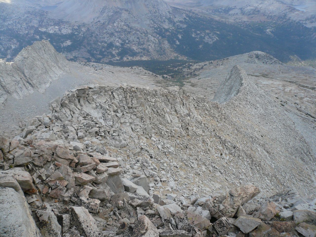 Looking back down the East Ridge (Aug 08) |
East Ridge: Class 3. From Lake 11520’, gain the ridge a short distance west of the ridge toe to bypass the Class 5 blocks. Ledges and cracks provide easy purchase to the top of the ridge and then a pleasant scramble along the ridge leads to the summit. Near the summit, an overhanging rock presents a short pause but is easily climbed by dropping down on the north side and climbing onto it using good foot and handholds. |
 Southeast Slope (photo by Rick Kent) |
Southeast Slope: Class 3. A mostly class 1/2 sandy rocky slope that is excellent for the descent if using the East Ridge as an ascent. This approach doesn’t bypass the overhanging rock mentioned above hence the rating. |
 Ruskin from Marion Peak (photo by Matthew Holliman) |
West Ridge: Class 3. As reported in R.J. Secor’s “The High Sierra Peaks, Passes and Trails”, the West Ridge is gained from Cartridge Pass. Either climbing the ridge direct or traversing to the South Ridge leads one to the summit. |
 Southwest Face & West Ridge (photo by Matthew Holliman) |
Southwest Face: Class 3. Chutes lead to the South Ridge from the basin just south of Cartridge Pass. |
 The North Ridge (photo by Matthew Holliman) |
North Ridge: Class 3/4. According to Secor, the first ascent party accomplished this climb as a traverse from Saddlehorn. However, a steep scree and talus slope (seen in the lower left part of the photo) accesses the ridge from the top of the cirque immediately NE of Mt Ruskin. |
Red Tape , Camping, and Conditions
Everything you need to know about permits, regulations, and driving directions can be found on the Eastern Sierra - Logistical Center page. While overnight hikes require a wilderness permit, day hikes can be done without red tape.Climbing can be done in almost any season but May through October are the most popular times. In heavy snow years, the chutes and slopes may hold residual snow. This is also true for any of the routes over the Sierra Crest. Check for current weather.
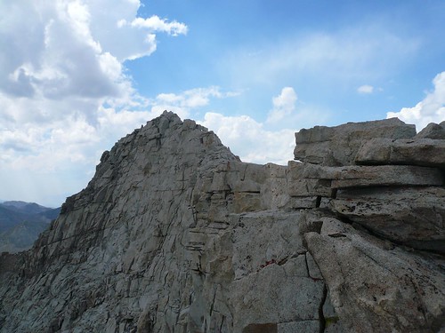
Approaching the summit (Aug 08)
External Links
Trip Reports:2008 Sierra Challenge Day 7
Climber.org reports
Pictures:
Rick Kent’s Sierra Challenge photos
Matthew Holliman’s photos including the West Ridge
My pics & summary