
|
|
Mountain/Rock |
|---|---|
|
|
36.32846°N / 50.92231°E |
|
|
Mountaineering |
|
|
Summer |
|
|
13278 ft / 4047 m |
|
|
Overview
Click for Introduction to the Central Alborz Mountains.Click to see the Map of the Takhte Soleyman Massif.
My GPS measured an elevation of 4058 m. The 4047 m figure is per the Iranian 1:50 000 map.
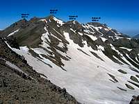
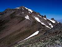
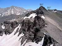
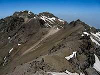
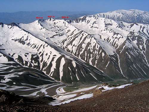 The three summits of the Nezar Peak
The southwestern arm of the Takhte Soleyman Massif consists of a ridgeline that starts on the western flank of the Gardooneh Kooh Peak and first heads west, then turns northwest. This ridgeline gives rise to many high points with elevations in the 4000-4078 m range. The high points can be divided into three different groups with each group constituting a separate peak. East to west, the peaks are as follows:
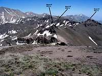
1) Meeshchalak 4067 m
2) Nezar 4047 m
3) Kalvan 4078 m
Nezar sits between the Meeshchalak & Kalvan Peaks and is made of three high points itself. These include: Point 4047 m, Point 4033 m & Point 4023 m.
The northern slopes of the Nezar Peaks create a number of alpine bowls that sit at elevations of 3700 to 3850 m and house large snow fields. The bowls form the headwaters of the Sehezar River. As the river heads north, it steadily loses elevation until it reaches the Caspian Sea. On a straight line, the distance between the summit of Nezar and the Caspian Sea is approximately 50 Km.
To the east, Nezar is connected to the 4067 m Meeshchalak Peak and to the west Nezar is connected to the 4078 m Kalvan Peak. The southern slopes of Nezar go down to reach a branch of the Shah Rood (Taleghan) River.
Nezar is a very long way from any trailhead. Reaching its summit requires a multi-day hiking program. Usual approaches are:
1) From the east via the summit of Gardooneh Kooh (starting at the village of Roodbarak)
2) From the south via the village of Parachan in the Taleghan Valley
3) From the north via the Sehezar River Valley (See Route Information below)
The Sehezar Valley approach is of particular interest because it takes the hiker from just below Sea level on the Caspian Coast all the way to above 4000 m.
Nezar #1, 4047 m:
 |  |  |  |
Nezar #2, 4033 m:
 |  |  |  |
Nezar #3, 4023 m:
 |  |  |
Below you will see pictures from the Sehezar Valley. For more pictures see the pages for Kalvan and Meeshchalak Peaks.
Sehezar Valley Below 2000 m:
Caspian Forests cover the slopes below 2000 m
 |  |
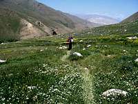
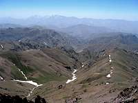
Sehezar Valley 2000-2500 m:
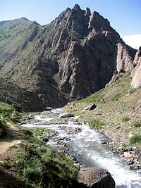 |  Langari #2 Peak from Mid Sehezar Valley Langari #2 Peak from Mid Sehezar Valley |  |
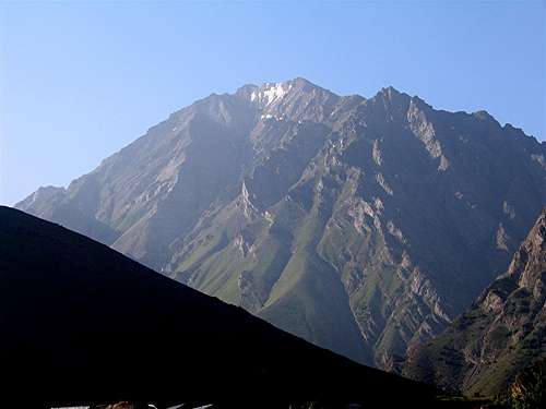
Sehezar Valley 2500-3500 m:
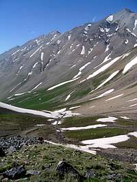
 |  | 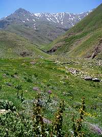 | 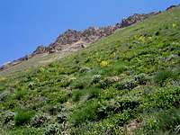 |
 |  | 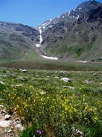 |  |
Sehezar Valley Above 3500 m:
 | 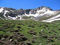 |
Views From the Summit of Nezar #1:
 Kalvan Kalvan |  Gardooneh Kooh Gardooneh Kooh |  Khersan & Haft Khan Khersan & Haft Khan |
 Naz & Kahar Naz & Kahar | 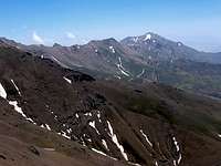 Zarrin Kooh Zarrin Kooh |  Shah Alborz Shah Alborz |
Route
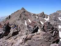
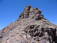
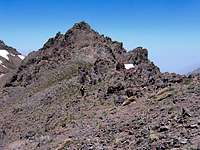
The starting point for this route is the summit of Meeshchalak Peak. Click here to see the Route Page for Meeshchalak Peak.From the summit of Meeshchalak head west and follow the ridge-top past the many ups and downs (no more than 75 meter vertical) to reach first Nezar #2 4033 m and then Nezar #1 4047 m. Hiking the ridge-top requires class II-III scrambling. Reaching the very top of Nezar will needs a short segment of rock climbing (a few meters, see picture below). Distance from the summit of Meeshchalak is 1.50 Km.
 Rock climbing below summit
Getting There
Directions for Sehezar Valley:From the coastal town of Tonkabon (Shahsavar), you will have to drive roughly 50 Km up nameless remote roads through the forested slopes in the Sehezar Valley to reach the end of the road at the village of Shahrestan (elevation 2000 m)(sorry about the vague directions, we were driven by locals through these roads). Hiking starts here.