-
 6927 Hits
-
 81.18% Score
-
 13 Votes
|
|
Mountain/Rock |
|---|---|
|
|
46.33749°N / 114.34083°W |
|
|
Ravalli |
|
|
Hiking, Scrambling |
|
|
Spring, Summer, Fall |
|
|
8652 ft / 2637 m |
|
|
Overview
Latitude & Longitude – 46.33749 N / 114.34083 W
Route Type – Scramble
Elevation – 8,652'
Class Levels – Class 2+ to 4
Length of Time Required To Complete Route – One Day
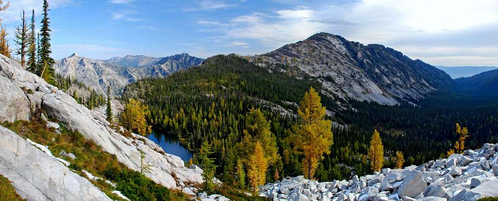
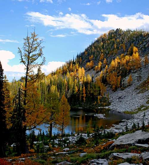
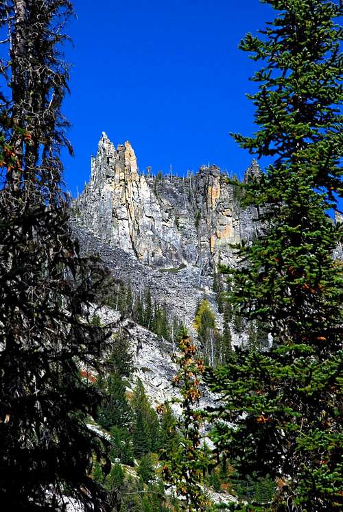
With no through trail between Montana and Idaho, the "closed-end" Sheafman Canyon is home to several (officially) unnamed and seldom visited highpoints, one of which is Point 8652. West Sheafman Peak, as I refer to it, sits toward the west end of the north rim of this beautiful canyon.
Frequented mostly by hardy backpackers (who camp at Knaack Lake), climbers of Castle Crag, and in the fall, hunters on horseback (looking for elusive deer and elk), Sheafman Canyon is a wonderful place to experience the wilderness in seclusion.
The few climbers who visit generally enter the canyon for a single destination, Castle Crag. A well-known Bitterroot Landmark, Castle Crag is easily recognizable from many places in the valley. But because it is such a long way from the trailhead, 7 plus miles, few climbers are willing to make the lengthy trek.
West Sheafman is equally far from the trailhead but less technical in nature to climb if one uses the West Ridge to reach the summit. To be sure, if you desire a more difficult climb, the Connecting Ridge between East and West Sheafman offers difficulty up to Class 4.
Offering stupendous views of the surrounding summits plus Sheafman and Fred Burr Canyons, I enthusiastically recommend this totally unspoiled peak as being one of the best of the Bitterroots.
Getting There

From Hwy 93 about 5 miles north of Hamilton, turn west at the Woodside Crossing (marked by a stop light) onto Dutch Hill Road.
In about 2.5 miles you will reach a T intersection. Turn right (north) onto Bowman Road and follow it as it completes two 90 degree turns (left then right – west then north).
In 1.2 miles turn left (west) onto the gravel West Cow Creek Road.
Staying on the main road, drive an additional 5 miles to the trailhead, which is marked (right side of the road) with a Forest Service sign.
Parking is available for several vehicles along both sides of the road.
Area Restrictions (Red tape)
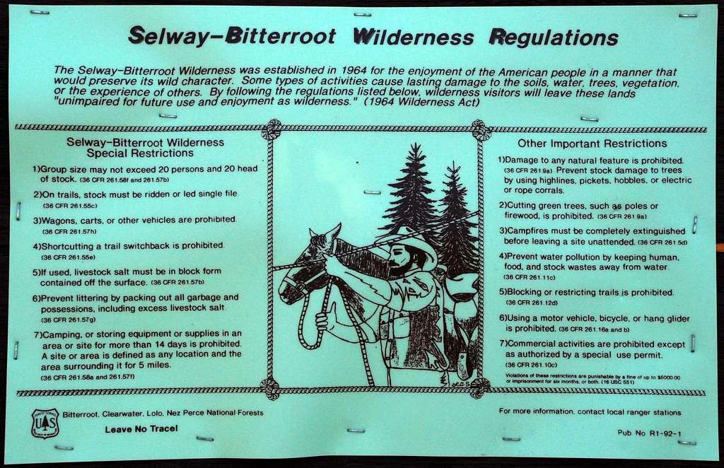
Just over two miles from the trailhead you pass into an official wilderness area, The Selway-Bitterroot. All wilderness rules and regulations apply.
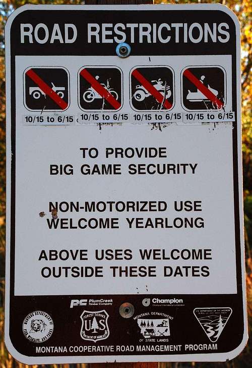
Additionally, the road to the trailhead is gated between October 15th and June 15th to provide a "partial" winter sanctuary for big game animals. What that means is, at least they won't be bothered by motorized vehicles; however hunters on foot and on horseback still have access during hunting season. I'm guessing the elk, deer, and goats must be pretty good at staying hidden in this canyon, because I've seen little evidence of stock animals in Sheafman Canyon.
Camping
About a half mile from the trailhead there is a much-visited overlook area where some camp, especially if they want an overnight with their small children. But as far as camping goes, it's not much.
Most people who camp in the Sheafman drainage set up in the fairly level grassy area just east of Knaack Lake. This is a much better spot for climbers to spend a night or two in the canyon.
The Routes
There are two good routes to the summit of West Sheafman Peak. The most obvious follows the Sheafman Creek Trail to Knaack Lake, then uses the peak's west ridge to reach the summit. Climbing never exceeds Class 2+ and the route is doable during the winter on skis or snowshoes.
The other route uses the connecting ridge from East Sheafman Peak and includes Class 3 to 4 climbing. This route is more "fun" and, if put together with an ascent of East Sheafman Peak and descent of the West Ridge Route, makes a nice "partial-loop" climb and offers the option of bagging two summits during a single outing.
West Ridge
Approach – Trailhead to Knaack Lake
Note: I don't recommend using this route during the spring runoff unless you want to get very wet. There are no "dry" ways to cross the creek after you pass the bridge at the first crossing.
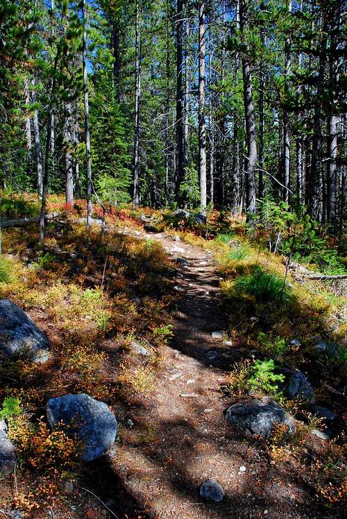
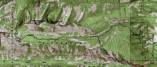
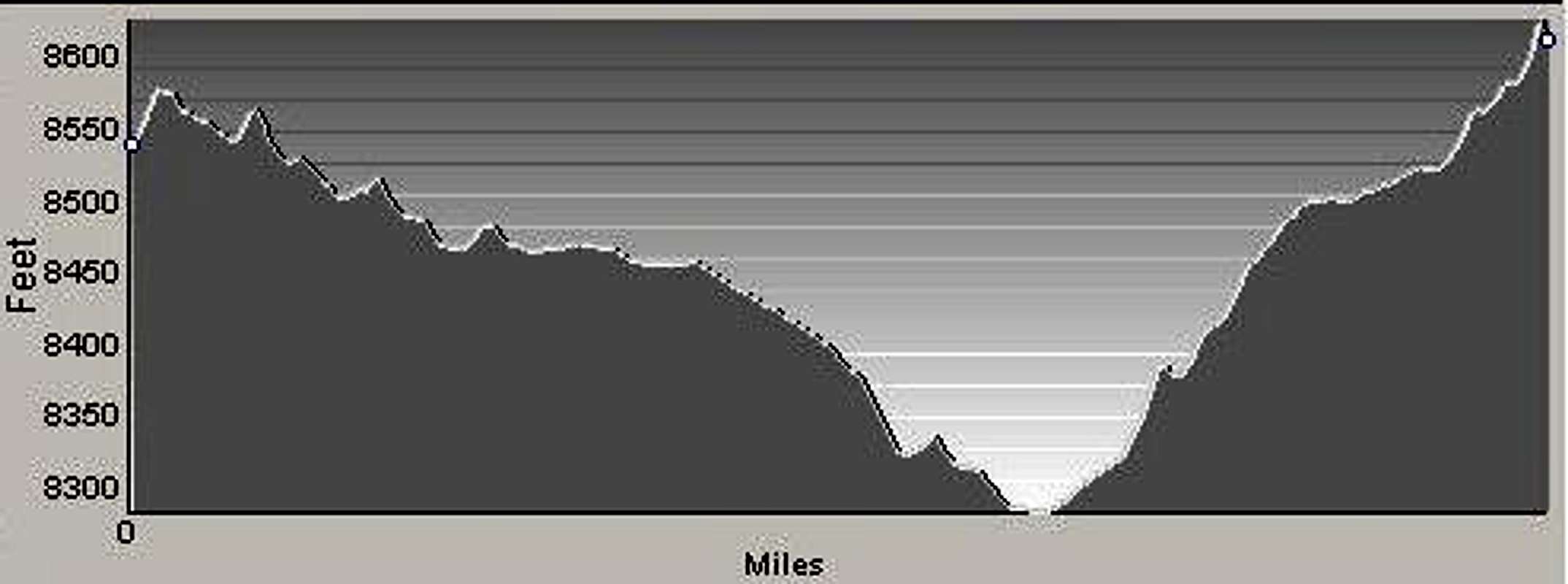
From the trailhead, follow the trail as it traverses northwest across the end of a ridge. As the trail curves west then southwest around the ridge, it loses a bit of elevation before beginning to ascend at a fairly consistent rate.
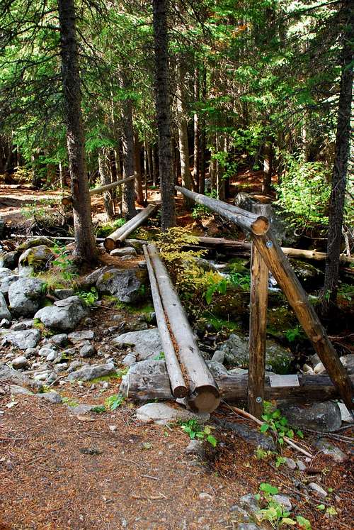
At a point slightly more than 2 miles from the trailhead – a point which also happens to be the wilderness boundary – the trail crosses to the north side of Sheafman Creek on a nice little bridge built by a local Boy Scout Troop.
Stay on the trail, now meandering in a mostly westerly direction where, after passing the 4 mile mark, it crosses back and forth over Sheafman Creek several times.
About 5.5 miles from the trailhead, the trail turns toward the southwest. Just before reaching the 5 mile mark the trail passes along the north side of Sheafman Lake, a beautiful little mountain tarn.
From the lake, follow the cairn-marked trail west then northwest to the meadow on the east side of Knaack Lake. This meadow of grass and open woods is by far the best place to camp in Sheafman Canyon.
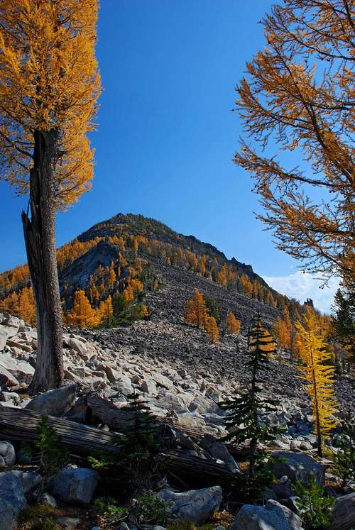
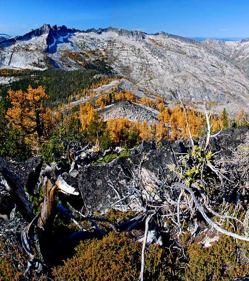
Climbers' Route – Knaack Lake to the Summit
From the Knaack Lake Meadow, head north-northwest toward West Sheafman Peak's west ridge. There is no trail to follow, just pick your own line.
Note: I found there to be slightly less vegetation closer to the ridge-crest and recommend gaining the crest as soon as possible. There are a few rock outcrops along the way which it makes sense to circumvent on the right (south), but for the most part the woods is fairly open with little deadfall or underbrush.
Once you reach the crest of the ridge follow it upward to the summit. As you climb the woods gets thinner and thinner and is interspersed with boulders and areas of talus. The talus is very stable and offers good footing.
Follow the ridge as it takes your track in a more easterly direction an up the last talus slope interspersed with small clumps of Alpine Larch. At 7.7 miles from the trailhead, you will reach the summit.
Connecting Ridge
Climbers' Route – From East Sheafman Peak to West Sheafman Peak
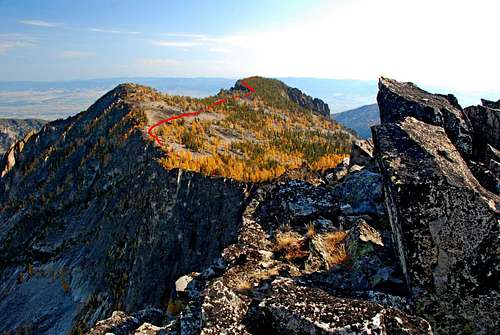
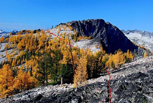
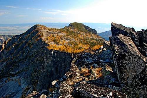
From the summit of East Sheafman Peak, head west and southwest along the ridge-crest. On your right (north) you will see a highpoint on the rim. Bypass this by traversing west on stable talus directly across its south face.
Continue traversing around the obvious bowl staying close to the ridge-crest. As you approach the lowpoint of the ridge, take a moment to study the south ridge of West Sheafman Peak. You should be able to pick out a rather obvious gap in the rock outcropping which guards the ridge-crest. Head southwest directly for the gap.
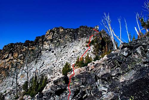
After passing through the wide gap change your direction of travel to northwest and continue toward the summit block. Until you get closer, the summit looks to be an impossible climb up a small but sheer face of slab-granite.
Head toward the right (north) edge of this face. As you draw near you should be able to see the face is not as impossible as it looked from a distance but instead is indeed climbable. Ascending the face is the crux of this route.
The right (north) side of the face offers mostly Class 3 climbing in the form of granite blocks and ledges. Toward the top, the exposure increases to the point that many climbers will consider the last few feet below the summit area to be Class 4.
Note: If this face is too easy for you, climb onto the ridge farther to your left (south). You're sure to find several mid-Class 5 options to the summit. Have fun.
After attaining the summit area, continue a few yards northwest to the obvious highpoint and enjoy the views – in every direction.
When To Go
The best time to visit West Sheafman Peak is when the gate is open on Cow Creek Road; otherwise the 4+ miles are added to the length of the route – one way. But if you insist on climbing this summit during the winter, the West Ridge route from Knaack Lake is the best track to follow because it has little chance of avalanche.
Essential Gear
During the normal climbing season only sturdy footwear and weather-appropriate clothing is required for the routes to the summit of West Sheafman Peak.
The slope of West Sheafman Peak's west ridge is gentle enough that it can be climbed on skinned skis or snowshoes, though an ice axe should be carried and kept handy. Climbing the ridge connecting East and West Sheafman Peaks will always require the use of an ice axe if snow is present and may require the use of crampons in several places.
Note: I do not recommend ascending or descending the South Face Chute to East Sheafman Peak unless the snow is very well consolidated. If you want to climb both East and West Sheafman Peaks on snow which is not well consolidated, it is advisable to climb West Sheafman from Knaack Lake then follow the Connecting Ridge to reach East Sheafman. Descend by reversing that same ascent route.
Route Statistics
Summit – 8,652'
West Ridge Route
Gain – 3,976' (total)
Distance – 7.7 miles
(one way)


