
|
|
Mountain/Rock |
|---|---|
|
|
47.38540°N / 121.0227°W |
|
|
Hiking |
|
|
Spring, Summer, Fall, Winter |
|
|
6433 ft / 1961 m |
|
|
Overview
There was a massive fire here in 2017!! A lot of the trails and routes here have been severely damaged!! Stay tuned for updates!!
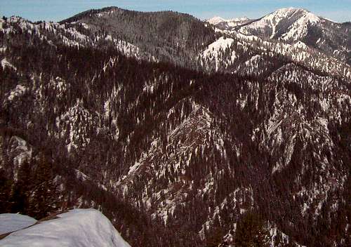
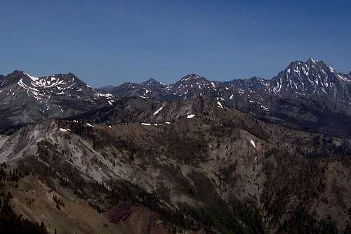
Jolly Mountain located in the in the western Teanaway region is a relatively popular summit. The summit is home to a former lookout tower that when clear has great views of the surrounding Teanaway Region as well as Mount Rainier, Glacier Peak, Mount Adams Mount Stuart and the Enchantments. Views here are excellent here and it is advisable to hit this mountain on a clear day. If you hit a clear day prepare to take more than 75 pictures.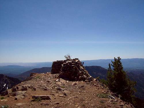
This summit is one of the higher mountains in the western Teanaway and often because it is more west than the other Teanaway Region, it often receives more precipatation. I found this out personally when on my first try I ran into some very strong snow and wind here. That being said Jolly Mountain is still a better call when weather is bad in Seattle then the traditional I-90 corridor (Mailbox, Defiance, etc.).
Jolly Mountain can be reached on it's western side by two different routes. The first route is the logging road. This road during summer is open at least part of the way up, which leads to a much easier trip to the Sasse Ridge Trailhead. Once on the ridgeline trail look for a spur bootpath/trail on your right that will lead you to the summit of Jolly Mountain.
The second way is the much longer but more scenic Jolly Mountain Trail (Trail 1307). Starting from the Cayuse Horse Campground, the signs at the beginning can be confusing so pay attention to them. The 12.4 mile 4400 feet elevation gain hike can be a grind so give at least 5-7 hours.
Getting There
FROM I-90: Take Exit 80 and head north on Bullfrog Road. You will hit two traffic circle on the way to Roslyn. In both traffic circles focus on heading directly to Roslyn (not Suncadia Resort or Cle Elum. Once in Roslyn go through the town on Route 903 (Salmon La Sac Road) and stay on it for eleven miles. You will go well past Cle Elum Lake and will then be driving near Salmon la Sac River.For the road option take the dirt road located just one mile south of the Cayuse Horse Campground and take it all the way up until you hit the gate. Then just walk up the road two miles to the Sasse Ridge Trailhead.
For the Jolly Mountain Trail option stay on the road until the turnoff for the Cayuse Campground. There will be a parking area on the side of the road.
Red Tape
I have read in many reports that a Northwest Forest Pass required here but when I was there I saw no such place. Bring one just in case.Also in full winter season Jolly Mountain is a Sno-Park so bring a snow park permit.
Camping
Salmon La Sac Campground is located very close to the Jolly Mountain trailhead as well as the Cayuse Horse Campground.External Links
Here is a trip report of the Jolly Mountain region.Weather Conditions
Here are what the weather conditions would be from nearby Cle Elum. alt="Click for Cle Elum, Washington Forecast" height=60 width=468>