
-
 3703 Hits
-
 80.49% Score
-
 12 Votes
|
|
Mountain/Rock |
|---|---|
|
|
44.82920°N / 109.0905°W |
|
|
Park |
|
|
Hiking, Scrambling |
|
|
Spring, Summer, Fall, Winter |
|
|
4990 ft / 1521 m |
|
|
Overview
 Peak 4990
Peak 4990 is the most visually striking mountain in the Badland Hills, located in Badger Basin in Wyoming. Its small summit cone and steep sides contrast with the other mountains in this area, which have large summit plateaus that don't allow for complete panoramas of the surrounding land. It is also the most challenging scramble found on any of the four peaks in the Badland Hills.
During the hike to this peak, you will encounter large fields of sage brush, cactus, and yucca plants scattered among the weird but typical badlands earth and rock formations that are found here; sometimes it is necessary to look up at the neighboring Beartooth and Absaroka Mountains to remind yourself that you didn't accidentally travel to the moon!
Getting There
To reach Peak 4990 from Cody, Wyoming, head towards Powell on Highway 14A for about 13 miles and turn left on Highway 294. From Powell, go towards Cody for about 8.5 miles and turn right. Drive on 294 for 8.4 miles and turn left on Little Sand Coulee Road, which is the unmarked dirt road that crosses over a green cattle guard through the fence. This road is in pretty good shape with just a couple of rough spots where water drainage has damaged the road, but there is no need for 4WD. Drive for 5.5 miles and turn right on the road that parallels the fence just before the cattle guard; this is a 4WD road that requires a high clearance vehicle in many places. There is one place where the road forks, so stay right and do not go left through the fence. After 1.5 miles this road starts to get really rough and it finally disappears entirely around the small cluster of trees. Park and head west on foot towards the mountain, which is easily recognized by its distinctive summit cone. Approach to the summit
 Beartooths
The easiest way up the cone is from the northeast ridge; the topographic map makes it look like the gentle ridge leading up from the south would work, but the closer I got to the mountain, the more obvious it was that the cone would be too steep from that side. It might be possible to ascend the south ridge and skirt around the base of the cone around to the north side, but this looked sketchy to me. Having studied the peak from the summit of Peak 4932, I knew there was a route up the other side, so I opted for that. To get there, keep to the right as you approach the base of the peak and ascend to the ridge that connects this mountain to the smaller point (4901 on the map) off to the north.
From here, follow the obvious ridge up until you reach the steepest section, where you have go left or right around the rocky part. Either way works, but going right is slightly less steep. After a short but very steep scramble straight up the hill, you will find yourself on a small summit with incredible views all around.
The total hiking distance to the summit is about 1.5 miles with about 400 feet of elevation gain; it ranges from easy Class 2 off-trail to steep scrambling near the top.
 Summit view southwest
Red Tape
There are no fees to hike in Badger Basin. This area is mostly BLM land with a few very small parcels of Wyoming state land scattered throughout. Fences generally separate these areas and run along the highways; cattle graze this land from time to time, so the fences and cattle guards help keep the animals off of the road. Since it is pretty much all federal and state land, hiking is allowed throughout the entire area. Judging by some deep animal tracks and some pretty torn up places on the 4WD roads that branch off of the main dirt roads, this area gets pretty treacherous when it is wet, so exercise caution. It would probably be best to avoid this area during hunting season, so check with the Cody BLM office about dates. Rocks and Yucca
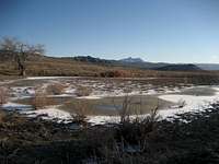 Heart Mountain
This is prime rattlesnake country with very little in the way of established trails, so every step taken while walking around the basin takes you close to another clump of sage brush that could hide a snake. For this reason, the winter months may be the best time to hike this area, as the snakes will stay in or very close to their dens during the cold season; if you do hike here in the summer, always keep listening and watching!
Camping
Standard BLM regulations for camping apply throughout the basin. There is very little water here, so plan accordingly. For more information, visit the BLM camping rules page at:http://www.blm.gov/pgdata/etc/medialib/blm/wy/information/docs.Par.1775.File.dat/wynf-0019.pdf
External Links
Information on the Badland Hills Quadrangle:Badland Hills
What to do in case of a Rattlesnake bite:
http://www.whmentors.org/saf/snakes.html