
|
|
Mountain/Rock |
|---|---|
|
|
39.06020°N / 111.9976°W |
|
|
San Pete |
|
|
Hiking |
|
|
Spring, Summer, Fall |
|
|
8436 ft / 2571 m |
|
|
Overview
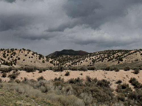
This is a peak that almost no one (even in Utah) has ever heard of. I found it because I've been having fun climbing and hiking the Utah prominence peaks that are found on this list (click here), created and supported by John Kirk, on his 'List of Johns' which is an incredible resource. Few people climb it, let alone find it as there is nothing that would draw your attention to the peak from the road. I almost decided not to put this up on Summitpost as it would not be a peak that many would find interesting but then a friend suggested that it would be helpful to fellow prominence peakbaggers so here it is, the peak that ranks #71 out of the top 100 Utah prominence peaks (prominence of 2176'). Another good resource is here. Stevens BM is also the highest point in the Valley Mountain range. If you've never heard of the Valley Mountain range, you are not alone.Stevens Peak (referred to as Stevens BM on the topos) is a peak without a trail. Yet, on a nearby lesser summit, a small communications tower stands
which is most likely serviced by helicopter. I can say this with strong
assurance since a helicopter was there the day we climbed (or hiked) to Stevens BM. Much of the fun is finding your way to the summit and trying to
determine by map and visual reference, what route would work the best. I should also point out that this peak is the high point for the mountain range known as the Valley Mountains. Again, relatively unknown but hopefully this page will put a bit of a spotlight on this area.
I climbed this peak with fellow SP member, gjagiels and due to the arid desert like qualities of this non alpine area, hot days in the summer should be avoided.At least carry plenty of water as there is none to be found once the snow is gone.
Getting There

Take I-15 to Scipio and take the exit for highway 50, heading towards Salina.
Go through the little town of Scipio and follow the nice two lane highway a
good 15 miles or so. Watch for a gate that heads to an old abandoned gravel pit which is a good place to park. That gate I just mentioned is just past the road that leads to Maple Grove Campground and is a left turn, again, just past that Maple Grove road. Look for MP 146, it is also, not far from the road to the left. . If you are coming from the south on US 50, find that MP 147 is your clue to slow down for the access road and the gate you need will be on the right side of the road. The gate is silver in color. Please close the gate after you enter and just stay on the track goes directly east to the gravel pit. On the map, you can see that it is the more southerly of two gravel pits that are shown. From where you park your vehicle, it is all cross country from there. More will be covered on a route page.
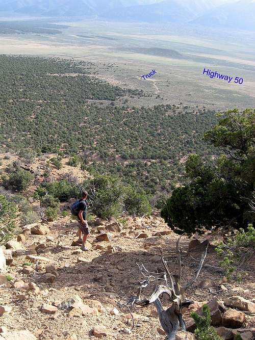
Other routes up are probable from the eastern side but at this time, I can
not comment on them since our experience was based on the southwest ridge route.
Andy Martin has chimed in with a different route from the north which I will share below:
" Also, we found a hiking route in from the north
that is probably easier than the Summitpost
route starting from the gravel pit by route 50.
Our route:
Leave Japs Valley Road at
39.13019, -111.98759
Park at 39.08640,-112.00364
The last 1/2 mile is on a faint road, but the Honda
made it. You can not drive to the south end of Little Long
Valley due to locked gates, and residences.
Hike SW and gain the ridge top with spot elevation 7401.
Follow this ridge south, then east. Contour around
the west side of hill 8041 at an elevation
of about 7900'
An ATV trail is picked up at this saddle:
39.06571 -112.00265
Follow the trail a few hundred feet south, until
it levels off. At this point a steep trail is picked up
that leads to the ridge extending NW
from the west summit area. Climb this west
summit, which has a small wind powered repeater,
and then head east to the BM summit."
If you go to peakbagger.com - both Eric Kassan and Sam Grant have posted GPS tracks that they made during their visit.
Red Tape
None that I am aware of. I believe that the land is BLM land.BLM lands in Utah
BLM Main Office
150 E. 900 N.
Richfield UT 84701
Phone: 435-896-8221
Camping
Car camping is generally ok on BLM land but a much better solution is theForest Service campground that is nearby:
CAMPGROUND NAME: Maple Grove
RANGER DISTRICT: Fillmore
RESERVATIONS: No
DIRECTIONS:
In Scipio, UT, take US Rt. 50 east 14.8 miles to Maple Grove
campground sign. Turn right at sign and go 3.7 miles on an
unnamed road to campground.
GENERAL COMMENTS:
The elevation is 6,400 ft.
The campground, built by the Civilian Conservation Corps (CCC) in
1938 by Company 479, is composed of 4 loops. One unnamed loop is
devoted to single-family campers while the remaining 3 loops (A,
B, and C) are for group camping. These group loops may be used
by single-family campers if they are not reserved; the single fee
is charged and the group sites are included in the Campground
Site Configuration below. Ivie Creek runs through the campground
providing a lush riparian, oasis-like environment. The
understory is grass and the overstory is made up of cottonwoods,
maple, Box-elder, and oak trees. Because of young deciduous
trees forming a middlestory and shrubs such as wild roses,
privacy between camp sites is excellent. This very attractive
campground backs up onto towering red cliffs with views from some
camp sites enjoying a panoramic view of a valley and distant
mountains. Some of the camp sites are adjacent to Ivie Creek.
SEASONS
Open Seasonal: Yes
Open All Year: N
Seasonal Comment:
Open May 15 through September 15.
RATE AND MAXIMUM STAY PERMITTED (as of 2007)
Rate: $10 per day
Maximum Stay Permitted (days): 14
CAMPGROUND SITE CONFIGURATION
No. RV Sites: 0
No. Tent Sites: 0
No. Combined Sites (Tent or RV): 27
Group Tent Sites: Yes
RV INFORMATION
Hookups: None
Group RV Sites: Yes
# of RV Pull Throughs: 2
Waste Station: No
Average Parking Apron Size: 16' X 40'
Comments:
The parking aprons are paved.
FACILITIES
Vaults: Yes
Flush Toilets: No
Hot Showers: No
Wheelchair Friendly Toilets: Yes
# of Water Spigots (non-site): 9
Weather


The summit area
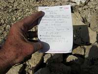
The summit itself is a rounded area with a large boulder on the southwestern perimeter. That boulder is the highest spot and can easily be climbed or touched by your hand. A reference benchmark is found on it s top and that reference will point toward the main benchmark which is surrounded by a circle of rocks. A glass container was within the circle and contained a rudimentary type of register.
Summit Benchmark
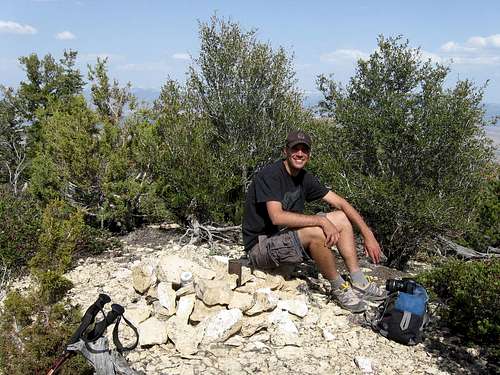
Greg enjoys a moment at the summit

The highest spot
Links
Fishlake National ForestMap of Fishlake National Forest
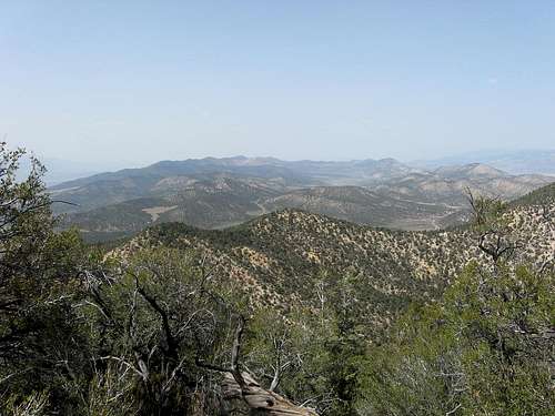
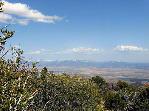
Looking north